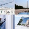
Connect with us

Washington, D.C

DC snow storm forecast: 5 to 10 inches of snow across DC, Maryland & Virginia

Published

on

DC snow storm forecast: 5 to 10 inches of snow across DC, Maryland & Virginia


Advertisement

The Washington, D.C. region continues to brace for the first winter storm of 2025 with a significant snow threat from Sunday night into Monday.

When will the snow start on Sunday?

A sizable amount of snowfall is expected to roll in across the region, late Sunday night into Monday. The storm will start as snow early Monday, then possibly mix with sleet and freezing rain in the morning.

“We still remain in the early stages of this and developing. We could get a burst of snow, which would bring the numbers up, we could get more mix in there, warmer air, which could bring the numbers down,” Gwen Tolbart said.

Advertisement

How much snow could we get on Monday?

The latest forecast shows a widespread five to ten inches of snow possible across much of the D.C. region, with locally more possible. Areas south of D.C. will have a better chance of a mix of snow, sleet, and freezing rain.

Temperatures are expected to remain in the low 30s and 20s. The wind chill across the D.C. region is looming in the 10s. 

Advertisement

According to the FOX 5 Weather Team, heavy snow is expected Monday morning which will drastically impact traffic and travel. 

Latest weather updates on FOX Local. Check for updated school closings and delays.

Stay with the FOX 5 Weather Team for the latest forecast updates and check the updated list of closings and delays. The FOX LOCAL app is your source for live FOX 5 DC weather updates. Click here to download.

Advertisement

Stay warm and prepared for the winter weather ahead! 

MORE COVERAGE:

Advertisement

DC winter snow storm: Timing, how much to expect by Monday

DC winter snow storm: 1-2 punch expected to bring snow, sleet to DMV

Snow threat prompts early dismissals: DC, Maryland, Virginia closures & delays

Advertisement

DMV snow forecast: Winter preparedness on the road

The Source: The National Weather Service and FOX 5 reporting contributed to this article.

Advertisement
WeatherWeather ForecastNews


Source link

Washington, D.C

Storm Team4 Forecast: Foggy Friday morning with scattered showers

Published

on

Storm Team4 Forecast: Foggy Friday morning with scattered showers


4 things to know about the weather:

  1. So Many Clouds
  2. Not Too Much Rain
  3. Milder For The Weekend
  4. Warmer Days Next Week

The dividing line between the 50s and the 70s is a cold front that has been wedged right down into our area by high pressure anchored over New England. East winds will bring our air off the ocean and Bay and both of those bodies of water are COLD this time of year.

Afternoon highs will stay in the 40s near the Bay, should reach the low/mid 50s near DC and could be near 60° west of Fredericksburg.

Very little sunshine today but not too much of a rain chance. Clouds, fog and 40s for all tonight.

Download the NBC Washington app on iOS and Android to check the weather radar on the go.

Advertisement

A developing storm over the Ohio Valley will finally begin to push that high pressure away tomorrow. Our afternoon highs will be dependent on how soon our wind can turn around to the Southwest.

Plan for a cloudy and chilly Saturday morning with a big jump in temperatures by mid-afternoon. Northern and Northeastern Maryland will remain cooler, but the rest of the area should pop above 70° for the first time this year.

The aforementioned storm will send a front through our area Saturday night. That front will bring a round of showers along with it. Showers will be likely Saturday evening and night.

The majority of that rain chance will be ending before noon on Sunday and the return of a little sun on Sunday afternoon should warm most areas to near 70° once again.

The first few days of next week will feel more like May than March. Highs on Monday should be near 75° and both Tuesday and Wednesday could top 80°. That warm pattern won’t last long, but it sure will feel good.

Advertisement

QuickCast

TODAY:
Mostly Cloudy
Coolest Along, East Of I-95
Isolated Showers
Wind: East 5-15 mph
Chance of Rain: 20%
HIGHS: 48° to 62°

TONIGHT:
Cloudy And Damp
Isolated Showers
Areas Of Fog
Wind: East 5-10 mph
Chance Of Rain: 20%
LOWS: 40° to 45°

SATURDAY:
Partly To Mostly Cloudy
Breezy And Warmer
Isolated Showers
Wind: Southwest 10-20 mph
Chance of Rain: 20%
HIGHS: 65° to 75°

SUNDAY:
Partly Sunny
AM: Showers Likely
PM: Dry For Most
Wind: Northwest 5-15 mph
Chance of Rain: 40%
HIGHS: 64° to 72°

MONDAY:
Sun And Clouds
Nice And Mild
Light Breeze
Wind: Variable 5 mph
Chance of Rain: 0%
HIGHS: 66° to 72°

Advertisement

Sunrise: 6:33       Sunset: 6:06
Average High: 53°  Average Low: 36°

Stay with Storm Team4 for the latest forecast. Download the NBC Washington app on iOS and Android to get severe weather alerts on your phone.


Source link

Continue Reading

Washington, D.C

Storm Team4 Forecast: Thick fog to clear before storms, rain Thursday night

Published

on

Storm Team4 Forecast: Thick fog to clear before storms, rain Thursday night


4 things to know about the weather:

  1. Grab the umbrella
  2. Big temperature ranges
  3. Thunder possible Thursday night
  4. Warmer days on the way

Heads up commuters! For Thursday morning, there will be some thick fog in spots with some rain possible, especially around the Mason-Dixon line. The fog should clear out by 10 a.m.

Throughout the day, some sunshine should develop with highs warming into the low 60s. Those in Northern Maryland could see some showers throughout the day but those near the D.C. area will stay relatively dry except for a stray shower or two.

Some rain and evening storms by 8 p.m. will impact the area Thursday night. Although it’s a bit unusual for this time of year, don’t be surprised if you hear thunder Thursday evening.

Warmer temperatures coming this weekend

These next few days will come with some major forecast challenges.

Advertisement

Much, much warmer air is just to our south and cold, high pressure is moving into New England. The front separating the 40s from the 70s will be laying right across our region for the next two to three days.

So keep in mind, when you’re looking at the forecast highs in the text below, that it will be warmest in Fredericksburg, VA and coolest in northern Maryland.

Friday’s weather will be similar as a front system remains just over the area, separating chilly air to the north and warmer air to the south. There might be a stray shower or two, too.

For the weekend, Saturday looks to be the warmer of the two days with highs in the low to mid 70s. Some rain overnight Saturday will lead to cooler temperatures on Sunday.

Download the NBC Washington app on iOS and Android to check the weather radar on the go.

Advertisement

QuickCast

THURSDAY:
Mostly Cloudy
Stray Shower Possible
Big Temperature Range
Wind: Southeast 5 mph
Chance of Rain: 40%
HIGHS: 62° to 72°

THURSDAY NIGHT:
Cloudy And Chilly
Rain Likely
Some Thunder Possible
Wind: Northeast 5 mph
Chance Of Rain: 70%
LOWS: 44° to 54°

FRIDAY:
Mostly Cloudy
Cooler For Most
Isolated Shower Or Two
Wind: East 5-15 mph
Chance of Rain: 20%
HIGHS: 52° to 68°

SATURDAY:
Partly Sunny
Breezy And Warmer
Isolated Shower
Wind: Southwest 10-20 mph
Chance of Rain: 20%
HIGHS: 66° to 78°

SUNDAY:
Mostly Cloudy
Cooler
Few Showers Possible
Wind: Northwest 5-15 mph
Chance of Rain: 20%
HIGHS: 64° to 72°

Advertisement

Sunrise: 6:35       Sunset: 6:05
Average High: 53°  Average Low: 36°

Stay with Storm Team4 for the latest forecast. Download the NBC Washington app on iOS and Android to get severe weather alerts on your phone.


Source link

Continue Reading

Washington, D.C

Tax expert explains DC filing season amid Congress-District dispute

Published

on

Tax expert explains DC filing season amid Congress-District dispute


D.C. taxpayers may be confused by back-and-forth between the D.C. City Council and Congress over taxprovision. The city’s financial officer sent a letter to Mayor Muriel Bowser and D.C. Council Chair Phil Mendelson, that said the District’s tax laws will not change, despite recent actions by Congress.

7News spoke to director of Tax Policy at the Center for American Progress Corey Husak to explain the complicated tax policy.

“The short answer is, nothing changes. Filing Season can continue as it has been, continue as planned, and according to the laws as we understood them in January,” said Husak.

“If you’ve already filed your taxes, you don’t have to change anything. And if you want to file your taxes, the rules are still the same as they were on the books before,” said Husak.

Advertisement

RELATED | DC Council Chairman talks taxes, budget, bodycams, federal surge

Chief Financial Officer Glen Lee’s revenue estimate issued Friday does not include an estimated $180 million expected this fiscal year from the city’s decoupling law, “due to the uncertainty of the associated revenue as a result of Joint Resolution 142,” according to a released letter.

“The CFO was in a tough spot here. If he agreed with Congress, then businesses and overtime workers will get bigger refunds. But if he agreed with the Mayor and the Attorney General, then families with children and lower income workers would get bigger tax cuts,” said Husak.

SEE MORE | Development of new Commanders stadium scrutinized at DC oversight hearing

“We as District residents can’t control, you know what happens in the courts, what happens in, you know, what Congress does in the future,” said Husak. “But for now, the CFO has said, you know this is, this is a law as it stands, and the law that I’m going to enforce so, you know, file your legally obligated taxes, and maybe in the future, there’ll be a surprise.”

Advertisement

WATCH THE FULL INTERVIEW

7News spoke to director of Tax Policy at the Center for American Progress Corey Husak to explain the complicated tax policy (7News).{ }


Source link

Advertisement
Continue Reading

Trending