Utah
Meteorological winter is here. What's in store for Utah this season?


Despite a warm and dry start to the season, Utah’s statewide snowpack ended meteorological fall slightly above average with 2.8 inches of snow water equivalent.
However, meteorological fall typically produces hors d’oeuvres when compared to meteorological winter, Utah’s main snowpack course. About two-thirds of Utah’s mountain snowpack — a calculation of water in fallen snow — falls between the beginning of December and the end of February.
That’s according to the Natural Resources Conservation Service’s 30-year median average of data collected from 1991 through 2020. Since about 95% of Utah’s water supply comes from the snowpack collection and spring runoff process, the success of meteorological winter often makes or breaks any given water year.
“That’s when we get our most amount of snow, so it’s very significant,” says Candice Hasenyager, director of the Utah Division of Water Resources, talking about the season that began on Sunday.
A good winter also matters for snow recreation outdoors, but what’s in store this winter remains a bit of a mystery as long-range forecasts offer no clear signal when it comes to precipitation. That’s par for the course, though, with the conditions setting up over the Pacific Ocean.
Utah’s winter outlook
The National Weather Service’s Climate Prediction Center updated its La Niña watch last month, noting that there was about a 57% chance that the oceanic pattern would emerge by the end of this year and last through the first quarter of 2025.
Above-normal trade winds blow warm Pacific Ocean water west, allowing cooler water to resurface in the eastern Pacific during a La Niña pattern, as noted by the National Oceanic and Atmospheric Administration. This typically causes the winter jet stream to move north, often creating a track that sends winter storms through Alaska, the Pacific Northwest and the upper Midwest as systems move east.
Meanwhile, warmer and drier conditions generally set up across the southern U.S. during a La Niña pattern.
This also shows up in the prediction center’s final outlook for meteorological winter, where most of the upper West and Great Lakes regions are listed as having the highest precipitation probabilities this winter. The Southwest through the Southeast have higher probabilities for drier conditions.
Utah, however, is less influenced by La Niña — or El Niño — than other states. Both oceanic patterns tend to help or hurt areas north and south of the Beehive State, while Utah tends to get a wide range of winters that are good, bad or somewhere in between. It all comes down to where the jet stream forms.
Its last three La Niña winters — 2020-21, 2021-22, and 2022-23 — are perfect examples of this. Utah only received 2.34 inches of precipitation statewide during the 2020-21 winter, which was its 18th-driest meteorological winter dating back to 1895, per federal climate data. The following season was also below normal but closer to normal.
Then in the 2022-23 winter, Utah received 5.78 inches statewide — its ninth wettest winter on record. That same water year, boosted by a jet steam that kept pushing storms through Utah, also produced the state’s largest snowpack on record. It was was larger than the 2020-21 and 2021-22 water years combined.
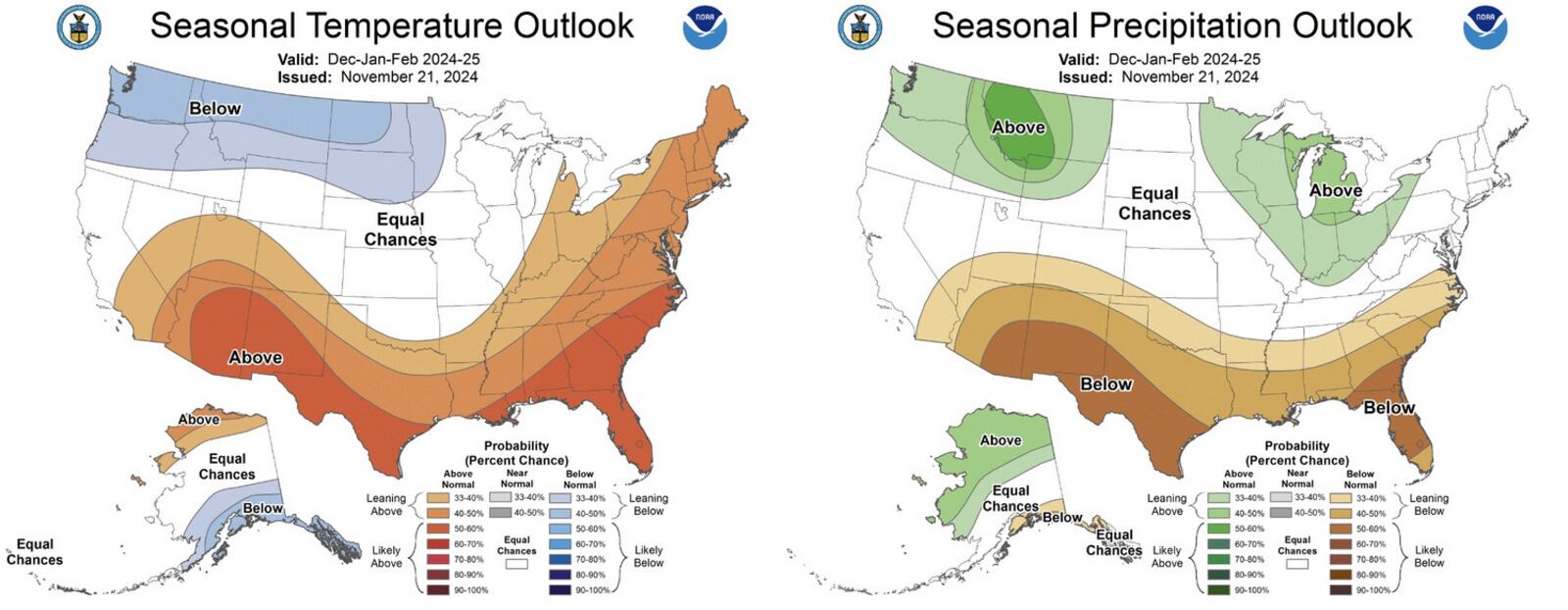
Long-range forecasts for the next three months reflect this uncertainty. Most of Utah is listed as having “equal chances,” meaning there’s about an equal probability that Utah ends up with a wetter, drier or near-normal precipitation this winter. Southern Utah has a slightly higher probability of below-normal precipitation.
Most of the state has a slightly higher probability for above-normal temperatures over the next three months. Only a sliver of northern Utah is listed as having equal temperature odds.
Utah’s water savings account
Hasenyager told KSL.com that she’s holding out hope, but the state has a saving grace in its reservoirs right now. Utah’s reservoir system entered December nearly three-fourths full, which is about where it was this time last year. It’s also 20 percentage points ahead of the winter median after back-to-back above-normal snowpack and lower consumption averages in recent years.
That gives Utah’s water reserves a boost in case the state endures another bad season.
“They’re our bank account. They help us to extend over periods where we have less than optimal snowpack and less than optimal runoff,” Hasenyager said. “We’re hoping for a big year, as always. But if for some reason we don’t, it’s nice to have the reservoir (capacity) available.”
She adds that ways to reduce water consumption are still recommended in case there is a bad winter followed by more drought in the summer. However, another good winter would mean another boost for the Great Salt Lake and Lake Powell, two large bodies of water that remain well below full capacity after major drops during the two-decadeslong “megadrought.” Both have benefitted from controlled releases out of reservoirs to combat flooding concerns.
Gov. Spencer Cox said Monday that he believes that the Great Salt Lake could even move toward “healthy territory” by next spring should the Great Salt Lake Basin have another good snowpack collection.
“We’re hopeful to have a good year,” he said. “Regardless of whether we have another great year, a mediocre year or a terrible year, we’re in better shape than we’ve been in many years because of (conservation efforts).”



The Utah Jazz won their final summer league game against the Portland Trail Blazers 83-79. It was a fun game that came down to the wire, with a few Jazz players showing promise that could help the team.
The player who surprisingly didn’t help as much as you’d hope was Blake Hinson, who shot just 1/9 from three. Hinson was a sharpshooter for the Jazz last season, and it’s too bad that he couldn’t show that shooting stroke in the summer league. It’s likely not a big deal, but it would have been nice to see that shooting continue in the summer league. It does make you wonder why all the players who played for Utah last season, or will be getting regular minutes next year, didn’t shoot well in Las Vegas. Is that a trend? Or is it just a coincidence? It makes you wonder if the Jazz have been running hard practices, or if the players are tired from enjoying their time in Las Vegas? There’s no way to really know, but it’s interesting.
Utah’s strongest performer, in terms of plus-minus, was Bez Mbeng. He was a team-leading +14 and, even though he didn’t shoot the ball well either, his defense and intensity really shows on the floor. In this one, Mbeng had 4 steals and handled the ball for a lot of the game. He was also one of the top players in minutes with 20 in this one. I personally really like Mbeng and I’m rooting for him to make the team. I do think he can be a defensive-focused do-it-all player who could really contribute if he keeps improving.
Justin Harmon scored the ball well, leading the team in scoring with a team-leading 21 points. He had 6 free throws in this one and was a positive contributor overall. Harmon could be a nice addition to the training camp roster and, if he can show out, maybe he can earn himself a roster spot. He’s worth watching going forward at the very least.
And with that, the summer league is now over, and we now enter a long summer that will lead into one of the most exciting eras of Jazz basketball I can remember. It will be led by the best prospect in Jazz history to actually suit up for the Utah Jazz, and I can’t wait to see him develop into a superstar wearing the purple and blue.

Jon Anderson will be charged with moving the Orem school forward following the death of conservative commentator Charlie Kirk on campus last year.
(Bethany Baker | The Salt Lake Tribune) Incoming UVU President Jon Anderson poses for a photo with his family after an event announcing his selection at Utah Valley University in Orem on Friday, July 17, 2026.

BEAVER COUNTY, Utah — A massive community effort is underway as volunteers and Beaver County crews distribute thousands of sandbags to protect homes from the potential path of floodwaters.
After the Cottonwood Fires, residents have been waiting for weeks for relief to come in the form of rain, though officials now warn it may come all at once with an increased risk of flooding and debris flow.
Emergency Service Director Les Whitney believes that the fire has left plenty of debris to bring trouble for residents.
“We got a lot of water. We’re bringing debris with it, so tree branches, tree limbs, logs, lots of different size firewood, and that’s all in the creeks. We’re worried about that plugging up our bridges and stuff, so we have heavy equipment and excavators located in strategic places so that we can keep those bridges open,” said Whitney.
An estimated 140 homes and condominiums were spared from the flames, but remain in the paths of floodwaters.
Residents can also pick up sandbags at the Beaver County Sheriff’s Office or at the Beaver County Rodeo Fairgrounds.
-

 Kentucky3 minutes ago
Two-vehicle crash injures one in Pike County, Kentucky, troopers say
-
 Louisiana9 minutes ago
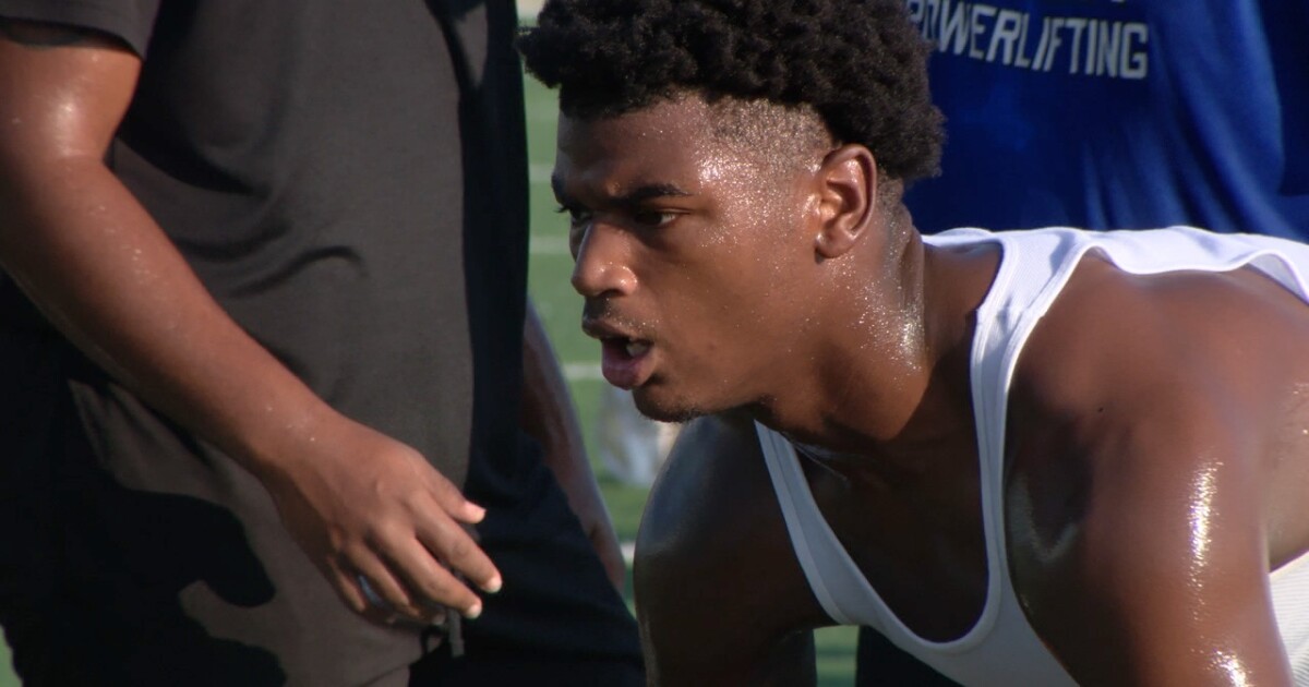
Lafayette Renaissance edge rusher Ansinneo Charles commits to Louisiana
-

 Maine16 minutes ago
Maine Trust announces 2 hires in Augusta, Waterville
-

 Maryland21 minutes ago
What Doesn’t Change in Chevy Chase, Maryland
-

 Michigan27 minutes ago
Huntington Bank to close 13 Michigan branches by the end of August — see full list here
-

 Massachusetts33 minutes ago
Massachusetts RMV under fire after illegal immigrant trucker kills state trooper
-

 Minnesota39 minutes ago
Thousands expected to attend Minnesota Yacht Club festival in St. Paul
-

 Mississippi45 minutes ago
Mississippi Lottery Mississippi Match 5, Cash 3 results for July 17, 2026

