Colorado
Flash flood warning issued for Northern Colorado


When the National Weather Service issues summer warnings
The National Weather Service issues special weather announcements, including tornado, thunderstorm, high wind and high fire danger warnings.
A flash flood warning was issued by the National Weather Service in Denver at 11:40 a.m. on Tuesday, June 17. This warning applies to Larimer County.
The NWS warns: “Move to higher ground now. Act quickly to protect your life. THIS IS A LIFE THREATENING SITUATION! Heavy Rainfall will cause extensive and severe flooding of creeks, streams, roads and culverts in the affected part of the Cameron Peak burn area. Rock slides or debris flows can also be expected across roads in the warning area.”
See weather radar for Northern Colorado
What are NWS meteorologists saying?
At 11:40 a.m., the NWS issued a statement:
“The National Weather Service in Denver has issued a Flash Flood Warning for: Central Larimer County in north central Colorado, Until 2:15 p.m. MDT. At 11:40 a.m. MDT, Doppler radar indicated thunderstorms producing heavy rain near Pennock Pass, or 21 miles west of Fort Collins, moving east at 10 mph. Between 0.5 and 1 inch of rain has fallen. Additional rainfall amounts of 0.5 to 1 inch are possible in the warned area. Flash flooding is ongoing or expected to begin shortly. The storm producing the flooding is over rural areas of Central Larimer County, moving east at 10 miles per hour.
HAZARD: Life threatening flash flooding. Thunderstorms producing flash flooding on the Cameron Peak burn scar.
SOURCE: Radar indicated.
IMPACT: Life threatening flash flooding of creeks and streams, roads, and low lying areas. Some locations that will experience flash flooding include: Pennock Pass and Glen Haven.”
What is a flash flood?
A flash flood is a flood caused by heavy or excessive rainfall in a short period of time, generally less than 6 hours, according to the NWS. Flash floods are usually characterized by raging torrents after heavy rains. A flash flood can be sudden and violent and take just minutes to develop. It is possible to experience a flash flood in areas not immediately receiving rain.
What’s the difference between a flash flood watch and a flash flood warning?
A flash flood warning is issued when a flood is imminent or occurring, the NWS says. If you are in a flood prone area, you should move immediately to high ground.The NWS issues a flash flood watch when flash flooding is possible.
What to do during a flood warning
- If advised to evacuate, do so immediately.
- Use a battery-operated radio or television to get the latest emergency information.
- Do not walk through floodwater. Just six inches of floodwater can sweep you off your feet if it is moving swiftly.
- Turn around, don’t drown; do not drive into a flooded street. Cars can be swept away by two feet of moving water or there may be unseen damage to the road. If you come to a flooded area turn around and go another way. Most flood-related deaths are caused by people driving through water.
- Watch out for fire hazards.
- Move to higher ground.
- Stay alert, turn weather notifications on.
- Do not allow children to play in flowing water. Waters can hide rocks, trees and debris.
Reporters Jana Hayes and Victoria Reyna-Rodriguez contributed to this article.
This weather report was generated automatically using information from the National Weather Service and a story written and reviewed by an editor.
See the latest weather alerts and forecasts here


Colorado
Suddenly hazy skies in Denver prompt some residents concerned about wildfire smoke to call 911

Some people who live in the Denver metro area on Thursday afternoon were making calls to 911 after skies became noticeably hazy and winds kicked up. It was due to smoke from wildfires in Nebraska moving into Colorado. A cold front also was moving through the Front Range, and there is dust in the air.
The poor air conditions led to reduced visibility downtown after 3 p.m. Several of CBS Colorado’s City Cams showed dust or smoke in the air.
Temperatures were expected to drop by as much as 20 to 30 degrees with the cold front.
The suddenly dusty skies prompted at least one fire agency to put out a plea to residents to please only call 911 “if you see flames.” That warning was put out by South Metro Fire Rescue, which shared a photo on X of an office building with haze visible outside.
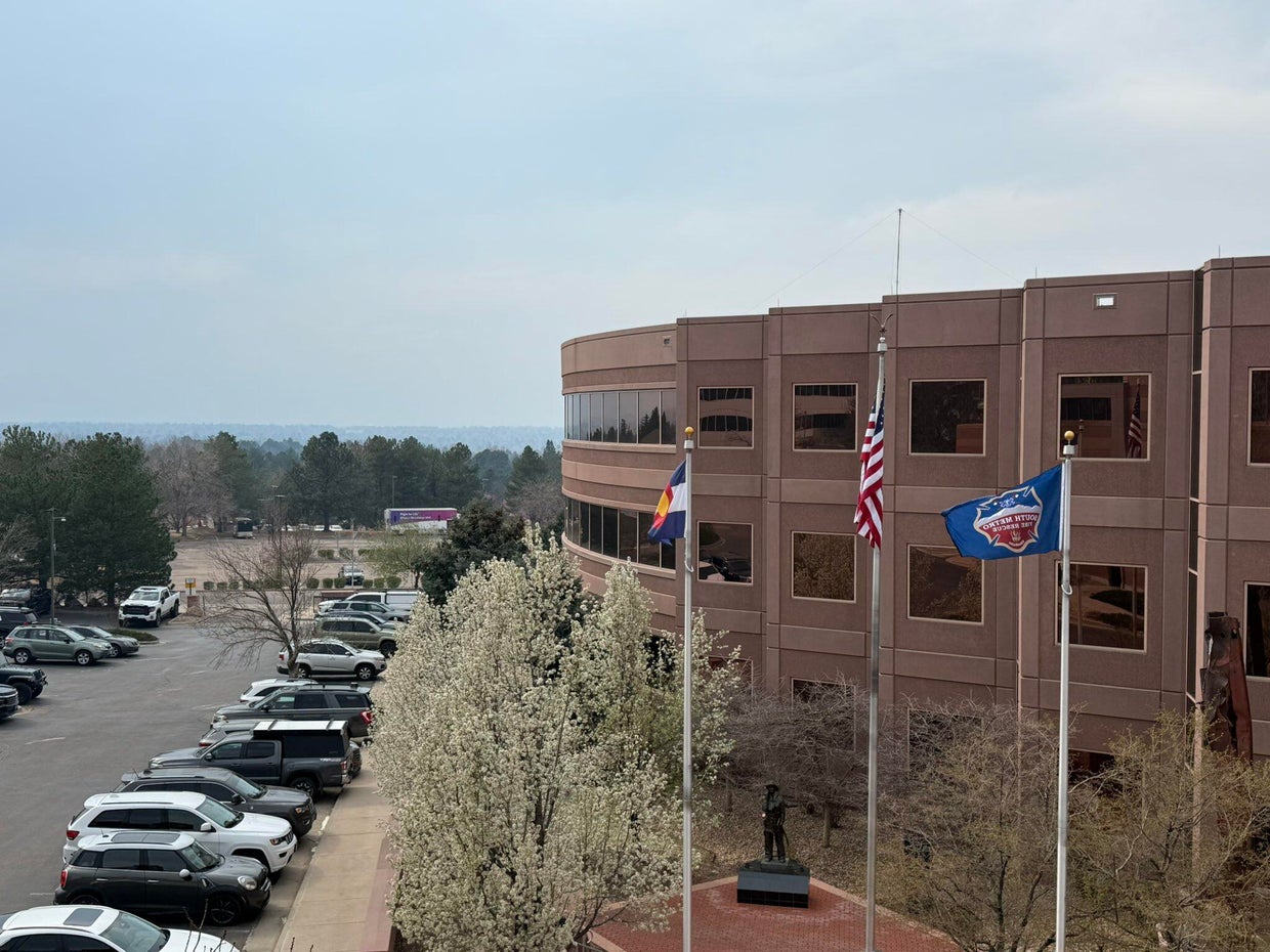
South Metro Fire Rescue said in their post that the smoke is from Colorado’s neighbor to the east. They called it a “significant haze” in the air.
Earlier this month, the Morrill Fire and the Cottonwood Fire burned a significant amount of Nebraska grassland and ranchland. They have mostly been contained by firefighters. Nebraska Gov. Jim Pillen said those two fires combined with several others have burned approximately 800,000 acres of land. On Thursday, Pillen announced that he is signing several executive actions intended to ease the burden caused by the fires.
There were no wildfires burning in the Denver metro area on Thursday afternoon.

ARAPAHOE COUNTY, Colo. (KKTV) – A homicide suspect based out of Colorado, wanted in a fentanyl-related death, is back in the state after being captured in Colombia.
The Arapahoe County Sheriff’s Office (ACSO) said 33-year-old Max Arsenault had been on the run since January 17.
Deputies said this stemmed from an incident in May 2023, where deputies responded to a call for a man named Nicholas Dorotik, who was found unresponsive.
ACSO said the cause of death was a mixed drug overdose involving meth and fentanyl, having about three times the lethal amount of fentanyl in his system.
One year later, Arsenault was arrested. He was scheduled for trial in January 2026 when deputies said he fled the country while on bond three days before the trial was set to start.
He was caught in Medellin, Colombia, on March 4, following a two-month international investigation. He has since been extradited back to Denver, where he is facing charges and awaiting trial.
Copyright 2026 KKTV. All rights reserved.


46 anti-Trump No Kings protests planned in Vermont. How to go

Virginia bill targets vape shops that sell to underage buyers – WTOP News

These Wisconsin Rapids restaurants are offering Easter specials

West Virginia Agencies Shielding Details on $1.44B DOE Coal Bail-out Loan from Public – CleanTechnica

Wyoming Reporter Now Facing An Additional 10 Felony Charges

Florida High School Football Rankings: Top 25 teams – Oct. 21

How old is Bo Nix? What to know about Oregon quarterback ahead of 2024 NFL Draft

Cleary's 21 help Le Moyne down Central Connecticut State 69-64 in OT

99th annual Pony Swim held in Virginia

Indiana Members Credit Union announced as new anchor tenant at Bottleworks District

Video: Will ICE Change Under Its New Leader?

DHS shutdown breakthrough comes at cost for Republicans as funding fights nears end

Rubio joins crucial G7 talks as Iran war set to dominate second day

A surprise resignation could open the door for an independent to win a Montana Senate seat

Video: Savannah Guthrie Says She Believes Her Mother Was Taken for Ransom
-

 Detroit, MI1 week ago
Drummer Brian Pastoria, longtime Detroit music advocate, dies at 68
-

 Science1 week ago
How a Melting Glacier in Antarctica Could Affect Tens of Millions Around the Globe
-

 Movie Reviews1 week ago
‘Youth’ Twitter review: Ken Karunaas impresses audiences; Suraj Venjaramoodu adds charm; music wins praise | – The Times of India
-
 Science1 week ago
I had to man up and get a mammogram
-

 Sports6 days ago
IOC addresses execution of 19-year-old Iranian wrestler Saleh Mohammadi
-

 New Mexico4 days ago
Clovis shooting leaves one dead, four injured
-
 Business1 week ago
Disney’s new CEO says his focus is on storytelling and creativity
-

 Texas1 week ago
How to buy Houston vs. Texas A&M 2026 March Madness tickets