Delaware
Delaware Blue Coats face Greensboro Swarm Saturday on PHILLY57

WILMINGTON, Del. (CBS) — The Delaware Blue Coats, the NBA G League affiliate of the Philadelphia 76ers, are 6-4 to start the season.
For the second time this month, they’ll face the Greensboro Swarm Saturday at 6 p.m. at home.
The game will air on PHILLY57 and stream at CBSPhiladelphia.com.
The Blue Coats beat the Swarm 123-113 back on Dec. 2 at the Chase Fieldhouse in Wilmington, Delaware.
Team Ambassador of Basketball Joe Richmond believes this team is really starting to come together.
“Coach has a crazy rotation and these guys just like to play together, they just genuinely like to be around each other,” Richmond said.
Several Blue Coats games this season will air on PHILLY57, CBS Philadelphia’s sister station, and stream online.
Watch Delaware Blue Coats home games on PHILLY57
December
- Saturday, Dec. 16 at 6 p.m. Long Island Nets vs. Delaware Blue Coats
January
- Saturday, Jan. 6 at 6 p.m. Westchester Knicks vs. Delaware Blue Coats
- Saturday, Jan. 27 at 6 p.m. Wisconsin Herd vs. Delaware Blue Coats
February
- Saturday, Feb. 10 at 6 p.m. Austin Spurs vs. Delaware Blue Coats
- Thursday, Feb. 22 at 11 a.m. Grand Rapids Gold vs. Delaware Blue Coats
- Sunday, Feb. 25 at 3 p.m. Motor City Cruise vs. Delaware Blue Coats
March
- Saturday, March 16 at 6 p.m. Birmingham Squadron vs. Delaware Blue Coats
- Sunday, March 24 at 3 p.m. Long Island Nets vs. Delaware Blue Coats
- Wednesday, March 27 at 11 a.m. Capital City Go-Go vs. Delaware Blue Coats
- Saturday, March 30 at 6 p.m. Oklahoma City Blue vs. Delaware Blue Coats
Thanks for reading CBS NEWS.
Create your free account or log in
for more features.

Delaware
Kohl's store in Delaware County being hit time and time again by shoplifters

HAVERFORD TWP, Pa. (WPVI) — Police say a Kohl’s in Delaware County is being repeatedly targeted for retail theft, with more than $5,000 worth of goods stolen in the past month.
The store in Haverford Township sits between West Chester Pike and Township Line Road. Police say one suspect has hit the store repeatedly.
In one trip on March 29, police say he took more than $2,000 worth of sneakers and sportswear.
“All the security officers talk, obviously, and they have found that this same person has hit different stores in different parts of the area,” said Chief John Viola.
He says the suspect had an escape plan.
“Went out the fire escape door, put it in the back of the pickup truck and drove away,” he said.
That was one of five times police say the same Kohl’s has been victim to retail theft in the past month.
“It gets hit continually with shoplifting,” said Viola. “These criminals think they can just walk in and grab stuff and walk out – and they do.”
Earlier that same day, on March 29, police say a man in an Eagles jersey walked out with more than $500 worth of clothing.
On March 5, police say a woman took close to $1,000 worth of makeup from Sephora.
On March 10, investigators say two men walked out with more than $700 worth of merchandise.
“You and I go shopping. These thefts drive our prices up. Who ends up paying for it? The consumers do,” said Viola.
The problem goes far beyond Haverford Township. The Action News data journalism team found in 2023, the FBI took nearly a million shoplifting reports.
Police in Delaware County say these criminals need to know they will be held accountable.
“Some of the areas don’t prosecute as heavily as we do and that drives a lot of the crime out to our area,” said Viola.
Copyright © 2025 WPVI-TV. All Rights Reserved.
Delaware
Del. Gov. Meyer says state of the state strong despite revenue uncertainties
From Philly and the Pa. suburbs to South Jersey and Delaware, what would you like WHYY News to cover? Let us know!
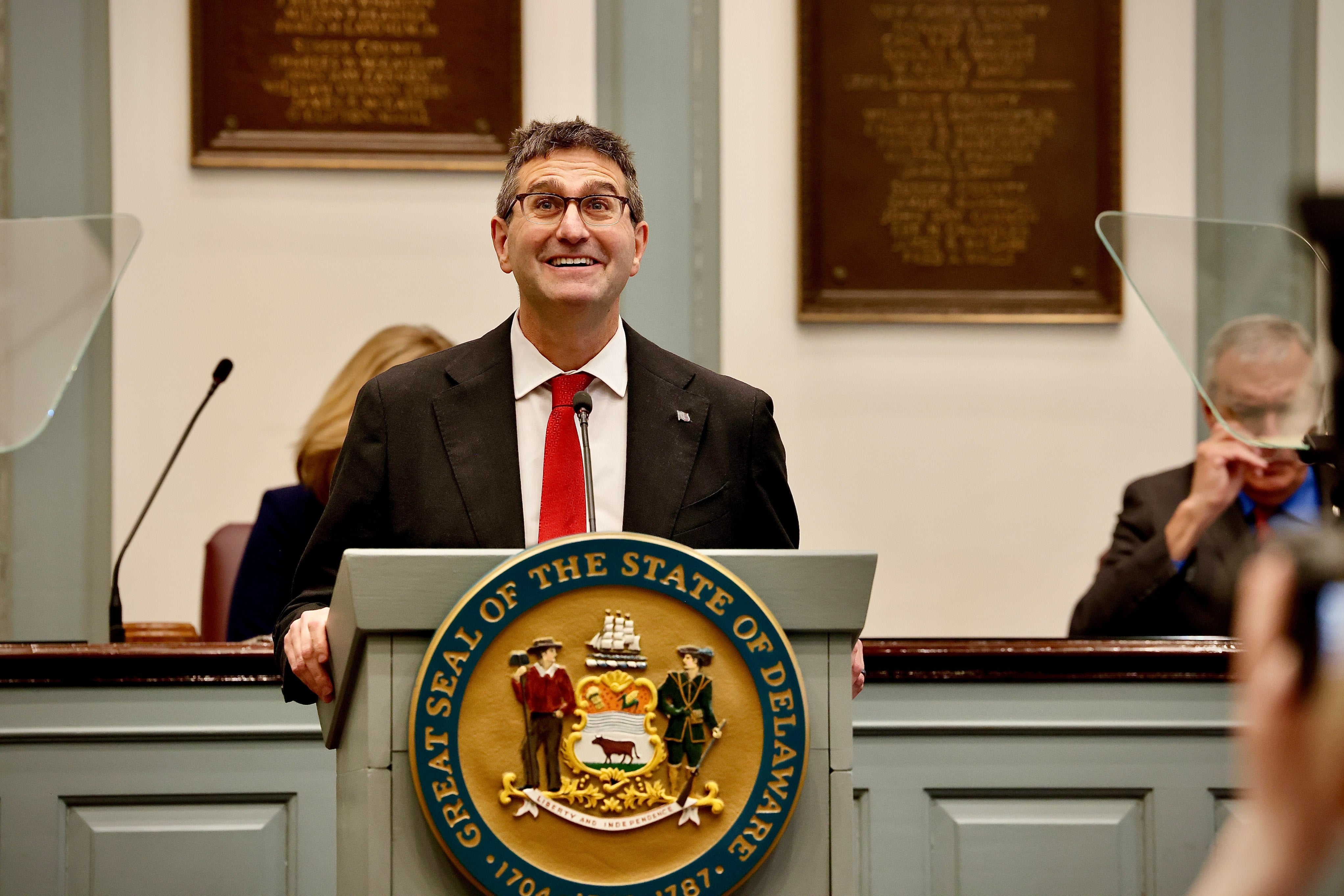
Delaware Gov. Matt Meyer laid out his legislative priorities and his vision for the state’s future in a joint address to the General Assembly in Dover on Thursday.
He declared the state of the state was “strong,” despite Delaware predicting slower future economic growth in future years that could force it to deplete money it has socked away.
Meyer gave his budget “reset” last month. He’s proposing a budget of nearly $6.6 billion for fiscal year 2026, up 7.4% from $6.1 billion for fiscal year 2025. The plan does not touch either the state’s Budget Stabilization Fund or the Rainy Day Fund, relying instead on new revenue from the change in tax brackets and an increase in fees.
The governor acknowledged the difficulty of crafting the state budget amid major policy shifts at the federal level, including funding freezes and cuts plus varying levels of tariffs.
“In building this year’s budget, our team is managing swings in revenue and expenses in the tens of millions of dollars — sometimes from one hour or day to the next, sometimes from one headline out of Washington to the next,” he said.
Under Delaware’s current income tax system, Delawareans making over $60,000 a year pay the state’s top tax rate of 6.6%. Meyer said he wants the new brackets to start at $125,000 of annual income, then go to $250,000 before topping out at $500,000. If the tax brackets plan gets approved by lawmakers, earnings between $60,000 and $125,000 would be taxed at a 6.6% rate. The tax rate would rise to 6.75% for income earned between $125,000 and $250,000, go to 6.85% for income earned between $250,000 and $500,000 and jump to 6.95% for wages over $500,000. The governor argued the plan would reduce taxes for most Delawareans.
Meyer’s budget depends on the additional $16.5 million in personal income revenue in 2026 and $35.2 million in 2027. His proposed cigarette tax of an extra $0.50 per pack would generate $8 million next year and $11.5 million in 2027. New revenue from other tobacco products would amount to $12.5 million over the next two years.
Delaware
At least 8 University of Delaware students see visas revoked by the Trump administration
Trump cracks down on visas as some students face deportation
The visas of international students around the U.S. are being unexpectedly revoked under the Trump administration’s agenda to reduce the number of both legal and undocumented immigrants.
unbranded – Newsworthy
At least eight college students studying in Delaware have had visas revoked by the Trump administration.
The University of Delaware confirmed Thursday the U.S. Department of Homeland Security quietly terminated the records or visas of eight university-sponsored holders, which it learned through reviewing its Student and Exchange Visitor Information System. Delaware State University has not yet disclosed whether students have been impacted.
This comes as the new administration has revoked hundreds of international student visas across the country so far, as reported by USA TODAY, setting off a scramble for them to leave the United States within days. So far, these reflect a small portion of an estimated 1.5 million international students studying in the U.S. or some 2,400 in Newark alone.
Shockwaves are being felt, regardless.
U.S. Secretary of State Marco Rubio said there is no right to a student visa and that it is a “privilege” that can be revoked, especially if students are involved in any kind of lawbreaking behavior. However, in many cases, exact reasons have not been given to students and universities.
Delaware’s largest university said it was not provided with any “specific facts underlying the decisions” in these eight cases.
A spokesperson said the federal department has the legal authority to terminate these records at any time, but giving notice to the host school, at least, is not required. In terms of whether students must cease study immediately, UD said it remains “a case-by-case situation.”
UD did not share more specifics on these students, citing sensitivity and privacy concerns. It did mention staff has conducted outreach and resources to assist with identifying legal immigration services, alongside other campus support.
“They are part of the fabric of University of Delaware, and taking away these records or these visas will prevent them from studying and living and working in the United States,” ACLU of Delaware Executive Director Mike Brickner said. “And, there are very specific steps that the government has to go through in order to revoke a student visa — they have due process, they have to have the ability to challenge it.”
ACLU affiliates in other states have already moved to challenge the administration on these visa revocations, alongside the National Immigration Project. Brickner did not confirm or deny similar plans in Delaware, but the director said any students or families impacted should contact ACLU-DE.
Delaware Gov. Matt Meyer’s office declined to comment on this issue Thursday morning.
This story is developing and will be updated as more information becomes available.
Have you been impacted by this administration’s immigration crackdown? Contact Kelly Powers at kepowers@gannett.com.
What’s going on?
There is no central accounting of just how many students have had their visas revoked or where they came from, USA TODAY reported earlier this week.
President Donald Trump campaigned on promises of tough immigration controls, while some conservatives have accused countries — particularly China — of sending students to study in the United States to steal intellectual property.
Money-wise, international students are typically ineligible for financial aid and usually pay full tuition, thus subsidizing other students. Many contribute to the economy and to U.S. research, Brickner noted, while often choosing to live in the country after their studies as paying taxpayers.
Last month, Rubio said he has revoked at least 300 visas of students, citing pro-Palestinian support and largely activities that are considered protected First Amendment rights. Others appear to be connected to incidents as minor as roommate disputes or off-campus traffic tickets, university officials told USA TODAY.
So far, these cancellations appear to be different than the detentions of Columbia University graduate Mahmoud Khalil and Tufts University student Rümeysa Öztürk, USA TODAY reported, largely because the students are not being detained.
Instead, many are being told to self-deport within a week.
“Our fear is that this may just be sort of the tip of the iceberg, right?” Bricker said. “We’ve seen some number of students have their visas revoked — but we’re still very early in this administration.”
USA TODAY contributed to this report.
Have you been impacted by this immigration crackdown? Contact Kelly Powers at kepowers@gannett.com.
-

 News1 week ago
Supreme Court Rules Against Makers of Flavored Vapes Popular With Teens
-
 News1 week ago
NYC Mayor Eric Adams' corruption case is dismissed
-

 Technology1 week ago
Here’s how you can preorder the Nintendo Switch 2 (or try to)
-

 World1 week ago
‘A historic moment’: Donald Trump unveils sweeping ‘reciprocal’ tariffs
-

 Politics1 week ago
FBI flooded with record number of new agent applications in Kash Patel's first month leading bureau
-

 Business1 week ago
Amazon Said to Make a Bid to Buy TikTok in the U.S.
-

 World1 week ago
Commission denies singling out NGOs in green funding row
-

 Health1 week ago
Federal Health Workers Make Up Less Than 1% of Agency Spending
