A Century of Citizenship
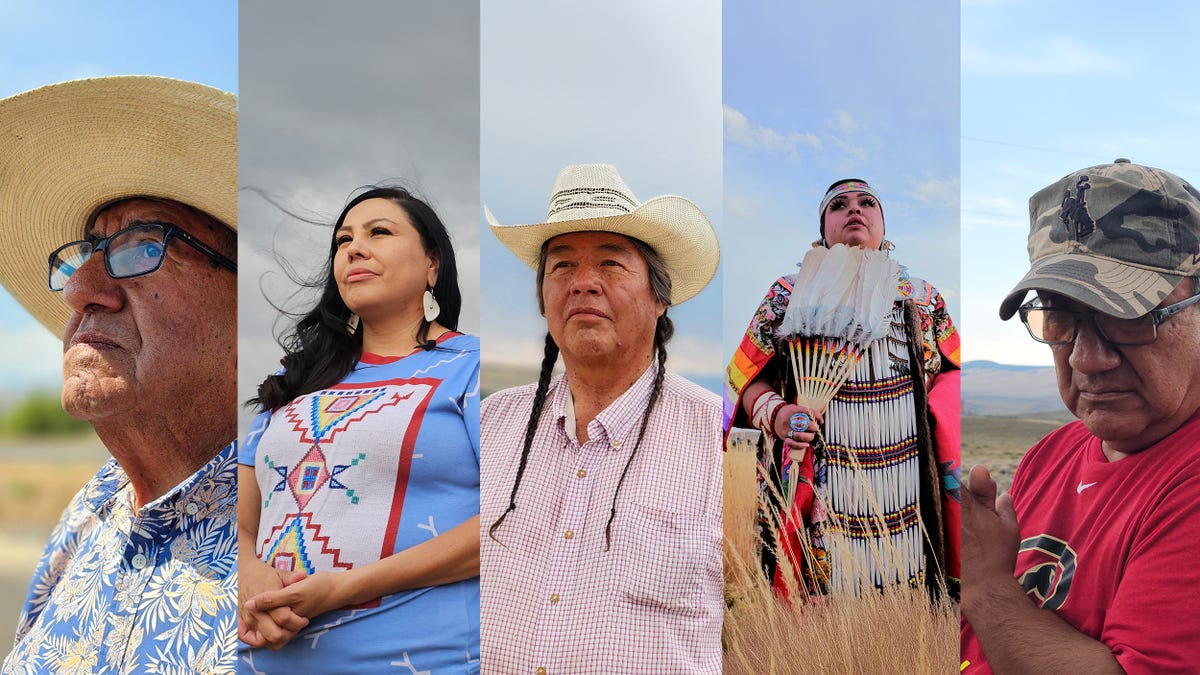
Rhyia Joyheart, 26, is no stranger to the day-to-day grind of 21st-century life, such as rising rent, high grocery bills, and long hours spent in city traffic. Born on Wyoming’s Wind River Indian Reservation and currently working at Denver’s Urban Indian Health Clinic, Joyheart says bringing resources to Indigenous communities involves working with systems that are designed to exclude them.
“It’s become my passion to become a translator for our community, in the sense of making a spot at the table,” Joyheart says. “I do feel at times the only way to get anywhere is to assimilate to the system.”
Congress passed the Indian Citizenship Act a century ago, granting citizenship to “all noncitizen Indians born within the territorial limits of the United States.” Today, Native Americans claim dual citizenship, recognizing their identity with both their tribal nations and the United States. But this relationship is far from simple.
USA TODAY traveled to Wind River to learn from Indigenous community leaders about how they balance these identities a century onwards, and what gives them hope for a better future.
More: Native Americans fight barriers to voting, 100 years after being recognized as U.S. citizens
Moving history, changing borders
Wes Martel, of Eastern Shoshone and Northern Arapaho heritage, sits with a plate of hash browns and fried eggs in front of him. At 74, he’s been active in tribal politics, buffalo restoration, environmental protection, and the fight for water rights. He thinks that Native Americans still live under the same legal constraints as they did a century ago.
He points to the Doctrine of Discovery, enacted by the Pope in the 15th century, which gave control of land to settlers who “discovered” it. The Vatican renounced the Doctrine, but it was cited by the U.S. Supreme Court as recently as 2005.
He also takes issue with the authority the U.S. government holds over Native Americans, known as “plenary power,” defined as “complete or absolute authority granted to a governing body…without limitations.” In Martel’s words, Congress “can do whatever the hell they want.”
All this makes Martel question the equality of Native American citizenship.
“It’s 2024, as a tribal member, I can’t own land,” Martel says. The Bureau of Indian Affairs “has to hold it in a trust for me.”
Martel points out that tribal nations along the Colorado River are reclaiming water rights and says that a brighter future is possible when Indigenous communities fight back.
“If you’re just going to give me some more Christianized, colonized attorneys, I don’t want no part of it,” Martel says. “We need some pit bulls for treaty law, constitutional law, and to fight this plenary power bullshit.”
Martel sips his coffee and talks about the history of Wind River. An 1863 treaty had the territory of the Eastern Shoshones stretching as far as present-day Utah and Colorado. Laws and treaties cut the reservation’s size by 95 percent. The U.S. government moved the Northern Arapaho Tribal Nation to Wind River in 1878.
At the turn of the 20th century, allotment and leasing acts opened up land to white settlers. Their descendants own property today, making Wind River a checkerboard of Indigenous and settler “discovered” land.
Sitting at his dining table in a maroon Arizona Diamondbacks shirt, Clarence Thomas, 60, questions the borders that define modern sovereignty – not just Wind River. Thomas descends from the Onk Akimel O’odham (Pima) tribal nation near today’s U.S.-Mexico border and moved to Wind River for his wife, who is Eastern Shoshone.
Thomas’ ancestors historically roamed throughout the Southwest. Thomas says that “tribal cousins” now live across the U.S.-Mexico border. He prickles at the idea of closing it.
“This whole country is full of those who immigrated here. And we as Indigenous people, we just watch them come and go,” Thomas says. “But yet they are the ones who always will say, “let’s stop the immigrants.””
Assimilation, bridging two worlds
Jeff Means, an Oglala Sioux, argues that the notion of citizenship as a “gift” to Native Americans is “disingenuous.” As an associate professor of History and Native American and Indigenous studies at the University of Wyoming, Means says it’s the culmination of decades of policy designed to blend American Indians into white society.
“All that you have left are the Natives who’ve known nothing else but reservation life. And they’re struggling desperately to try and maintain their identity and their sovereignty and independence,” Means says. “You’re now declaring these people citizens of a completely different nation.”
Thomas says his elders taught him a similar message
“Citizenship in itself came with “you will do it this way, but that’s the only way you’ll do it,” Thomas says. “And in that, everything else is gone. And even to this point, we’re still, as tribal people, trying to gain that back. But it’s still a fight.”
Reinette Curry, 40, wears heart-shaped beaded earrings and a blue t-shirt. Curry works at the University of Wyoming and pushes for Indigenous education and cultural preservation. She says a level of assimilation can be a necessity, but community building is the ultimate goal.
“Although we’re getting educated out in the white man’s world, we’re able to come back home and bring that education in,” Curry says. She tells her children and younger community members, “If you go off to college and you get educated, you can use that as a tool to fight for our people.”
The impact of federal policy plays out in Curry’s personal life. Curry, while an enrolled member of the Northern Arapaho tribal nation, also has Northern Ute and Pyramid Lake Paiute heritage. The Bureau of Indian Affairs instituted blood quantum in the 1880s. It’s a sort of inversion of the Jim Crow South’s “one-drop rule” that measures a person’s amount of “Indian blood” to determine tribal eligibility.
As Curry’s family and others have children with members of other tribes, or with outsiders, they become less Indigenous in the eyes of the United States government. This can make them less eligible for tribal membership and benefits.
“It was basically placed to eventually fade us out,” Curry says.
Curry sits inside a white canvas tent as the roar of a summer thunderstorm lashes against its sides. She explains that parents encourage their children to form partnerships with other Indigenous people to avoid the risk of losing their tribal status and associated benefits.
“Tough conversations like that we as Native people have to have, other people don’t have to have,” Curry says.
An honest narrative, a path forward
When Joyheart, who’s Northern Arapaho, Flathead, and Eastern Shoshone, looks at the last century, she sees a reluctance to truthfully tell a story that could repeat itself.
“They’re like “okay, yeah, get over it,” but they don’t understand that it’s not that simple. How can you get over a genocide of a people?” Joyheart asks. “We understand that what has happened is in the past, but it doesn’t mean that it couldn’t happen again.”
A desire for an honest look at history isn’t unique to Joyheart and Native Americans. Japanese internment camps have been transformed into museums. In Washington, D.C., the Smithsonian National Museum of African American History and Culture documents the timeline of the cultural and civil rights abuses against Black Americans. Although there is a National Museum for the American Indian, Joyheart wants broader recognition of the unique challenges Indigenous people have overcome.
President Joe Biden took a step forward to reconciliation when he recently apologized for abuses committed at government and church-run boarding schools. Earlier this month, the Department of the Interior announced an oral history initiative with the National Museum of American History to preserve the stories of survivors of the federal Indian boarding school system.
The schools played a crucial and often harsh role in assimilating American Indians into non-Indigenous society. Their legacy lingers at Wind River, to this day.
Thomas tells the story of his grandfather greeting a teacher at a boarding school in his native language.
“And she [the nun] kept hitting him every time he said that … finally, when he started learning the language, what she was saying was, ‘Don’t speak your dirty language to me and don’t look at me.’” Thomas says, “Don’t look at me. Look down.”
Joyheart, who beads and sews regalia for young powwow dancers, says more teaching of Native American history is needed, both inside and outside her communities.
“A lot of our Native people are rediscovering a lot of the history within our own stories,” Joyheart says.
Allison Sage, 66, Northern Arapaho, works to connect youth on Wind River with these histories. He tells a favorite joke from the front seat of his pickup truck.
“In the 1800s … General George Armstrong Custer told Congress’ don’t do nothing till I get back,” Sage says.
The oft-mythologized Custer died in the Battle of Little Big Horn – and in Sage’s eyes, the federal government hasn’t changed its tune since: “They divide you up, then they conquer you.”
Sage saddles up with youth from around Wind River for monthly healing rides to connect young people with their cultural heritage. The annual highlight is a pilgrimage to the site of Custer’s defeat.
“We go every year to the Battle of the Little Big Horn victory ride, which is the decolonization ride,” Sage says.
Martel, sitting over his breakfast, believes the government has failed Native Americans, but he has faith in the strength of tribal communities. He has five great-grandchildren. When asked about his wishes for them, he emphasizes health, happiness, food on their table, and an “understanding of our lodges, ceremonies, and medicines.”
“Strength in our families and our communities, that’s all we’re trying to do,” Martel says. “But nobody gets it.”
Curry is optimistic that this strength and these practices will find future generations so they can continue to be proud of their culture no matter where life carries them. Just a few generations removed from the violence of boarding schools, and with a new understanding of intergenerational trauma, Curry is already seeing the results.
“Now we can start teaching our babies at a younger age. And so I get excited when they’re dancing and singing and singing songs in our language,” Curry says. “So much hope that our kids are going to learn all this, and they’re going to be able to hold us down when we’re all gone.”
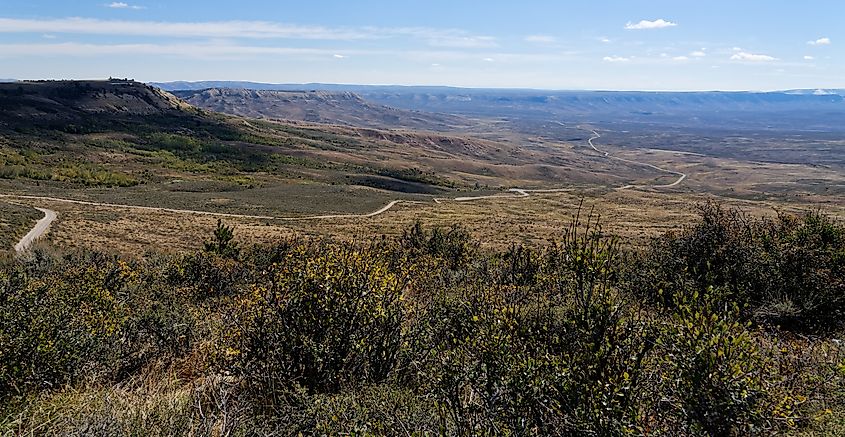
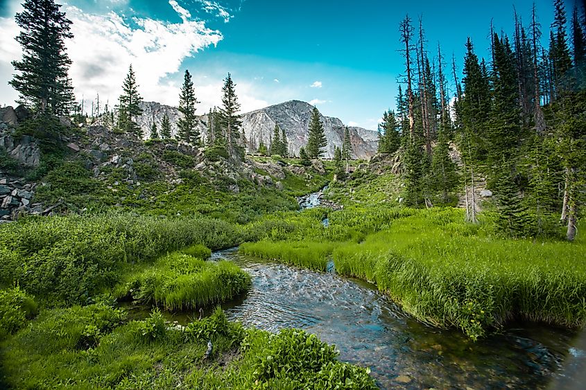
One hundred years after the Indian Citizenship Act, Joyheart stands in a field of tall grass, sharp peaks of the Wind River mountains behind her, her gaze brushing over a ring of trucks and tents, everything tinged rose by the setting sun. Just a few generations ago, her regalia and the dance she performs were outlawed.
“We live in our children’s past,” Joyheart says. “Meaning that when we’re long and gone, that all of our cultural teachings and legacies are going to carry on with them.”
Cy Neff reports on Wyoming politics for USA TODAY. You can reach him at cneff@usatoday.com or on X, formerly known as Twitter, @CyNeffNews

/cloudfront-us-east-1.images.arcpublishing.com/gray/X346VKCDJJCARPTQLOFZ23URLQ.JPG)
/cloudfront-us-east-1.images.arcpublishing.com/gray/D5CLUU46LRBE7HDK5OMK3YG2R4.JPG)
/cloudfront-us-east-1.images.arcpublishing.com/gray/C34LDEQSWVFKNLUTVYBJVWWRNE.JPG)








/cdn.vox-cdn.com/uploads/chorus_asset/file/24924653/236780_Google_AntiTrust_Trial_Custom_Art_CVirginia__0003_1.png)


/cdn.vox-cdn.com/uploads/chorus_asset/file/25672934/Metaphor_Key_Art_Horizontal.png)
