California
What happened the last time a tropical storm hit California in 1939

A Sunset Beach home collapsed into the surf due to the tropical storm that hit Los Angeles, Calif., in September 1939.
Newspapers.com
A historic storm could be headed for California this weekend, one the state hasn’t seen in almost a century. Hurricane Hilary is on track to barrel toward Southern California, possibly making landfall on Sunday as a tropical storm. This type of weather event is incredibly rare for the state, according to the weather service, and the last time one hit California was on Sept. 25, 1939.
That fall, Southern California was suffering from an intense heat wave, with temperatures reaching as high as 107 degrees, when the warning of a growing storm started to ripple through the coast. The hurricane began forming around Sept. 15 off the coast of Central America and made its way slowly toward California. Its intensity was downgraded to a tropical storm by the time it started raining in Los Angeles on the evening of Sept. 24, but the winds that were about to hit California hadn’t been experienced in decades. (An 1858 storm off San Diego was officially classified as a hurricane, though it never made landfall.)
Photograph of house on storm-damaged beach on Sept. 24, 1939.
Malibu Historical Photograph Collection/Pepperdine University Archives
Advertisement
Article continues below this ad
Severe gale force winds hit San Pedro on Sept. 24, measuring up to 65 mph and pummeling Los Angeles 5.42 inches of rain in 24 hours, according to Los Angeles Times reports from the time. The Los Angeles River became a “raging torrent,” as described in the Times, and half the city’s phone lines went out due to the wind and downed trees.
Rain totals were highest on Mount Wilson, which received 11.88 inches of rain, and Mount Baldy, which saw 7.92 inches of rain, according to the Times.
Three homes on Alamitos Bay collapsed into the surf due to the tropical storm that hit Long Beach Calif., Sep. 26, 1939.
Newspapers.com
An Associated Press report at the time called it a “violent storm,” and at least 45 people perished on land, with 48 dying at sea. Twenty-four of the deaths occurred on the fishing vessel Spray, which capsized. An Associated Press report on Sept. 26 warned that more two dozen boats “had not been heard from since the storm broke.”
Advertisement
Article continues below this ad
Reports assessed property damage at more than $1 million (about $22 million in today’s dollars), with some homes crumbling into the ocean. In Long Beach, at least a dozen homes were destroyed along the coast.
Photograph of people surveying damage around trailers at Coral (Corral) Beach after a storm on Sept. 24, 1939.
Malibu Historical Photograph Collection/Pepperdine University Archives
One school in Inglewood attempted to weather the storm. Students were ferried to the building by boat, but class was later dismissed when the lake continued to balloon in size.
Railroad tracks washed out in several parts of the state, including 150 feet of track in the Coachella Valley. Infrastructure damage was extensive, with roads and highways closed or flooded and bridges washed out. In Indio, a deluge of 5 inches of rain came down in just seven hours.
Advertisement
Article continues below this ad
Photograph of houses on beach damaged by a storm on Sept. 24, 1939.
Malibu Historical Photograph Collection/Pepperdine University Archives
The storm, which also became known as “the Lash of St. Francis” or El Cordonazo, did have one upside — there was no weather bureau in the area at the time, and the devastating effects led to its creation in 1940.
Northern California didn’t see much influence from the storm, aside from slightly cooler temperatures than normal. San Francisco got a drizzle — 0.08 inch of rain in the 24-hour period recorded on Sept. 25, according to the San Francisco Chronicle.
More California Storm News

California
Millennial Democrat Ian Calderon announces bid for California governor
California
2 bills meant to speed up California Delta Tunnel project die without vote

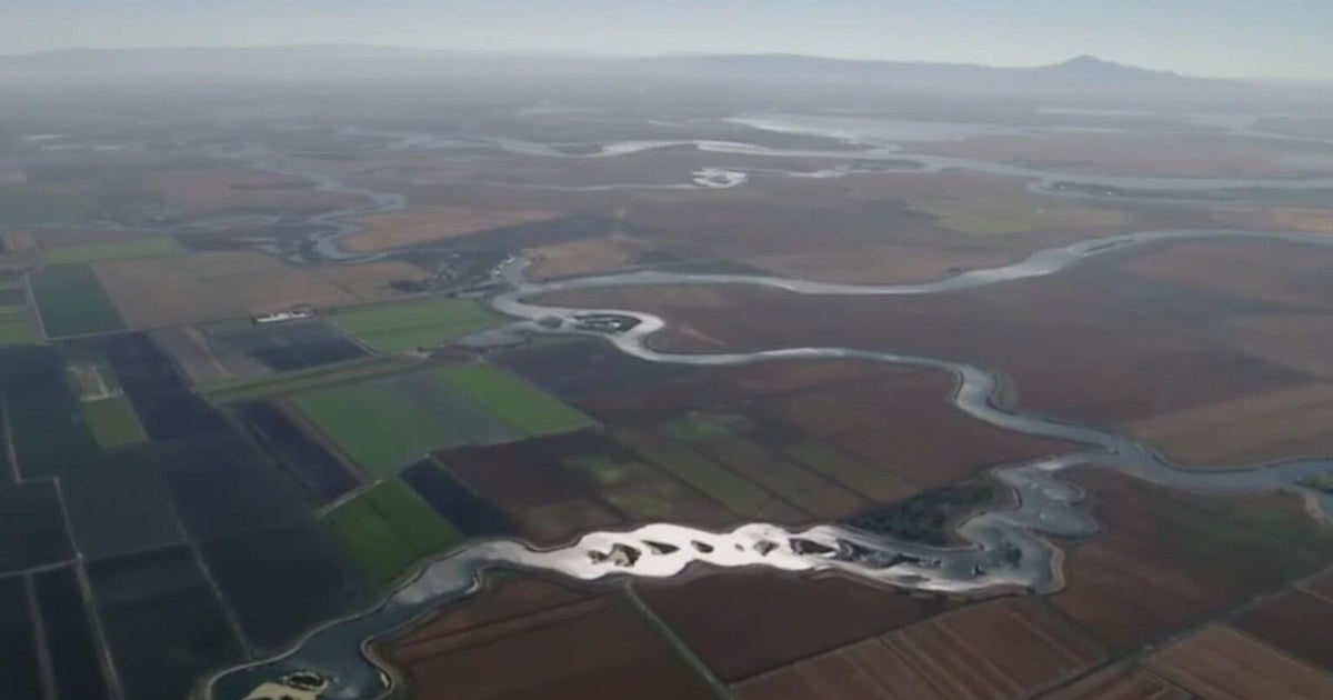
Last Tuesday, the California Legislature cast a vote on Gov. Gavin Newsom’s controversial water tunnel project in the Sacramento-San Joaquin River Delta by not voting at all.
A couple of bills meant to speed up the process were allowed to die in committee before reaching the state Assembly. Opponents of the project consider it a victory in a fight to protect the water of the delta and the towns that live along its banks.
The delta town of Isleton sits frozen in time, a relic from its “Old West” past. It may be a little quiet these days, but it’s no ghost town — yet. It all depends on the river that runs alongside the town.
“Well, the history of Isleton is really deep in the river,” said Iva Walton. “Isleton used to be the main stop on the steamboat between Sacramento and San Francisco. So, it has a long history of depending on the traffic on the river.”
Walton owns the Mei Wah Beer Room, a former Chinese saloon and brothel in the 1800s. The whole town relies on people visiting the delta, and the proposal to bury a giant tunnel to siphon off billions of gallons of water farther up the Sacramento River to send to Southern California cities and Central Valley farms has drawn the ire of many people living along the delta.
“I think, in general, people are aware that it would be bad for the environment, for the property, the land, and the tourism that comes out here, if the tunnels were to drain a lot of the water from here,” Walton said. “It just seems ridiculous to take from something that is a fragile environment. There has to be other options.”
Still, Newsom has made it his key climate resilience initiative. In his May budget revision, he included a pair of bills that would make things go faster by exempting it from CEQA, simplifying permitting, allowing the state to acquire land, authorizing bonds to pay for the project, and limiting future legal challenges to the tunnel.
His office released a statement saying: “For too long, attempts to modernize our critical water infrastructure have stalled in endless red tape, burdened with unnecessary delay. We’re done with barriers — our state needs to complete this project as soon as possible, so that we can better store and manage water to prepare for a hotter, drier future. Let’s get this built.”
“Barriers are put in its way,” said Jon Rosenfield. “Those barriers being the state’s laws that everyone else needs to comply with. But the governor seems determined to try to circumvent those laws to get his tunnel built.”
Rosenfield is science director for SF Baykeeper, one of the groups opposing the tunnel for the damage they think it would inflict on already faltering fish populations downstream in the delta. But he thinks it is the project’s whopping price tag that caused legislators to let the bills die without a vote.
“I think it means there’s not a lot of support for the Delta Conveyance Project,” Rosenfield said. “I think the majority party, which is the governor’s own party in the legislature, is rightfully concerned about the cost of living. And taking on another $60-100 billion project that doesn’t really address our problems, that would still require more money to address, is not a winning proposition at this time, or ever.”
It’s also not a winning proposition in Isleton, where protecting the river is considered vital.
“It’s an amazing place and I would hate to see it go away,” said Walton.
If approved, the tunnel would run 45 miles from the Sacramento River to an existing reservoir near Livermore, before heading south via the California Aqueduct. Construction probably couldn’t begin until 2029 and would take at least 15 years to complete.
First, the project will have to undergo the normal regulatory process, at least for now.
Newsom said he would like to see the tunnel fully entitled by the time he leaves the governor’s seat. There are major political forces at work and no one seems to think this will be the end of it.
California
Lawyers fear 1,000 children from Central America, dozens in California, are at risk of being deported

Lawyers and advocates fear about 1,000 Central American children, including dozens in California, are at risk of being deported to dangerous situations in their home countries before finishing their immigration court proceedings.
They believe the U.S. government is now expanding their list of hundreds of children across the country, which started with children from Guatemala, to include those from Honduras and El Salvador. Lawyers for some children saw their scheduled hearings disappear from the immigration court calendars in recent weeks.
“It has been heartbreaking and infuriating these last two weeks to have to warn our child clients that our government seeks to violate their rights and return them to danger,” said Marion Donovan-Kaloust, director of legal services at the Los Angeles-based Immigrant Defenders Law Center, which represents unaccompanied minors. “The fact that the government is doubling down on this cruel scheme should shock everyone’s conscience.”
In the middle of the night over Labor Day weekend, the government removed 76 Guatemalan children from shelters in Arizona and Texas. Many of their cases had vanished from calendars before the Department of Homeland Security placed them on a plane set to return to Guatemala without telling their parents, according to court documents.
A transport van with migrants onboard departs the Valley International Airport, Sunday, Aug. 31, 2025, in Harlingen, Texas.
(Michael Gonzalez / Associated Press)
A federal judge blocked the flight in an emergency order as children sat aboard a plane on the tarmac. Many feared for their safety should they return to Guatemala, where attorneys say they face gang violence, physical abuse and neglect.
U.S. Department of Justice attorney Sara Welch said during a hearing this week there were “no immediate plans” to remove immigrant children from other countries. The Department of Homeland Security and the Refugee Resettlement office did not respond to requests for comment.
A legal aid worker with knowledge of the situation said Honduran counterparts are expecting 300 children to be returned to the country, which would account for nearly all Honduran children in Office of Refugee Resettlement custody nationwide. Another 100 unaccompanied children from El Salvador are in U.S. government custody, said the worker, who requested anonymity to share sensitive details.
Earlier this summer, Guatemalan officials said U.S. officials had sent them a list of 609 teenagers ages 14-17 to be returned to the country. At least 40 immigrant children living in California were on that list, the legal aid worker said.
In a Sept. 6 sworn declaration, Angie Salazar, acting director of the refugee resettlement office, said that 457 Guatemalan children were initially identified as “potentially appropriate for reunification with a parent or legal guardian,” but that after reviewing individual cases, 327 children were determined to be ultimately eligible for removal from the U.S.
During the hearing this week, Welch walked back earlier government assertions that the children’s parents had asked for them to be returned, after lawyers for the minors produced a memo from the Guatemalan Attorney General that showed officials had contacted about 115 families, nearly half of whom were upset at the prospect of their child being returned.
Another 50 families said they were willing to accept the children, but had not asked for their return. In one case, the memo noted the parents said they will “do everything possible” to get their daughter out of the country again, “because she had received death threats.”
Since the deportation attempt over the holiday weekend, attorneys for the children, who crossed the border without legal guardians and are now under the care of the Office of Refugee Resettlement, have been on high alert.
One attorney with the non profit Estrella del Paso in Texas said in sworn statements that on Sept. 5 she received an anonymous call from a shelter that the “government was planning to repatriate all children under the ORR custody without making any announcements.”
Another attorney, Roxana Avila-Cimpeanu, deputy director of the Florence Immigrant & Refugee Rights Project in Arizona similarly said the same day that “credible reports continued to stream in from the network regarding the imminent removal of Honduran children.”
The facilities that did not wake up the Guatemalan children in the middle of the night were sent a “DEMAND FOR COMPLIANCE” letter from the Office of Refugee Resettlement on Aug. 31.
“Negligent or intentional failure to comply with lawful requests from ORR regarding the care of the children in your care facility will result in prompt legal action and may result in civil and criminal penalties and charges, as well as suspension and termination of contractual relations with your facility,” states the letter, which was obtained by The Times.
The letter frightened shelters and foster families, said Shaina Aber, executive director of the Acacia Center for Justice.
“We have heard from shelters and foster families that they are very nervous and they don’t know whether to follow the law as they understand it from years of doing this work, or to go along with this novel extrajudicial process,” Aber said.
Lawyers in the case are asking Judge Timothy R. Kelly, a Trump appointee, to extend the emergency order, which expires Sunday, and halt the removal of children from other countries who don’t wish to be returned. They argue U.S. officials do not have authority to remove them without providing them an opportunity to have their cases for asylum heard before an immigration judge.
“I am certain that people there who hurt me and threatened to kill me before will once again hurt me and will carry out their threats to kill me,” said one 17-year-old identified as D.I.R. in court records.
Among those named is a 16-year-old Guatemalan boy in long term foster care in Fullerton. His immigration proceedings had been closed and not yet decided. Another is a 16-year-old Guatemalan girl living in foster care in Riverside. She’s in immigration proceedings and is scared of being sent back. Both are being represented by the Immigrant Defenders Law Center.
Some Guatemalan children in the U.S. were interviewed by officers with Homeland Security Investigations, a branch of Immigration and Customs Enforcement, said Efrén C. Olivares, Vice President of Litigation and Legal Strategy for the National Immigration Law Center. Some family members in Guatemala also received calls from local government officials who said their children would be sent back.
Olivares, one of the lead attorneys for the plaintiffs in Washington, warned if the court sided with the Trump administration, “they can do this to all children in ORR custody of every nationality.”
“That’s the worst-case scenario,” he said.
Guatemalan officials have publicly acknowledged efforts to coordinate with the U.S. to receive hundreds of children currently held in U.S. facilities.
The Honduran government posted on X Sept. 1 that it had initiated efforts to coordinate the “safe return of minors deported from the United States.”
While the Salvadoran government has not released public communications about the repatriation of children from the U.S., Olivares pointed to the coordination between the two governments earlier this year, when hundreds of Venezuelan migrants in the U.S. were sent to a notorious mega-prison in El Salvador.
“It’s worrisome that they have a very close relationship,” Olivares said
Meanwhile, two localized cases are playing out in Illinois and Arizona.
On Thursday, a federal judge in Arizona temporarily blocked the Trump administration from removing dozens of Guatemalan and Honduran children living there in shelters or foster care. Similarly, a federal judge stopped the removal of Guatemalan children in Illinois, and a hearing is set for Tuesday.
“These are children who are literally here without without a parent, and very vulnerable,” said Laura Smith, executive director of the Children’s Legal Center in Chicago and an attorney on the Illinois case, who also got word from a facility shortly after Labor Day that immigration officials were readying to take custody of Honduran children. “So I am surprised by the administration’s attacks.”
The move to deport unaccompanied children comes amid broader efforts to strip away protections for young immigrants. For instance, the Administration has sought to end funding for lawyers who represent unaccompanied children. It is also seeking to end a decades-old agreement that requires minimum standards of care for children held in detention.
-

 Finance7 days ago
Reimagining Finance: Derek Kudsee on Coda’s AI-Powered Future
-

 World5 days ago
Syria’s new president takes center stage at UNGA as concerns linger over terrorist past
-
North Dakota6 days ago
Board approves Brent Sanford as new ‘commissioner’ of North Dakota University System
-

 Technology5 days ago
These earbuds include a tiny wired microphone you can hold
-

 Culture5 days ago
Test Your Memory of These Classic Books for Young Readers
-

 Crypto5 days ago
Texas brothers charged in cryptocurrency kidnapping, robbery in MN
-

 Crypto7 days ago
EU Enforcers Arrest 5 Over €100M Cryptocurrency Scam – Law360
-

 Rhode Island6 days ago
The Ocean State’s Bond With Robert Redford


