California
Silverton dog rescue cares for severely burned puppy found in California

SILVERTON Ore. (KPTV) – A 3-month-old puppy spent Saturday enjoying the outdoors at the Woods Creek Dog Rescue in Silverton after he was found severely burned in California several weeks earlier.
Around May 5, Hector Adrian found Phoenix in an alley near his home in Fresno, Calif. He was on his way to work when he heard whining – initially thinking it was a person.
[Translation from Spanish]: “The dog was scratching himself and bleeding,” Adrian said. “I didn’t want to move him or his paws because I didn’t want to hurt him more. He tried to get up, but he couldn’t.”
Adrian took Phoenix to a Fresno animal shelter. Adrian said he wasn’t able to adopt the puppy because his rental doesn’t allow animals.
SEE ALSO:
That’s when Tammy stepped in after seeing photos of Phoenix wrapped in bandages on Facebook. She had the puppy shipped to Oregon and immediately took him to the OSU Veterinary Hospital.
“It was really hard seeing him on the table,” Tammy said. “They had him fully sedated and seeing how extensive his burns were and they said fourth degree.”
Now Phoenix is under the care of Dr. Serena Mills at Alpine Animal Hospital.
Dr. Mills said all four of Phoenix’s paws and his belly were burned. Doctors removed dead tissue and char.
Now Phoenix wears bandages that have to be changed three times a week. However, Tammy said the puppy’s care and pain medicine costs a hefty $700 a week
“He has to be sedated every time he has the bandage changes. It hurts to take it off, so he cries and gets a little upset.”
Phoenix’s healing is progressing. Dr. Mills says his tissue is starting to grow back and he will develop calluses on his paws for protection.
“We’ve got to put booties on him before he comes outside. He struggles a little bit with those. He’s so good-spirited, he just sits in his little playpen and waits for his turn.”
While no one knows yet how Phoenix’s story began, Tammy is helping the puppy find his happy ending.
“That’s what I consider it part of their journey either to help them find on their path to a forever home and making sure they’re quality of life is going to be good for them,’ says Tammy.
Learn more and contact the Woods Creek Dog Rescue via this link
Find Woods Creek Dog Rescue’s Venmo link on their Facebook page
Copyright 2024 KPTV-KPDX. All rights reserved.

California
RWE to start California offshore wind project surveys
June 16, 2024
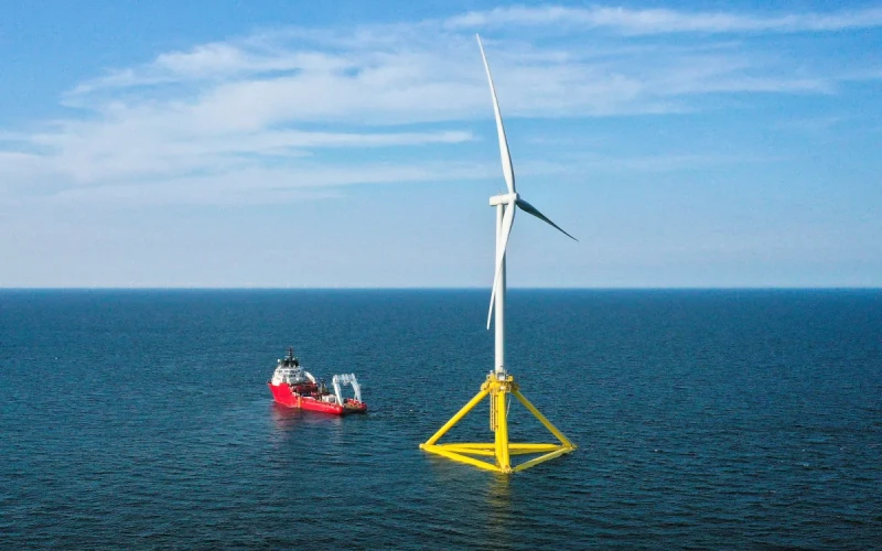
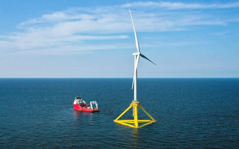
Offshore wind developer RWE announced it will start site investigation surveys for its planed 1.6-gigawatt Canopy Offshore Wind Farm off northern California.
Located 20 miles off Humboldt County, the Canopy project would anchor floating wind turbines on a 63,338-acre lease RWE obtained in a 2022 auction by the federal Bureau of Ocean Energy Management.
“Surveying is an important step on the path toward developing Canopy Offshore Wind and helping provide clean energy that meets California’s ambitious climate goals,” said Sam Eaton, CEO of RWE Offshore Wind Holdings, in a June 12 statement. “RWE is committed to responsible, inclusive development by engaging Humboldt residents, Tribal Nations, and working closely with the fishing community as we begin offshore activities on the project.”
RWE selected subsea service provider Argeo to perform the Canopy site investigation work. “Argeo is pleased to partner with RWE on their first commercial scale floating offshore wind project. We will conduct subsea surveying utilizing proven, state-of-the-art technology,” said Dave Gentle, vice president for North and South America at Argeo.
Argeo will utilize an autonomous underwater vehicle (AUV) to conduct surveys in the Humboldt lease area, where depths range from 500 to 1,100 meters (1,640 to 3,600 feet) according to BOEM.
“The use of an AUV as the survey platform during this initial site characterization effort will enable high-quality data collection close to the seafloor, including photographs of biological communities,” according to a summary by RWE.
Using the autonomous vehicle “significantly reduces the potential for entanglement of fishing gear as they are not towed equipment,” the company says. The sensors carried by the AUV operate at safe sound levels and meet California low energy equipment requirements for geophysical surveys that are in place to minimize impacts to marine mammals and other wildlife.”
Groups opposing offshore wind projects off the U.S. East Coast have worked to tie survey work to whale strandings and deaths. West Coast wind power is just entering that first phase of development, and RWE officials said they are planning to deploy protected species observers on survey vessels.
The company has engaged Geo SubSea and Coastal 35 Consulting to provide PSOs on survey vessels. Smultea Sciences will provide PSO training “to Tribal citizens and Humboldt County community members to increase the involvement and workforce opportunities for individuals who possess local and Indigenous knowledge of the area during the site investigation campaign,” according to RWE.
The first survey work is planned to start in June to map the seafloor and begin assessing best locations for turbines, anchors and cables, and charting habitat and environmental factors.
“Protected Species Observers are an essential part of ensuring site surveys occur safely in a way that avoids interactions with wildlife,” said Jeff Gardner, president of Geo SubSea, in a joint statement with RWE. “They are an important way to ensure offshore wind surveys are conducted in a manner that results in minimal disturbance to the marine ecosystem.”
“The role of the PSO is solely dedicated to monitoring for protected species,” said Jenn Klaib, owner of Coastal 35 Consulting. “PSOs work to enforce environmental regulations that protect marine wildlife and also provide valuable data for Canopy to better understand marine mammals, their habitats, behaviors, and migration routes.”
In April, Smultea Sciences trained 19 members of the local Humboldt and Tribal communities as Protected Species Observers. Several graduates of this program subsequently participated in Global Wind Organization safety training
“The Smultea Sciences team is pleased with the strong turnout of local CalPoly Humboldt and other students, local Tribal members, and community members attending and successfully completing our Marine Protected Species training,” said “It was very fulfilling to share our collective knowledge and experience in my hometown community and to open the door to work opportunities in the realms of marine biology and green energy development for Humboldt residents.”
RWE says its consultations with the northern California fishing industry “resulted in Canopy survey planning intended to avoid and minimize the potential for activity overlap, with activities sequenced in different areas during varying fishing seasons.”
The company is sending local commercial fishermen to Global Wind Organization safety training. Local fishing captains, identified by the area’s fishing industry, “will serve as an Onboard Fisheries Liaison (OFL) on the survey vessel to manage at-sea communication and coordination with the fishing fleet during survey activities,” the company says.
California
Burn permits suspended in multiple Northern California counties as active fire season continues

(FOX40.COM) — As California deals with an active fire season, multiple Northern California counties have suspended burn permits for outdoor residential burning beginning Monday, June 17.
The Cal Fire Amador-El Dorado Unit and the California Department of Forestry and Fire Protection Nevada-Yuba-Placer Unit said the areas included are Alpine, Amador, El Dorado, Sacramento, San Joaquin, Nevada, Yuba, Placer, and Sierra counties.
Cal Fire Amador said the new burn permit restrictions are in addition to those placed in other areas throughout Amador and El Dorado counties on June 10.
“This suspension takes effect Monday, June 17, 2024, at 8 am. and bans all residential outdoor burning of landscape debris such as branches and leaves,” Cal Fire said.
It continued, “While outdoor burning of landscape debris by homeowners is no longer allowed, CAL FIRE is asking residents to take that extra time to ensure they are prepared for wildfires by maintaining a minimum of 100 feet of Defensible Space around every home and building on their property and being prepared to evacuate if the time comes.”
The announcement comes as Northern California has dealt with an active fire season, including a recent 800-acre fire in Sacramento, a 1,000-acre fire in Butte County, and a 14,000-acre fire in San Joaquin County before July 1.
Some tips offered by Cal Fire to help Californians prepare their homes and property for fires include:
- Clear all dead and or dying vegetation 100 feet from around all structures.
- Landscape with fire-resistant plants and non-flammable ground cover.
- Find alternative ways to dispose of landscape debris like chipping or hauling it to a biomass energy or green waste facility.
California
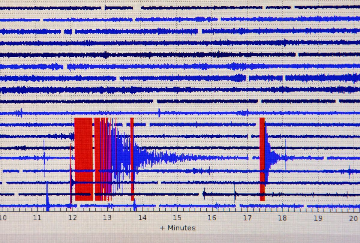
Six earthquakes hit Southern California in one week. Does that mean ‘The Big One’ is coming?

In recent days, Southern California has experienced one earthquake after another. A 3.6 in Ojai on May 31. Two of a similar magnitude under the East Los Angeles area of El Sereno. Another three quakes near Newport Beach and Costa Mesa.
While these quakes were far weaker than historic temblors like the 6.7 Northridge Earthquake of 1994, which caused an estimated $20bn in damage and killed over 57 people, do they herald the arrival of the so-called Big One in a state sitting on multiple, highly active faultlines?
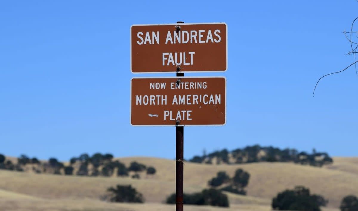
There’s the notorious 800-mile-long San Andreas, which runs from near the Mexico border, east past Los Angeles, then up the coast north of Sacramento.
Major quakes occur along the fault every 180 years or so, and the San Andreas hasn’t had a majorly powerful one since 1906. The US Geological Survey estimates it has a 60 percent chance of causing a magnitude 6.7 or greater in the Los Angeles area in the next 30 years.
Of even greater concern is the Cascadia Subduction Zone, which runs from Northern California to British Columbia, Canada. It’s overdue for an even larger quake compared with historical averages.
So, are the recent earthquakes an ominous omen of something larger, or business as usual in a state with an estimated 35 quakes a day?
The El Sereno quakes, for example, happened just under the Puente Hills thrust fault, which runs beneath downtown Los Angeles and Orange County. The 10-mile deep fault angles like a ramp and gets closest to the surface near the LA campus of the University of Southern California. If a quake along this fault hits the loose earth of the Los Angeles Basin, it could amplify the intensity of an earthquake by up to ten times compared to areas located on bedrock.
The Newport Beach-Costa Mesa temblors, meanwhile, took place near the Compton thrust fault, which could raise the LA River by up to 5 feet in a strong quake, wreaking havoc on city sewer systems. There have been six quakes above magnitude 7 along the fault in the last 12,000 years, according to geologists.
Scientists argue that instead of focusing solely on the largest quakes by magnitude, the key consideration is how much damage they could do to densely settled areas. The San Andreas, despite its famous reputation, runs for large sections through sparesly populated desert.
“In some respects, the ‘big one’ in terms of damages and deaths would be ones running through town rather than one that’s a long distance away,” Dr. Pat Abbott, professor of geology emeritus at San Diego State University, told KSWB last year. “There’s the size of the earthquake, and then also where you are situated compared to where the fault’s moving.”
He pointed to major quakes like the 1857 and 1906 San Andreas earthquakes, as well 1994’s Northridge earthquake, all of which were under the 8.0 magnitude contemplated in “Big One” scenarios but which still caused “horrendous” damage.
“Unfortunately, earthquake prediction remains an extremely challenging endeavor,” according to the California Governor’s Office of Emergency Services website. “While scientists can monitor fault lines and detect patterns of seismic activity, they cannot predict exact earthquakes reliably.”
Instead, scientists deal more in the realm of long-term probability, which can inform what high-risk areas can do to prepare for the day when the hard-to-predict prospect of a major quake arrives.
For instance, the USGS estimates that there’s a 72 per cent chance a 6.7 or greater magnitude quake will hit the San Francisco Bay Area in the next 30 years.

Finding a greater level of precise prediction is the “holy grail” of earthquake science, University of Washington seismologist Harold Tobin wrote last year.
“Science has not yet found a way to make actionable earthquake predictions,” he wrote. “A useful prediction would specify a time, a place and a magnitude – and all of these would need to be fairly specific, with enough advance notice to be worthwhile.”
In the meantime, until that magic predictor code is unlocked, governments can push for preparedness measures like digital alert systems, practice drills, and building retrofits, while individual citizens are advised to have emergency kits in place and drop to their knees, cover their head and neck, and hold onto something stable when a quake begins.
-

 News1 week ago
Would President Biden’s asylum restrictions work? It’s a short-term fix, analysts say
-

 Politics1 week ago
Newson, Dem leaders try to negotiate Prop 47 reform off California ballots, as GOP wants to let voters decide
-

 World1 week ago
Dozens killed near Sudan’s capital as UN warns of soaring displacement
-

 News1 week ago
Read Justice Clarence Thomas’s Financial Disclosures for 2023
-

 World1 week ago
‘Bloody policies’: Bodies of 11 refugees and migrants recovered off Libya
-

 Politics1 week ago
Embattled Biden border order loaded with loopholes 'to drive a truck through': critics
-

 Politics1 week ago
Gun group vows to 'defend' Trump's concealed carry license after conviction
-

 Politics1 week ago
Should Trump have confidence in his lawyers? Legal experts weigh in


