North Carolina
Why NC had so many downed trees after Tuesday’s storms

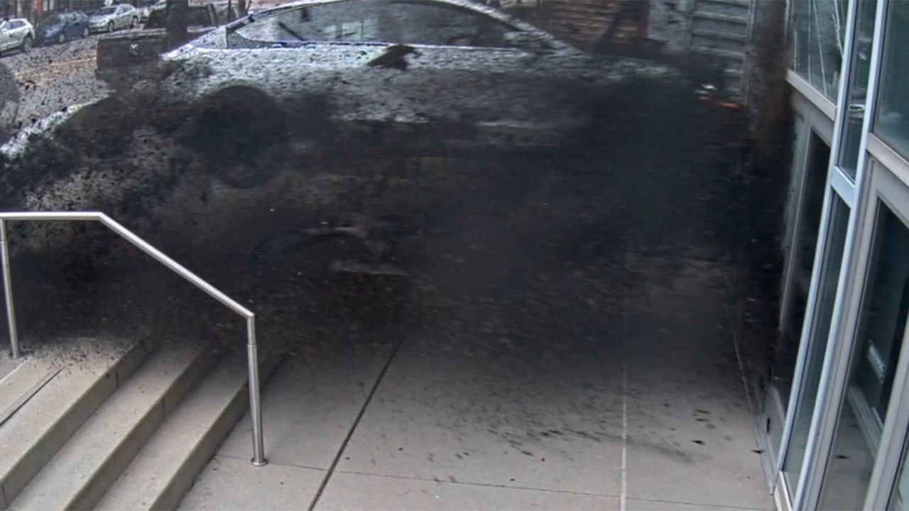
Tuesday’s storms caused downed trees in Durham, Creedmoor and Falls Lake.
Some people described the storm damage as the worst they’ve seen since Hurricane Fran in 1996. The Triangle had 52 reports of wind damage, which is the most in a single day in 2023.
Robert Bardon with NC State Extension’s Forestry department said there are three main reasons central North Carolina had trees come down during Tuesday’s storm:
- The root system
- The main stem of the tree
- Or the branches
“The first thing to do is any time we have major storms like this [is] people should get out and inspect the trees,” Bardon said.
Bardon said trees are meant to sway back and forth. He said some of the reasons we see trees coming down is rooted in the Triangle’s growth. As development clears wooded areas to make way for new homes or businesses, the trees left standing aren’t as strong.
“You remove the support of the neighboring trees away, that tree didn’t form that wood when it was developing, so they’re more susceptible to damage and things from windstorms,” Bardon said.
Dana Wilson works as an arborist from Davy Resource Group. WRAL News asked Wilson how we know if trees are hiding their twig legs under the soil. Wilson said there are two types of assessments.
There is a visual assessment – which costs between $100 and $200 per tree – where someone walks around the tree and studies it.
There is also a piece of equipment that works like a tree MRI. It uses electrical signals that can map the inside of a tree to show where it’s strong and where it’s decaying. It typically costs between $200 and $300 per tree.
After a storm, Bardon says trees that shifted or pulled up the ground around them should be removed immediately. He also said check trees for new cracks.
Realtor Jason Kogok had four trees come down this summer at his rental properties.
“Just as a tip, it’s sometimes more expensive to take a tree that’s laying down than a tree that’s standing up,” Kogok said.
Kogok encourages people to be proactive and trim trees that may be touching the house or at risk of doing damage from a fall.
“It’s not just the property damage,” Kogok said. “It’s the people inside the house you have to be thinking about as well.”
NC State Cooperative Extension offices in your county offer free resources for tree care.
Bardon said a tree’s leaves can play into why they fall during a windstorm.
If the ground is really saturated and trees have a lot of leaves on them, the leaves can act like sails on a ship and push the tree over.
A tree fell on Josh Avery’s home on Tuesday.
“It was consistently down one way, then, all of a sudden, it would switch back up and the trees would go opposite,” Avery said.
Avery described the damage his home sustained.
“Rafters, roof, all the fascia boards, the gutters. Everything’s ripped off,” Avery said.

North Carolina
Tropical Storm Debby expected to bring rainfall to Virginia & North Carolina

Tropical Storm Debby already has parts of Florida under tropical storm warnings. The Florida Big Bend is currently under a Hurricane Warning. Debby is forecast to briefly strengthen into a category 1 hurricane as it moves over the Gulf of Mexico where water temperatures are near 90 degrees.
As it continues its path over land it is expected to dial back to tropical storm strength as it reaches the Carolinas mid to late next week. Moderate rainfall is possible for northeast North Carolina and southern Virginia by the end of the week.

Higher amounts of rain are possible for southernmost portions of the Outer Banks but generally models show 2-4 inches for northeast North Carolina and 1-2 inches for southern Virginia through Thursday.
Stay with News 3’s First Warning Weather Team for the latest updates as the storm develops.
North Carolina
Tropical weather update for Wilmington: What we can expect and when

The National Hurricane Center continues to monitor a tropical depression over Cuba. It’s expected to become a tropical storm later Saturday, bringing impacts to the Carolinas around the middle of next week.
Heavy rainfall and flooding are the primary impacts expected, according to the National Weather Service in Wilmington.
“Gusty winds are also possible, but it is too early to predict specific impacts in great detail at this time,” the weather service said.
At the same time, there is the potential for heavy rainfall and some flooding associated with front expected to stall inland this weekend.
As of 11 a.m. Saturday, the center of the tropical depression, which would be name Debby if it becomes a tropical storm, was over Cuba and moving west-northwest near 15 mph. The hurricane center said a turn toward the northwest is forecast for Saturday, followed by a northward motion on Sunday and then a slower northeastwardmotion Sunday night and Monday.
Maximum sustained winds were near 35 mph. Slow strengthening is expected throughout the day Saturday. Faster strengthening is possible Sunday, with the storm nearing hurricane strength when it reaches the Florida Gulf Coast, the hurricane center said.
STORM TRACKER: Monitor the latest tropical developments here.
Here’s a look at what we can expect in the Wilmington area, according to the latest briefing from the National Weather Service in Wilmington.
Wind
The probability of tropical storm force winds has increased, especially for the South Carolina coast. The most likely time of arrival of for northeast South Carolina is Tuesday night into Wednesday morning, and for Southeastern North Carolina is during Wednesday morning.
Rain
The potential for significant rainfall exists with 8 to 12 inches possible from near Cape Fear to portions of thenortheast South Carolina coast. Flash flooding and urban flooding are possible. Some rivers, including the North Cape Fear River and the Waccamaw River, could exceed flood stage next week.
INTERACTIVE MAP: Enter your address to see hurricanes, tropical storms that have passed nearby
Marine impacts
Rough surf, including dangerous rip currents, and hazardous marine conditions are expected this weekend and will persist into the upcoming week.
Are you prepared for a hurricane?
Hurricane season runs from June 1 to Nov. 30. Even if this system won’t pose a threat to the NC coast, it’s never too early to be prepared.
GET READY: Are you prepared for a hurricane? Here’s what to know if you live in the Wilmington area.
North Carolina
Tropical Depression Four forms on its way to the Gulf of Mexico

As of the 5 AM update Friday, Tropical Depression Four has formed. Areas along the East Coast including North Carolina need to continue monitoring this system. Winds are at 30 MPH and gusts are up to 40 MPH. The pressure dropped to 1009 mb and is moving to the west at 16 mph. TD 4 is expected to become Tropical Storm Debby over the weekend. Tuesday night and Wednesday are First Alert Weather Days due to the threat to ENC from this system but we may need to adjust the timing as we get closer.
It’ll move slowly before escaping to the north next week. As it moves up the East Coast, there’s a lot more uncertainty about the track and threats. We expect the track of this system to change through the weekend and even into next week. If ENC sees impacts from this system, they’d likely come mid-week. The longer this system stays over land, the weaker it’ll be. It’ll have the chance to strengthen if it moves back over open water, especially if it moves over the warm waters of the Gulf Stream.
The speed of this system is just as important as the strength. The quicker it moves through, the less rain piles up. If it slows down or stalls, higher rainfall amounts would be expected. Our river levels have dropped a bit since July’s wet weather, but levels are still higher than what you’d find in a typical August.
This is a reminder that we are heading into the heart of the hurricane season and to make sure your emergency supplies are ready.
Stay with WITN and WITN.com as we continue to track this system over the coming days and monitor the 2024 Atlantic hurricane season.
Copyright 2024 WITN. All rights reserved.
-

 Mississippi4 days ago
MSU, Mississippi Academy of Sciences host summer symposium, USDA’s Tucker honored with Presidential Award
-

 World1 week ago
Typhoon Gaemi barrels towards China’s Fujian after sinking ship off Taiwan
-

 Politics7 days ago
Republicans say Schumer must act on voter proof of citizenship bill if Democrat 'really cares about democracy'
-
World6 days ago
More right wing with fewer women – a new Parliament compendium
-

 News1 week ago
Video: Kamala Harris May Bring Out Trump’s Harshest Instincts
-

 News1 week ago
Who Can Achieve the American Dream? Race Matters Less Than It Used To.
-

 Politics1 week ago
Trump announces to crowd he 'just took off the last bandage' at faith event after assassination attempt
-

 World7 days ago
Israel says Hezbollah crossed ‘red line’, strikes deep inside Lebanon


