Mississippi
Mississippi survives wild finish to beat UCF and remain undefeated

ORLANDO, Fla. — Allen Flanigan scored 18 points and blocked a layup with a second remaining to help Mississippi survive a wild final minute and even wilder final two seconds to defeat UCF 70-68 on Sunday.
Ole Miss held a six-point lead with 52 seconds left before UCF’s Marchellus Avery hit a 3-pointer to cut the lead in half. After a turnover Shemarri Allen made two from the line to get the Knights within 68-67. The Rebels committed another turnover, but Moussa Cisse blocked back-to-back layup attempts and Flanigan grabbed the rebound. He made two free throws for a 70-67 lead with four seconds left.
With their three-point lead, the Rebels fouled Darius Johnson, who made only one of two free throws. Flanigan’s inbound pass was stolen but he blocked a layup by Sellers. Avery got the rebound but his short bankshot that would have tied the game was ruled to be after time expired.
TJ Caldwell had 14 points off the bench for Mississippi (9-0). Matthew Murrell had 12 points and Jaylen Murray scored 10. Flanigan had seven rebounds and five steals but committed five turnovers.
Cisse, who was playing his third game with the Rebels after getting a waiver from the NCAA for his transfer from Oklahoma State, had eight points and four blocks.
Johnson scored 25 points, Allen 14 and Sellers 11 for the Knights (6-3). Johnson had five steals and Sellers had four.
Neither team led by more than three points in the first 15 minutes of the game, then Murrell made a layup and followed it with a 3-pointer to help the Rebels go ahead 30-23. Flanigan scored six consecutive Ole Miss points and Caldwell’s 3-pointer had Mississippi up 37-30 at the break.
Ole Miss hosts California on Saturday. UCF hosts Maine on Dec. 18.
___ Get poll alerts and updates on AP Top 25 basketball throughout the season. Sign up here

Mississippi
Rare ‘particularly dangerous situation’ alert warns of tornado danger Saturday

Severe weather causes travel woes across US
Post-holiday travel was slowed as much of the country faced severe weather.
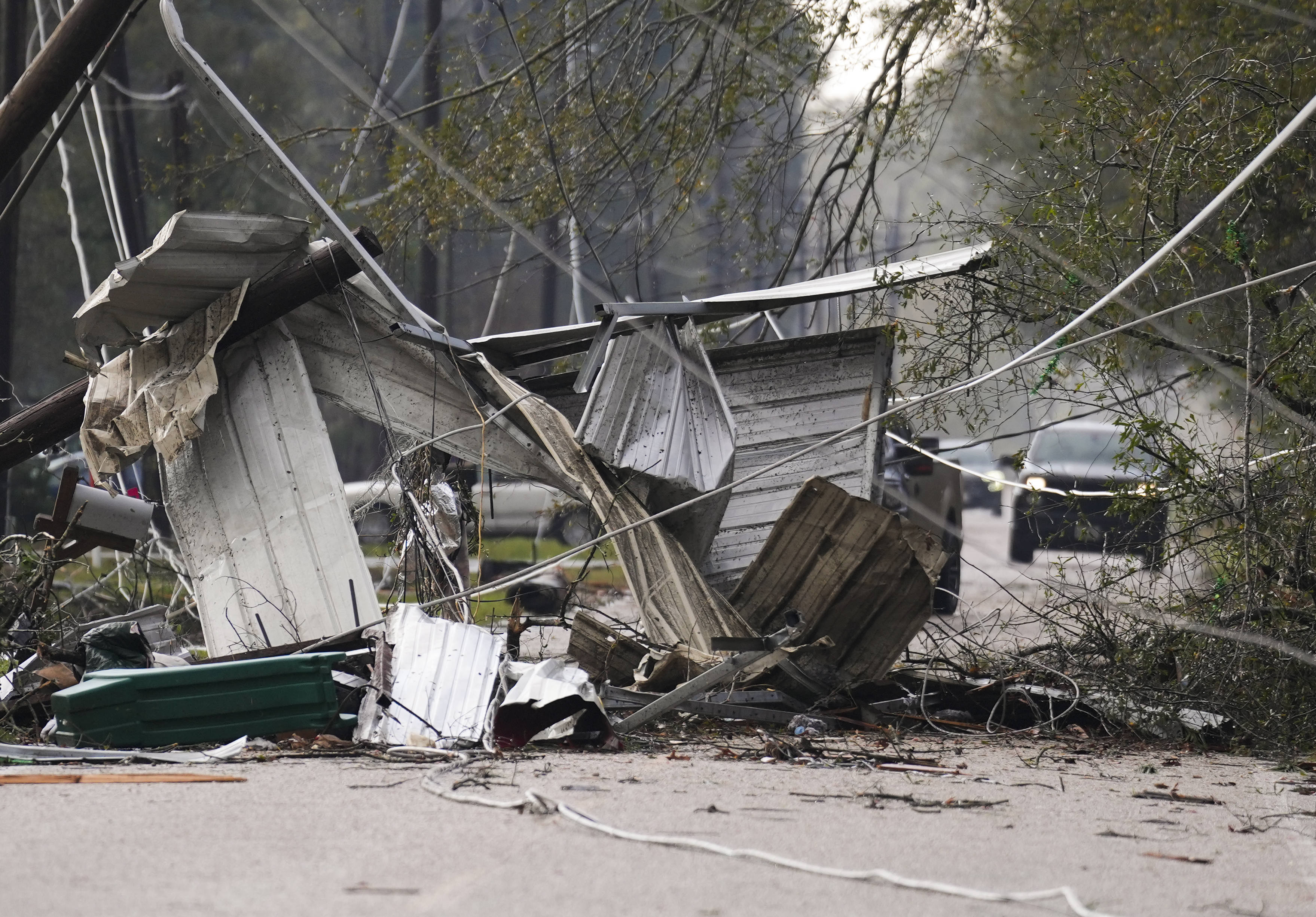
A tornado outbreak threatened parts of the South on Saturday, prompting forecasters to issue a rare “particularly dangerous situation” alert amid severe storms that damaged homes and a fire station, according to preliminary reports.
Millions of people were under tornado watches on Saturday in parts of Texas, Louisiana, Mississippi and Arkansas. Multiple more dangerous tornado warnings were also issued throughout Saturday. (The National Weather Service maintains a list of current tornado alerts, which change frequently as tornado threats develop and pass.)
The “particularly dangerous situation” wording is used in “rare situations when long-lived, strong and violent tornadoes are possible,” the weather service said. “Numerous” tornadoes are expected, forecasters said.
Multiple homes were destroyed between Alvin and Liverpool, Texas, when a possible tornado went through the area Saturday afternoon, according to a preliminary report cited by the Storm Prediction Center. In Montgomery County, mobile homes were damaged and a roof was ripped off a home.
The East Montgomery County Fire Department said in a post on Facebook that Station 154 had sustained “extensive damage” from a tornado, but said there were no injuries reported.
One tornado is suspected to have touched down in Katy, Texas, in the Houston metro area, according to videos posted to social media by AccuWeather and other meteorologists.
In Dermott, Arkansas, which was under a severe thunderstorm warning Saturday morning, forecasters said: “This destructive storm will contain baseball sized hail!”
The storms come after a previous round of weather hit parts of Texas and Louisiana on Thursday with multiple tornadoes and severe thunderstorms, AccuWeather reported.
Severe weather warnings and watches map
What’s a tornado watch, warning?
A tornado watch happens when weather conditions are prime to spawn tornadoes, and they alert people to be ready to act quickly in and around the area of a watch.
A tornado warning means a tornado has been spotted or is indicated by weather radar, and there is imminent danger to life or property. During a tornado warning, people should seek shelter in interior rooms on the lowest floors of study buildings, and keep away from windows.
(This story has been updated to add new information and to correct a misspelling/typo.)
Mississippi
Dense fog advisory issued for southwest Mississippi until Saturday morning

Dense fog advisory issued for southwest Mississippi until Saturday morning
Published 9:16 pm Friday, December 27, 2024
The National Weather Service issued a dense fog advisory at 9:11 p.m. on Friday in effect until Saturday at 9 a.m. The advisory is for Ashley, Chicot, Morehouse, West Carroll, East Carroll, Richland, Madison, Franklin, Catahoula, Tensas, Concordia, Bolivar, Sunflower, Leflore, Grenada, Carroll, Montgomery, Webster, Clay, Lowndes, Choctaw, Oktibbeha, Washington, Humphreys, Holmes, Attala, Winston, Noxubee, Issaquena, Sharkey, Yazoo, Leake, Neshoba, Kemper, Warren, Hinds, Rankin, Scott, Newton, Lauderdale, Claiborne, Copiah, Simpson, Smith, Jasper, Clarke, Jefferson, Adams, Lincoln, Lawrence, Jefferson Davis, Covington, Jones, Marion, Lamar and Forrest counties.
The NWS describes, “Visibility of one quarter mile or less in areas of dense fog.”
“Low visibility could make driving conditions hazardous,” comments the NWS. “If driving, slow down, use your headlights, and leave plenty of distance ahead of you.”

Guidance from the NWS for navigating foggy conditions
If a dense fog advisory is issued for your area, it means that widespread dense fog has developed and visibility often drops to just a quarter-mile or less. These conditions can make driving challenging, so exercise extreme caution on the road, and if possible, consider delaying your trip.
If you must drive in foggy conditions, keep the following safety tips in mind:
Moderate your speed:
Slow down and allow extra travel time to reach your destination safely.
Visibility matters:
Ensure your vehicle is visible to others by using low-beam headlights, which automatically activate your taillights. Utilize fog lights if your vehicle is equipped with them.
Avoid high-beams:
Refrain from using high-beam headlights, as they create glare that impairs your visibility on the road.
Keep your distance:
Maintain a significant following distance to account for abrupt stops or shifts in traffic patterns.
Stay in your lane:
Use the road’s lane markings as a guide to staying in the correct lane.
Zero visibility strategy:
In situations of near-zero visibility due to dense fog, activate your hazard lights and seek a secure location, such as a nearby business’s parking lot, to pull over and come to a stop.
Limited parking options:
If no designated parking area is available, pull your vehicle as far off the road as possible. Once stationary, deactivate all lights except the hazard flashers, engage the emergency brake, and release the brake pedal to ensure your tail lights are not illuminated, reducing the risk of other drivers colliding with your stationary vehicle.
By adhering to these recommendations from the NWS, you can navigate foggy conditions with greater safety, mitigating the risk of accidents and prioritizing your well-being.
Source: The National Weather Service
Mississippi
‘Strong Tornadoes Possible’ Across Mississippi Saturday

Severe storms are headed for Mississippi Saturday, with forecasts estimating a high likelihood of tornadoes, hail and damaging winds across most of the Magnolia State tomorrow, lasting into the night. Emergency management services are warning Mississippians to expect power outages as storms batter the state.
The Weather Channel predicts that the greatest threat of strong tornadoes faces central Mississippi, including Jackson and the surrounding area, passing east through the state and toward the eastern seaboard into Sunday.
Presently, the precise timing for when the most severe weather is expected is not available. A National Weather Service update from this afternoon explained that the breadth of the severe weather made such a prediction difficult. “This event will likely (include) multiple rounds of severe weather … will likely have a larger window to see severe weather, and will have a longer duration,” NWS explained.
Malary White, Mississippi Emergency Management Agency chief communications officer, provided the Mississippi Free Press with a statement from the agency.
“(MEMA) is on standby and ready to respond with local emergency managers if the need arises. In the meantime, we urge all residents to stay weather aware Saturday. Have multiple ways to receive weather alerts by downloading the free MEMA App and prepare your home and family for potential power outages.”
December, though not traditionally considered a part of tornado season, has generated severe tornado outbreaks in the past. In 2021, an outbreak of 71 tornadoes centered just north of Mississippi killed 89 people and injured hundreds more.
Mississippi will likely see multiple rounds of severe weather tomorrow (12/28/2024). Now is the time to prepare!
🌪️Tornadoes are likely and some could be strong tornadoes
🌬️Damaging winds up to 70 mph
⛈️Golf ball-size hail
❗Stay Weather Aware
📻Have multiple ways to receive… pic.twitter.com/m7UMElzwXb— msema (@MSEMA) December 27, 2024
The following is a list of tips MEMA provides for staying safe amid tornadoes:
What to Do if You Are in Your Home During a Tornado
- Go to the lowest level of the home, an inner hallway, or smaller inner room without windows, such as a closet or bathroom.
- Get away from windows and go to the center of the room. Avoid corners, because they tend to attract debris.
- Get under a sturdy piece of furniture, such as a workbench or heavy table.
If You Are in a Mobile Home
- Evacuate the mobile home, even if it is equipped with tie-downs. Take shelter in a building with a strong foundation, or if one is not available, lie in a ditch or low-lying area a safe distance away from the mobile home. Tornadoes cannot change elevation quickly enough to pick someone up out of a ditch, especially a deep ditch or culvert.
If You Are at Work or School
- Go to the basement or to an inside hallway at the lowest level of the building.
- Avoid places with wide-span roofs, such as auditoriums, cafeterias, large hallways or shopping malls.
- Use your arms to protect your head and neck.
If Outdoors
- If possible, get inside a sturdy building with a concrete foundation.
- If shelter is not available, or there is no time to get indoors, lie in a ditch or low-lying area or crouch near a strong building.
- Be aware of the potential for flooding.
If You Are in a Vehicle
- Never try to out drive a tornado in your vehicle. Tornadoes can change direction very quickly and can lift a vehicle and toss it in the air.
- Get out of the vehicle and take shelter in a nearby building.
- If there is no time to get indoors, get out of the vehicle and lie in a ditch or low-lying area away from the vehicle.
Related
-
/cdn.vox-cdn.com/uploads/chorus_asset/file/24924653/236780_Google_AntiTrust_Trial_Custom_Art_CVirginia__0003_1.png)
 Technology1 week ago
Technology1 week agoGoogle’s counteroffer to the government trying to break it up is unbundling Android apps
-

 News1 week ago
Novo Nordisk shares tumble as weight-loss drug trial data disappoints
-

 Politics1 week ago
Illegal immigrant sexually abused child in the U.S. after being removed from the country five times
-

 Entertainment1 week ago
'It's a little holiday gift': Inside the Weeknd's free Santa Monica show for his biggest fans
-

 Lifestyle1 week ago
Think you can't dance? Get up and try these tips in our comic. We dare you!
-
/cdn.vox-cdn.com/uploads/chorus_asset/file/25672934/Metaphor_Key_Art_Horizontal.png)
 Technology4 days ago
Technology4 days agoThere’s a reason Metaphor: ReFantanzio’s battle music sounds as cool as it does
-

 News5 days ago
France’s new premier selects Eric Lombard as finance minister
-

 Business4 days ago
On a quest for global domination, Chinese EV makers are upending Thailand's auto industry


