New Hampshire
Conference addresses housing needs: Is Montana an example for NH? – NH Business Review

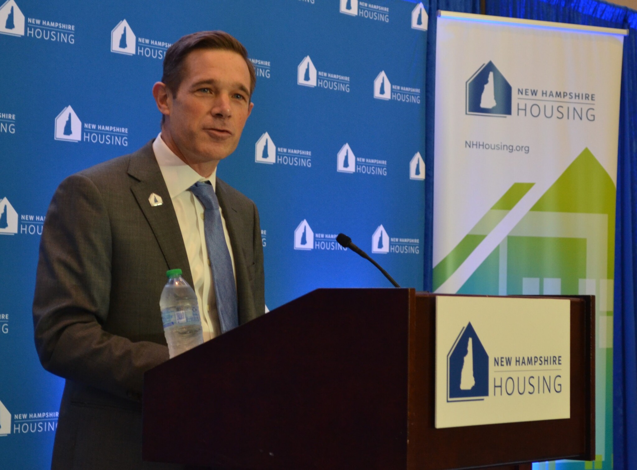
Montana State Sen. Forrest Mendeville talks about the “Montana Miracle” of legislation to encourage more housing at New Hampshire Housing’s 2024 Housing & Economic Conference. (Photo by Paul Briand)
When it comes to increasing the amount of affordable housing, can the state of New Hampshire take a lesson from the state of Montana?
The NH Housing Finance Authority thinks so.
The agency invited a Montana state senator, who’s been instrumental in housing-related legislation, to its annual conference held Oct. 23 at the Grappone Conference Center in Concord.
Forrest Mandeville, a Republican state senator from Columbus, Montana, was one of several presenters at the conference that addressed challenges and possible solutions to the housing crisis in the Granite State.
Mandeville reviewed legislation brokered in a bi-partisan fashion in 2023 designed to increase Montana’s housing supply.
Montana, like New Hampshire, is a mostly rural state that has experienced a housing dearth that makes homes expensive to buy and apartments expensive to rent. Montana, in fact, has it worse than New Hampshire in that it is the least affordable state in the country, according to National Association of Realtors tracking.
Montana, like New Hampshire, passed legislation easing the creation of ADUs — accessory dwelling units on residential property. Montana’s legislation also eased restrictions on duplexes.
The Montana Legislation in 2023 passed the Land Use Planning Act (LUPA), which requires that cities in Montana with populations over 5,000 people that are located in counties with populations over 70,000 people update their land-use plans and zoning and subdivision regulations within three years of its passage. LUPA’s ultimate goal is to ensure sufficient housing for the growing population and for different income levels through coordinated and planned growth across the state.
Politically, both the Montana House and Senate are controlled by Republicans, similar to New Hampshire.
Mandeville, who titled his presentation “Montana Miracle,” pointed to a governor who wanted to see more housing and a coalition of stakeholders — including politicians, builders and planners — who wanted to give him something he could sign into law.
“We streamlined a lot of processes,” said Mandeville. “We legalized a lot of stuff that’s not always been legal. Some of the main things we did that are often lumped into the ‘Montana Miracle’ is we legalized ADUs in single-family zones, legalized duplexes in single-family zones. We allow residential development in commercial areas, and we passed the Land Use Planning Act.”
Creators of the legislation did not pursue items they knew the governor wasn’t going to approve of, according to Mandeville.
“We focused really on the supply side and on the ability to address the demand, the ability of developers to meet the market demands, because that’s what was going to fly in Montana,” said Mandeville. “I’ve had some people tell me: You know, the Land Use Planning Act should have included a climate action plan. That was not going to pass. We were not going to vote for that because the governor was not going to sign. So as much as some people might want to see it, it’s not going to happen. So understand the political factors and take what you can get. You can always work on fixes later.”
Mandeville had four pieces of advice for housing stakeholders to navigate the political divide: take what you can get, know when you lost on an issue and move on, know when to compromise, and build a coalition.
Besides Mandeville, other presenters at the 2024 Housing & Economy Conference included:
- Linlin Liang, principal associate at Pew Charitable Trusts, who spoke about policy approaches to improve housing supply and affordability.
- Tina Lund from Urbanonics, who presented data that debunks the notion that more families with school-age children in a community means higher property taxes.
- Angela Brooks, president of the American Planning Association, whose topic was “Overcoming Housing Obstacles.”
- Lisa Prevost, freelance journalist and author, who spoke on how zoning in New Hampshire throws up roadblocks to affordable housing.
Rob Dapice, executive director and CEO of the New Hampshire Housing Finance Authority, opens the 2024 Housing & Economic Conference held Oct. 23 at the Grappone Center in Concord. (Photo by Paul Briand)
NH Housing’s executive director and CEO, Rob Dapice, set the stage for the day by illustrating the need for purchased and rented housing in the Granite State. About 300 people registered for the event.
Dapice said the 2024 legislative session in New Hampshire produced a lot of activity with respect to housing but with few results, which he called “disappointing.”
“The market can’t do it all itself,” said Dapice, “and so we desperately need more money for the affordable housing fund so we can build more housing for Granite Staters. In addition, there are a number of great ideas and opportunities to lower regulatory barriers to housing.”
He noted that the state needs almost 60,000 new units between 2020 and 2030, nearly 90,000 new units between 2020 and 2040. To meet production needs, he said, local authorities need to increase permits by 36% over recent levels.
During her presentation, Liang tied lack of rental property to increasing rents to increasing homelessness here.
She noted that the median monthly rent in New Hampshire increased 57% from January 2017 to September 2024. At the same time, homelessness in the state grew by 68%.
Using the example of Minneapolis, she said the city made a concerted effort to increase its rental housing supply. Rents decreased and homelessness decreased by 13%, according to Liang.
Lund said Urbanomics, a consulting group that serves businesses and government in the areas of economics, public finance and urban planning, studied the perceptions and numbers of whether more school-age children in a community drives up property taxes.
“The perception is development, particularly multifamily housing, leads to additional public school children, which leads to higher property taxes on single-family homes,” said Lund. “Now our hypothesis, based on all the work we’ve done elsewhere in the country, is that developmental multifamily does indeed yield some additional public school children, but it also yields significant additional property taxes, so there is no additional implicit property taxes to existing residents.”
This notion supports prior data offered by the New Hampshire Association of Realtors (NHAR) that also addressed the issue as being false.

Join us for a community conversation exploring how land conservation supports thriving communities, healthy ecosystems, and local economies. Recent research from Maine highlights the growing economic value of conserved lands — from supporting recreation, forestry, agriculture, and tourism to protecting clean water, storing carbon, and strengthening climate resilience. The findings reveal something important: protecting natural landscapes is not only good for the environment, but also for the people and communities that depend on them.
Together, we’ll explore what this research means both regionally and here at home. How do conserved lands shape our quality of life, local economy, and sense of place? How can communities balance growth, conservation, and long-term sustainability? And what role can each of us play in protecting the landscapes that support both nature and people?
At each “Let’s Talk Nature” gathering, we share a short article in advance and come together for an informal, welcoming discussion. Each session stands on its own, and everyone is welcome. No expertise needed. Bring your curiosity and a willingness to listen and share. Drinks and cookies provided.
Read this session’s article: Conserved Land in Maine has Growing Economic Power
Grey Rocks Conservation Center
10:30 AM – 11:30 AM on Wed, 1 Jul 2026
Event Supported By
Newfound Lake Region Association
603-744-8689
info@NewfoundLake.org

High winds and widespread rain contributed to more than 12,000 power outages Saturday as a low pressure system passes over New Hampshire.
A high wind advisory remains in effect for southeastern New Hampshire until midday.
There is a high surf advisory in effect for the Seacoast area until 8 p.m. Saturday, with large-breaking waves in the range of 6-9 feet, according to the National Weather Service.
The forecast warns of dangerous wintry winds for hikers and campers, with heavy wet snow likely at higher elevations and a foot of snow possible on summits in the White Mountains.
In southeastern New Hampshire, the wind advisory calls for steady winds of 15-25 mph, and potential wind gusts up to 50 mph.
Eversource reported over 10,000 outages as of 9:30 a.m. Unitil had about 1,400 outages at that time.
The Mount Washington Observatory has recorded winterlike weather over the past 24 hours. Weather observers there say over half a foot of snow and sleet has fallen at the summit.
New Hampshire
Opinion: The farm bill passed the House. Western New Hampshire got the bill. – Concord Monitor

In 1794, George Washington wrote that he knew of “no pursuit in which more zeal and important service can be rendered to any Country than by improving its agriculture.” Two hundred and thirty years later, the House just passed a farm bill that proves his successors stopped believing it.
Drive Route 12 through Walpole. Take Route 10 up through Haverhill. Cut across to Littleton, past the diner that has been feeding the town since 1930. The farms are there. Lush land that produces. People who work till their sweat and blood soak the ground they nurture. A region with every ingredient to feed itself.
What is not there is the processing facility that makes it worth raising the animal. The cold storage that keeps the crop from spoiling before it finds a buyer. The regional market that pays a price worth planting for. I want to believe Washington did not forget to build those things. Regardless, it built something else instead — a system that works beautifully for an operation running 10,000 acres in the Midwest and leaves the farmer on Route 12 doing the math at the kitchen table at midnight wondering if this is the last season.
And the 2026 Farm Bill just made that system more expensive to survive. Large commodity operations received a $54 billion subsidy increase over the next 10 years, with individual payment caps that can exceed $900,000 per operation. Is the farmer at your farmers market in position for this kind of payout?
The bill guarantees money, codified by law, for the people who need it least. Local food programs were reauthorized with zero mandatory funding, but plenty of empty words. They exist on paper and nowhere else. It means a farmer in Plainfield cannot count on them. It means Coos County, where one in seven people cannot reliably put food on the table, keeps waiting for help that has been promised and deferred so many times the promise itself has become an insult. Especially when supermarkets and superstores — just 15% of SNAP-accepting establishments — vacuum up nearly 74% of every food assistance dollar, while the local farm stand sees almost none of it.
And that is before the input costs.
Local farmers know this better than most. You buy fuel and fertilizer on global markets you have no vote in and no say over. Russia invaded Ukraine in 2022, causing record high prices for fertilizers globally, all because Russia is the world’s top exporter and suddenly it wasn’t exporting. And while that news cycle is long buried, remember that the Iran war has closed the Strait of Hormuz, through which a third of the world’s seaborne fertilizer travels. Diesel recently crossed $5 a gallon, which large trucks that move food and tractors rely on. Fertilizer went from $500 a ton to $850. One tractor cost $350 more than it did last year. You did not start either of those wars, yet you pay for both of them. And that is not even accounting for the sharp sting of tariffs on the inputs you depend on to plant next season.
Chapter 12 farm bankruptcies rose 55% in 2024. Then another 46% in 2025, and those numbers only count the farms that qualified for Chapter 12, which requires the majority of family income to come from farming. The ones that don’t qualify quietly disappear, not even a balance sheet to mark the years of struggle, labor and community these farmers gave. They just stop. Since 2018, this country has lost more than 158,000 farms, with every size category shrinking except operations over a million dollars in annual revenue. Those are still growing, and will do so as long as the policy is written to grow them. Another example of an unlevel playing field where the rich get richer.
To be clear about something: large-scale agriculture feeds a lot of people and nobody sat in a room and decided to destroy the small farm. But does intent matter when these are the results? The system produces what it was designed to produce. That is exactly the problem. It was not designed with you in mind, and after enough years of that, the results look intentional even when they are not.
I got involved locally here because I believe western New Hampshire has everything it needs to feed itself and then some. Four thousand farms, nearly half a million acres, led by a direct-sales culture that leads the entire country. What is missing is not the land or the people or the will. What is missing is a representative who walks into bill negotiations fighting for the farmer on Route 12 instead of the operation collecting a $900,000 subsidy check in a state they have never visited, and pretending it actually helps their constituents.
I have a specific plan for how existing federal dollars already flowing into this district get redirected toward processing, storage and regional market access that actually serves the farms here. No new appropriations. No new programs. A full breakdown is at livefreenh02.com/food-independence.
Daniel Webster, born thirty miles from where I am writing this, put it in the Capitol: “The farmers, therefore, are the founders of human civilization.” Washington and Webster were not just statesmen. They farmed. They understood what was at stake when the land stopped producing for the people who worked it. The authors of the 2026 farm bill apparently do not.
Robbie Mahrou is an independent candidate for U.S. Congress in New Hampshire’s Second District and a Walpole resident. She can be reached out robbie@livefreenh02.com.
-

 Virginia2 minutes ago
Mass. family, Worcester woman identified as victims in deadly Virginia bus crash
-

 Washington5 minutes ago
Workers killed in chemical vat implosion at Washington paper mill identified; 11 dead
-

 Wisconsin10 minutes ago
Smith: A celebration of wild turkeys and the people who brought them back
-

 West Virginia17 minutes ago
Starting Lineups + Live Score Updates for West Virginia vs. Wake Forest
-

 Wyoming20 minutes ago
Don Day’s Wyoming Weather Forecast: Sunday, May 31, 2026
-

 Crypto25 minutes ago
Bitcoin Futures Hit $42.6B Across 11 Exchanges — Here Is What Open Interest Signals for June
-

 Fitness30 minutes ago
Tight on Space? You Can Still Get a Great Workout With This Compact Home Gym Equipment
-

 Finance32 minutes ago
New financial grades raise concerns about colleges’ long-term stability

