News
55 of the 67 victims have been recovered from the D.C. plane crash

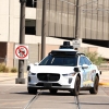
Rescue and salvage crews work near the wreckage of an American Airlines jet in the Potomac River near Ronald Reagan Washington National Airport on Sunday in Arlington, Va.
Jose Luis Magana/AP
hide caption
toggle caption
Jose Luis Magana/AP
Officials have recovered the bodies of 55 of the 67 victims killed after an Army helicopter and an American Airlines passenger plane collided at low altitude near Ronald Reagan Washington National Airport last week.
“It’s my belief that we’re going to recover everyone,” said D.C. Fire Chief John Donnelly during a Sunday briefing on the victim recovery efforts and debris removal.
Divers are still searching the frigid Potomac River for the remains of 12 people. The waterway remains closed to unauthorized vessels.
All 64 people aboard AA Flight 5342 and all three people in the Black Hawk helicopter were killed the Wednesday night collision, the deadliest air crash to happen in the country in two decades.

The process of lifting the wreckage out of the river will start Monday.
“Our goal is to really lift as much as we can, given the fact that we are also accounting for the human remains component,” said Col. Francis Pera of the Army Corps of Engineers.
Meanwhile, the National Transportation Safety Board is leading the investigation into how the crash could have happened.
The NTSB said Saturday that the airplane — an inbound flight from Wichita approaching one of DCA’s three runways — was 325 feet in the air, give or take 25 feet, at the time of impact. Early information suggests the Army helicopter was flying above 200 feet, the maximum allowed altitude for the path it was on, according to the independent federal agency.
The helicopter was on a training mission, and investigators are working to confirm whether the crew had on their night vision while flying the clear, dark skies.
The collision has renewed concerns about the area’s level of air traffic congestion, which leaves little room for error in the airspace above major transport hubs that serve the nation’s capital region.

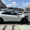
A Waymo robotaxi drives in San Francisco’s North Beach neighborhood this week.
Heather Diehl/Getty Images
hide caption
toggle caption
Heather Diehl/Getty Images
Police in San Mateo, Calif., posted Monday on social media that they had apprehended a pair of teenagers from a Waymo driverless robotaxi after the company alerted authorities to suspected criminal activity. It’s the latest incident involving video surveillance of passengers and others by autonomous vehicles — raising questions about the limits of privacy in such vehicles.
The Facebook post by the San Mateo County Police said: “Parents do you know where your teens are? @waymo does!”
The 15-year-olds were allegedly drinking alcohol and shooting toy guns from the car, according to the police. They said Waymo’s systems detected behavior that then triggered a safety response, after which the company disabled the vehicle and contacted police.
Waymo’s cars, equipped with an array of cameras, microphones and other sensors to monitor passengers and other nearby vehicles, are becoming more common in cities across the United States. Experts say the detention of the two teens in San Mateo highlights a potential — but not inevitable — trade-off between privacy and convenience. It also questions the extent to which companies similar to Waymo are required to hand over private data, including audio and video of passengers, in situations where a crime is suspected.
NPR reached out to Waymo, which is owned by Alphabet, the parent company of Google, for comment on the details of the San Mateo incident and how the company responded, but did not hear back. But on its website, the company says that as many as 29 cameras in its autonomous cars provide an all-around view and “are designed with high dynamic range and thermal stability, to see in both daylight and low-light conditions, and tackle more complex environments.”
“There already exist laws that govern duty to report or even duty to protect” for carriers such as Waymo, according to Alessandro Acquisti, a professor of information technology at the MIT Sloan School of Management. “The privacy problems arise when and if driverless carrier companies used such laws or ethical obligations as a pretext for blanket, indiscriminate accumulation of identifiable data for unspecified future purposes.”
That includes not just monitoring people inside the cars, but outside too. Take, for example, a hit-and-run investigation last year in Los Angeles. Media reported that the police inquiry was aided by video captured by a Waymo taxi that had a clear view of the crime. Critics suggested at the time that authorities were using the company’s vehicles as a mobile surveillance platform. And during 2025 protests in Los Angeles against Immigration and Customs Enforcement crackdowns, demonstrators vandalized Waymos, apparently angry that video recorded by the vehicles could be used by police, although there is no evidence that happened.
In a transparency report, Google says it received nearly 290,000 requests from governments worldwide in the first six months of 2025 for disclosure of user information across all its platforms, including Waymo. The company says that in more than 80% of the requests in those six months, some information was disclosed. “Google carefully reviews each request to make sure it satisfies applicable laws. If a request asks for too much information, we try to narrow it, and in some cases we object to producing any information at all,” the company says.
In an email to NPR, San Mateo Police Department spokesperson Jeanine Luna said that detaining the teens in the Waymo on Monday was “wholly appropriate” under the circumstances. “We received the call of a ‘firearm’ being shot from a moving vehicle,” she said. “Furthermore, the occupants were described as being possibly ‘intoxicated.’” she said.
“Being that the vehicle was disabled (the occupants had every right to exit the vehicle before police arrival, but they did not), a high-risk traffic stop was conducted to ensure the safety of all involved,” Luna added. “They were not arrested and were released to their parents, however, potential charges are still pending dependent on what the video from inside the vehicle shows.”
Autonomous taxis represent an ethical gray area
Robotaxis began to roll out across the U.S. in December 2018, when Waymo launched in Phoenix. These services have been used for less than a decade — so the norms surrounding them aren’t settled, experts agree.
The Facebook post may make Waymo passengers wonder what triggers a police intervention, says Irina Raicu, director of the Internet Ethics program at Santa Clara University. She has used Waymo’s driverless taxis and says ethically, the privacy issues surrounding them sit in a gray area. “There’s something about being in a car without another person that makes you think it’s private.”
“With all these recording devices, we don’t see them, [and] they’re not these obvious things being stuck in our faces,” Raicu adds.
That brings up a key issue: informed consent, Acquisti says.
“It is not clear the extent to which passengers … are reminded that when they step into the car, that they are being monitored, and most likely they are not told in its entirety how the data will be used,” he says.
Bruce Schneier, a cybersecurity and privacy expert and professor at the Munk School at the University of Toronto, believes that Waymo does have a compelling interest in protecting its vehicles. He compares monitoring a robotaxi via cameras to a human taxi driver keeping an eye on passengers in the rearview mirror.
“Maybe the driverless car comes back … and it has all of its cushions slashed, and it’s like, ‘Who the hell did that? Let’s go and look at the tape,’” Schneier suggests. “You can’t have sex in the back of a taxi, right? Someone would say, ‘Stop it.’”
He concludes that some supervision makes sense. In an Uber rideshare, he notes, “most of the time there’s a camera recording the back seat.” (Uber says on its website that it allows drivers to install such cameras for the purpose of “fulfilling transportation services.”)
Waymo robotaxis, while a fairly common sight in the San Francisco Bay Area, are still a novelty in much of the country. And many people are hesitant to ride in one, according to a Pew Research Center poll published this month. The survey found that only 5% of Americans had ever ridden in a driverless car. Meanwhile, 71% of those polled said they would feel uncomfortable in one, with only 7% saying they would be “extremely or very comfortable” riding in one.
For that reason, experts who spoke with NPR said they were optimistic that it’s not too late to shift gears on privacy norms and policies surrounding these vehicles.
Acquisti doesn’t see why privacy measures can’t be built into driverless vehicles.
“I would immediately challenge the notion that people have to be monitored,” he says, noting that privacy-preserving technologies exist and can be installed.
“Driverless cars are coming, but they don’t have to come in this particular incarnation,” Raicu says. “They’re still being designed and redesigned. It’s early days.”

Donald Trump has terminated the remaining members of the independent, federal commission that assists election administration officials nationwide just a few months before the midterm elections, multiple outlets reported Thursday.
The remaining three commissioners of the four-member bipartisan commission were forced out on Thursday in different ways. The one Republican appointee resigned and the other two, Democratic appointees were notified of their terminations via email from the White House presidential personnel office.
“On behalf of President Donald J Trump, I am writing to inform you that your position as Commissioner of the Election Assistance Commission is terminated, effective immediately. Thank you for your service,” the email, seen by Reuters, said.
The White House did not immediately respond to a request for comment.
The Election Assistance Commission serves as a “national clearinghouse of information on election administration”, accredits testing laboratories and certifies voting systems, and maintains the national mail-voter registration form developed by the National Voter Registration Act of 1993, according to the commission’s website. The terminations follow Trump and top administration officials’ advocacy to change vote-by-mail requirements and investigations into the 2020 election outcome, which Trump lost to Democrat Joe Biden.
“It is irresponsible and dangerous that this Administration remains dead set on causing chaos for our election officials across this country,” Arizona secretary of state Adrian Fontes said in a Thursday statement. “This move undermines the integrity of nonpartisan election administration.”
The 2002 law that established the commission, the Help America Vote Act, states the president can appoint replacements to the commission.
It is unclear how Trump will move ahead with the commission.
Reuters contributed reporting

Former U.S. Olympian David Hearn (left) walks with his attorney Norman Eisen to speak to reporters and protesters gathered after his arraignment at the Superior Court of the District of Columbia in Washington, D.C. on Thursday.
Finn Gomez/Getty Images
hide caption
toggle caption
Finn Gomez/Getty Images
Former U.S. Olympic canoeist David Hearn pleaded not guilty to damaging the Lincoln Memorial Reflecting Pool in D.C. Superior Court Thursday morning.
Federal prosecutors charged Hearn with a single count of destruction of property causing more than $1,000 in damage to the pool.

Hearn has previously claimed, which his attorneys repeated during a short press conference outside the court, that he simply touched the water in the pool out of curiosity.
The Trump administration had just completed a $14 million renovation of the pool.
But shortly after the work finished, peeling paint and algae gathered in the water. The remodel has been largely criticized as a massive failure and waste of taxpayer dollars.

Superior Court Judge Carmen McLean released Hearn on his own recognizance. His next hearing is scheduled for Aug. 5.
Norm Eisen, one of Hearn’s attorneys, spoke to reporters outside of court following the hearing. He said the administration is using Hearn as a “scapegoat … for their own failures.”
“It is not a crime to touch the reflecting pool, to touch water in the United States of America,” he said.
Prosecutors say there is a host of evidence against Hearn.
This is a developing story.
-

 Politics13 seconds ago
WATCH: Trump’s Energy chief reveals what escalating Iran tensions could mean for gas prices
-

 Health7 minutes ago
Coffee may have powerful effect on liver health, major study suggests
-

 Sports10 minutes ago
Oba Femi vs Brock Lesnar at SummerSlam is a ‘generational matchup,’ WWE legend JBL says
-
 Business22 minutes ago
Billionaire exodus? California drew 10 times more venture capital than any other state this year
-
 Entertainment25 minutes ago
Disney Channel maximalism to pop-star glam: What fans wore to Hilary Duff’s L.A. show
-
 Lifestyle30 minutes ago
L.A. Affairs: It’s hot when a man drives to me. But would this new guy make the trek from the Valley?
-
Politics37 minutes ago
Black mold and $1 wages: Settlement forces immigrant detention centers to protect workers
-
 Science40 minutes ago
Trump administration seeks to limit federal funding that doesn’t ‘advance’ presidential policies


