Colorado
After 360 miles of whitewater and irrigation, the Arkansas River leaves Colorado as a trickle

What is a river?
It depends on your point of view. Sun reporters have fanned out along the Arkansas River, from the headwaters near Leadville to the border with Kansas, to learn what the river means to people in the places it runs through.
▶ Follow along for more from this series
ㅤ⚲ㅤ HOLLY
The sky is wide open above these plains, where the autumn corn stalks are tall and dry, cattle prices and George Jones are on the radio, and a river meanders through it.
In the last Colorado town before the Kansas state line, the Arkansas River is brown and slow, in some spots like a string of big mud puddles connected by sand bars. Ten miles into Kansas, it disappears, depleted this time of year by thirsty cities and farms along its 360-mile journey through Colorado.
By the time the Arkansas reaches the eastern edge of Colorado, far from its origin as a trickle of snowmelt on a 13,000-foot peak above Leadville, it is a different river. Slow flowing and serene, it’s no longer the wide rush of whitewater that descends from the Rocky Mountains and carves canyons.
This story first appeared in Colorado Sunday, a premium magazine newsletter for members. Experience the best in Colorado news at a slower pace, with thoughtful articles, unique adventures and a reading list that’s a perfect fit for a Sunday morning.
“You can walk across it and not get your ankles wet,” said Randy Holland, the town administrator of Holly, population 800.
The river, and stories of lush fields where the wheat and corn came easy, drew people to Prowers County to settle and farm. Sandy-bottomed canals, dug by horses pulling slip scrapers more than 130 years ago, bring water from the Arkansas, giving farmers and ranchers a reason to plan for the next harvest.
The canals are dry except when a gate upstream is opened and each farmer down the line takes their share. Now, though, the gate isn’t opened as often, the water doesn’t flow as far, and the farmers wonder how much longer the Arkansas will give them enough to continue.
The canals and ditches are a main conversation topic for the “coffee-ers,” the morning regulars at the diner. The ditches are a source of conflict — sometimes among neighbors, always among lawyers. Almost everyone here agrees that the cities upstream, and the politicians who live in them, don’t listen or don’t care when people on the Eastern Plains tell them the river is running dry.
The Arkansas River, as it curves along the south end of town and runs parallel to a two-lane highway to Kansas, carries a resentment deeper than its waters.
“The further you get down the river,” Holland summed up, “the less you feel important.”

“We use it to feed people”
Gary Melcher grows corn and alfalfa on the eight acres behind his house, across the street from the high school and Holly community pool. The gooseneck trailer he transformed into a barbecue truck to serve up brisket sandwiches with his special sauce is parked in the driveway, resting between festivals and county fairs. Restaurant-sized cans of baked beans and pickles wait on his kitchen counter.
Melcher grew up in Holly and has been farming since high school. Besides his small farming operation in town, he and his dad grow 460 acres of corn and wheat south of town, about 2 miles from Kansas.
Water from the muddy Arkansas flows down a ditch near Melcher’s house, the last ditch in Colorado diverting water from the Arkansas, and he uses every drop he can to irrigate his fields.
Some 20 years ago Melcher was in Denver to watch the Broncos play and, while sipping a beer in a bar, overheard city guys complaining about how much water is wasted on agriculture. It’s true, agriculture accounts for 89% of water consumed in Colorado, but what the Denver guys didn’t know is that plains farmers are so concerned about every raindrop that they use moisture probes to decide when and how to water, that the ditches are so regulated there is no room for waste.

“They just thought we wasted water,” Melcher said. “That’s the sentiment that Denver has. And the problem with farmers is we just put our heads down to work, and so sometimes we’re our worst enemy because we do not tell our story good enough. People do not waste water out here.”
The river’s slow flow through Holly is the result of drought and climate change, but also manmade reservoirs and dams, and the sale of water to cities 200 miles to the northwest. Decades of water deals that allowed cities to purchase water from farmers in the Lower Arkansas Valley, and take those shares from cleaner waters upstream, have dried up farmland and made the water that does reach the far eastern edge of the state saltier and more polluted.
It’s like the rest of Colorado forgot about Holly, Melcher thinks.
“The Front Range communities taking water greatly affects every piece of our life,” he said. “When they’re basically watering lawns and developing parks and golf courses and all that, that’s when it really stings. They’re using a lot of water just for beautification, where we use it to feed people.”
“What is a river?” is the question The Colorado Sun has asked throughout its multi-part series from Leadville to Holly.
Along the Arkansas, people look at the same river and see it differently.
Just below Leadville, not far from its headwaters on the Continental Divide, a portion of the rushing waters of the Arkansas are claimed for the faucets of Aurora and Colorado Springs. Colorado Springs uses detention ponds on Fountain Creek, a tributary of the Arkansas, to temporarily hold off storm water and prevent flooding. In Salida and Buena Vista, the river is a playground, where rafters float through Browns Canyon and surfers hit the man-made Pocket Wave. Cañon City used the river to reinvent itself as an outdoors hub with riverside mountain bike trails. And Pueblo, the city that has long relied on the Arkansas for industry and agriculture, built a Riverwalk that made the downtown cool.
By the time it reaches Holly, the river is concentrated with salts and other minerals, plus pollutants picked up along the way from wastewater treatment and agricultural runoff. Decreased snowpack and upstream dams and diversions have taken away the river’s ability to flush itself clean.
“That has changed the health of our system,” Melcher said. “We need the flow, the flush. That’s the biggest problem with being the end-user. If anybody above you affects their water flow, it decreases ours.”
In high school, Melcher tested the salt content of the water from the Arkansas that he was using to water his corn and wheat. It was saltier than the Great Salt Lake. “So as you were watering your crops, you were actually starving them from water as well,” he said.
Two main canals bring water from the Arkansas to farms in Holly and the rest of Prowers County — the Buffalo and the Amity.


The nearly dry Buffalo Canal and the totally dry Amity Canal, shown near the north end of Holly on Sept. 24. Water rights holders in the region have felt the squeeze of water demands by upstream users as well as water sales to cities along Colorado’s Front Range. (Mike Sweeney, Special to The Colorado Sun)
The Buffalo canal begins north of Grenada, about 20 miles west of Holly by road. A small, concrete dam across the river pools water until it rises high enough to open the gate and let it flow down the ditch. A flume tracks the flow to make sure the canal takes only what’s allowed.
As water flows down the Buffalo, the first farmer in line opens their head gate and takes their share, a portion regulated by the “ditch rider,” work that decades ago was done on horseback but now by four-wheeler. Then that farmer closes their gate and the water flows down to the next farm.
The Amity ditch takes water from the Arkansas between Las Animas and Lamar, just below the John Martin Reservoir. The water travels some 80 miles, bending around curves and under bridges.
If the ditches dry up, Holly could, too.
“Without water, I would say 25% to 40% of the economic stability of these small towns would be affected,” said Melcher, whose father and uncle moved from Texas to Prowers County to farm in the 1940s. “John Deere would have a hard time staying open. You would lose a lot of ag-support jobs here. Every life here in this area depends on the ag dollars — the grocery store, the gas station, the tire shop, the school.”
“Water is their 401(k)”
Water is worth more than land in the Lower Arkansas Valley.
Nearly one-third of the farmland that was irrigated in the 1950s is dried up now because the water was sold to cities, according to the Lower Arkansas Valley Water Conservancy District. Farmers on the Eastern Plains can sell water rights for hundreds of thousands of dollars, millions even, and cities have been allowed to take those purchased shares upstream, many miles from Holly.
“You hear farmers say water is their 401(k),” said Peter Nichols, a Boulder attorney who represents the water district. “Fewer and fewer of their children want to stick around and farm and ranch. They get to a point where they can’t do it.”
The district was formed in 2002 by a 2-to-1 vote of people in five southeastern Colorado counties willing to tax themselves to stand up against cities fueling their “unchecked urban growth” with the valley’s water. There have been some successes, including the thwarting of a 2009 plan by Aurora to buy more water from the Lower Arkansas Valley and use the federal Frying Pan-Arkansas Project to exchange it upstream for use in Aurora.
Another battle erupted when a Louisiana investment group bought irrigation water on the Fort Lyon Canal with plans to sell it for use in 20 Front Range counties, Nichols said. That plan was blocked by the Colorado Supreme Court in 2005.
There are more fights to come. In Holly, people are paying attention to what happens to the water owned by Tri-State Generation, which bought up 49% of the shares on the Amity Canal as the company made plans to run a power plant outside Holly. The plans died when the state moved away from coal. The talk of the town is what would happen if Tri-State ever tried to sell those shares to cities upriver.
Any proposed sale to someone outside the valley would surely end up in court.


Holly, Colorado, is at the junction of U.S. Highway 50 and State Highway 89, along the Arkansas River and only a few miles from Kansas. It’s small, with a population of about 800 people, and has a long agricultural history in the region. (Mike Sweeney, Special to The Colorado Sun)
“People who continue to farm and ranch in the Arkansas Valley say the big municipalities have swooped in when times were bad, taken the water rights, dried up a lot of land and damaged the economy in the process,” Nichols said. “They kind of feel like their water was stolen even though they followed Colorado law.”
The people who rely on a river of stillwater at the Colorado-Kansas border look at Turquoise Lake, with its blue-green glacier melt, and Pueblo Reservoir, with its 60 miles of shoreline, and wonder if they got their fair share. “Everybody’s suspicion is they are not getting the water they are entitled to,” Nichols said.
On paper, the Arkansas River around Holly should have just as much water today as it did decades ago, despite the water sales to cities. That’s because farmers are allowed to sell only the portion of water used on their crops, not the water that ended up back in the river after they irrigated their fields. If 40% of the water makes it back into the river, then the farmer can sell only 60% of their water. “That’s the way it’s supposed to work,” said Jack Goble, general manager of the Lower Arkansas Valley Water Conservancy District.
The quality of the water, though, that’s different.
“By the time the water gets to Holly, the water quality is much, much worse than even 100 or 50 miles upstream,” Goble said. Farmers in the valley have adopted the attitude that “wet water with salt in it is better than no water,” he said.
The salt leaches into the river from layers of sediment that 80 million years ago was covered by an ocean. That shale layer is full of sodium, magnesium and calcium, plus heavy metals including selenium, uranium and arsenic, that are absorbed by the river, Goble said.
Colorado Springs buys water from the Fort Lyon Canal, around Las Animas, but through a water exchange, the city actually takes the water from the Pueblo Reservoir, which is cleaner and far less salty, Goble said. Colorado Springs uses the water, sends it through its treatment plant, into Fountain Creek and back to the Arkansas — returning the water at a lower quality than the city received it.
“It’s a compounding effect,” Goble said. “That’s what these folks are concerned about and should be.”
Even worse, he said, Aurora bought 95% of the water in the Rocky Ford Ditch, but takes the water way up by Buena Vista, where it’s near pristine. When Aurora is finished with it, the water flows into the South Platte, “gone forever” from the Arkansas River basin, Goble said.
“It’s getting to where the cities are our enemies”
Jerome Seufer’s family came from Kansas to Prowers County after reading a newspaper ad in 1899 that said the land was better than anywhere else. The farmland was along the Amity Canal, the ad boasted, and connected to the “Greatest Reservoir System In the WORLD.”
That system expanded with the John Martin Dam and Reservoir, built by the U.S. Army Corps of Engineers in the 1940s with a pause for World War II. The reservoir in nearby Bent County is a popular state park for boating and fishing, but the bigger point was to prevent flooding after gully washers, and to store water for farms in Colorado and Kansas. The two states signed the Arkansas River Compact in 1948 — not that it put an end to fighting over the water.
Seufer’s grandfather, who remembered the days when water was so abundant he could irrigate all winter, was no fan of the reservoir. “All they did was build a bank of water that the Front Range can sell on paper,’” Seufer recalled him saying, often.
“For my grandpa, the river ran so much water all the time that it was swept clean from a rain,” Seufer said. “They’d have to go check and see if they could cross it with their wagons and horses back in the day. Now, I mean, even if you had to cross it with a wagon, you could go probably about any time.

“And so as years go on, it’s just getting less and less all the time. It used to just free flow all the way through. It’s getting to where the cities are our enemies.”
Seufer’s farm is the last on the Amity Canal. It’s up to the Colorado Division of Water Resources to determine when the gate that fills the Amity is lifted and how long it stays open, depending on snowpack and rain. Each farmer along the canal might get hours or three days, depending on their share.
The gate used to open for the first time in April, but lately, it’s May or even June, said Seufer, who is a board member of the Amity Canal. It used to run 10 or 12 times a season, but not anymore. “We are averaging four to five runs of water, if we’re lucky, during the growing season.”
In 20 years, the price per share for water dues on the canal has climbed to about $55, up from about $5. The size of a share fluctuates depending on how much water is available, but traditionally is around one acre-foot — enough water to cover one acre of ground with one foot of water, or about the amount used by two suburban households per year. That means farms pay close to $9,000 per year in canal dues to irrigate each quarter section of land, or about 160 acres. They could sell the rights for far more, though.
“I don’t know what our future is,” Seufer. “We talk to our lawyers all the time. Because we cannot keep paying more and more on our water rights to farm. We’ve got to figure this out in the next 10 years, or we won’t be able to continue.
Government subsidies that farmers receive for growing food, and that support the whole town, are decreasing as production decreases, he said. “It’s getting tougher. I hate to say it,” Seufer said. “But I don’t know if we’ve got enough to hold it here, unless somebody above at the state intervenes.”
Prowers County people look to Crowley County, just to the west, as a cautionary tale. Most of the farms sold their water shares of the Arkansas to cities upstream, decimating local agriculture. “It left all these people with no water,” Seufer said. “It looks terrible.”
The number of farms is dwindling in Prowers County, too. Seufer can tell by the number of people who come to Amity Canal annual meetings. “When I was little, you’d go to the annual meeting and there would be 80 to 100 farmers that showed up,” he said. “Now there isn’t 15.”
Holly’s relationship with the river has been passed down for generations
At the Lower Valley Water Conservancy District, Goble is pushing farmers who want to sell their water rights to lease them instead. That way the money keeps coming back to the communities.
Goble, who lives in Bent County, wonders when people who don’t live in farming areas will understand the broader consequences of dried-up farmland.
“I’m worried that it won’t be until there is not adequate food in the grocery stores, or at least not at an affordable price,” he said. “Maybe our citizens will finally wake up at that point and go, ‘Why did we dry up all this land?’ Once the water leaves, it’s never coming back.”
The people of Holly know this already, because their relationship with the river has been passed down for generations.
Over the decades, Holly has been flooded by the Arkansas, smacked with dust storms and partially flattened by a tornado. In 1965, the town was evacuated when the river roared through and spilled over its banks, leaving much of Holly underwater.

Holly became a town in 1903, named after a cattle rancher whose stone barn is now a historic building on Main Street. Settlers had come from Kansas and Oklahoma, drawn by the cheap and lucrative land. The Holly Sugar Plant opened in 1905, to turn sugar beets into sacks of white sugar. And from 1965 to 1995, Gateway Downs offered horse racing on a half-mile “bush track” oval just west of town.
A sign reminds drivers entering on U.S. 50 that Holly is the hometown of former Gov. Roy Romer, and a trail along the banks of the Arkansas is named for a 4-year-old boy, Justin Harrington, who drowned in an irrigation ditch in 2006.
The Arkansas River doesn’t supply the town’s drinking water; that comes from deep-water aquifers, trapped under shale. And that has problems, too.
The town is facing a potential $10 million overhaul of its water treatment system after state and federal officials grew concerned about high levels of radium, a natural mineral that can cause health problems including cancer if people drink it for years. Town trustees send notes with water bills telling people that children should not drink the water and suggesting people buy bottled instead.
Some farmers in Prowers County pump their water from the Ogallala Aquifer, so large that its underground expanse stretches across eight states, including the eastern edge of Colorado. Those farmers don’t rely on the flow of water in diversion ditches from the Arkansas, but even so, the health of the river is related to the aquifer, which is shrinking.
Holly’s population is shrinking, too, with about 400 fewer people today than in 1950.
After the Arkansas River leaves Colorado, the river that began as melting snow on a mountain top and flowed for hundreds of miles across the state barely trickles into Kansas. Exhausted by the journey, it even disappears underground for a stretch, until it’s replenished along the way by tributaries in Oklahoma and Arkansas. Then it disappears again, spilling into the Mississippi.


")
")

As a result of a snow drought and a heat wave that have both set records, some Colorado residents face the earliest restrictions on their water use ever imposed.
Denver Water announced Wednesday that it is seeking a 20% cut in water use, asking people to turn off automatic watering systems until mid-May and restricting the watering of trees and shrubs to twice a week.
“The situation is quite serious,” said Todd Hartman, a spokesperson for the utility. “We’re in such a dire situation that we could be coming back to the public in two or three months and saying you’re limited to one day a week.”
It is the earliest in the year that Denver Water has ever issued a restriction, Hartman said.
Colorado’s snowpack peaked at extremely low levels on March 12 — nearly a month earlier than usual — then cratered during the recent heat wave that cooked nearly every state in the West.
“We already had the lowest snowpack we’ve seen since at least 1981, and now, with the heat wave conditions, we’ve already lost about 40% of the statewide snowpack” since the March 12 peak, said Peter Goble, Colorado’s assistant state climatologist. “Conditions are looking more like late April or early May.”
The water restrictions are a harbinger of what’s to come in many Western states as officials try to manage widespread drought concerns. Nearly every snow basin in the Mountain West had one of its warmest winters on record and is well behind normal when it comes to water supply, according to the U.S. drought monitor. The dwindling snowpack is likely to raise the risk of severe wildfires, hamper electricity generation at hydropower dams and force water restrictions for farmers.
Hartman said nearly every community east of the Rockies, along Colorado’s front range, is in much the same boat as Denver.
City Council members in Aurora are considering similar water restrictions; reservoirs there stand at about 58%, according to the city’s website. In the town of Erie, officials declared a water shortage emergency on March 20 after they observed a massive spike in consumption.
Gabi Rae, a spokesperson for the town, said Erie was perilously close to having taps run dry because so many residents had started watering their lawns early amid the unseasonable heat.
“We were a day away from running out of water. That’s why it was such an emergency,” she said.
Erie officials demanded that residents stop using irrigation systems altogether.
Goble said this month’s heat wave has set records in every corner of Colorado, sometimes by double digits.
“I can’t remember seeing a single heat wave that broke this many records, and seeing it across such a large portion of the country is certainly eye-popping,” he said, adding: “I’m located in Fort Collins, and we got up to 91 last Saturday. The previous record for March was 81, so we smashed that record. And it wasn’t just one day, either.”
Denver Water, which serves about 1.5 million residents in the city and its surrounding suburbs, gets about half of its water from the Upper Colorado River Basin and the South Platte River Basin. The latter’s snowpack was at about 42% of normal Tuesday, the utility reported. The Upper Colorado River Watershed was at 55%.
Systemwide, Denver Water’s reservoirs are about 80% full, which is only about 5 percentage points lower than in a typical year.
“That sounds pretty good,” Hartman said. “Except that what we’re not going to be able to rely on is that rush of water that will bring those reservoirs back up, because the snowpack is so low.”
In other words, the snowpack — a natural water reservoir — is mostly tapped already and won’t replenish reservoirs later this spring and into summer, when runoff usually peaks.
In Erie, city workers plan to aggressively police water use until sometime next week using smart meters that monitor residential usage. Rae said the city is also sending utility workers to patrol neighborhoods and look for sprinklers that are turned on.
“People have been kind of annoyed with how aggressive we were, and I don’t necessarily think they understand the ramifications if we weren’t,” Rae said. “It is an actual serious emergency situation. We were so close to reaching empty, there would literally be no water coming out of the taps — hospitals, schools, fire hydrants, your home would have no water.”
Although the limits on outdoor watering will be lifted soon, Rae expects more restrictions later this spring and summer.
Colorado
Suddenly hazy skies in Denver prompt some residents concerned about wildfire smoke to call 911

Some people who live in the Denver metro area on Thursday afternoon were making calls to 911 after skies became noticeably hazy and winds kicked up. It was due to smoke from wildfires in Nebraska moving into Colorado. A cold front also was moving through the Front Range, and there is dust in the air.
The poor air conditions led to reduced visibility downtown after 3 p.m. Several of CBS Colorado’s City Cams showed dust or smoke in the air.
Temperatures were expected to drop by as much as 20 to 30 degrees with the cold front.
The suddenly dusty skies prompted at least one fire agency to put out a plea to residents to please only call 911 “if you see flames.” That warning was put out by South Metro Fire Rescue, which shared a photo on X of an office building with haze visible outside.
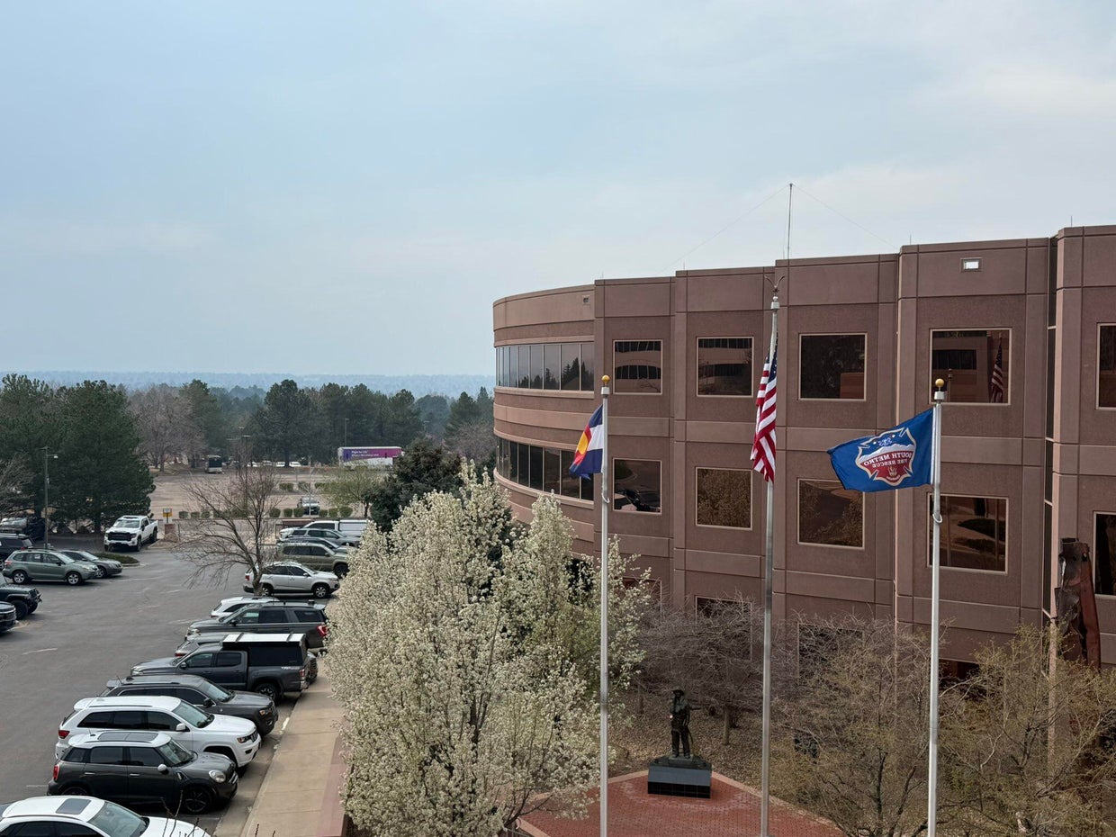
South Metro Fire Rescue said in their post that the smoke is from Colorado’s neighbor to the east. They called it a “significant haze” in the air.
Earlier this month, the Morrill Fire and the Cottonwood Fire burned a significant amount of Nebraska grassland and ranchland. They have mostly been contained by firefighters. Nebraska Gov. Jim Pillen said those two fires combined with several others have burned approximately 800,000 acres of land. On Thursday, Pillen announced that he is signing several executive actions intended to ease the burden caused by the fires.
There were no wildfires burning in the Denver metro area on Thursday afternoon.

ARAPAHOE COUNTY, Colo. (KKTV) – A homicide suspect based out of Colorado, wanted in a fentanyl-related death, is back in the state after being captured in Colombia.
The Arapahoe County Sheriff’s Office (ACSO) said 33-year-old Max Arsenault had been on the run since January 17.
Deputies said this stemmed from an incident in May 2023, where deputies responded to a call for a man named Nicholas Dorotik, who was found unresponsive.
ACSO said the cause of death was a mixed drug overdose involving meth and fentanyl, having about three times the lethal amount of fentanyl in his system.
One year later, Arsenault was arrested. He was scheduled for trial in January 2026 when deputies said he fled the country while on bond three days before the trial was set to start.
He was caught in Medellin, Colombia, on March 4, following a two-month international investigation. He has since been extradited back to Denver, where he is facing charges and awaiting trial.
Copyright 2026 KKTV. All rights reserved.

Iran-linked hackers have breached FBI Director Kash Patel’s personal emails | CNN Politics

Retired Detroit sergeant faces new sexual assault charge involving 14-year-old victim from 2002

Trump floats sending federal agents to San Francisco to tackle crime

Dallas ISD will offer free pre-K starting next school year

Norwegian Cruise Line offers a first look at Luna, new cruise ship setting sail from PortMiami – WSVN 7News | Miami News, Weather, Sports | Fort Lauderdale

Florida High School Football Rankings: Top 25 teams – Oct. 21

How old is Bo Nix? What to know about Oregon quarterback ahead of 2024 NFL Draft

Cleary's 21 help Le Moyne down Central Connecticut State 69-64 in OT

99th annual Pony Swim held in Virginia

Indiana Members Credit Union announced as new anchor tenant at Bottleworks District
Iran-linked hackers have breached FBI Director Kash Patel’s personal emails | CNN Politics

Live: CPAC 2026 Day 2

Video: Will ICE Change Under Its New Leader?

DHS shutdown breakthrough comes at cost for Republicans as funding fights nears end

Rubio joins crucial G7 talks as Iran war set to dominate second day
-

 Detroit, MI1 week ago
Drummer Brian Pastoria, longtime Detroit music advocate, dies at 68
-

 Science1 week ago
How a Melting Glacier in Antarctica Could Affect Tens of Millions Around the Globe
-

 Movie Reviews1 week ago
‘Youth’ Twitter review: Ken Karunaas impresses audiences; Suraj Venjaramoodu adds charm; music wins praise | – The Times of India
-

 Sports6 days ago
IOC addresses execution of 19-year-old Iranian wrestler Saleh Mohammadi
-

 New Mexico5 days ago
Clovis shooting leaves one dead, four injured
-
 Business1 week ago
Disney’s new CEO says his focus is on storytelling and creativity
-

 Technology5 days ago
YouTube job scam text: How to spot it fast
-

 Tennessee4 days ago
Tennessee Police Investigating Alleged Assault Involving ‘Reacher’ Star Alan Ritchson