Alaska
Downtown Juneau street to be renamed Heritage Way
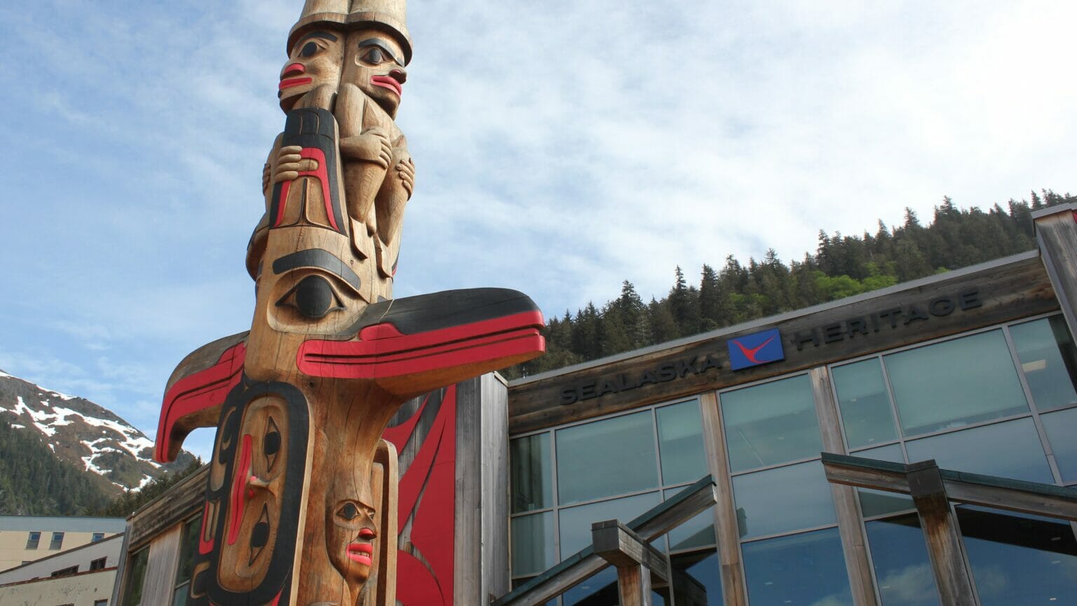
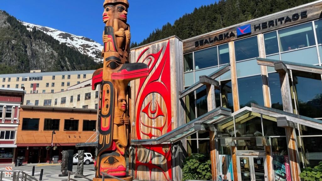
Part of a street in downtown Juneau will have a new name this fall. At a meeting Tuesday night, the city’s planning commission approved a request to change South Seward Street to Heritage Way.
The nonprofit Sealaska Heritage Institute made the request. SHI President Rosita Worl announced the proposal in April at a ceremony celebrating Kootéeyaa Deiyí, the totem pole trail installed along Juneau’s waterfront this spring.
“I think naming it Heritage Way really celebrates the heritage of Alaska’s first people,” Worl said at Tuesday’s meeting.
South Seward Street runs from Front Street to Marine Way, between the Sealaska Heritage Institute building, Heritage Square and the Sealaska Corporation headquarters.
“I would like to thank the city administration for all the support we’ve had as Sealaska Heritage Institute,” Worl said. “I think we’ve become a model for many communities in terms of the partnership between citizens, organizations and the city.”
Juneau’s City Hall is also on that street. The name change won’t go into effect until Nov. 1 so that it won’t interfere with voter information materials for the October election.
“We have to put out voter information as far as where to mail back ballots and also where voting locations are, which is City Hall,” said Jill Maclean, director of Juneau’s community development department.
The city’s planning commission approves name change requests. The Juneau Assembly agreed to support the change last month. The city is the only other property owner on South Seward Street. Seward Street begins at the crosswalk between Heritage Coffee’s downtown cafe and Juneau Drug Co.
The planning commission unanimously approved the street name change.
“We’re headed in the right direction,” Maclean said. “It’s a good day for Juneau.”
William Seward was the secretary of state in 1867 when the U.S. bought unceded Alaska Native land from Russia. In 2020, hundreds of people signed a petition to remove a statue of Seward near the Alaska State Capitol, saying the purchase of Alaska reflected U.S. imperialism.

Alaska
Alaska governor, ally of Trump, will keep flags at full-staff for Inauguration Day • Alaska Beacon
Alaska will join several other Republican-led states by keeping flags at full-staff on Inauguration Day despite the national period of mourning following President Jimmy Carter’s death last month.
Gov. Mike Dunleavy announced his decision, which breaks prior precedent, in a statement on Thursday. It applies only to flags on state property. Flags on federal property are expected to remain at half-staff.
Flags on state property will be returned to half-staff after Inauguration Day for the remainder of the mourning period.
The governors of Indiana, Idaho, Iowa, Texas, Florida, Tennessee, Oklahoma, North Dakota, Nebraska, Montana and Alabama, among others, have announced similar moves.
U.S. Speaker of the House Mike Johnson, a Republican from Louisiana, said on Tuesday that flags at the U.S. Capitol would remain at full-staff on Inauguration Day.
Their actions follow a statement from President-elect Donald Trump, who said in a Jan. 3 social media post that Democrats would be “giddy” to have flags lowered during his inauguration, adding, “Nobody wants to see this, and no American can be happy about it. Let’s see how it plays out.”
Dunleavy is seen as a friend of the incoming president and has met with him multiple times over the past year. Dunleavy and 21 other Republican governors visited Trump last week in Florida at an event that Trump described as “a love fest.”
Since 1954, flags have been lowered to half-staff during a federally prescribed 30-day mourning period following presidential deaths. In 1973, the second inauguration of President Richard Nixon took place during the mourning period that followed the death of President Harry Truman.
Then-Gov. Bill Egan made no exceptions for Alaska, contemporary news accounts show, and no exception was made for Nixon’s inauguration in Washington, D.C., either.
A spokesperson for Dunleavy’s office said the new precedent is designed to be a balance between honoring the ongoing mourning period for former President Jimmy Carter and recognizing the importance of the peaceful transition of power during the presidential inauguration.
“Temporarily raising the flags to full-staff for the inauguration underscores the significance of this democratic tradition, while returning them to half-staff afterward ensures continued respect for President Carter’s legacy,” the spokesperson said.
GET THE MORNING HEADLINES.
Alaska
Federal disaster declaration approved for Northwest Alaska flooding
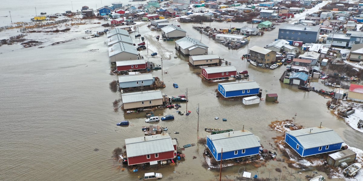
ANCHORAGE, Alaska (KTUU) – President Joe Biden announced the approval of federal disaster assistance on Thursday for recovery efforts in areas that sustained damage from flooding and storms in October 2024.
Those areas include the Bering Strait Regional Educational Attendance Area (REAA) and the Northwest Arctic Borough area where many structures were damaged by a severe storm from Oct. 20-23, 2024.

In a press release, FEMA announced that federal funding is available on a cost-sharing basis for emergency work to the state of Alaska, tribal and eligible local governments, and certain private nonprofit organizations.
The announcement comes just a few days after Biden released the major disaster declaration approval for the August Kwigillingok flooding.
See a spelling or grammar error? Report it to web@ktuu.com
Copyright 2025 KTUU. All rights reserved.
Alaska
Arctic hotspots study reveals areas of climate stress in Northern Alaska and Siberia

Ecological warning lights have blinked on across the Arctic over the last 40 years, according to new research, and many of the fastest-changing areas are clustered in Siberia, the Canadian Northwest Territories, and Alaska.
An analysis of the rapidly warming Arctic-boreal region, published in Geophysical Research Letters, provides a zoomed-in picture of ecosystems experiencing some of the fastest and most extreme climate changes on Earth.
Many of the most climate-stressed areas feature permafrost, or ground that stays frozen year-round, and has experienced both severe warming and drying in recent decades.
To identify these “hotspots,” a team of researchers from Woodwell Climate Research Center, the University of Oslo, the University of Montana, the Environmental Systems Research Institute (Esri), and the University of Lleida used more than 30 years of geospatial data and long-term temperature records to assess indicators of ecosystem vulnerability in three categories: temperature, moisture, and vegetation.
Building on assessments like the NOAA Arctic Report Card, the research team went beyond evaluating isolated metrics of change and looked at multiple variables at once to create a more complete, integrated picture of climate and ecosystem changes in the region.
“Climate warming has put a great deal of stress on ecosystems in the high latitudes, but the stress looks very different from place to place and we wanted to quantify those differences,” said Dr. Jennifer Watts, Arctic program director at Woodwell Climate and lead author of the study.
“Detecting hotspots at the local and regional level helps us not only to build a more precise picture of how Arctic warming is affecting ecosystems, but to identify places where we really need to focus future monitoring efforts and management resources.”
The team used spatial statistics to detect “neighborhoods,” or regions of particularly high levels of change during the past decade.
“This study is exactly why we have developed these kinds of spatial statistic tools in our technology. We are so proud to be working closely with Woodwell Climate on identifying and publishing these kinds of vulnerability hotspots that require effective and immediate climate adaptation action and long-term policy,” said Dr. Dawn Wright, chief scientist at Esri. “This is essentially what we mean by the ‘Science of Where.’”
The findings paint a complex and concerning picture.
The most substantial land warming between 1997–2020 occurred in the far eastern Siberian tundra and throughout central Siberia. Approximately 99% of the Eurasian tundra region experienced significant warming, compared to 72% of Eurasian boreal forests.
While some hotspots in Siberia and the Northwest Territories of Canada grew drier, the researchers detected increased surface water and flooding in parts of North America, including Alaska’s Yukon-Kuskokwim Delta and central Canada. These increases in water on the landscape over time are likely a sign of thawing permafrost.
-

Warming severity “hotspots” in Arctic-boreal region between 1997-2020 were detected by analyzing multiple variables including satellite imagery and long-term temperature records. Watts et al., 2025, Geophysical Research Letters. Credit: Christina Shintani / Woodwell Climate Research Center
-

Map of areas of severe to extremely severe drying in the Arctic-boreal region. Drying severity was determined by analyzing multiple variables from the satellite record. Watts et al., 2025, Geophysical Research Letters. Credit: Christina Shintani / Woodwell Climate Research Center
-

Map of areas that experienced vegetation climate stress in the Arctic-boreal region between 1997-2020 as detected by multiple variables from the satellite record. Watts et al., 2025, Geophysical Research Letters. Credit: Christina Shintani / Woodwell Climate Research Center
Among the 20 most vulnerable places the researchers identified, all contained permafrost.
“The Arctic and boreal regions are made up of diverse ecosystems, and this study reveals some of the complex ways they are responding to climate warming,” said Dr. Sue Natali, lead of the Permafrost Pathways project at Woodwell Climate and co-author of the study.
“However, permafrost was a common denominator—the most climate-stressed regions all contained permafrost, which is vulnerable to thaw as temperatures rise. That’s a really concerning signal.”
For land managers and other decisionmakers, local and regional hotspot mapping like this can serve as a more useful monitoring tool than region-wide averages. Take, for instance, the example of COVID-19 tracking data: maps of county-by-county wastewater data tend to be more helpful tools to guide decision making than national averages, since rates of disease prevalence and transmission can vary widely among communities at a given moment in time.
So, too, with climate trends: local data and trend detection can support management and adaptation approaches that account for unique and shifting conditions on the ground.
The significant changes the team detected in the Siberian boreal forest region should serve as a wakeup call, said Watts.
“These forested regions, which have been helping take up and store carbon dioxide, are now showing major climate stresses and increasing risk of fire. We need to work as a global community to protect these important and vulnerable boreal ecosystems, while also reining in fossil fuel emissions.”
More information:
Regional Hotspots of Change in Northern High Latitudes Informed by Observations From Space, Geophysical Research Letters (2025). DOI: 10.1029/2023GL108081
Provided by
Woodwell Climate Research Center
Citation:
Arctic hotspots study reveals areas of climate stress in Northern Alaska and Siberia (2025, January 16)
retrieved 16 January 2025
from https://phys.org/news/2025-01-arctic-hotspots-reveals-areas-climate.html
This document is subject to copyright. Apart from any fair dealing for the purpose of private study or research, no
part may be reproduced without the written permission. The content is provided for information purposes only.
-
/cdn.vox-cdn.com/uploads/chorus_asset/file/25822586/STK169_ZUCKERBERG_MAGA_STKS491_CVIRGINIA_A.jpg)
 Technology1 week ago
Technology1 week agoMeta is highlighting a splintering global approach to online speech
-

 Science6 days ago
Metro will offer free rides in L.A. through Sunday due to fires
-
/cdn.vox-cdn.com/uploads/chorus_asset/file/25821992/videoframe_720397.png)
 Technology1 week ago
Technology1 week agoLas Vegas police release ChatGPT logs from the suspect in the Cybertruck explosion
-

 News1 week ago
Photos: Pacific Palisades Wildfire Engulfs Homes in an L.A. Neighborhood
-

 Education1 week ago
Four Fraternity Members Charged After a Pledge Is Set on Fire
-

 Business1 week ago
Meta Drops Rules Protecting LGBTQ Community as Part of Content Moderation Overhaul
-

 Politics1 week ago
Trump trolls Canada again, shares map with country as part of US: 'Oh Canada!'
-
/cdn.vox-cdn.com/uploads/chorus_asset/file/23935558/acastro_STK103__01.jpg)
 Technology5 days ago
Technology5 days agoAmazon Prime will shut down its clothing try-on program

