Science
How a water scientist hopes to save California habitats that could be pumped dry

California is recognized as one of the world’s hotspots of biodiversity, with more species of plants and animals than any other state. And a significant number of the state’s species, from frogs to birds, live in habitats that depend on groundwater.
These rich ecosystems — including spring-fed streams, wetlands, riparian forests and oak woodlands — are vulnerable to declines in groundwater levels. In areas where unchecked pumping from wells severely depletes aquifers, once-thriving wetlands and forests can dry up and die.
Spotting threats to vulnerable natural areas has become a mission for Melissa Rohde, a hydrologist who has spent years analyzing satellite data and water levels in wells to come up with strategies for preventing ecosystems from being left high and dry.
“Nature has been getting the short end of the stick. It basically gets whatever is left behind, which oftentimes is not enough,” Rohde said. “How do we ensure that these ecosystems are protected?”
More than 300 species of birds have been seen at Kern River Preserve.
(Robert Gauthier / Los Angeles Times)
California is the only state with a groundwater law that includes provisions intended to protect groundwater-dependent ecosystems. But the law, adopted in 2014, gives considerable leeway to local agencies in developing water management plans that prevent “significant and unreasonable adverse impacts.”
When Rohde and other scientists examined the local plans for parts of the state that fall under regulation, they found only about 9% of groundwater-dependent ecosystems are adequately protected, while the remaining 91% are vulnerable.
When they looked at the entire state, they determined only 1% of the ecosystems are sufficiently protected under measures adopted to date.

Aggressive and impactful reporting on climate change, the environment, health and science.
Rohde has been focusing on finding ways to change that, in California and around the world.
Often working at home, she has pored over satellite data to spot decreases in vegetation greenness during drought, a telltale sign of die-off caused by declining aquifer levels. And she has analyzed how different types of trees, including willows, cottonwoods and oaks, fare when water levels fall depending on the depth of their roots.
Rohde and other researchers recently published a study outlining how California can set targets for maintaining groundwater levels — based on a formula including the type of vegetation, local water data and satellite imagery — to ensure the plants that anchor each ecosystem will be able to reach water and survive during dry times.
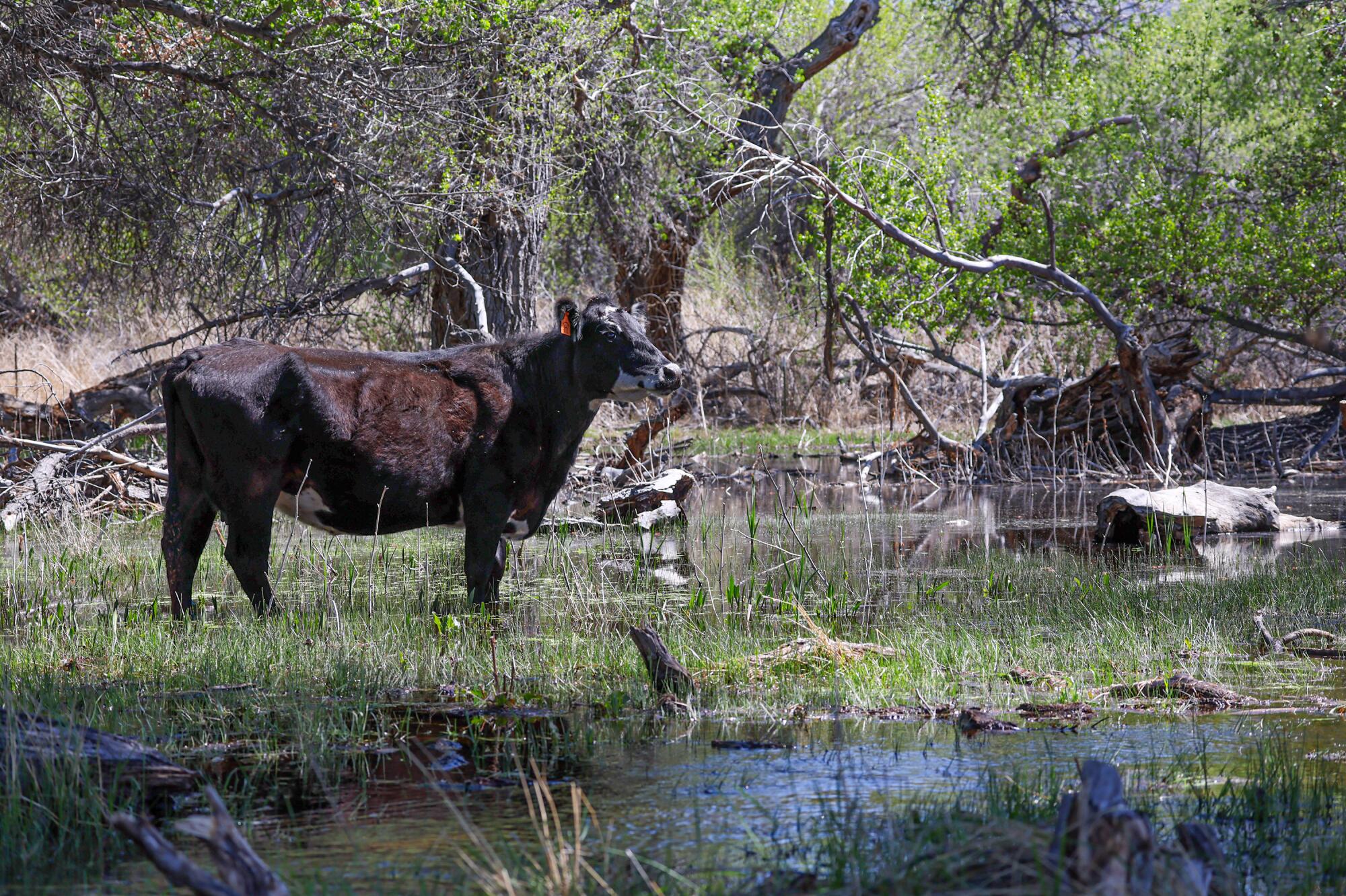
Cattle graze at the Kern River Preserve.
(Robert Gauthier / Los Angeles Times)
“If we don’t have groundwater levels that are able to support these diverse native vegetation ecosystems, then basically we run the risk of losing that important habitat for a lot of our threatened and endangered species,” Rohde said. “When you play around with keeping groundwater levels too deep to support the habitat, then you could lose species, and then that’s irreversible. The consequences can be severe.”
In California’s Mediterranean climate, trees, shrubs and the species they support are naturally adapted to drought. But excessive pumping from wells can push habitats beyond ecological limits by depleting the sources that sustain them.
With humanity’s heating of the planet intensifying droughts, the strains affecting these ecosystems continue to grow.
Already, California has lost the vast majority of its original wetlands to development, water diversions and agriculture. To avoid losing what remains, Rohde said, the state needs “a precautionary and preventative approach that can ensure that these ecosystems can withstand the intensification of droughts in climate change.”
During a recent visit to Kern County, Rohde and several conservation specialists walked in the shade through a lush forest of cottonwood trees near the south fork of the Kern River, visiting a nature preserve she had previously seen only in satellite images.
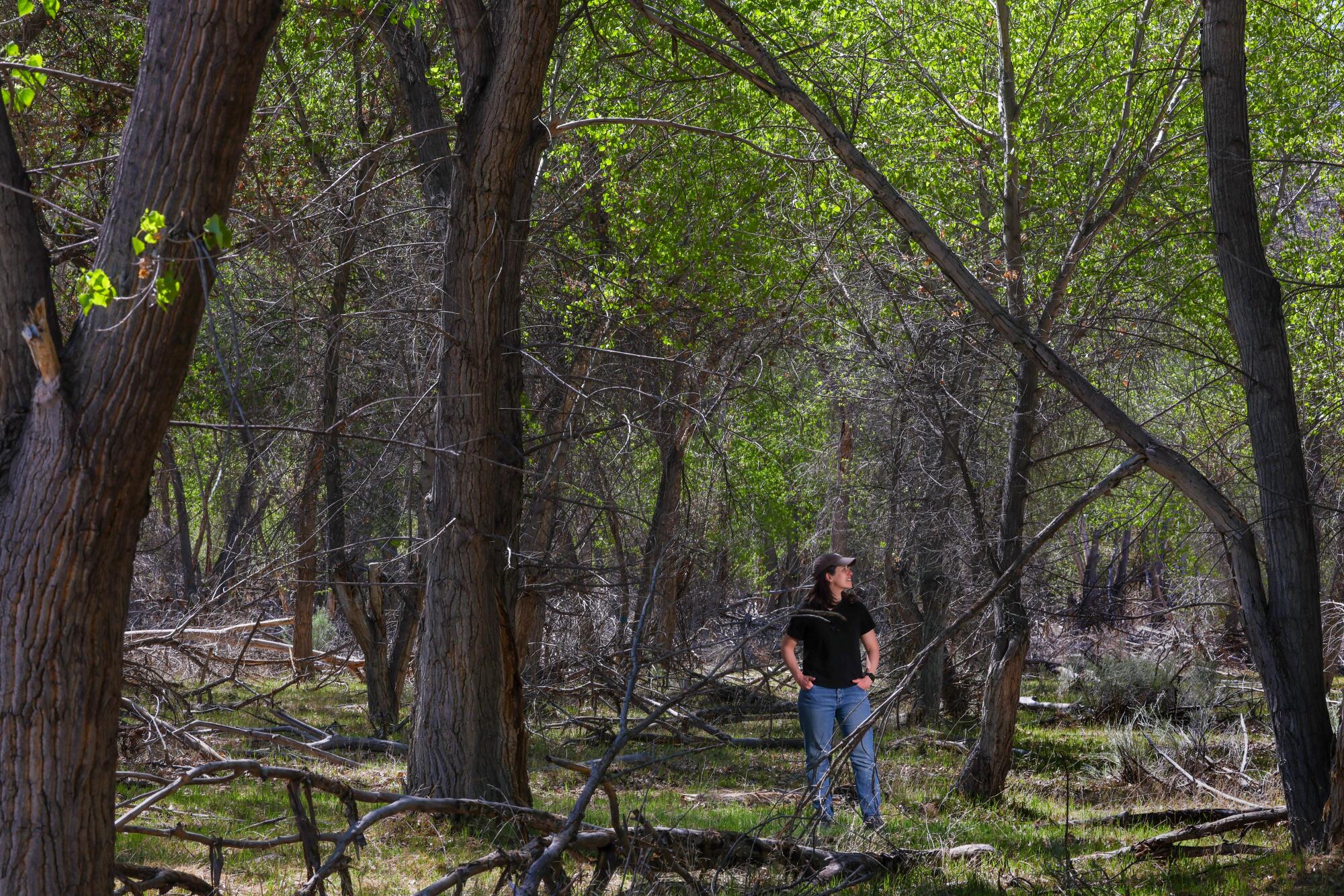
Scientist Melissa Rohde visits a riparian forest at the Kern River Preserve.
(Robert Gauthier / Los Angeles Times)
At the edge of a clearing, she came upon the bare, sunbleached skeletons of dead trees.
She said satellite data had revealed that parts of the forest died along this part of the Kern River during the drought between 2012 and 2016.
“That’s because the groundwater levels rapidly declined,” Rohde said.
After that die-off, she said, groundwater levels rebounded in the area, and the native vegetation has been growing back.
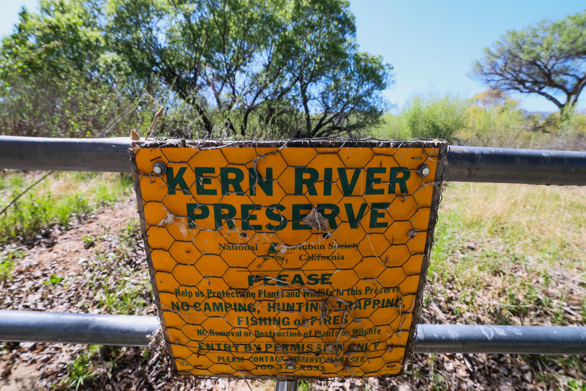
The Kern River Preserve protects the riparian ecosystem along the south fork of the Kern River.
(Robert Gauthier / Los Angeles Times)
It helps that this forest is protected as part of the Kern River Preserve, which is managed by the National Audubon Society, and that some nearby farmlands have been retired and converted to conservation lands over the years.
The preserve’s managers, working with the organization Ducks Unlimited, have also restored an expanded wetland by diverting water from the river and flooding a section of pastureland where cattle used to graze.
The wetland attracts birds, such as coots and tricolored blackbirds, and also recharges the aquifer that the roots of cottonwoods and willows tap into.
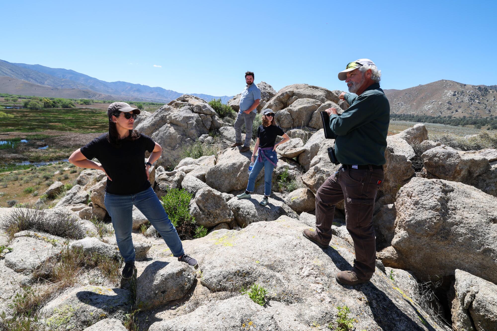
Scientist Melissa Rohde, left, and conservation specialists from Ducks Unlimited and the Audubon Society, including Reed Tollefson, right, stand on rocks overlooking a wetland at the Kern River Preserve.
(Robert Gauthier / Los Angeles Times)
The 3,300-acre preserve has expanded as adjacent alfalfa fields have been purchased and agricultural wells have been shut down, said Reed Tollefson, the preserve’s manager. These efforts have helped protect a refuge for birds including willow flycatchers and yellow-billed cuckoos.
As he pointed to several dead trees poking from the living cottonwoods, he said protecting the forest from groundwater pumping and climate change will require additional effort.
“I think it’s tenuous,” he said. “We’ve got more work to do to try and really sustain this.”
The dead trees that have appeared here and elsewhere in California over the past decade represent the sort of die-off that water managers need to focus on preventing, Rohde said.
“It has to be an intentional practice of setting thresholds, monitoring, using satellite data or other scalable means to measure the impacts, in order to make sure that we are not allowing this to happen on a wider scale,” she said. “From a biodiversity perspective, it’s absolutely critical.”
Rohde said she felt hopeful seeing the forest rebounding and much greener than it was several years ago, with many young trees coming up.
Some other parts of California haven’t fared nearly as well.
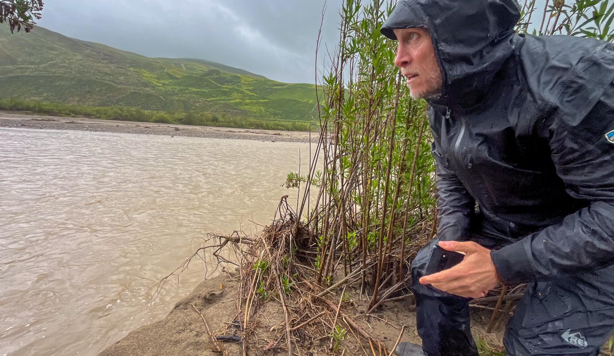
One rainy day last month, Rohde visited an area along the Santa Clara River in Ventura County where several hundred acres of willows and cottonwoods dried up and died during the drought in the mid-2010s.
When groundwater pumping by farms and communities caused aquifer levels to fall, many trees died along the river near the city of Fillmore.
“We saw this catastrophic drop in groundwater at this site,” Rohde said.
She visited the area with a research colleague and two managers from The Nature Conservancy. They stood on a gravel road next to a lemon grove, checking on what remained of the forest.
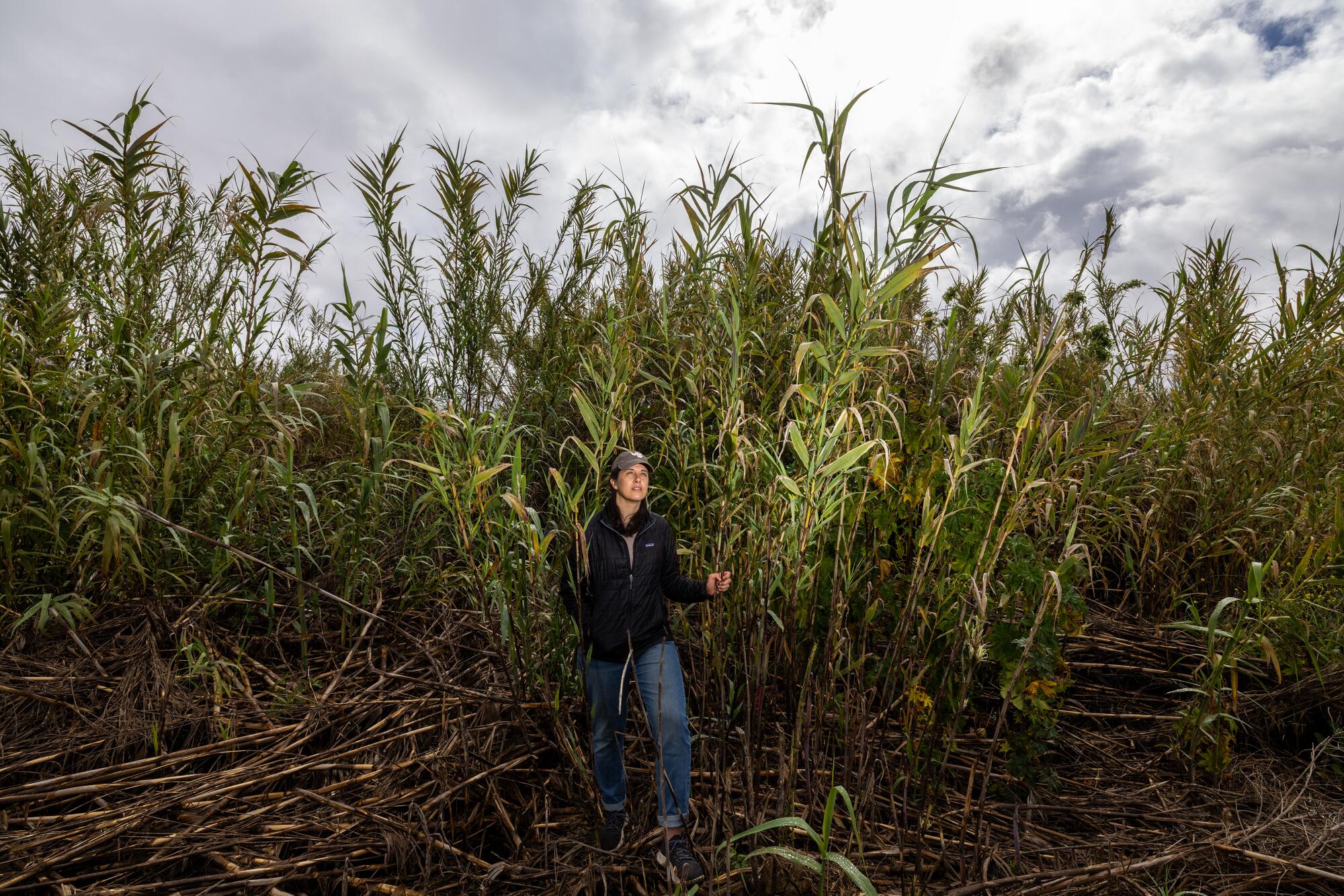
Scientist Melissa Rohde stands in a thicket of arundo, an invasive reed that has proliferated along parts of the Santa Clara River in Ventura County. There are ongoing efforts to remove the nonnative reeds in the area.
(Brian van der Brug / Los Angeles Times)
Where native trees died, an explosion of invasive reeds has taken over. The nonnative reeds, called arundo, have grown into thickets more than 20 feet tall. And unlike willows, Rohde said, arundo offers little value as habitat for birds.
“When we had that massive die-off, and the groundwater levels remained deep, there was no way for the native vegetation to regenerate,” she said. “But arundo is extremely efficient at extracting soil moisture. And so it was able to outcompete the native vegetation.”
She said efforts to prevent this sort of habitat degradation should be prioritized.
When managers of local agencies set goals for maintaining groundwater levels, she said, they can tailor targets to the type of vegetation — whether there are cottonwood trees, with roots averaging about 9 feet long, or oaks, with roots that average nearly 30 feet but can grow much deeper.
Her colleague Michael Bliss Singer said when native trees are ravaged by multiple years of low water levels, they will start losing leaves and then dropping branches.
In one study, Singer and others documented a “brown wave” of trees drying along the Santa Clara River between 2012 and 2016 — a loss they saw in satellite images.
Scientist Michael Bliss Singer looks out over the Santa Clara River in Ventura County.
(Brian van der Brug / Los Angeles Times)
“It’s completely transformed the ecosystem here,” said Singer, a professor at Cardiff University in Wales who is also a researcher at UC Santa Barbara.
When plants die off like this and don’t recover, it’s a symptom of an ecosystem in decline. To prevent more of these losses in an era when climate change is driving more severe droughts, Singer said, it’s crucial to “come up with creative solutions for the worst-case scenario.”
Rohde has found in her research, however, that most local groundwater plans in California haven’t adequately accounted for climate projections.
Previously, Rohde did other types of climate research, including a stint in Antarctica in 2010, where she was part of a drilling team collecting ice cores. From that experience, Rohde said she realized that “I didn’t want to spend my career convincing people that climate change was an issue; I wanted to do something about it.”
She wore a faded cap with an Antarctica map, a memento of that trip. Rohde said her recent work is motivated by concerns about the climate crisis and biodiversity, as well as a conviction that proactive steps to protect ecosystems can make a difference.
“I have two young kids. I really want to make sure that I’m doing the best thing that I can to ensure a sustainable future for them, where they can access nature,” Rohde said.
E.J. Remson, a senior project director for The Nature Conservancy, surveys a wetland along the Santa Clara River in Ventura County.
(Brian van der Brug / Los Angeles Times)
“Often groundwater is out of sight, out of mind,” she said. “We don’t measure it, we don’t understand it and we misuse it. And we need to make sure that we are managing groundwater so that it is supporting us, and making sure that we have a sustainable future.”
Rohde now works as an independent scientist. Previously, as a researcher for The Nature Conservancy, she helped write an atlas of threatened and endangered species that rely on groundwater.
California’s groundwater-dependent ecosystems lie not only along streams, but also in habitats such as mountain meadows, coastal redwood forests and mesquite bushes among desert sand dunes. The species they support range from tiger salamanders to desert pupfish, and from songbirds to mammals such as ground squirrels and bighorn sheep.
“The risks are high when species are on the verge of extinction,” Rohde said.
Rohde and other scientists have found that ecosystems sustained by groundwater are under threat worldwide. Some of the few regions that have measures intended to protect them, she said, include Australia, the European Union and California.
Still, even with California’s groundwater regulations and endangered species laws, Rohde said, “we continue to miss the mark in actually protecting them.”
Rohde said state officials should give local water agencies clear direction to ensure they’re using science-based methods to safeguard ecosystems in their state-mandated plans. She said agencies can now use the approaches scientists have outlined to map strongholds of biodiversity and set targets for maintaining aquifer levels.
“It’s very attainable,” she said. “Now, it’s just basically up to political will, or enforcement by the Department of Water Resources, to ensure that that happens.”
Walking in the rain at the Santa Clara River Preserve, Rohde followed her former Nature Conservancy colleagues Peter Dixon and E.J. Remson on a trail through a stand of healthy trees.
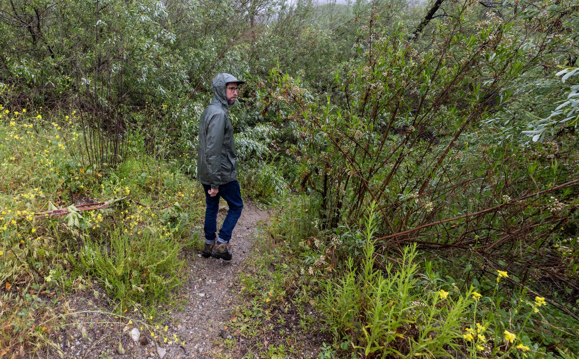
Peter Dixon, a project manager with The Nature Conservancy, walks on a trail through the riparian forest at the Santa Clara River Preserve.
(Brian van der Brug / Los Angeles Times)
They stood on the banks of the fast-flowing river, watching the muddy water churn past.
In the summer and fall, this part of the river usually dwindles to a trickle.
And during the next drought, when the river dries up, the forest will depend on the same groundwater that nearby communities and farms also use.
If the water needs of this and other ecosystems aren’t prioritized, Rohde said, vital habitats will suffer.
“We need to be deliberate about the planning, and ensuring that they get their fair share,” she said. “Their existence is potentially imperiled if we don’t act.”

Federal employees who were axed during waves of cuts by the Trump administration have fought back against the dismantling of a key climate science website, Climate.gov, and put up a new site, Climate.us, that can now do everything the original did.
The site, with millions of users each year, was known for colorful charts that anyone could freely download and that simplified giant sets of data, such as temperature readings. Now it refers to another page and is no longer being updated.
Daniel Swain, a UC Agriculture & Natural Resources climate scientist, called the resources available at Climate.gov “the most efficacious dollars spent by NOAA on public-facing science, possibly ever.” He has used graphics from the former website on his popular weather blog.
“I am a terrible artist or illustrator. It would be very bad if I had to create those on my own.” Swain said. The website didn’t just make graphics that were beautiful, he said, they were accurate and reliable because of the network of researchers who fact-checked them.
Rebecca Lindsey was the editorial lead and program manager for Climate.gov until February 2025, when her position at the National Oceanic and Atmospheric Administration was eliminated by the Elon Musk-led Department of Government Efficiency, or DOGE. She explained that the online resource was “a bridge between scientists, data and the public.”
Lindsey and her team have now rebuilt the bridge piece by piece, if just a bit further downstream.
The team is made of the same editorial and technical staff that ran Climate.gov. It’s paid for through a crowdfunding campaign and one large, anonymous donation.
The group has raised some $380,000, about $100,000 of which came in the last week. They also have recruited 80 scientists who are willing to volunteer as subject matter experts and fact checkers. It’s enough to keep the work going through February while they seek more long-term funding.
The first iteration of Climate.us went online in 2025 to keep the last 15 years of work from the government website available. The newest version restores the full function of the previous website.
For Californians, the timing could be important.
“We’re headed for a very strong El Niño event that will have significant implications for Southern California,” Swain said. “Climate.gov and the scientists behind it did a great job walking people through the last one, and I would expect that’s the case this time as well.”
Climate.gov excelled at tapping into a pool of academic experts to explain what was happening in nearly real time. This allowed the public to see how events such as wildfire, drought or large weather patterns such as El Niño were shaping their lives when they needed the information most. Research from academic institutions, by contrast, can take years to publish results from major natural disasters.
Swain emphasized that cuts to resources that give context to hard-to-interpret data is not just a loss for the research community.
“It’s getting more and more difficult for the American public to access the science and the scientists that their tax dollars have supported for over half a century,” he said.
With the revival of Climate.us, Swain said he plans to directly use the site and its graphics to keep Californians connected to the world of climate science.

Scientists have long dreamed of discovering the alchemy by which chemicals can be turned into life. On Wednesday, a team at the University of Minnesota announced that it had taken a major step toward that vision.
Blending together dozens of ingredients, the researchers have synthesized simple cells that feed, grow, reproduce and compete with one another for food. If these cells are not yet fully alive, they have most of the hallmarks of life.
“Life is not binary,” said Kate Adamala, a synthetic biologist who led the research. “That’s why I’m hesitant to call this ‘alive.’ There’s no clear line, as much as we would love it to be.”
Until now, scientists had never mastered the recipe for a cell that can perform so many functions, said John Glass, a synthetic biologist at the J. Craig Venter Institute in La Jolla, Calif., who was not involved in the study.
“It is dazzling that she has put these things all together,” he said.
Drew Endy, a synthetic biologist at Stanford University, said, “It’s a cell that was built, not born. It’s constructed, but it does what cells do.”
Dr. Adamala named her creation SpudCell, after its potato-like appearance. Rather than patent it, she and Dr. Endy are organizing a community of scientists to focus on making SpudCells more fully alive and adapting them to new kinds of experiments.
They and their colleagues have founded a nonprofit research organization that Dr. Endy estimates will spend hundreds of millions of dollars on the effort in the next decade. Hundreds of scientists are expected to join.
“We’re going to remember this moment,” said Roseanna Zia, a computational biologist at the University of Missouri who was not involved in the project.
Dr. Adamala and her colleagues posted a 190-page account of their work online. The research is under review for publication in a scientific journal.
Scientists hope synthetic cells can tell them things about life that natural cells cannot, including such basic questions as how many genes are necessary for a minimal form of life.
But synthetic cells also might someday be engineered to do things that natural cells can’t, like making new kinds of medicine or drawing large amounts of carbon dioxide from the atmosphere. In theory, engineered SpudCells might produce a vast range of proteins that natural cells cannot be coaxed to make, or even toxic chemicals like rocket fuel.
Now, “we can think about doing chemistry that we’re barely getting our heads around,” Dr. Glass said.
The trouble with life as we know it: mysterious, messy complexity. Our own DNA contains tens of thousands of genes, as well as millions of molecular switches turning those genes on and off. Scientists barely have a clue as to what many of those pieces of DNA are doing. Often a gene that they think they understand turns out to be performing other jobs than scientists expected.
One way to sidestep this intricacy is to simplify.
In the 1990s, a team led by the late biologist Craig Venter began studying a microbe that had fewer than 1,000 genes. The team, now led by Dr. Glass, went on to strip the microbe’s genome down to 525 essential genes.
In a 2016 paper, the team reported it didn’t know what a third of those genes were doing. Dr. Glass and his colleagues have spent the last decade trying to solve the puzzle, and they still can’t say what 56 of them do.
“There are still significant tasks that every cell has to do that we don’t know,” Dr. Glass said.
Other researchers tackled the problem from the opposite direction. Instead of working from the top down, they moved from the bottom up, seeking to combine lifeless molecules to produce a living cell.
Since the 1990s, several labs have bitten off small pieces of this problem. Some of them have perfected recipes to make hollow bubbles from oily molecules. Others have found ways to encapsulate simple genetic molecules inside those bubbles.
But scientists struggled to put these pieces together into more complex systems, let alone something that could be called a cell.
In recent years, Dr. Adamala took on one of the fundamental challenges: cell division. A natural cell divides with the help of proteins that lock together into a ring anchored to its inner wall. The ring winds itself tighter, pinching the cell in two.
Other proteins act like winches, moving DNA and other molecules into the forming cells, so that they have the ingredients necessary to keep living.
At first, Dr. Adamala tried building a simpler version of the natural system. But then she decided not to mimic real cells at all.
Biophysicists had found that if they stuck proteins on a membrane, they created pressure that made the membrane bend. Dr. Adamala and her team created bubbles that could snag proteins floating around them. When a bubble collected enough proteins, its surface began bending inward until it popped in two.
While the idea was simple, getting it to work in the lab required a year of experiments. “But once it works, it works,” Dr. Adamala said.
That success prompted the team to try to build a synthetic cell in its entirety.
The first step was to create a broth of the molecules necessary for a cell to operate. The recipe ultimately included about a hundred kinds of proteins and simple molecules required for crucial chemical reactions, such as making new proteins from genes.
The researchers also provided their synthetic cell with genes borrowed from a virus and the ubiquitous microbe Escherichia coli. They picked 36 genes for basic jobs like copying DNA.
After mixing these ingredients together into a soup, the scientists added the building blocks of membranes. They spontaneously joined together into bubbles, each engulfing some of the soup.
Many of these bubbles ended up encasing the right mix of genes, proteins and other molecules, and they started carrying out the chemical reactions seen in real cells.
As the new cells floated in flasks, Dr. Adamala and her colleagues added food. The cells slurped up small molecules through channels on their surfaces.
The scientists also put in small bubbles loaded with proteins and other molecules that were too big to fit through the channels. By bumping and fusing into one of these bubbles, the cell could feed on the treats inside.
As the cells fed, they grew. And in just a few hours, they were big enough to divide.
The scientists added a special protein to the flasks, which latched onto the surface of the cells and forced them to bend inward. Once the cells split in two, the pair of new cells kept growing.
Now the SpudCells grew, fed and reproduced. As it turned out, the cells even had a rudimentary ability to evolve.
Dr. Adamala and her colleagues created a mutant version that bound more tightly to the snack-filled bubbles floating around it. To test it, they created a 50-50 mixture of original and mutant SpudCells.
The cells competed for five generations for food. Eventually the mutants outnumbered the originals, suggesting that they were outcompeting the originals for food.
“That’s the shake-the-ground accomplishment here,” said Dr. Zia. Scientists will be able to put various synthetic cells in competition with one another and rapidly develop more sophisticated ones.
For all this evidence of life, SpudCell still has some major shortcomings. For starters, it can’t make the molecular factory that produces new proteins, called a ribosome. The cells can carry all the genes they need to build ribosomes, but for some reason the parts don’t come together.
For now, Dr. Adamala and her colleagues have to feed ready-made ribosomes to SpudCells. This solution has an expiration date, though: SpudCells can keep making proteins through five to 10 generations before they fail as their ribosomes become defective.
“I don’t want to say it dies, but it stops working,” Dr. Adamala said.
When Dr. Adamala showed SpudCell to Dr. Endy last year, he was so awestruck that he decided to help her found Biotic, the nonprofit organization intended to create a community of SpudCell researchers.
“I’m pouring my life’s work into this,” Dr. Endy said. One of the first tasks for Biotic will be to make it easier for other scientists to create SpudCells.
Dr. Adamala can create a fresh batch of them in her own lab in about a day. But that’s only because she has freezers full of purified proteins and an intimate understanding of each step of her recipe. Biotic expects to offer scientists easier recipes and provide the required ingredients.
Dr. Endy hopes that the open-source tools will encourage scientists to collaborate on building new kinds of SpudCells with more of the defining features of life, such as the ability to make their own ribosomes and to divide indefinitely.
“It’s completely doable,” said Dr. Glass.
Biotic researchers are already planning their first meeting, in September in Philadelphia. High on their list of priorities will be formalizing plans to safeguard this area of research.
For now, the synthetic cell can only survive a few generations on a special lab diet. But future versions may be more robust, raising the possibility that someone might someday use SpudCells unethically, perhaps even to make a weapon.
Dr. Endy argues that an open-source research community will be better prepared to prevent that from happening. “We can have these conversations now, as opposed to waiting for somebody else to do it, and then we’re just all reacting,” he said.
Dr. Endy likens SpudCells to a biological version of the Wright flyer, the crude plane that the Wright Brothers used to make the first sustained controlled flight in 1903, ushering in the age of airplanes.
“The Wright flyer flying for 12 seconds doesn’t get you a 737,” Dr. Endy said. “This is just the beginning.”

For the next five years, the Environmental Protection Agency has indicated it will not require public water utilities to test for microplastics or pharmaceuticals in drinking water, according to a proposed rule published in the Federal Register.
On Friday, the EPA submitted a list of chemicals it plans to test for under the Unregulated Contaminant Monitoring Rule, a mandatory testing program used to collect information about concerning chemicals in drinking water that could be harming human health. It did not include microplastics or pharmaceuticals.
The omissions come after announcements by EPA Administrator Lee Zeldin earlier this year that his agency was designating microplastics and pharmaceuticals priority contaminants for testing.
“This is a direct response to the concern of millions of Americans who have long demanded answers about what they and their families are drinking every day,” he said at an April news conference with Health and Human Secretary Robert F. Kennedy Jr. at EPA headquarters.
Zeldin’s announcement was seen at the time as a move to placate the increasingly disgruntled Make America Healthy Again contingent of Trump supporters.
Now the agency says it has no validated or standardized method to test for the plastic particles in drinking water, and wouldn’t be able to develop one before December, when testing is required to begin.
Among the 33 chemicals the EPA will require water utilities to test for are seven PFAS, or forever chemicals, and three pesticide residues.
It will be five years before the EPA proposes another list.
The EPA did not respond to a request for comment.
The agency noted in its proposed rule that it will collaborate with other federal agencies to “evaluate risks and exposures” of microplastics for future monitoring.
Environmentalists reacted with frustration and resignation. They pointed out that the European Union has developed methods to test for the tiny plastic particles, which have been found in people’s blood, brains and lung tissue. California has one in the works.
“The California water board has spent a lot of time and money on how to measure in drinking water,” said Judith Enck, a former EPA regional administrator and president of the anti-plastic environmental group Beyond Plastics. “EPA should give them a call.”
California was required by a 2018 state law to establish a protocol for local water utilities to test for the particles in drinking water. The state has not yet begun reporting its results, but protocols were established in 2021. Blair Robertson, a spokesman for the State Water Resources Control Board, said it’s not “a fully validated, end-to-end regulatory method” yet.
At the April meeting, Zeldin announced that he would place microplastics on what is known as the Contaminant Candidate List, which acts as a preliminary “watch list” of unregulated, priority contaminants in drinking water. Like the mandatory monitoring list, it is updated only every five years. The most recent list was published on April 2 — the day he made his announcement.
“Americans have been ignored as they sound the alarm about plastics in their drinking water,” Zeldin said during the announcement. “That ends today by placing microplastics on the contaminant candidate list for the first time ever. EPA will follow the science, will pursue answers and will hold ourselves to the highest standards to protect the health of Americans.”
There appears to be no clear association between these two lists, although the contaminant list is supposed to inform the monitoring list. Seventy-five chemicals and four chemical groups (microplastics, pharmaceuticals, PFAS chemicals, and disinfection byproducts) were listed on the 2026 contaminant list. Only seven of those chemicals were also on the proposed monitoring list (as well as seven PFAS chemicals).
When Zeldin announced microplastics as “‘a priority contaminant for regulation,’ and called it ‘a historic action on microplastics,’ he made it seem like the administration was going to take microplastics seriously,” said Mary Grant, water policy director for the environmental group Food & Water Watch.
“By not including them, they made it clear they don’t actually have plans to immediately address this crisis by getting the real-world monitoring data that we need right now to really start correcting ourselves,” she said.
Craig Davis, senior director of plastics chemistry at the American Chemistry Council — the nation’s largest trade group for chemical companies — said that while his organization supports microplastic research, it also agrees with the EPA’s decision not to include them in the monitoring list.
“National drinking water monitoring should be based on validated, standardized methods that can produce reliable and comparable data,” said Davis in a statement. He said “limited” national monitoring resources should be focused where data can produce “actionable public health information.”
The public has 60 days to comment once the plan is published in the Federal Register.
-
Missouri2 minutes ago
Missouri Lottery Powerball, Pick 3 winning numbers for July 1, 2026
-

 Montana7 minutes ago
Montana state auditor urges homeowners to review flood, wildfire insurance coverage
-

 Nebraska14 minutes ago
Online sports betting petition heads to Nebraska ballot review as opposition mounts
-

 Nevada17 minutes ago
Nevada Test Site shaped U.S. nuclear history, Southern Nevada’s growth
-

 New Hampshire22 minutes ago
Driver dead, Mass. woman and several children sent to hospital, in 3-vehicle crash in Nashua, N.H. – The Boston Globe
-

 New Jersey29 minutes ago
Empire State Building daredevil couple are New Jersey residents
-

 New Mexico32 minutes ago
Law limiting license plate reader data being shared goes into effect in New Mexico
-

 North Carolina37 minutes ago
Western NC activists push for statewide ban on new data center construction

