Hawaii
Hawaiian Electric Gets The Green Light On Its $190 Million Resiliency Plan To Harden The Grid

State energy regulators have given their conditional approval to a five-year, $190 million plan by Hawaiian Electric to retool some of the most vulnerable parts of its grid as the company looks to address wildfire dangers and other threats related to climate change.
The decision comes almost six months after a deadly wildfire swept through Lahaina, destroying much of the West Maui town and killing at least 100 people.
Local watchdogs and energy policy experts who keep an eye on the state’s largest power company said they’re pleased with the Public Utility Commission’s decision Wednesday to green-light Hawaiian Electric’s new grid-hardening plan.
The timing of the approval, they said, allowed Hawaiian Electric to meet a deadline that will help it secure a $95 million federal grant for about half that work. The grant should cut the cost of the grid upgrades in half for electricity ratepayers.
President Joe Biden announced that Department of Energy grant in August after visiting the Lahaina disaster zone.
“We view it as a win,” Michael Colon, energy director for the Ulupono Initiative, said Thursday. “It’s great that the federal money is coming.”
Still, many millions of additional dollars and investment will be needed in the coming decades if Hawaii’s grid is to be modernized and made more resilient overall, he added. The expensive task of burying overhead power lines underground in West Maui to help protect that area against wildfires, for example, hasn’t undergone any local planning yet.
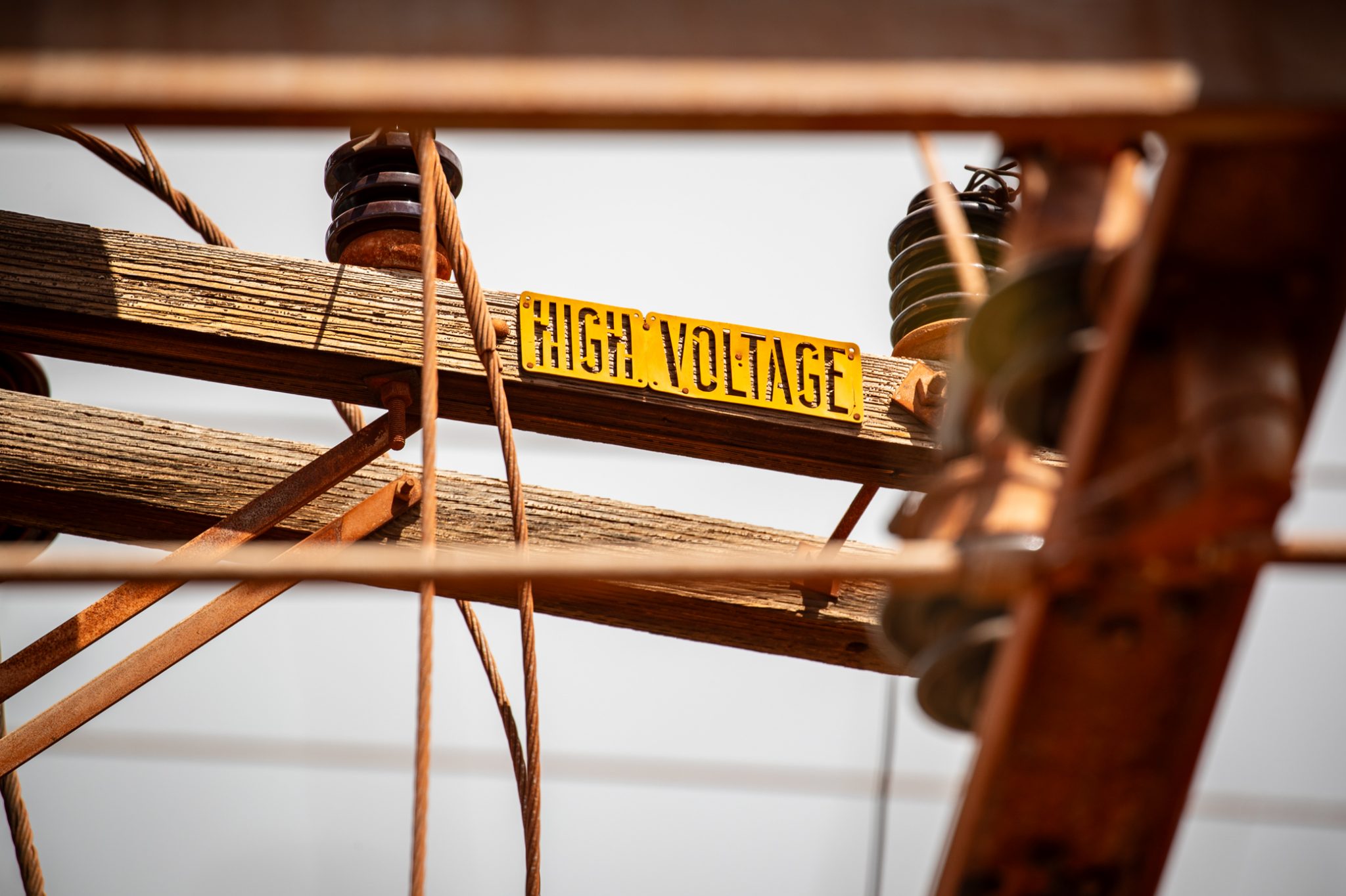
The new Hawaiian Electric plan will include replacing and hardening some 2,100 poles across the grid so that they might better withstand heavy wind gusts, according to a company statement.
It will also involve installing sensors plus replacing circuits and equipment along the transmission routes so that they’re less prone to spark fires, according to documents filed with the PUC.
Many questions remain as to how exactly the company will carry out its grid-hardening. The PUC added about a dozen conditions in its decision that require Hawaiian Electric to come back and brief regulators on the details of its projects as they develop.
“That was kind of the tension there,” Colon said Thursday.
The PUC wanted to ensure Hawaiian Electric’s plans would be effective, especially after the Lahaina disaster, but it needed to “figure it out quickly” in order to hold on to the federal grant, he said.
In a statement Thursday, Hawaiian Electric Senior Vice President Colton Ching said the company appreciated the PUC’s approval of its plan and thanked federal partners for their support.
Ching was unavailable Thursday to discuss the decision further, company officials said.
An Effort That Started Before Lahaina
Hawaiian Electric initially applied for the “Climate Adaptation Transmission and Distribution Resilience Program” in June 2022, more than a year before the destructive wildfires in Lahaina and Upcountry Maui.
The company’s application at that time focused heavily on protecting against the threat of hurricanes and heavy storms.
After the Aug. 8 tragedy, however, the threat of wildfires took center stage in Hawaii. Regulators and utility watchdogs had new, lengthy questions about whether Hawaiian Electric’s $190 million proposal would sufficiently address the wildfire dangers in its service area, which includes Maui, Molokai, Lanai, Oahu and the Big Island.


In November, Hawaiian Electric responded by adjusting the plan somewhat, giving higher priority to service areas with a high wildfire risk. It shifted tens of millions of dollars worth of grid-hardening work from areas not prone to wildfires into those high-risk regions.
It also boosted the plan’s Wildfire Prevention and Mitigation initiative from an original budget of $14 million to $42 million by taking money from other areas. The $190 million price tag remained the same.
“The question was what can be done with the existing application to lean it more toward wildfire mitigation?” Colon said Thursday.
The nonprofit environmental and community watchdog group Life of the Land submitted numerous questions after the Lahaina disaster about Hawaiian Electric’s ability to address the wildfire threat. Earlier this month, Hawaiian Electric responded to many of those questions and Life of the Land then said it would support a PUC decision on the climate plan.
Henry Curtis, the group’s executive director, said Wednesday he was pleased with the PUC conditions.
“We look forward to more disclosures and more discussions as the process moves forward,” he said.
Next, Hawaiian Electric will finalize its deal with the Department of Energy for the plan’s grant, Colon said. The company is also expected to conduct community outreach and gather more input on the latest version of the climate and wildfire plan, he said.
“This is kind of step one,” Colon said. “Wildfire is something that’s been ignored for a long time in Hawaii. Now, it’s front and center.”
Civil Beat’s coverage of Maui County is supported in part by a grant from the Nuestro Futuro Foundation.
Civil Beat’s coverage of environmental issues on Hawaii island is supported in part by a grant from the Dorrance Family Foundation.

Sign up for our FREE morning newsletter and face each day more informed.


HONOLULU — Hawaii Pacific coach Dane Fujinaka joked with his staff that it was a lose-lose situation.
When HPU Sharks all-time saves leader Ryan Inouye took the mound in the ninth inning for the University of Hawaii against his former team Wednesday, there were plenty of mixed emotions in the Les Murakami Stadium visitors’ dugout.
“It was like we either come back and make a push here, and our guy obviously has to wear it,” Fujinaka said. “Or he shuts it out like he did, and we lose.”
The 5-foot-9 Kailua High graduate with the unorthodox right-handed mechanics limited the Sharks to a single to record his first save in a Kelly green uniform, as UH beat its crosstown opponent 4-1.
[Note: See below for more photos of Hawaii-Hawaii Pacific baseball.]
Inouye, his face a neutral mask minutes later, resolved to keep his emotions the same way as he stepped on the turf.
“Gotta keep it the same even though I know a lot of the guys over there,” he said.
Afterward, he greeted old teammates and coaches and was warmly received.
Inouye posted 20 saves over the last three years with Division II HPU, including the program single-season record of 13 en route to second-team All-West Region honors in 2025. He learned last season that he had a year of eligibility restored from his time at Menlo at the front end of his college career. But by rule he also would not be able to apply it at the D-II level.
Once the season ended, Fujinaka reached out to UH pitching coach Keith Zuniga and head coach Rich Hill.
“I said, ‘Hey, is there any interest here? I think you guys like perfect fit. He lives five minutes away. He’s a different arm that a lot of your league hasn’t seen.’”
“It was an easy phone call, and he was out of Division II eligibility, so he wouldn’t have been able to come back to us anyway,” Fujinaka added. “I’m just really happy that that UH, Rich gave him a chance to continue playing.”
It was his seventh appearance for the Rainbow Warriors, but first since March 8 against Cal Poly.
Hill acknowledged it was “weird” to put Inouye in a situation to face his old friends. He was the last of seven pitchers to see work in the mid-week bullpen game.
“He went to war with those guys for a few years. But they understand,” Hill said. “And he loves his teammates and he loves his coaches on both sides. I don’t think that entered into it at all. He was just trying to execute pitches and get a save for his team.”
Four UH pitchers — Derek Valdez, Saul Soto, Jack Berg and Zac Tenn — took a combined no-hitter into the seventh, when the Sharks’ Owen Wessel singled to right off Tenn.
Shortstop Elijah Ickes threw Wessel out at home on Ethan Murakoshi’s fielder’s choice. Jayden Gabrillo scored on a wild pitch by Tsubasi Tomii to give the Sharks a momentary lead.
Ben Zeigler-Namoa started a four-run rally in the bottom of the frame with a single to right. Kody Watanabe tied the game with an infield single and catcher Jake Redding drew a bases-loaded walk for the go-ahead score.
After UH faced ex-‘Bows pitcher Rylen Bayne in the bottom of the eighth — Bayne got through old teammates Zeigler-Namoa, Ickes and Draven Nushida cleanly — it was Inouye’s turn to face old friends.
He got Blake Helsper to foul out with a nice sliding catch by third baseman Tate Shimao just in front of the UH dugout.
Noah Hata singled up the middle, but Inouye struck out Carter Jones on eight pitches and Gabrillo grounded out to first to end the game.
Inouye was teammates with all the batters he faced, save Helsper.
“Definitely wanted to get all of them out,” Inouye said. “But Noah got a hit, so he’s definitely gonna hold that one over me.”
UH (13-10, 3-6 Big West) now readies for Cal State Fullerton (11-13, 5-4) in a three-game series starting Friday.
Hill said he appreciated the closely played contest that tested his team’s nerve when the Sharks got on the board first late in the game. HPU hadn’t beaten UH since 1986.
“It felt like the game meant something,” Hill said. “It’s good for our guys to be in that situation heading into Cal State Fullerton. You can’t replicate that in practice.”
As for Fujinaka, it was encouraging to see some of his eight pitchers on the day work their way out of jams, a known trouble spot for his group.
His message to the players was, “Look, guys, like, we can play alongside anybody in the country, as long as we continue to throw strikes, play defense, do the fundamental stuff that we talked about all year.”
HPU (12-14, 10-10 PacWest), which beat Chaminade 11-7 on Tuesday, hosts Fresno Pacific in a four-game series at Hans L’Orange Park next Wednesday.
The Sharks have weathered a literal storm or two.
They had a four-game home series against Westmont washed out by the first of two Kona low storms to hit Oahu. HPU’s practice site at Keehi Lagoon was inundated by knee-deep water — something Fujinaka had never seen.
They will attempt to make three of the Westmont games up on the road, Fujinaka said, in a tough 11-games-in-12-days stretch in mid-April.
Hawaii pitcher Ryan Inouye threw a pitch against his former team, Hawaii Pacific, in the ninth inning. (Spectrum News/Brian McInnis)
Hawaii third baseman Tate Shimao, sitting, made a sliding catch in foul territory near the UH dugout against Hawaii Pacific. (Spectrum News/Brian McInnis)
Former Hawaii pitcher Rylen Bayne threw a pitch for HPU against his old team. (Spectrum News/Brian McInnis)
Hawaii’s Jake Redding got caught in a rundown short of home plate as HPU catcher Brock Wirthgen stood in his way. (Spectrum News/Brian McInnis)
Brian McInnis covers the state’s sports scene for Spectrum News Hawaii. He can be reached at brian.mcinnis@charter.com.


Gov. Josh Green on Tuesday asked President Donald Trump to declare a major disaster to help Hawaii recover from the back-to-back Kona low storm systems, with the hope that the federal government will provide up to 90% in funding.
The first storm hit on March 10, followed by a second Kona low on Thursday that the governor’s office said brought “catastrophic flooding, landslides, infrastructure damage and emergency evacuations across multiple islands.”
“These storms have impacted every county in our state and stretched our emergency response capabilities,” Green said in a statement Tuesday. “This request is about getting our communities the support they need to recover quickly and safely.”
If approved, Trump’s declaration would trigger the Federal Emergency Management Agency to provide support for residents in the form of housing assistance, disaster unemployment assistance, crisis counseling and legal services.
There would also be federal funding for debris removal, emergency protective measures and permanent repairs to roads, bridges, utilities and public facilities.
Green also hopes for federal assistance to strengthen infrastructure and reduce the risks of future disasters across the state.
The storms knocked down trees, and triggered mudslides and rockfalls that blocked highways, isolated communities and disrupted emergency access statewide.
The first storm caused more than $400 million in damage, followed by the second, which, combined, is expected to exceed more than $1 billion in damage.
Otake Camp in Waialua was hit especially hard, and the Hawaii National Guard continues to help with debris removal and clearance operations, along with National Guard recovery and emergency operations statewide, Green’s office said.
“The scale of damage we are seeing — from washed-out highways to overwhelmed water systems — makes clear that federal partnership is essential,” Green said in his statement. “We are doing everything we can at the state and county level, but this is exactly the type of event where FEMA support is critical.”
On the North Shore, water “buffaloes” have been deployed in Waialua, Haleiwa and at Sunset Elementary to provide drinkable water.
The state and city have also set up a mobile clinic at Haleiwa’s Ali‘i Beach Park, while Kaiser Permanente has also deployed a mobile clinic to Kula on Maui to help patients from Kula Hospital who had to evacuate because of storm damage.

Indiana coach Cignetti sends message to star transfer with pre-practice dress code lesson

Drone food delivery launches in New Jersey

FKA twigs sues ex-boyfriend Shia LaBeouf over ‘unlawful’ NDA

LAPD chief backed cops who shot at author, Weezer bassist’s ex; commission overruled him

What European Luxury Can Learn From American Fashion

Florida High School Football Rankings: Top 25 teams – Oct. 21

How old is Bo Nix? What to know about Oregon quarterback ahead of 2024 NFL Draft

Cleary's 21 help Le Moyne down Central Connecticut State 69-64 in OT

99th annual Pony Swim held in Virginia

Indiana Members Credit Union announced as new anchor tenant at Bottleworks District

Rubio joins crucial G7 talks as Iran war set to dominate second day

A surprise resignation could open the door for an independent to win a Montana Senate seat

Video: Savannah Guthrie Says She Believes Her Mother Was Taken for Ransom

Stefanik grills University of Michigan leader on lack of audit after string of Chinese national arrests

Photos: More than one million displaced by Israel’s evacuations in Lebanon
-

 Detroit, MI1 week ago
Drummer Brian Pastoria, longtime Detroit music advocate, dies at 68
-

 Science1 week ago
How a Melting Glacier in Antarctica Could Affect Tens of Millions Around the Globe
-

 Movie Reviews1 week ago
‘Youth’ Twitter review: Ken Karunaas impresses audiences; Suraj Venjaramoodu adds charm; music wins praise | – The Times of India
-
 Science1 week ago
I had to man up and get a mammogram
-

 Sports6 days ago
IOC addresses execution of 19-year-old Iranian wrestler Saleh Mohammadi
-

 New Mexico4 days ago
Clovis shooting leaves one dead, four injured
-

 Texas7 days ago
How to buy Houston vs. Texas A&M 2026 March Madness tickets
-

 Tennessee3 days ago
Tennessee Police Investigating Alleged Assault Involving ‘Reacher’ Star Alan Ritchson