Kentucky
Vanderbilt upsets Tennessee ahead of Kentucky showdown

The Kentucky Wildcats have a slight bye week coming up as they have a week off until they make the trip to Nashville next Saturday.
Their opponent? The Vanderbilt Commodores.
However, this is not the Vandy team we have become accustomed to seeing over the last several years, as the Commodores sit at 15-3 on the season. Memorial Gymnasium will also be rocking after the Dores knocked off the sixth-ranked Tennessee Volunteers Saturday afternoon, 76-75.
Although they almost gave the game away, Chaz Lanier of the Vols missed a game-tying free throw that secured the upset for Vandy.
Memorial is always a unique place to play, and will be the first time this staff has coached a game in the one of a kind setup. Will the Cats respond after a tough loss to Alabama?
One thing is for sure: Vandy and their fans will be ready for the chance to knock off another top-25 team.

Kentucky
Missing on this PF in the transfer portal could be a good thing for Kentucky

Power forward has been one of the positions that Mark Pope and the Kentucky Wildcats have to fill with Andrija Jelavic and Mo Dioubate gone. The two players that Pope has had on campus at the power forward position are Syracuse’s Donnie Freeman and Colorado’s Sebastian Rancik. Both are really good players, but Freeman is better by a wide margin.
It has felt that entire time that Kentucky wanted Rancik as the backup to Freeman or a backup plan if they weren’t able to land Freeman. Well, Rancik just picked Florida State, so perhaps this is a sign that the Wildcats will land Freeman.
Big Blue Nation was torn on Rancik, but I do believe he would have been a really solid backup power forward. I personally didn’t want him to be the starting four for this team. It is clear that he wanted to go somewhere where he could be the guy at the four, so he will be heading to the ACC to play for FSU.
Now that Kentucky has missed on Rancik, it is very important that the Wildcats land Freeman soon. The problem with waiting on some of these players is the fact that the portal isn’t slowing down. If Pope targets two power forwards and misses on both of them, most of the good fours in the portal will be gone.
There will be some panic in Lexington if the Wildcats are not able to land Freeman, but I do believe the Wildcats are in a good spot to land the elite power forward. From the beginning, Freeman has been my top player for Kentucky in the portal, as he, plus Malachi Moreno, will give the Wildcats an elite frontcourt.
If Pope is able to land Freeman and Tyran Stokes to pair with Zoom Diallo, Alex Wilkins, Moreno, and Kam Williams, this could be the start of a really good team in Lexington. Hopefully, an announcement for where Freeman will transfer comes soon, and hopefully, this will be to play for Pope at Kentucky.
Fans of rival teams will say Pope “whiffed” on Rancik, but if this whiff was because the Wildcats are set to land Freeman soon, then it was more than worth it for Kentucky. If the Wildcats are able to land Freeman, it will officially be time for Big Blue Nation to start getting excited about the 2026-27 season. I expect a decision from Freeman to come within the next day or two.
Rancik would have been a solid backup four in Lexington but Freeman has been the guy from the beggining for this staff so if Kentucky lands him all is well. If the staff misses on Freeman not landing Rancik will look bad.
Follow
Kentucky
Kentucky is poised to land either Donnie Freeman or Sebastian Rancik this weekend, per report

Jones posted on Twitter that “Kentucky will have (absent a major change) either Freeman or Rancik by tomorrow,” while also noting the Wildcats still need to add another shooter and another big to round out the roster.
One of the top targets is Donnie Freeman, a 6-foot-9, 205-pound sophomore forward transferring from Syracuse. Freeman arrived in Lexington on Tuesday night and began his visit on Wednesday before leaving without a commitment. While there was concern he could land at UConn, that visit has since been canceled, leaving Kentucky and St. John’s as the top teams.
Freeman averaged 16.5 points, 7.2 rebounds, and 1.3 assists per game last season, while adding nearly a block and a steal per contest. He shot 47.4% from the field but 30.2% from 3-point range across 23 games.
The other option is Sebastian Rancik, a 6-foot-11, 220-pound sophomore forward transferring from Colorado. Rancik visited Kentucky starting Wednesday through Thursday and brings a versatile skill set, averaging 12.3 points, 5.6 rebounds, and 2 assists per game while shooting 33.1% from 3.
Either Freeman or Rancik would provide a significant boost at the power forward position for head coach Mark Pope. Kentucky has already added guards Zoom Diallo and Alex Wilkins in the portal.
Kentucky
Kentucky football spring game offers early look at Will Stein’s Cats

Kentucky football coach Will Stein reflects on new position
Will Stein was officially introduced to fans and media as the head coach for the Kentucky Wildcats, replacing Mark Stoops.
LEXINGTON — Kentucky football had its first spring game under new coach Will Stein at Kroger Field on Saturday.
The offense, in blue jerseys, had its moments. So too the defense, donning white uniforms.
Ultimately, the blue squad earned a 23-18 victory in a game called just after noon because of inclement weather.
Stein admitted he “got emotional” as he charged onto the field prior to kickoff.
“I know it wasn’t a real game, but when I ran on the field, I definitely — man, I felt it,” he said. “It was like a wave running over me. And very, very, just cool.”
While it doesn’t count in the standings, Stein walked away pleased.
“I think we got a lot of really good work,” he said. “That’s the goal of spring is to improve with fundamentals and technique, learn how to practice, learn what winning edges that we need throughout spring to go into summer and fall and prepare the team for play. And we came out of the scrimmage clean. There (were) no injuries, which to me, that’s the biggest win of the day. I could (not) care less about the score.
“If we come out clean, that’s good. The Wildcats won.”
New starting QB Kenny Minchey looked about as expected, with sharp passes evened out by moments of inconsistency. Martels Carter Jr., a defensive back who is lining up at running back this spring, scored a touchdown and had several nice runs.
And the defense forced multiple three-and-outs and also picked off one Minchey pass on a two-point conversion.
This story will be updated.
Reach Kentucky men’s basketball and football reporter Ryan Black at rblack@gannett.com and follow him on X at @RyanABlack.
-

 Sports3 minutes ago
Ryan Ward has a solid debut, but bullpen blows it again as Dodgers lose to Rockies
-

 World15 minutes ago
Schools, shops shut in northern Israel to protest the Lebanon ceasefire
-

 News45 minutes ago
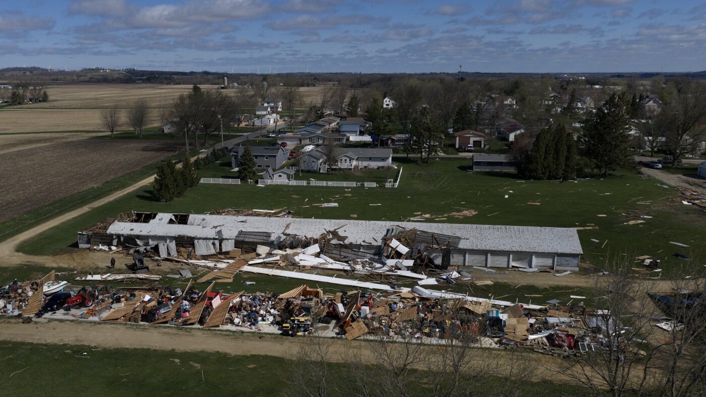
Communities launch cleanup after severe weather and tornadoes churn across Midwest
-

 Detroit, MI3 hours ago
Game 21: Tigers at Red Sox, Garrett Crochet battles both Detroit and the weather
-

 San Francisco, CA3 hours ago
Why do gray whales keep dying in San Francisco’s waters?
-

 Dallas, TX3 hours ago
Dallas Mavericks Owners Might Be Making Big Mistake in Search for New GM
-

 Miami, FL3 hours ago
Defense dominates, Mensah flashes in Miami’s spring game – The Miami Hurricane
-
Boston, MA3 hours ago
A crowd scientist is helping the Boston Marathon manage a growing field of 30,000-plus runners


