Indianapolis, IN
Nebraska takes the stage at Big Ten Media Days in Indianapolis
/cloudfront-us-east-1.images.arcpublishing.com/gray/GUNIUEHB6BCOTJOGCNF3XJGSY4.png)
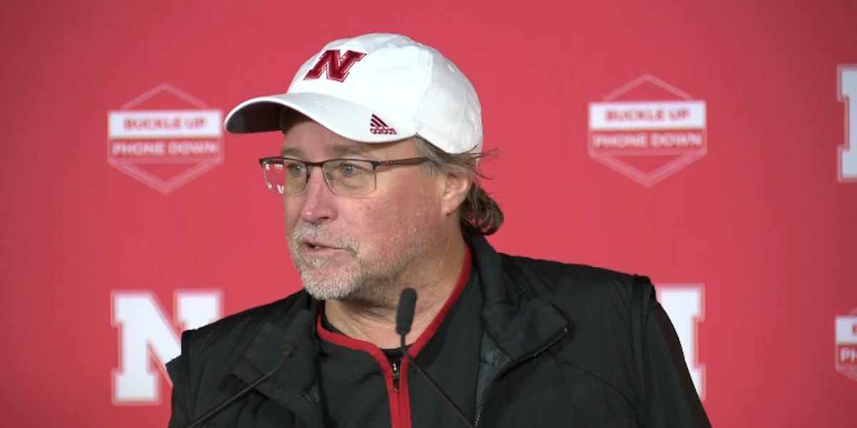
LINCOLN, Neb. (KOLN) – Nebraska Football Head Coach Matt Rhule is set to make his debut on the stage at Big Ten Football Media Days in Indianapolis on Thursday.
The two-day event got underway Wednesday at Lucas Oil Stadium.
Nebraska guard Ethan Piper, quarterback Jeff Sims and linebacker Luke Reimer are scheduled to speak Thursday at around 12:45 p.m. CT, followed by Coach Rhule. You can watch their press conference live right here when it begins.
Copyright 2023 KOLN. All rights reserved.

Indianapolis, IN
Indy leaders urge residents to stay off roads as winter storm looms

INDIANAPOLIS (WISH) — Indianapolis leaders are calling on residents to stay off the roads Sunday afternoon into Monday as the first major winter storm is set to hit the region.
Winter storm warnings have been issued by the National Weather Service Indianapolis for the area for the first time since Jan. 2023. The warnings last midday Sunday into early Monday afternoon, according to Storm Track 8.
Ahead of the snowfall, Indianapolis Mayor Joe Hogsett spoke alongside leaders of the National Weather Service, Indianapolis Department of Public Works, and other local agencies at a Saturday press conference.
Hogsett asked Indianapolis residents to limit their time on the road and to expect wind gusts up to 30-35 mph. Visibility issues and the possibility of snow buildup from gusts could create hazardous conditions for driving.
“The city, as you can see, we are all hands on deck to address weather impacts,” Hogsett said.
Beginning late Saturday night, salt trucks will begin pretreating the roads ahead of the snow. They have 15,000 tons of salt available.
The crews will begin plowing snow as soon as it begins to stick. DPW says they plan to update which roads have been treated with their Snow Force mapping tool.
The department said it has contractors on standby to help with plowing, if needed.
“Another full call out of drivers will arrive at 11 a.m. (Sunday),” Deputy Director for Planning at DPW Natalie van Dongen said. “This will be an around-the-clock operation.”
If drivers must be on the road, Hogsett recommended they leave for their destinations earlier, provide space to other cars on the road, and keep emergency supplies in their cars. He specifically recommended blankets, a shovel, and chargers.
“Again, we ask all residents, be prepared, just like they would during April and May and severe weather this is much the same,” Jacob Spence, Emergency Management Director at Metropolitan Emergency Services Agency said. “Have a plan, planned accordingly if you do have to be out, have an emergency preparedness kit in your car, and at your house.”
He also recommended anyone on the road be on the lookout for issues, including fallen trees or traffic lights without power. If issues are noticed, drivers should call the Mayor’s Action Center at (317) 327-4622. Drivers can dial option #2 to reach DPW’s dispatch center direction.
The storm may cause power outages for residents in the area. If you experience any issues, report it to AES Indiana by contacting (317) 261-8111, or clicking this link.
Anyone in need of shelter or a warm area can call the action center, call 211, or use the Indy Cares app.
Residents can also go to former IPS School 68, which was recently transformed into a winter contingency family shelter. Indy Parks Family Centers will also be open as warming centers during the day.
Indianapolis, IN
Winter storm warning issued, Indianapolis expected to get 6+ inches of snow starting Sunday

How drivers can prepare for bad winter weather
This video offers tips from the Indianapolis Department of Transportation to help drivers navigate bad winter weather conditions.
The National Weather Service has upgraded a winter storm watch to a winter storm warning for central and southern Indiana, which is expected to receive up to 8 inches of snow on Sunday. The warning will remain in place from Sunday morning until Monday afternoon.
A watch was first issued for Indianapolis on Thursday afternoon. That’s meant to put people on notice that a severe storm could occur in the coming days, said NWS meteorologist Andrew White. A warning, on the other hand, indicates serious threats to travel, property and life in the coming hours.
Winter storm watches become warnings when there will be 5 inches or more of snow in a single event.
The NWS has “much more high confidence than we’ve had in a while” about heavy snowfall Sunday, White said.
During earlier predictions of the storm it was estimated Indy could see 8-10 inches of snow. The storm shifted south, changing those snow predictions.
To see the latest forecast for Central Indiana, visit www.weather.gov/ind.
Indiana weather radar
How much snow will Indianapolis get?
Here’s how much snow is predicted throughout central Indiana as of Saturday morning:
- Indianapolis: 6-8 inches
- Noblesville: 4-6 inches
- Kokomo: 2-3 inches
- Muncie: 3-4 inches
- Lafayette: 2-3 inches
- Bloomington: 6-8 inches
Indiana road conditions
The National Weather Service expects “widespread travel impacts” throughout the region.
Experts advise you to avoid driving unless necessary. If you do have to drive, INDOT recommends you bring an emergency kit with includes extra layers of clothing, booster cables, a flashlight, shovel, blankets, drinking water, a first aid kit and maps.
Give yourself plenty of time to travel to your destination. Drive slower than you normally would, allow more distance between cars, and do not slam on the gas or brake pedals.
Check road conditions in real-time at 511in.org.
Where should I go if I need shelter?
Sunday temperatures are expected to stay in the 20s, which will be dangerously cold without adequate protection from the elements.
People can find information about warming shelters via the city’s winter contingency plan or by calling 211. Emergency warming shelters will be available during harsh weather conditions through March 31.
Indy Parks Family Shelters will be open to all during normal business hours, which can be found at this link.
Symptoms of hypothermia and frostbite
Freezing temperatures carry the risk of cold-related injuries like frostbite and hypothermia, and it’s important to recognize the early warning signs of both conditions. Both can be prevented by bundling up and limiting time outdoors, and medical attention should be sought immediately if you suspect either condition.
Frostbite is a skin injury caused by prolonged exposure to freezing temperatures, and it’s most common in parts of the body that are exposed, like hands, ears and noses. Damage caused by severe frostbite can be permanent. According to the Centers for Disease Control and Prevention, early warning signs include:
- Redness and pain in skin
- Numbness
- Firm, waxy skin
- White or gray-yellow skin
People may not know they’re experiencing frostbite because affected areas become numb.
Hypothermia is when the body’s core temperature drops below 95 degrees. Advanced hypothermia is a serious, life-threatening condition that requires immediate medical attention. It’s prevented by staying in a warm environment and dressing appropriately for the cold. Per the National Weather Service, early warning signs of hypothermia include:
- Confusion
- Difficulty speaking
- Shivering
- Sleepiness
- Stiff muscles
Call an ambulance as soon as possible if you suspect frostbite or hypothermia. While waiting for medics, go indoors immediately, remove any wet clothing and bundle up in dry blankets. Areas with frostbite can be immersed in warm — but not hot — water. Drinking warm liquids can also be helpful, so long as they don’t contain alcohol or caffeine.
The National Weather Service warns that some groups, including infants, the elderly, outdoor workers, people with chronic illness and unhoused people are at increased risk for cold-related injuries.
Know your weather warnings
❗ Winter storm warning: Snow, sleet or ice expected. Take action. Confidence is high from meteorologists that a winter storm will produce heavy snow, sleet or freezing rain and cause significant impacts.
⚠️ Winter weather watch: Snow, sleet, or ice is possible so be prepared. Confidence is medium from meteorologists that a winter storm could produce heavy snow, sleet or freezing rain and cause significant impacts.
❄️ Winter weather advisory: Wintry weather is expected so exercise caution. Light amounts of wintry precipitation or patchy blowing snow will cause slick conditions and could affect travel if precautions are not taken
Weather info you need
🚨 Indiana Weather Alerts: Warnings, Watches and Advisories.
⚡ Indiana power outage map: How to check your status.
💻 Internet outages: How to track them.
🚫 What you should and shouldn’t do when the power is out.
🐶 Your neighbor left their pet outside. Who you should call.
Where to report power outages and downed lines
- AES Indiana customers: 317-261-8111
- Duke Energy customers: 1-800-343-3525
How to report downed traffic signals or tree limbs blocking a road
If you encounter a downed traffic signal or a limb blocking a roadway, contact the Mayor’s Action Center at 317-327-4622 or online at RequestIndy.gov. When calling after hours, press “2” to be connected.
Indianapolis, IN
Indianapolis Colts Injury Report: QB Anthony Richardson Ruled OUT Of The Season Finale

The Indianapolis Colts today released their Friday injury report for Week 18 of the NFL season ahead of their season finale Sunday game against the Jacksonville Jaguars.
Quarterback Anthony Richardson has been ruled OUT for Sundays game against the Jaguars due to a back injury. Richardson has been unable to practice all week, making it two weeks without a practice and now a second game he will miss due to the back injury. It was originally described as “soreness” but after further conversations with Richardson and the team it appears to be back spasms which Richardson said have occurred due to a “chronic” back condition. With Richardson OUT this Sunday he has now missed 17 out of 34 career games so far. It looks like another start for veteran quarterback Joe Flacco on Sunday in the Colts last game of the 2024 season.
Cornerback Juju Brents has been listed as QUESTIONABLE for Sundays game against the Jaguars due to a knee injury. Brents has practiced all week, for the second week in a row, in a bid to make his return from injured reserve. It appears he is in a similar situation to last week where it looked like he may have finally been activated only to be ruled out on the Saturday before the game. Hopefully this is the week he gets activated and gets to make his long awaited return to game time on Sunday. If he is unable to play expect the usual starting line up at cornerback of Jaylon Jones and Samuel Womack on the boundary and Kenny Moore in the nickel.
-

 Health1 week ago
New Year life lessons from country star: 'Never forget where you came from'
-
/cdn.vox-cdn.com/uploads/chorus_asset/file/24982514/Quest_3_dock.jpg)
 Technology1 week ago
Technology1 week agoMeta’s ‘software update issue’ has been breaking Quest headsets for weeks
-

 Business4 days ago
These are the top 7 issues facing the struggling restaurant industry in 2025
-

 Politics1 week ago
'Politics is bad for business.' Why Disney's Bob Iger is trying to avoid hot buttons
-

 Culture4 days ago
The 25 worst losses in college football history, including Baylor’s 2024 entry at Colorado
-

 Sports4 days ago
The top out-of-contract players available as free transfers: Kimmich, De Bruyne, Van Dijk…
-

 Politics2 days ago
New Orleans attacker had 'remote detonator' for explosives in French Quarter, Biden says
-

 Politics2 days ago
Carter's judicial picks reshaped the federal bench across the country
