Cleveland, OH
What the Weather Has Been Like on April 8 in Cleveland the Last 20 Years

What we hope April 8 doesn’t look like
When a once-in-a-lifetime celestial show arrives, you want nothing more than the perfect conditions for which to enjoy it.
For the total solar eclipse on April 8, that would mean clear skies with an unadulterated view of the sun and no pesky clouds to diminish the effect of totality. A perfect view of the corona and big black dot are what we’re after, with the full effect of the transition into totality and out of it. Sure, it’ll get dark and cooler with cloud cover, but, as those who’ve experienced eclipses in both situations will attest, the difference is all the difference in the world.
Unfortunately, we’re in Cleveland, OH, where gray skies basically ride shotgun through most of the early spring.
What are the chances Northeast Ohioans and all the eclipse chasers who will be traveling to the shores of Lake Erie to catch nearly four minutes of darkness will be blessed with ideal meteorological conditions?
Not great.
The experts over at Fox 8 dutifully reminded us that April sees 60-70% cloud cover, meaning just 30% clear, sunny skies during the month.
And the National Weather Service last week put the date’s forecast into historical perspective with details from the last 20 years. (Gird thyself for the number of times “clouds” make an appearance.)
2023- Mostly clear, 53
2022 – Cloudy/rain, 47
2021 – Parly cloudy, 64
2020 – Fair skies, 64
2019 – Cloudy, 66
2018 – Fair skies, 35
2017 – Fair skies, 57
2016 – Mostly cloudy, 40
2015 – Cloudy, 51
2014 – Fair skies, 53
2013 – Mostly cloudy, 70
2012 – Partly cloudy, 59
2011 – Cloudy, 49
2010 – Cloudy, 50
2009 – Fair skies, 48
2008 – Mostly cloudy, 63
2007 – Cloudy, 30
2006 – Partly cloudy, 36
2005 – Fair skies, 69
2004 – Mostly cloudy, 52
2003 – Cloudy, 53
Remember, of course, that partly cloudy could be just fine for the experience, assuming Cleveland sees a clearing just before 3 p.m. Who cares if it’s cloudy at 9 a.m. or 7 p.m., after all.
Subscribe to Cleveland Scene newsletters.
Follow us: Apple News | Google News | NewsBreak | Reddit | Instagram | Facebook | Twitter | Or sign up for our RSS Feed

Cleveland, OH
Man who claims girl found in suitcase is his daughter says he begged courts and CPS for help

CLEVELAND, Ohio (WOIO) – 19 News spoke with a man who claims he is the father of one of the two little girls found dead and buried in suitcases in Cleveland.
Deshaun Chatman shared that he was overcome with grief and anger as he came to terms with the terrible truth that his 8-year-old girl, Mila Chatman, is dead.
“I’ve been looking for my daughter for five years. I’ve been calling CPS, going to the courts, trying to get emergency custody, calling the police for welfare checks. But they denied all access,” Chatman alleged.
On Monday, she and her half-sister, Amor Wilson, 10, were found dead and partially buried, after a neighbor walking his dog near a field in the area of East 163rd and Midland Avenue called 911 after his dog picked up a scent.
Cleveland police on Wednesday detained a person of interest, whom officers later identified as Aliyah Henderson, 28, near the crime scene.
Records show Henderson was booked into the Cuyahoga County Jail on Wednesday evening.
According to Chatman, the little girl’s mother had been avoiding him and moving around a lot. The last time he said he saw her was when he helped buy clothes for kindergarten.
Chatman told 19 News that he is now working with detectives to prove he was Mila’s father.
“I’m still in contact with the detectives. We’re doing the DNA samples. So I’ll get more details within the next couple of days.”
Chatman visited the site where his little girl’s body was found with 19 News.
“What I’m feeling is hate. I’m not going to lie, I feel hate. I asked you on numerous occasions for my daughter. If it’s too much for you. I just want my daughter,” Chatman said when asked how he felt.
Chatman, so overwhelmed by the sight, needed to be comforted by a friend.
“I don’t get how you can hate your kids enough to kill them. To bury them. To do all this and go right there to that home, right there, and live there when your kids are right here. Go be a mother to another child, while you just killed your other two.”
Now, he tells 19 News that he wants changes to the system, which he said denied him a chance to be a father.
“Change these laws. Make it better. A man do have a say so in their child’s life, married or unmarried,” Chatman said.
19 News has reached out to Cuyahoga County Children and Family Services to learn if it was involved in any way and if Chatman had any contact with the office.
Copyright 2026 WOIO. All rights reserved.
Cleveland, OH
Several Ohio schools placed under lockdown after threat

CLEVELAND, Ohio (WOIO) – Several schools throughout Ohio were placed on lockdown on Wednesday due to threats.
ROCKY RIVER CITY SCHOOLS
Rocky River High School got a phone call at approximately 10:53 a.m. threatening the safety of the school.
The Rocky River Police Department said the caller said they were heading to the school with weapons, RRPD later shared in a press conference.
Police officers teamed up by mutual aid swiftly arrived to ensure no unauthorized persons were on campus, RRPD stated.
“Rooms were cleared and no dangers were located,” RRPD said. “There are no indications that there was ever any danger to any of the students, staff or buildings of the district.”
Parents told 19 News their kids sent them pictures of officers walking through the halls with rifles.
Rocky River High School will have early dismissal as there will be a heavy police presence in and around the Rocky River Schools for the rest of Wednesday and throughout the week, according to RRPD.
Students who drive were expected to be released by 12:30 p.m., while students who walk or are picked up by parents were released at 1 p.m., RRPD shared.
RRPD called the phone call a swatting incident, and said “any person or people behind hoax threat calls will be prosecuted to the fullest extent of the law.”
Chief George Lichman says they are working with other agencies to find out who made the call. They said the number that popped up was not local. They do not know at this time if it was an incorrect number or a computerized message.
Chief Lichman says he doesn’t believe the school system has experienced a swatting call before.
There will be additional officers on campus throughout the week.
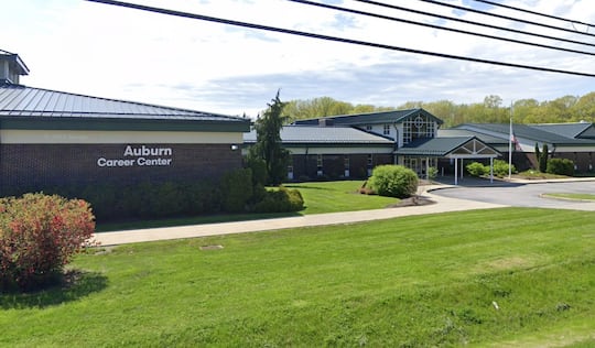
AUBURN CAREER CENTER
Auburn Career Center in Lake County’s Concord Township received a threat over the phone at approximately 10:16 a.m., Lake County Sheriff Frank Leonbruno stated.
Deputies were immediately sent to the school to assist the School Resource Officer in the investigation as a lockdown was implemented as a precaution.
Auburn Career Center shared at 12:55 p.m. that a thorough investigation determined the threat to be not credible, and all students were safely dismissed and left the building, which remained guarded by deputies.
All afternoon and evening classes for both high school and adult education scheduled for Wednesday have been canceled in light of the morning’s event.
“We want to thank the Lake County Sheriff’s Office for their immediate response and partnership during this situation,” said Superintendent Joe Glavan. “I also want to thank our staff and students for following procedures and doing exactly what was necessary to ensure everyone’s safety. While this threat was ultimately deemed not credible, we will always prioritize the safety of our students and staff.”
Leonbruno confirmed there is no active threat at Auburn Career Center, but the incident remains under investigation.
SHAKER HEIGHTS CITY SCHOOL DISTRICT
Shaker Heights High School briefly went under lockdown as a precaution during Pre-ACT and ACT testing after getting a call of a possible bomb threat outside of the building, Shaker Schools stated.
Shaker Schools also said Fernway and Onaway elementary schools briefly went into a lockdown.
Shaker Heights Police Department officers are at the high school and “have not found any evidence of a credible threat,” Shaker Schools stated.
FBI CLEVELAND
FBI Cleveland shared the following statement in regards to their response to the Northeast Ohio school swatting incidents:
OTTAWA HILLS LOCAL SCHOOL DISTRICT
In the Toledo area, Ottawa Hills Superintendent Adam Fineske said a call for a bomb threat came in at 10:45 a.m., targeting the Junior/Senior High School, stating “Bombs all over the school and coming with guns.”
Toledo Police K-9 units swept the school and nothing was found.
BOWLING GREEN CITY SCHOOLS
Bowling Green High School was also affected by the treats and placed on lockdown as a precautionary measure just before noon.
INDIAN HILL EXEMPTED VILLAGE SCHOOL DISTRICT
Indian Hill High School in Cincinnati evacuated students and staff around 11 a.m. on Wednesday with the help of Indian Hill Rangers after getting a potential bomb threat.
Indian Hill Middle School was evacuated as a precaution.
MASON CITY SCHOOL DISTRICT
Mason High School received a threatening phone call on Wednesday morning, Mason City Schools confirmed.
The Mason Police Department and Campus Safety team determined it was safe to resume normal school operations at 11:44 a.m. when law enforcement confirmed there was no credible threat to the schools, Mason City Schools stated.
CINCINNATI PUBLIC SCHOOLS
Cincinnati Public Schools’ Walnut Hills High School was under lock-in after receiving a bomb threat.
The lock-in was lifted after Cincinnati police cleared the area, and school resumed normal operations.
This is a developing story. Return to 19 News for updates.
Copyright 2026 WOIO. All rights reserved.
Cleveland, OH
Medical examiner releases new details about bodies of 2 young girls found in suitcases near Cleveland school
CLEVELAND, Ohio (WOIO) – The Cuyahoga County Medical Examiner released new information about the bodies of two young girls found in suitcases in Cleveland’s South Collinwood neighborhood.
On Wednesday morning, the Cuyahoga County Medical Examiner confirmed through DNA that the two girls are half-siblings.
At this time, they have not been positively identified, and no further information is available while the investigation is ongoing.
In a news conference on Tuesday, Cleveland Police Chief Dorothy Todd confirmed the bodies of two young girls were found in suitcases on the city’s East Side on Monday evening.
Cleveland police were called just after 6 p.m. to a field in the area of East 163rd and Midland Avenue for a suspected dead body.
According to police sources, a man was walking his dog in the area, for the first time in a while, due to the snow, and the dog hit on the scent.
The man immediately called 911.
“The officers responded out and located a deceased individual that was in a shallow grave inside of a suitcase,” said Chief Todd.
When officers and homicide detectives got to the scene, Todd said they found the second body nearby.
According to the chief, both suitcases were partially buried in shallow graves. She said the victims had been there quite some time.
“It is traumatic for everyone. It is traumatic for those who live in the area to know that this was right there at their doorstep,” said Todd.
Authorities said one victim is believed to be 8-and-a-half to 13 years old and the other is believed to be 10-and-a-half to 14 years old.
“Locally, we have no reports of missing children to match these identifications. We are checking statewide as well. We have assistance from our state, federal and local partners,” said Todd.
Detectives are checking with state and federal partners as well.
This crime scene is located near Ginn Academy in the city’s South Collinwood neighborhood.
Police said the investigation remains in its very early stages and there is no indication of an ongoing threat to public safety.
If anyone has any information, they are asked to call the Cleveland Police Homicide Unit at 216-623-5464.
Tips can remain anonymous.
Copyright 2026 WOIO. All rights reserved.
-

 World1 week ago
Exclusive: DeepSeek withholds latest AI model from US chipmakers including Nvidia, sources say
-

 Wisconsin4 days ago
Setting sail on iceboats across a frozen lake in Wisconsin
-

 Massachusetts1 week ago
Mother and daughter injured in Taunton house explosion
-

 Maryland5 days ago
AM showers Sunday in Maryland
-

 Massachusetts3 days ago
Massachusetts man awaits word from family in Iran after attacks
-

 Florida5 days ago
Florida man rescued after being stuck in shoulder-deep mud for days
-

 Denver, CO1 week ago
10 acres charred, 5 injured in Thornton grass fire, evacuation orders lifted
-

 Oregon7 days ago
2026 OSAA Oregon Wrestling State Championship Results And Brackets – FloWrestling


