Cleveland, OH
MLB playoffs: Lane Thomas' grand slam powers Guardians over Tigers in Game 5, into ALCS vs. Yankees

Lane Thomas’ aggressive approach at the plate paid off again for the Cleveland Guardians in Game 5 of the ALDS on Saturday.
On the first pitch he saw from Detroit Tigers starter Tarik Skubal in the bottom of the fifth inning, Thomas blasted a grand slam to help the Guardians to a 7-3 victory and a place in the ALCS against the New York Yankees.
“He threw one pitch over the middle, and I put a good swing on it. It’s as simple as that,” Thomas said afterward. “I don’t know how many scoreless innings he threw [in the series]. It just takes one.”
Skubal had been cruising along, quieting the Guardians’ bats through four innings, which gave him a total of 17 scoreless innings pitched in this postseason. But in the bottom of the fifth, the AL pitching Triple Crown winner and likely Cy Young recipient got himself into a jam that he couldn’t escape.
Singles from Andrés Giménez, Steven Kwan and David Fry brought José Ramírez to the plate with the bases loaded. Instead of the Guardians’ third baseman doing it with his bat like he has done so many times during the season, Ramírez took one for the team — a hit by pitch on the arm — to tie the game 1-1.
With Skubal in a tough spot, it was a prime opportunity for Thomas to be aggressive. Much like he did with a first-pitch, three-run blast in Game 1, his grand slam struck a blow in the Tigers’ hopes with their ace on the mound.
Thomas, who had 9 RBI in the ALDS, loved swinging away when the count was 0-0 during the regular season. The 29-year-old outfielder, who was acquired from the Washington Nationals on July 29, was 18-for-63 (.286) with a home run and 9 RBI on first pitches this season. So far in October, he has three hits — two of them home runs — in such situations.
“That’s who we are. That’s who that group has been in that room all year. As soon as we get punched, we answer,” manager Stephen Vogt said postgame. ” … But we can’t rely on the home run. We have to string things together, and our guys did both today. And then we got the add-on runs at the end, and I thought today was just a perfect picture of who our team is at our best — and couldn’t have come on a better day.”
The Tigers had a chance to respond in the top of the sixth inning following Thomas’ blast. They brought in a run on a Jake Rogers single, which made it 5-2, and after a Trey Sweeney walk, the bases were loaded for righty-killer Kerry Carpenter.
Carpenter had started the game on the bench while battling a nagging hamstring injury. He pinch-hit for Justyn-Henry Malloy in the top of the fifth and promptly knocked a 370-foot single to right-center field, scoring Sweeney and giving the Tigers a 1-0 lead.
But in the sixth, Carpenter could not win the bases-loaded battle against Guardians reliever Hunter Gaddis.
The Tigers scraped across one more run in the seventh, making in 5-3 before the Guardians added insurance runs in the seventh and eighth. Emmanuel Clase recorded the final six outs, including another massive strikeout of Carpenter in the eighth inning, to seal the victory for Cleveland.
“I have a heartbroken team for all the right reasons,” Tigers manager AJ Hinch said afterward. “We left everything we could on the field against a really good team, and we didn’t want the season to end as abruptly as it did. …
“I just told the guys … Once you play in one October, you never want to miss one the rest of your career, ever. And so we’re going to need to do a lot of work to get better and continue to play the brand of baseball that is winning baseball.”
With the Game 5 victory, the Guardians advance to the ALCS for the first time since 2016. Game 1 of Guardians vs. Yankees will be Monday at 7:38 p.m. ET at Yankee Stadium.
“You have to believe. If you don’t believe in your group, don’t even show up,” Vogt said. “We knew, as soon as we got back to Cleveland, we had a chance.”

Cleveland, OH
Bomb threats against Northeast Ohio school districts continue for 2nd day

CLEVELAND, Ohio (WOIO) – For the second day, Northeast Ohio school districts are receiving bomb threats.
On Friday morning, two schools in the Elyria City School District, the high school and Ely Elementary, received bomb threats.
Both schools are evacuating students, and emergency responders are on the way, according to a social media post.
All other district schools are in a lockout status as a precaution.
The district asks that family members not come to the schools or call school offices at this time so emergency communication lines remain available.
Elyria Police said that the department is working with the district to ensure the safety and security of students and school personnel following the threats.
“We are aware that neighboring school districts experienced similar swatting-related incidents yesterday, and our investigative personnel are working diligently with our law enforcement partners to identify the source of these threats,” police said.
Five Northeast Ohio school districts received bomb threats on Thursday, including:
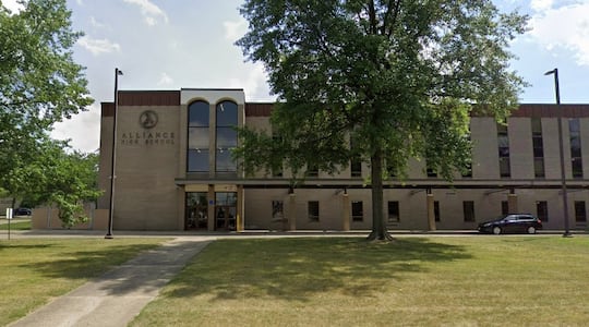
- Alliance City School District
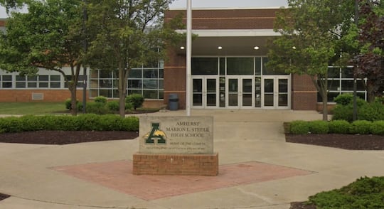
- Amherst Exempted Village Schools
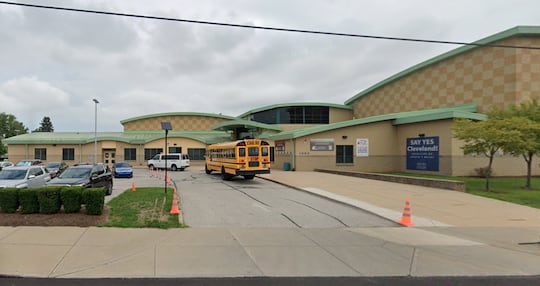
- Cleveland Metropolitan School District
- Lorain City School District
- Shaker Heights School District
Below are the details from each district and the protocols in place to protect students and staff.
ALLIANCE CITY SCHOOL DISTRICT
The Alliance Police Department confirmed there was an ’anonymous’ robo-voice style call that came into the high school saying there were ’20 pipe bombs’ outside of the school” before 12:30 p.m.
Officers rushed to the high school and Rockhill Elementary School campuses “due to an alarm in which we were not getting a response from the school,” according to APD.
APD shared that the schools evacuated the students temporarily as officers conducted a sweep of the area.
“Nothing was found, thankfully,” APD Lt. Christopher McCord stated. “The school staff, and especially the students, did a great job of staying calm and making everyone’s jobs easier, smoother, and safer.”
“We will be looking into the source of the threats to hold those responsible accountable, if possible,” McCord added.
AMHERST EXEMPTED VILLAGE SCHOOLS
The Amherst Exempted Village School confirmed at 10:25 a.m. that Marion L. Steele High School and Walter G. Nord Middle School received a bomb threat.
AEVS said all district facilities were placed on a level 1 lockdown before the two schools were evacuated to a safe location under the supervision of administration and staff, according to district protocol.
The Amherst police and fire departments teamed up with the Lorain County Sheriff’s Office to perform perimeter and building sweeps to determine if the threat was substantiated, said AEVS.
The perimeter sweeps of the two schools were complete by 11:34 a.m., and law enforcement then conducted the interior sweeps of the buildings, AEVS explained.
Amherst Junior High School and Powers Elementary School lifted their lockdowns at that time and resumed normal procedures, according to AEVS.
AEVS also confirmed at that time that all students and staff were accounted for and safe.
The Amherst Police Department completed its sweep of Steele High School and cleared the building of any threat by 11:51 a.m., AEVS updated.
Students were dismissed for the day at that time, according to AEVS.
AEVS instructed student drivers to leave the campus, and students unable to immediately leave were to stay at the school until they could be picked up by a parent, guardian, or approved emergency contact.
The bus routes were running at the scheduled normal dismissal time for students who need a ride home, AEVS added.
APD completed its sweep of Nord School and cleared the building of any threat by 12:32 p.m., AEVS updated.
Nord School students were safely escorted back into the building, according to AEVS, after evacuating to the New Beginning Church as a safe location.
AEVS instructed parents, guardians, and approved emergency contacts who wanted to pick up their student to report to the school’s front entrance, where staff and APD officers would help.
Classes, activities, and normal dismissal procedures resumed as scheduled for students who stayed at the school, AEVS shared, and bus dismissal also proceeded per usual.
“We appreciate the cooperation, patience, and support of our families and community throughout today’s situation,” AEVS stated.
According to AEVS Superintendent Mike Molnar, all evening activities at the school will continue as scheduled, and school will resume on Friday.
Molnar added that AEVS will have an increased police presence at schools on Thursday night and Friday.
CLEVELAND METROPOLITAN SCHOOL DISTRICT
The Cleveland Metropolitan School District confirmed two threats were received on Thursday morning. The threats were against East Tech High School and Buhrer Dual Language Academy.
According to CMSD, Cleveland police and CMSD’s Department of Safety & Security conducted an investigation and found the buildings to be safe.
From the information gathered during the searches, Cleveland police believe both calls were swatting incidents.
Classes at both schools were uninterrupted, and the school day progressed normally.
Cleveland Metropolitan School District’s Communications Officer Jon Benedict added that parents were informed about the incident.
LORAIN CITY SCHOOL DISTRICT
Lorain City School District confirmed the high school has been evacuated due to a bomb threat on Thursday afternoon.
This is the third Northeast Ohio school district to receive a bomb threat on May 7.
The district announced the evacuation of Lorain High School at 12:23 p.m., and dismissed students at 12:40 p.m.
Bus riders were escorted to the buses waiting to take them home, according to LCSD.
LCSD said many elementary and middle school students were at the high school for the dance showcase.
Those elementary and middle school students were brought back to their home schools, said LCSD.
All students and staff are safe and following established protocols, LCSD stated, and these measures are being taken out of an abundance of caution.
The district safety team and law enforcement partners continue to investigate this threat.
“Your students’ and our staff’s safety is our top priority,” LCSD stated.
A 19 News crew is on their way to the scene to learn more.
SHAKER HEIGHTS SCHOOL DISTRICT
Shaker Heights High School received its second threatening phone call this week on Thursday, the district confirmed.
Shaker Heights School District said it immediately teamed up with the Shaker Heights Police Department to investigate the threat and determined its credibility.
SHSD said it was aware of the other Northeast Ohio school districts that received similar threats on Thursday.
“Based on the SHPD’s assessment and established safety protocols, the decision was made to continue normal school operations rather than initiate a shelter-in-place,” SHSD stated.
Additional SHPD officers and a K-9 unit were sent to the school out of an abundance of caution to support the safety and security of the building as the investigation continues, SHSD added.
Orrville City Schools were also placed on a soft lockdown on Thursday.
However, this was not a bomb threat, nor any direct threat to the school.
The soft lockdown was a precautionary measure for an incident that happened not just off school property, but out of the town.
This is a developing story. Return to 19 News for updates.
Copyright 2026 WOIO. All rights reserved.
Cleveland, OH
Pistons vs. Cavs odds update: Cleveland on the brink ahead of Game 3

Cleveland, OH
Noble Beast bringing cask ale concept to former Bookhouse Brewing pub

-

 Wisconsin4 minutes ago
Wisconsin multi-county police chase, 2 people from Illinois arrested
-

 West Virginia10 minutes ago
wvnews.com | WVNews | Trusted West Virginia News, Sports & Local Coverage
-

 Wyoming16 minutes ago
(LETTERS) Sun Bucks and Wyoming GOP endorsement
-

 Crypto22 minutes ago
Lagarde Blocks Euro Stablecoin Push, Calls $300B Market a Stability Risk for ECB Policy
-

 Finance28 minutes ago
BofA revises Harley-Davidson stock price after latest announcement
-

 Fitness34 minutes ago
Strategic Exercise Techniques to Maximize Mood Elevation – The Boca Raton Tribune
-

 Movie Reviews46 minutes ago
1986 Movie Reviews – Dangerously Close, Fire with Fire, Last Resort, and Short Circuit | The Nerdy
-

 World58 minutes ago
Top 50 English-language news sites in the world in April: Just three newsbrands grow traffic in past month


