Cleveland, OH
Cleveland offers fireworks and heat safety reminders ahead of holiday

CLEVELAND, Ohio — The City of Cleveland has issued some safety and logistical reminders ahead of the Fourth of July celebrations, which they say they expect to attract almost 100,000 people to downtown and Edgewater Park.
The first reminder: the possession and use of fireworks within the city limits is illegal.
“Please leave fireworks displays to the professionals to prevent the risk of physical harm, accidental fires, and damage to property,” reads a post from the city.
Police also caution against celebratory gunfire and “unnecessary loud noise.”
If you’re bringing children to a crowded event, police recommend establishing a reunification point. They say if you lose your child in a crowd, you should call 911 to report them missing. They urge children to look for someone in uniform if they’re lost.
“Watch children closely at events where fireworks are used,” the post reads. “Never let children handle fireworks.”
The division of fire warns the public to not open any hydrants, noting they can deplete the water that could be needed for a fire.
Grilling is a popular pastime on Independence Day, but the division of fire is reminding those celebrating that they should only use propane and charcoal grills outside and at least three feet from their home or anything flammable.
The division of EMS is warning about the dangers of heat emergencies, as people spend their day and evening outdoors. They note that older people, very young people and those with chronic medical conditions are most at risk.
They specify three types of these emergencies: heat cramps, heat exhaustion and heat stroke. The first of these can be treated by ceasing activity, getting cool and ingesting fluids.
The third, heat stroke, can be identified by “dizziness, slurred speech, seizures and unresponsiveness.” They recommend an immediate call to 911 in addition to cooling the individual.
“Do your best to avoid becoming overheated,” the post reads. “Wear loose clothing, stay in a cool location if possible, and drink plenty of fluids. Check in on the elderly and watch children closely. These emergencies can come on and progress quickly; if you see any signs of heat illness in yourself or others, be sure to stop activity and cool down.”
The Division of Animal Care & Control recommends pets be left inside if fireworks are occurring in your area, as the loud noises could spook them and cause them to run away.
They also recommend keeping them inside if it is extremely hot, making sure they have water and shade if outside, keeping them off hot asphalt and keeping an eye out for heat stress. They also stress to never leave a pet in the car.
Finally, for some logistical advice, the police encourage the public to expect longer travel times if heading to a popular destination. They also note that some road closures are likely for those planning on heading to Edgewater Park.
They also recommend citizens read parking signs downtown, as various holiday parking restrictions will be in effect.
“The City of Cleveland and its Safety Divisions are working around the clock to ensure a safe holiday for all visitors and residents,” the city’s post reads. “These efforts are part of Mayor Bibb’s Summer Safety Plan, a comprehensive All-Of-Government approach to reducing crime citywide.”


Getty
CLEVELAND, OH – JUNE 08: LeBron James #23 of the Cleveland Cavaliers throws a pass against the Golden State Warriors in the first half during Game Four of the 2018 NBA Finals at Quicken Loans Arena on June 8, 2018 in Cleveland, Ohio. NOTE TO USER: User expressly acknowledges and agrees that, by downloading and or using this photograph, User is consenting to the terms and conditions of the Getty Images License Agreement. (Photo by Jason Miller/Getty Images)
LeBron James could return for a final run with the Cleveland Cavaliers with a massive caveat, and it involves center Jarrett Allen, who has been one of the team’s defensive anchors.
According to ESPN insider Brian Windhorst, the Cavaliers could get LeBron from the LA Lakers in exchange for Allen, a center the Lakers would want to pair with their franchise superstar, Luka Doncic.
However, Windhorst said James would first want to go to Cleveland to make the deal happen. On the other hand, such a trade is a no-brainer for the Lakers.
“There is a thought process in Los Angeles where they have to sign-and-trade LeBron James for Jarrett Allen. And I think if the Cavs are willing to do that, they can have LeBron,” Windorst said via ESPN Cleveland radio.
“Obviously, LeBron would have to want to sign with the Cavs, but if your pathway to paying LeBron the money is to trade Jarrett Allen for him, the Lakers would kill for Jarrett Allen. Kill for him. All right? They would do that deal in 17-tenths of a second.”
How A LeBron James-Jarrett Allen Deal Would Work
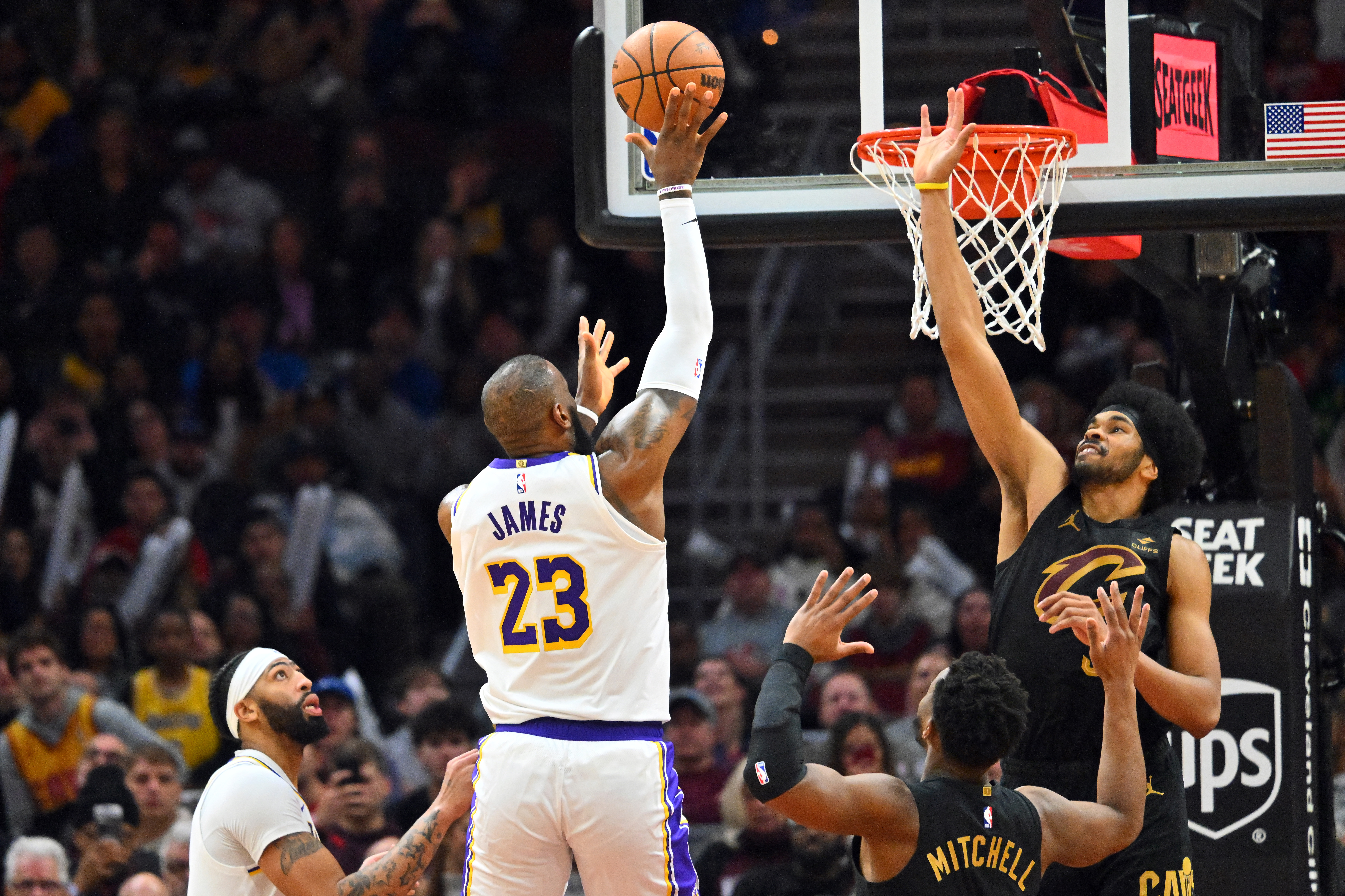
GettyCLEVELAND, OHIO – NOVEMBER 25: LeBron James #23 of the Los Angeles Lakers shoots over Jarrett Allen #31 of the Cleveland Cavaliers during the fourth quarter at Rocket Mortgage Fieldhouse on November 25, 2023 in Cleveland, Ohio. The Lakers defeated the Cavaliers 121-115. (Photo by Jason Miller/Getty Images)
LeBron James is an unrestricted free agent after his contract with the Lakers ended in the past season.
If they were to trade Allen, the Cavaliers could accommodate James’ expected hefty salary, as reports indicated that he is not willing to take a pay cut on his next contract.
There have been rumors about retirement for James and a possible homecoming once more to Cleveland over the past few months, but there are no decisions yet on his future.
There is no word yet about James’ contract value or how long a contract he would sign for, if he is to remain an active NBA player beyond 41 years old.
On the other hand, Allen is locked into a highly secure financial situation after signing a three-year, $91 million contract extension with the Cavaliers.
James last played with the Cavaliers in 2018, leading them to the NBA Finals, but they got swept by the Golden State Warriors. After that NBA Finals stint, he signed with the Lakers and has stayed in Los Angeles since then.
Such a deal suits the Lakers’ biggest offseason objective of getting an A-list center, as reportedly requested by Luka Doncic.
LeBron James’ Future Remains Up In The Air
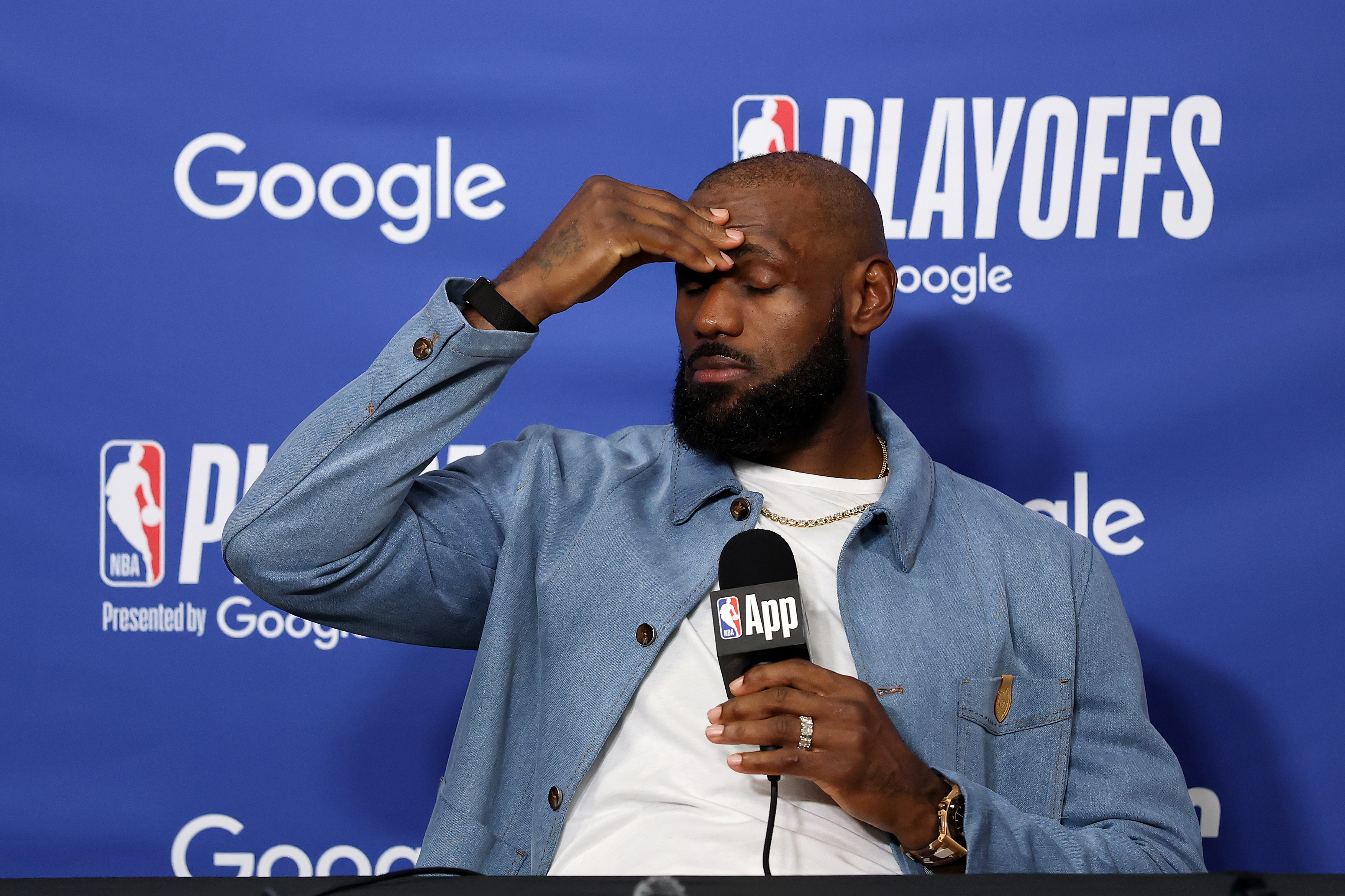
GettyLOS ANGELES, CALIFORNIA – MAY 11: LeBron James #23 of the Los Angeles Lakers speaks to the media during a press conference after the game against the Oklahoma City Thunder in Game Four of the Second Round of the NBA Western Conference Playoffs at Crypto.com Arena on May 11, 2026 in Los Angeles, California. (Photo by Luke Hales/Getty Images)
LeBron James, who had won an NBA championship with Cleveland in 2016, has been contemplating many things at this juncture of his life.
As retirement looms and Father Time starts to creep in, James is expected to decide on his career in the coming weeks.
Right now, according to ESPN’s Ramona Shelbourne, James’ future remains up in the air.
“LA is the first team he can talk to because they’re their own free agent,” Shelburne said during her interview on SportsCenter. “My understanding is they had initial conversations with LeBron James’ representative, but he has not even fully committed to returning next year in these conversations.”
James’ decision is one of the most awaited ones in free agency as teams could still be interested in getting one of the greatest players of all time for a final hoorah in the league.
Rob Andrew Lo Rob Andrew Lo is a writer at Heavy Sports and is covering the NBA. He has covered local, collegiate, professional and international sports in various sites. He was the sports editor of The Varsitarian, the official student publication of University of Santo Tomas, and a sports, entertainment, and lifestyle writer for Rappler.
A Journalism graduate from the University of Santo Tomas, he has built his voice across both collegiate and international platforms, previously contributing NBA coverage to Fansided and Sportskeeda.
More about Rob Andrew Lo

The Cleveland Cavaliers have traded out of the 2026 NBA Draft.
The Cavs had the No. 29 overall selection on Tuesday night. But Cavs President of Basketball Operations Koby Altman decided to trade that selection to the Sacramento Kings in exchange for No. 34 overall and a future second-round selection.
At No. 29 overall, the Cavs will send the Kings UConn forward Alex Karaban.
“It’s in the distant future,” a source told cleveland.com’s Chris Fedor about the future second-round selection acquired in this deal.
Reports from Fedor surfaced early Tuesday morning that the Cavaliers could be interested in bailing out of the first round. By late Tuesday night, Altman was able to execute a trade that sets the Cavs up for further flexibility in the offseason.
Why the Cavs traded out of No. 29 overall
The Cavaliers would’ve owed the No. 29 pick a guaranteed salary just under $2 million.
Because the Cavs are in the lone second apron – and could be looking to shed salary this offseason – ditching the No. 29 overall pick saves the Cavaliers a couple of bucks.
Second round picks are non-guaranteed, two-way deals. That gives the Cavs the financial flexibility they’re looking for.
What the Cavs could do at No. 34 overall
This is a talented draft class. A few high profile players slid into the second round.
UNC center Henri Veesaar is still waiting to hear his name called. The 7-foot center could be a backup to Jarrett Allen and Evan Mobley. Duke wing Isaiah Evans is also still waiting to hear his name called, and could fill a big position of need for the Cavaliers. Arkansas guard Maleek Thomas was consistently mocked to Cleveland, and he slid to Day 2 as well.
There’s always a chance that Altman could trade back again.
Second round draft picks are valuable because they could be used as sweeteners in trades this offseason. For example, in exchange for a team taking on the contract of a player like Dennis Schroder or Max Strus, the Cavaliers might want to attach a second round draft pick to make the package more appealing to a trade partner.
Flexibility should be the name of the game for Altman as he tries to improve Cleveland’s roster this offseason. The Cavs won’t have a first round draft pick until 2028. But bailing out of Tuesday night’s first round will give Altman plenty of options on Wednesday and into the rest of the offseason.
Follow

University of Minnesota star wrestler Max McEnelly won the 2026 NCAA national championship at 184 pounds, and he’s now set to face superstar Bo Nickal at Real American Freestyle (RAF) 12 on August 22nd in Cleveland, Ohio.
THIS MATCH UP🔥
Bo Nickal takes on Max McEnelly August 22 in Cleveland at RAF12.
Tickets in bio. Stream exclusively on @foxnation pic.twitter.com/loEWdeb5pZ
— Real American Freestyle (@RAFWrestlingUSA) June 22, 2026
McEnelly is preparing for his redshirt junior season with the Gophers, and Nickal is 9-1 as a professional mixed martial arts (MMA) fighter, following a storied collegiate wrestling career at Penn State. Their freestyle wrestling match will be contested at 215 pounds.
RAF is an American freestyle wrestling promotion that was founded by Chad Bronstein, Terri Francis, and Hulk Hogan in 2025. The August 22nd show at Rocket Arena will be the one-year anniversary of the promotion. The fights will be broadcast on FOX Nation.
Nickal most recently competed at UFC Freedom 250 at the White House, where he defeated Kyle Daukas via first-round finish. He’s now 6-1 in his UFC career. His match against McEnelly will be his second under RAF. He defeated Jacob Cardenas via decision at the promotion’s first show last summer.
Nickal is 6-foot-1, and he wrestled at 197 pounds at Penn State. He competes at the 185-pound middweight division in the UFC, so he might have a slight size advantage over McEnelly, who’s 5-foot-10. The event will be a high-profile opportunity, as McEnelly continues to establish himself as one of the best pound-for-pound wrestlers in the country.
Follow
-

 Los Angeles, Ca14 minutes ago
Clue may identify SUV in Long Beach hit-and-run that left woman injured
-

 Detroit, MI39 minutes ago
Ilitch Companies creates gaming platform, expands beyond Detroit
-

 San Francisco, CA51 minutes ago
First of its kind queer museum in San Francisco Chinatown amplifies Chinese LGBTQ artists
-

 Dallas, TX53 minutes ago
These children were sold for sex. Then the system failed them again
-

 Miami, FL59 minutes ago
Hard Rock Cafe lets Downtown Miami lease lapse after 30-plus years
-

 Boston, MA1 hour ago
Federal judge in Boston bars Trump from implementing proof of citizenship requirement to vote – The Boston Globe
-

 Denver, CO1 hour ago
Denver Broncos Foundation launches extension of ‘ALL IN. ALL COVERED.’ emphasizing youth football participation
-
Seattle, WA1 hour ago
Iran and Egypt to play in Seattle ‘Pride Match’ despite earlier complaints | The Jerusalem Post


