Lifestyle
These hiking trails are closed because of the Southern California wildfires

As firefighters complete the final steps to controlling three blazes around Southern California, it’s becoming clearer how and where hiking trails will remain closed for the foreseeable future.
Some trails have burned in the Bridge, Line and Airport fires and will take a long time to recover. Others are closed out of an abundance of caution.
The Times has put together a comprehensive list to help you understand where you can recreate responsibly, and also, whether your favorite areas were burned in recent blazes.
In the coming months, volunteer trail crews across L.A. County and beyond will head to these areas to help with recovery efforts. They are almost always in need of more volunteers.
To put together a better picture of the damage, The Times consulted mapping tool CalTopo, cross-referencing its maps and the fire footprints and forest closure orders with lists of local hiking trails to determine which routes were in the burn area. That said, just because a trail is in the burn area doesn’t mean it was destroyed. We’ll learn more about specific conditions of each trail in the coming weeks and months, as well as when trails might start to reopen.
The Bridge fire | The Line fire | The Airport fire
The Bridge fire
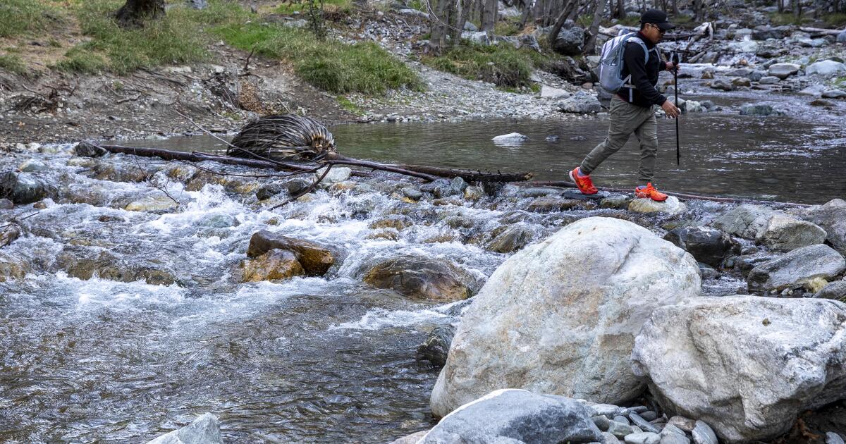
A hiker takes on the Mt. Baldy Trail in May 2017.
(Brian van der Brug / Los Angeles Times)
Almost 55,000 acres in the San Gabriel Mountains and nearby towns have been burned by the Bridge fire. That includes destroying homes and buildings in Wrightwood and the Mt. Baldy community.
As of Friday, the Bridge fire was 97% contained. Firefighters have completed a control line around the majority of the fire’s perimeter. But containment does not mean that the fire that has been extinguished. Wildfires can burn for weeks after full containment is reached and even after fire personnel leave if no risk remains to embers restarting a blaze.
On Sept. 21 , Angeles National Forest issued its Bridge fire closure order, which applies to federally managed roads, trails and other amenities. It is set to remain in place until Dec. 31, 2025, although that date could change.
Last week we cross referenced CalTopo, local trail lists and the Bridge fire map to tell you which trails appear to have been burned. Below you’ll find our updated list of trails that were burned by the fire and also those closed by the forest order.
📌 East Fork and Camp Williams area
The Bridge fire was named after Cattle Canyon bridge in the East Fork of Angeles National Forest, where it started.
Although the fire got close, firefighters were able to save Camp Williams Cafe & General Store and Camp Williams Mobile Home Park from burning.
However, the hiking trails below appear to have been affected, and unless otherwise noted, are closed:
📌 Mt. Baldy area
The road to reach the mountain community of Mt. Baldy has reopened, and businesses are returning to normal operating hours.
Popular hiking trails, including Icehouse Canyon and Icehouse Saddle appear, via the fire map, to not have burned in the Bridge fire. Additionally, San Antonio Falls, Ontario Peak, Cucamonga Peak, Cedar Glen Camp, and the three T’s — Timber Mountain, Telegraph Peak and Thunder Mountain — also did not burn. Although the fire moved near Stoddard Peak’s trailhead, its trail was spared.
Here is a list of some of the popular trails that appear to have burned, according to The Times’ analysis:
Additionally, these trails and sites do not appear to have been burned in the fire but are closed, per the closure order:
📌 Wrightwood and Vincent Gap area
Although the fire got within about 500 feet of the Mt. Baden-Powell trail, it was not burned in the Bridge fire. Additionally, nearby mountains, including Mt. Burnham, Throop Peak and Mt. Hawkins, did not burn. The immediate area surrounding Jackson Lake was not burned, but multiple trails in that area did. The Grassy Hollow Visitor Center was destroyed. Mountain High ski resort survived and aims to reopen later this year for its winter season.
Additionally, these trails and sites do not appear to have been burned in the fire but are closed, per the closure order:
The Line fire
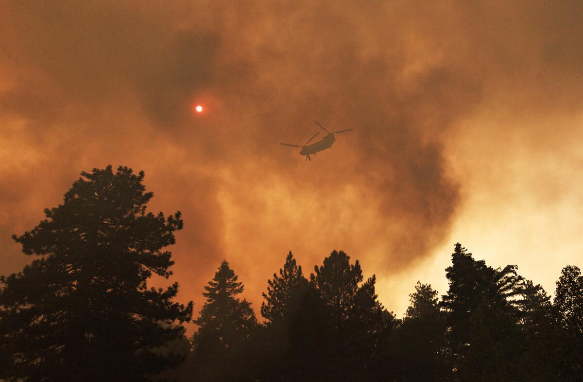
A water-dropping helicopter flies into thick smoke to drop water on the Line fire.
(Gina Ferazzi / Los Angeles Times)
The Line fire, which is alleged to have been started Sept. 5 as an act of arson, has burned more than 39,000 acres in San Bernardino County. It damaged four structures and destroyed one. It has also injured four firefighters. As of Friday, it was 83% contained with “minimal fire activity” and favorable conditions for firefighting expected in the coming days.
Several hiking trails are temporarily closed under the San Bernardino National Forest’s Line fire closure order, which ropes off what The Times estimates to be about 70% of national forest land to the public and includes large swaths of the region that weren’t burned by the fire. The order includes all of the Front Country and Mountaintop Ranger districts, and trails near Lake Arrowhead and Big Bear, among many others that did not burn.
The closure extends beyond the fire’s perimeter because “the fire is not completely contained,” said Sonny St. John, a patrol captain with the federal Forest Service’s Law Enforcement and Investigations unit on the San Bernardino National Forest. “We want to limit using resources on other parts of the forest where incidents could also occur.”
You can find a list of every trail and road closed here. In short, any trail in the San Bernardino National Forest that’s outside of the San Jacinto Ranger District — which sits south of the 10 Freeway and includes the Idyllwild area — is closed.
St. John said the order could be adjusted in scope and size, or terminated, as conditions allow. In the interim, it’s best to call ahead before visiting the area to determine whether the hiking area you’d like to visit is open.
Below you’ll find a list of trails that, based on The Times analysis, were burned by the fire.
Note: Just because a trail is listed doesn’t mean it was destroyed. There aren’t data available yet to discern how severely burned each trail was. This is a preliminary list, based on the Line fire burn map.
- Shelton Trail
- Plunge Creek Truck Trail: The first half-mile was not burned, but the rest was.
- Highland Natural Parkland Trail
- Exploration Trail: About 1.3 miles of the middle section burned
- Keller Peak Road and Keller Peak Fire Lookout: The last mile of the road leading to the peak, south of Keller Peak yellow post No. 9, appears to have burned; the 98-year-old lookout tower at the peak was destroyed
- Mill Peak Trail: The majority of the trail did not burn, but the fire got close to the peak; about a quarter-mile of trail burned, depending on the exact route you take.
- The Redlands R: An unofficial trail off City Creek Road to the iconic letter on the mountainside; the fire map shows the R, estimated to be 415 feet tall by 275 feet wide, in the burn area
- Santa Ana Divide Trail to Alder Creek Fire Road
- Alder Creek Trail 2W18
- Lower Santa Ana River Trail: The first mile does not appear to have burned. Just after the first mile, the fire burned the trail until just after Morton Peak, where there is a 1.8-mile stretch northeast of Morton Peak that wasn’t burned. There’s then another stretch, just under five miles, that’s burned until the trail nears Constance Peak, where the burn area ends north of Angelus Oaks. The remaining 23 miles from near Angelus Oaks east to the Pacific Crest Trail was not burned.
- Siberia Creek Trail: The most popular section of this trail — starting near the Bluff Lake Reserve and heading west to Gun Sight Rock — did not burn. But 1.5 miles southwest of Gun Sight Rock, the trail is burned for about three miles until it ends near Bear Creek. This section of the trail, per the forest service, has not beenmaintained for many years.
- Camp Creek National Recreation Trail: The last half-mile appears to be in or near the burn area, where it ends at Bear Creek.
- Constance Peak Trail: Although not an official forest service trail, hikers may trek about two miles from Angelus Oaks along Thomas Hunting Grounds Road (1N12), which did not burn, before heading off trail to Constance Peak. The off-trail route that hikers have previously taken might have burned, as there is a burned section west of the peak.
Popular attractions, including the Trail of the Phoenix in the National Children’s Forest, Little Green Valley Trail and climbing spot Dinosaur Rocks, did not burn. The Shady Cove Group Campground in the Children’s Forest was also spared. And the fire got close but did not destroy the Bluff Lake Reserve, where firefighters have quickly extinguished spot fires threatening the 80-acre reserve. The Morton Peak Fire Lookout suffered some damage but was not destroyed, per a Southern California Mountains Foundation representative.
The Airport fire

A pair of hikers crossed over the creek on their way into Holy Jim Canyon.
(Mark Boster / Los Angeles Times)
The Airport fire, unintentionally started by workers using heavy machinery to move boulders, has burned almost 24,000 acres since it began Sept. 9 near Trabuco Canyon in Orange County. It destroyed 160 structures, including several homes in El Cariso Village, and damaged 34 others. An estimated 22 people, including firefighters, have been injured. As of Friday, the fire was 95% contained.
Cleveland National Forest — where much of the fire has burned — issued a closure order that bars the public from entering the 138,971 acres of the Trabuco Ranger District, an area far larger than the fire’s footprint. All trails in the district are closed to the public. A list of closed trails and roads is available here. The order is set to expire Sept. 17, 2025.
Below you’ll find a list of trails that, based on The Times analysis, were burned by the fire.
Again, just because a trail is listed doesn’t mean it was destroyed. This is a preliminary list, based on the Airport fire burn map.
- Modjeska and Santiago Peak via Maple Springs and Main Divide Loop: The first half-mile did not burn, but the trails leading to both peaks did.
- Falls Canyon, off the Trabuco Creek Falls Canyon Trail.
- Holy Jim trail to Holy Jim Falls.
- Holy Jim trail to North Main Divide road: The majority of this trail was burned.
- West Horsethief Trail: Although the first half-mile near the trailhead was burned, the rest of the trail heading to North Main Divide Road was spared.
- Trabuco Peak via Trabuco Creek, West Horsethief and North Main Divide Road: Starting at the end of Trabuco Creek Road, the first half-mile along Trabuco Creek Trail is burned. The rest of Trabuco Creek Trail, and West Horsethief to North Main Divide Road to Trabuco Peak was not burned.
- Trabuco Canyon Trail: The area immediately around the Trabuco Canyon trailhead at Munhall Saddle was burned, but the 2.5 miles of the Trabuco Canyon Trail leading northwest to an intersection of the Trabuco Creek Trail and West Horsethief Trail did not burn. Heading west, the first 1.2 miles of Trabuco Creek Trail did not burn while the last half-mile (nearing where the fire is believed to have started) did.
- Upper Hot Spring Canyon to Falls Trail.
- Falcon Trail
- San Juan Trail: Starting at its upper trailhead near Blue Jay Campground, this trail is burned from its start to just past both Sugarloaf peaks. A 4.5-mile section of it due south of Sugarloaf Peak to its lower trailhead on Hot Spring Canyon is not burned.
- Chiquito Trail: Starting near the Ortega Oaks 74 Candy Store and Goods, the trail is not burned for four miles, until it reaches near Chiquito Falls, which appears to be in the burn area. The rest of the trail is burned.
- San Juan Trail to Sugarloaf Peaks: Starting at the trailhead just south of the Lazy W Ranch Camp off Hot Spring Canyon Road, this trail takes hikers northeast to Sugarloaf and New Sugarloaf Peaks. The first 4.5 miles did not burn, but the area surrounding both summits did.
- San Juan Trail to Los Pinos Trail Loop: Its trailhead just south of Lazy W Ranch Camp, the majority of this 21.6-mile loop was burned. It is not burned for 4.5 miles of the San Juan Trail at its start, or finish, and about 2 miles of the Los Pinos Trail in the same area.
- Los Pinos Peak via Bell View Trail: The majority of this trail — also called Bell Ridge on maps — burned, including near the peak. The first mile from the trailhead appears not to have burned.
- El Cariso Nature Trail
- El Cariso Truck Trail: The final mile of this trail is burned.
The Airport fire did not reach the Ortega Oaks 74 Candy Store and Goods, a popular stop for hikers headed to nearby trails, including Sitton Peak, which did not burn. Ortega Falls also appears to have been spared, sitting only about 240 feet south of the fire’s eastern flank. The fire remained far from the popular Black Star Canyon waterfall. Additionally, the popular Bedford Peak trail was not burned.
Did we miss a trail? Or do you have a question about your favorite spot? Please email Times outdoors reporter Jaclyn Cosgrove, who can update the list accordingly.


Entrepreneur David Huang tests out a VR headset while conducting demonstrations of the social dance lesson app Dance Guru at the Augmented World Expo in Long Beach, Calif., June 17, 2026.
Chloe Veltman/NPR
hide caption
toggle caption
Chloe Veltman/NPR
Wedding season is in full swing, bringing with it a familiar sense of dread for anyone who fears the dance floor.
But relief may finally be at hand with the help of a new app, Dance Guru, and a virtual reality (VR) headset.
The social dance instruction app transports users to a spacious, digital dance studio. Waiting inside is a computer-generated coach: a handsome, male avatar wearing a shirt open to his navel. He speaks with a slightly gravelly English accent.
“Watch me now,” he instructs at the start of a waltz lesson — which NPR tried out at the Augmented World Expo in Long Beach, Calif., an annual conference showcasing the latest developments in virtual and augmented reality.
The avatar then demonstrates a basic box step.

From there, the lesson becomes interactive. The coach tells the user to hold his hand while an electric pinging sound tracks the student’s foot placement.
“One, two, three, four, five, six,” the virtual teacher counts down.
When the user stumbles, he remains remarkably patient. “Do not worry, foundations take time. Let’s try that again. Work on grounding your steps more intentionally.”
Solving the beginner’s dilemma
Dance Guru creator David Huang said he came up with the idea for the app a couple of years ago out of frustration.
“I always wanted to learn to dance and I was always terrible at it,” Huang said. “And I always ended up stopping midway through the lessons.”
He soon realized that many beginners hit the exact same roadblocks.

“Private lessons are too expensive, and you feel like you’re always forgetting the dance steps,” Huang said. “You cannot find a partner to dance with. So I figured maybe I can create something like this.”
The Dance Guru platform currently offers tutorials in salsa, bachata, waltz, and cha-cha, in both lead and follow modes. To make the digital instruction feel authentic, Huang used motion-capture technology to record the movements of real-life dance teachers — with their permission.
Building on the legacy of online tutorials and video games
Dance Guru belongs to a small but growing wave of apps using VR to demystify social dance. At a nearby booth, conference attendee Victor Chen is testing out a competing app called Trip the Light. It currently offers salsa lessons, as well as freestyle options, where a user can dance with a partner without having to learn specific steps.

Trip the Light’s booth at the Augmented World Expo included posters of the app’s virtual instructors. Real-life performers, who gave Trip the Light permission to motion capture their movements, were used as a basis for these avatars.
Chloe Veltman/NPR
hide caption
toggle caption
Chloe Veltman/NPR
“A lot of times when you’re trying to learn a choreography, it’s watching a YouTube video and you have to pause it, rewind, and play it,” Chen said. “If you were to have a virtual avatar dancing in front of you and correcting for any parts that you missed, it might be a lot easier.”
Interactive video games like Dance Dance Revolution and Just Dance, and YouTube tutorials have been helping people improve their skills in private for years. But those games are mostly aimed at solo players. Unlike the new generation of immersive VR apps, they cannot simulate the mechanics or confidence required for partner dancing on a live dance floor.
The reality check
But this kind of app won’t work for every dancer.
“Everyone learns a little bit differently. And so unless you have a game that has lots of different ways of teaching, you’re going to have things that work for some people and don’t work for others,” said Ariana Katana, a trained contemporary dancer and dance content creator who’s active on YouTube, Twitch and other platforms. “Also, it’s hard to dance with a headset on.”
And then there’s the issue of not being able to physically feel a virtual partner’s hand or shoulder while dancing with them. Patrick Ascolese, the creator of Trip the Light, said the experience could become more tactile in the future. “Haptic suits and wearables will be coming, but I think we’re a little away from that,” he said.
Ascolese said even with their limitations, immersive tools like Trip the Light have immense potential as judgment-free training grounds — giving reluctant dancers the baseline confidence they need to eventually step onto the dance floor with real partners in the real world, including at weddings.
“Just like anything else, practice makes perfect,” said Ascolese. “So the more time you spend in VR with a virtual partner, it works towards helping you get over that social hurdle. We are teaching you the moves that you have to do in order to go out and have fun.”
Jennifer Vanasco edited the broadcast and digital versions of this story. Chloee Weiner mixed the audio.





For half a century, Deidre Hall has taken on every kind of disaster in the drama-packed town of Salem, Ill., as a star of “Days of Our Lives.”
There was the time — actually, it happened twice — when her character, Dr. Marlena Evans, was famously possessed by the devil and even levitated.

In Sunday Funday, L.A. people give us a play-by-play of their ideal Sunday around town. Find ideas and inspiration on where to go, what to eat and how to enjoy life on the weekends.
Or the time a serial killer, who was actually Marlena under hypnosis, seemed to kill several beloved characters. The long-running show’s storylines have become legendary, and in March, while promoting “Hail Mary,” actor Ryan Gosling even gave Hall a shout-out, admitting he was a fan, praising the hard work of soap opera actors and calling her an “OG acting inspiration.”
But Hall’s real life in Santa Monica is much quieter than her character’s, and she likes it that way.
“When I bought my house in Santa Monica, I didn’t realize how great it would be to live near Montana Avenue,” says Hall, 78, about the popular shopping spot. Every day, she walks to the main street with her golden retriever, Riley, and enjoys Pilates, art and good food along the way. “The owners of the Farms Market even keep dog biscuits, so guess where the dog wants to go every time we walk — the Farms, of course,” she says, laughing.
When she isn’t filming the daily soap opera, which airs on Peacock, Hall enjoys raising monarch butterflies, exploring the shops and restaurants on Montana, and hosting movie nights at home with her two sons.
Here’s what a perfect day in L.A. looks like for her.
This interview has been lightly edited and condensed for length and clarity.

7 a.m.: Breakfast and dog walk
I usually kick off my day with a protein shake, feed our golden retriever and take her out for a walk. She’s a phenomenal girl. When we adopted her, her name was Riley, but I did think about naming her after Mrs. Hughes from “Downton Abbey.”

10 a.m.: Church and garden time
After I walk the dog and go to church, I like to spend some time in my yard. I’m not a natural gardener, but I really enjoy it. I started raising monarch butterflies because my identical twin sister, who played my twin on the show, planted a butterfly garden. Monarchs are amazing because they are transitional. Every year, they travel from Mexico to southern New England, but it’s getting harder for them. Their numbers have dropped by about 80%. To help, I plant milkweed, which is what they need to survive. I buy my milkweed from the Staghorn Garden on Wilshire Boulevard in Santa Monica. Julie, who owns the nursery, is delightful and has a wide variety of milkweed. The monarchs always seem to find my garden. Julie was raising some caterpillars too, and she cared a lot about them. We talked about how important it is to help the butterflies. That’s why I do this. Sometimes I get milkweed with eggs already on it, and Julie knows her butterflies are going to a good home.

1 p.m.: Walk to Montana Avenue for some lunch
I live near Montana and love taking long walks, going to Pilates and trying out the great restaurants nearby, like R+D Kitchen and La La Land. I’m a big fan of the waffles at the Courtyard Kitchen. Just a few days ago, I had a chicken salad on raisin bread with an Arnold Palmer, and it was delicious. It is right on Montana and has a nice outdoor seating area. It’s one of my favorite spots. La La Land always has a long line in the morning, which is perfect if you want coffee. They serve coffee, doughnuts, croissants and avocado toast. There’s plenty of outdoor seating, and you can even bring your dog.

2 p.m.: Peek inside a clock shop
There’s a small clock shop on Montana Avenue that’s closed on Sundays, but if you walk by, you’ll see all kinds of clocks — standing, table and wall clocks. The owner is great at fixing them. Once, I bought a wall clock from MacKenzie-Childs, but it didn’t work. And I was really upset because it matched everything else on my countertop. I brought it to the owner and said, “I love this, but I can’t make it work.” He fixed it right away. His name is John, but I call him Geppetto. And we all know why. He really does have a magic touch.

2:30 p.m.: Visit a neighborhood art gallery
Ten Women Gallery is run by 10 artists, all of whom show their work there. I was drawn to some watercolors there, bought a few cards and spoke with one of the artists. She told me, “You seem to love watercolors,” and mentioned that the artist who painted them, Pamela Harnois, lives in Los Angeles and teaches nearby. I got Pamela’s name and found out she taught at the Brentwood Art School. I was so inspired by her gift that I started taking private lessons with her on Saturdays. That gallery is where I discovered my love for watercolor painting.

3 p.m.: Grab some ice cream at Rori’s
The other day, my longtime girlfriend wanted to get ice cream and told me, “We are walking to Rori’s Artisanal Creamery.” It’s a small shop on Montana near Lincoln. They make everything themselves, using local ingredients from grass-fed cows with no added hormones. The place is family-owned and probably has the healthiest ice cream you’ll find. They switch up their flavors often, but my favorite is the salted caramel.

6 p.m.: Family dinner and movie night at home
R+D Kitchen is always packed, so my sons, who are 31 and 33, do the cooking. They come over, and together we make salads and cook dinner. There’s a neighborhood grocery store called the Farms, off Montana, a small family-run place that has everything we need. Everyone knows each other there, and people bring their dogs. We try to have movie night every Sunday. Sometimes the day changes, but we always make sure to have one night a week where we cook a meal and sit down as a family. Keeping that tradition has become really important to us. My sons are great cooks, which is funny because they definitely didn’t get that from me. [Laughs]
9 p.m.: Take Riley for one last walk and visit neighbors
After dinner, I take my dog for a walk. It’s a great way to meet neighbors. We always go around the same block. We’ve met so many people, and since she’s a golden retriever, she loves meeting everyone.

10 p.m.: News, knitting and bedtime
I am a news junkie, so I usually watch whatever is on the news before I go to bed. I have a long-standing passion for knitting. Lately, though, the news would make me drop a stitch.
For Iris van Herpen, couture is a laboratory as much as a runway. Our chief fashion critic, Vanessa Friedman, takes us inside this Dutch designer’s latest Paris show — from sci-fi-inspired gowns to an audacious attempt at a dress made of charged plasma.
-

 Louisiana4 minutes ago
Louisiana judge admits to misconduct; is suspended without pay for rest of term
-

 Maine11 minutes ago
As Democrats pick up the pieces after Graham Platner, many wonder: how did this happen?
-

 Maryland11 minutes ago
Afternoon Summertime Storms Across Maryland Today
-

 Michigan19 minutes ago
117th annual Race to Mackinac takes off from Chicago’s Monroe Harbor
-

 Massachusetts26 minutes ago
Officials ID man and woman killed in Route 6 crash in Dartmouth
-

 Minnesota29 minutes ago
Minnesota weather: Warm Saturday with hotter days ahead
-

 Mississippi34 minutes ago
Tracking Mississippi State baseball players, signees picked in 2026 MLB Draft
-

 Missouri41 minutes ago
Missouri pushes for more nuclear energy to power the future

