Alaska
No special session this year on fiscal issues, Alaska legislators say
The Alaska Legislature will not meet in a special session this fall to discuss a long-term fiscal plan for the state.
Lawmakers had discussed the possibility of a special session in the spring, but in the last days of the regular session and in the following weeks, they drifted apart on key elements of a plan intended to keep state revenue and expenses in line for multiple years.
Jeff Turner, Gov. Mike Dunleavy’s deputy communications director, said by email that Dunleavy asked the Senate president and speaker of the House to see if there was a package of items they could agree on in a fall special session.
“At this point, the legislature has not shown meaningful interest in coming together to work on fiscal issues. Accordingly, the governor is not going to call them into special session and waste time and money,” he wrote in an email.
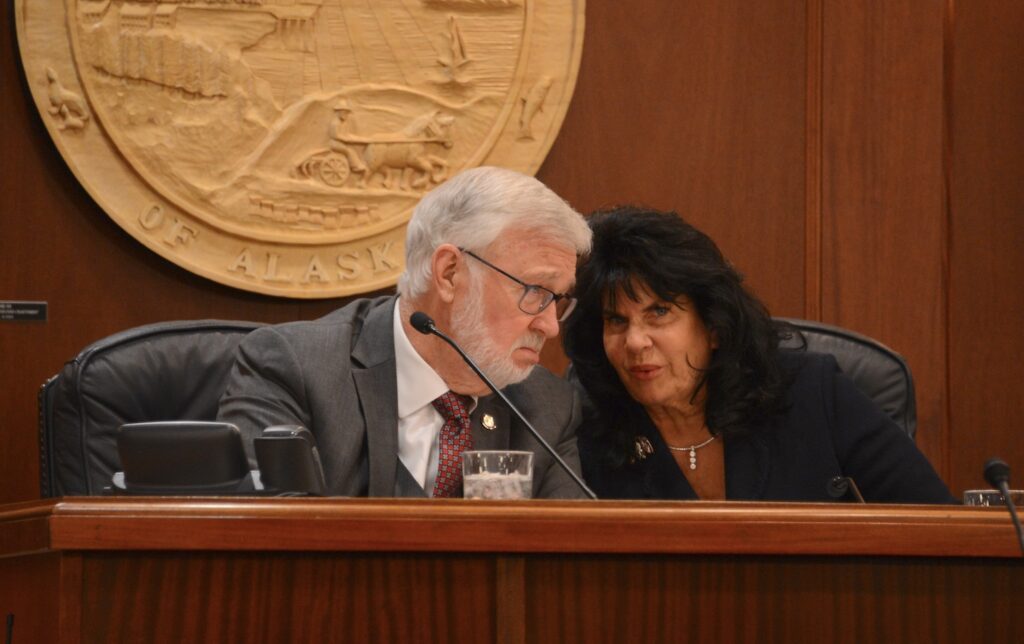
“That’s not going to happen,” Senate President Gary Stevens, R-Kodiak, said on Wednesday when asked about a special session.
“There’s really no consensus right now. There’s lots of plans out there and folks have lots of ideas,” he said, adding that lawmakers will have to see what percolates to the top when the regular session begins in January.
Continued disagreement over the elements of a comprehensive fiscal plan have members of the House now preparing to advance bills separately, rather than as a comprehensive whole, said Speaker of the House Cathy Tilton, R-Wasilla.
“We’ve realized that we don’t have the numbers to come to a consensus on a full plan with lots of components. Maybe we’ll try to focus on something that takes care of the (Permanent Fund Dividend) issue like HJR 7,” she said.
House Joint Resolution 7, proposed by the House Ways and Means Committee, would guarantee a dividend, paid according to a formula set in law.
Rep. Andy Josephson, D-Anchorage and the most senior member of the House minority caucus on the House Finance Committee, said he’s open to the idea of a constitutional guarantee, but the sticking point to amending the constitution is going to be first reaching agreement on the payout formula.
A 1980s-era formula already exists in state law, but legislators have ignored it since 2017, labeling it unaffordable.
They’ve been unable to decide on a replacement, and the Legislature has set the dividend by fiat for seven consecutive years. This year’s payout, expected in October, will be about $1,300 per recipient.
The Alaska Senate voted to approve a new formula this spring, but that proposal was amended by the House Ways and Means Committee and failed to advance through the House before the end of the legislative session.
Rep. DeLena Johnson, R-Palmer and co-chair of the House Finance Committee, said the core of the issue is whether legislators are willing to authorize taxes in order to pay for larger dividends.
“I think there’s disagreement — and I think it’s throughout the Legislature — about the idea of whether there should be a tax to pay out a PFD. And that’s the crux of it,” she said.
Before 2018, the sole primary spending from the Alaska Permanent Fund was to pay the annual cash dividend to residents.
That year, lawmakers began spending from the fund to pay for state services.
The annual transfer from the Permanent Fund to the state treasury — $3.5 billion this year — is the biggest general-purpose source of revenue for the state, larger than oil revenue.
Most new dividend formulas involve splitting that transfer in some way, preserving some money for dividends and the rest for services.
The Senate proposal, dubbed a 75-25 split, keeps 75% of the transfer for services and reserves 25% for dividends. Under most projections, can be paid sustainably as long as the transfer itself is sustainable.
But many members of the House support a 50-50 split instead, something that would either require significant new taxes or steep cuts to services. Supporters say the 50-50 split represents a middle ground between the 75-25 split and the traditional formula, which is close to 25-75 at current Permanent Fund values.
Spending on services has risen for the past two years, even accounting for inflation. Taxes were discussed during the last legislative session, but lawmakers say they’re far from agreement on the topic.
Through the first two and a half months of the fiscal year, oil prices have been running higher than state projections, and if they stay high, that will add to legislators’ unwillingness to raise taxes, Johnson said.
“Honestly, when we’re sitting here looking at near $100/barrel oil, the thought of implementing either a sales tax or an income tax — I think it’s going to have a hard time getting traction,” she said.
In previous years, some lawmakers have cited low oil prices as a reason to oppose new taxes.
Tilton said members of the predominantly Republican House majority will need to talk about a path forward, and that may include looking at things that help reduce spending, such as changes to the Executive Budget Act.
Alaska Beacon is part of States Newsroom, a network of news bureaus supported by grants and a coalition of donors as a 501c(3) public charity. Alaska Beacon maintains editorial independence. Contact Editor Andrew Kitchenman for questions: info@alaskabeacon.com. Follow Alaska Beacon on Facebook and Twitter.

Alaska
Sky Watch Alaska: planets align plus the aurora forecast

ANCHORAGE, Alaska (KTUU) – This is a great time of year to do some star gazing. If you have clear skies in your part of Alaska, take the time to check out the night — and morning — sky.
After sunset, look toward the southwest. Saturn and Venus are snuggled up together (of course, they are more than 800 million miles apart) in the evening sky. They set at about 9:40 p.m. in Southcentral.
Before 9:40 p.m., you can see four planets with the naked eye — Saturn, Venus, Jupiter and Mars. Jupiter and Mars stick around through the morning. Mars is very close to the moon right now.
The Aurora forecast is fairly weak for the next few weeks. That’s not to say there won’t be the occasional burst but overall, solar activity is expected to be fairly low until the beginning of February.
If you get great pictures of the planets, the sky, or the aurora, don’t forget to send them to Alaska’s News Source.
See a spelling or grammar error? Report it to web@ktuu.com
Copyright 2025 KTUU. All rights reserved.
Alaska
Short-lived cold snap, with another warming trend this weekend
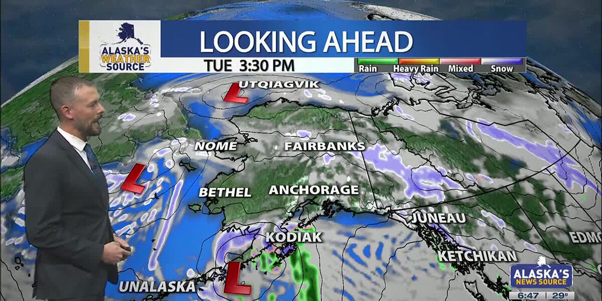
ANCHORAGE, Alaska (KTUU) – Temperatures across the state are cooling off, as our strong low from the weekend moves into the Chukchi Sea. This will set up for colder air to spread across the state this week, as another short-lived cold snap is expected. While some light snow is possible for the Interior, areas of the Slope and Western Alaska, Southcentral will stay on the drier side until the night. Meanwhile, Southeast will continue to hold onto moderate rain with gusty conditions.
SOUTHCENTRAL:
Temperatures this morning are 10 to 20 degrees colder than yesterday, as colder air has settled back into Southcentral. Clear skies and calm winds are evident this morning for parts of the region, with light snow falling through the Copper River Basin. We’ll see fairly quiet conditions today, outside of Kodiak which will see increasing snow and rain into the afternoon and evening hours. This comes as our next area of low pressure moves up the Alaska Peninsula.
We’ll see light snow spreading north across the Kenai overnight into Wednesday, with light snow expected through Prince William Sound. Several inches are likely through the Kenai and Chugach Mountains, with the pass expected to see a couple of inches of accumulation. Western parts of the Kenai will see the potential for a few inches, while inland areas of Southcentral largely stay dry. If Anchorage and surrounding locations see any accumulation, it’ll amount to less than half an inch.
As snow tapers off Wednesday, we’ll see the return to colder and drier conditions into Thursday. Thursday may be the coldest day this week across the region, before another warming trend carries us into next week. Right now holding with snow through early next week, but areas of wintry mix are possible as highs warm above freezing.
SOUTHEAST:
The winter storm warning for Skagway and higher elevations expired at 6am this morning. While some light snow showers are still possible, little accumulation will occur the rest of the day. Scattered to periodic showers are occurring elsewhere across Southeast today, with less than half an inch of rainfall through the day. Any moisture available into the evening will see a transition to some wintry mix or snow into Wednesday morning. However, the better chance will come from another low lifting north into the panhandle. Any snow and wintry mix we see for Wednesday will primarily stay confined to the central and southern panhandle. We’ll see much cooler weather taking hold this week for Southeast.
INTERIOR:
Some areas of light snow are possible this morning, with less than half an inch to be expected. While temperatures are still warm for much of the Interior, highs will steadily fall throughout the day. Many areas will see lows bottom out near or below zero by tomorrow morning. We’ll see high pressure keep things dry and sunny through the next couple of days, with the coldest stretch of weather from Wednesday morning into Thursday morning. Much like the rest of the state will experience, a warming trend arrives this weekend. We’ll see the return to highs in the 20s, with some snow in the forecast. Be prepared for some gusty conditions through the Alaska Range by the close of this week.
SLOPE/WESTERN ALASKA:
Areas of light snow and blowing winds will continue to impact the Slope, with a winter weather advisory remaining in place for the Central Brooks Range and the Beaufort Sea Coast. Both locations will see up to 1 inch of snow and gusty winds up to 35 mph. While the winter weather advisory will expire for the Central Brooks Range this afternoon, the Beaufort Sea Coast will see the alert continue into Tuesday evening. Snow and blowing snow will be the primary impact today, with a return to colder weather through the rest of this week, this comes as high pressure settles into the area.
The storm responsible for the damaging winds for Southcentral over the weekend, has pushed north into the Chukchi Sea. We’ll still see some light snow accumulations for Western Alaska, with 1 to 3 inches expected. Some fo the heaviest snow will fall across the Seward Peninsula and the Western Brooks Range.
An area of low pressure in the Bering Sea will keep gusty winds and snow in the forecast for Gambell/St. Lawrence. Be prepared for heavy snow at times and areas of reduced visibility. Overall, colder weather will settle into Western Alaska, with the possibility of morning fog in the valleys over the next few mornings.
ALEUTIANS:
Some light areas of snow will occur for the Pribilof Islands and into parts of the Alaska Peninsula today, as a weak low moves up the Peninsula. This will be the main focus for snow into Wednesday for Southcentral. This low will bring heavy precipitation and gusty winds for the Eastern Aleutians and the Alaska Peninsula. Looking ahead through the rest of the week, we can expect to see more a ridge beginning to build into the region. This ridge will slowly shift east, keeping several upper level disturbances traversing the Aleutians. Temperatures will remain fairly warm in the 30s and 40s.
OUTLOOK AHEAD:
Model consensus continues to agree on another warming trend heading our way into next week. This stretch of warmth will likely lead to many spots cementing themselves within the top warmest January’s on record. While we’ll spend the rest of this week on the colder side, highs steadily climb this weekend into next week. We’ll see highs in Southcentral climbing back above freezing, with areas of the Interior climbing back into the 20s.
Have a safe and wonderful Tuesday!
See a spelling or grammar error? Report it to web@ktuu.com
Copyright 2025 KTUU. All rights reserved.
Alaska
Anchorage, Alaska hit by hurricane-force winds, structures damaged across city

Associated Press
Hurricane-force winds cause widespread damage in Alaska’s largest city
Thousands of residents across Alaska’s largest city were still without power Monday, a day after a powerful storm brought hurricane-force winds that downed power lines, damaged trees, forced more than a dozen planes to divert, and caused a pedestrian bridge over a highway to partially collapse. A 132-mph (212-kph) wind gust was recorded at a mountain weather station south of Anchorage. A large low-pressure system in the Bering Sea brought the high winds, moisture and warmer than average temperatures — in the low 40s Fahrenheit (slightly over 4.4 degrees Celsius) — to Anchorage on Sunday, said National Weather Service meteorologist Tracen Knopp.
-

 Health1 week ago
Ozempic ‘microdosing’ is the new weight-loss trend: Should you try it?
-
/cdn.vox-cdn.com/uploads/chorus_asset/file/25822586/STK169_ZUCKERBERG_MAGA_STKS491_CVIRGINIA_A.jpg)
 Technology6 days ago
Technology6 days agoMeta is highlighting a splintering global approach to online speech
-

 Science4 days ago
Metro will offer free rides in L.A. through Sunday due to fires
-
/cdn.vox-cdn.com/uploads/chorus_asset/file/25821992/videoframe_720397.png)
 Technology1 week ago
Technology1 week agoLas Vegas police release ChatGPT logs from the suspect in the Cybertruck explosion
-

 Movie Reviews1 week ago
‘How to Make Millions Before Grandma Dies’ Review: Thai Oscar Entry Is a Disarmingly Sentimental Tear-Jerker
-

 Health1 week ago
Michael J. Fox honored with Presidential Medal of Freedom for Parkinson’s research efforts
-

 Movie Reviews1 week ago
Movie Review: Millennials try to buy-in or opt-out of the “American Meltdown”
-

 News1 week ago
Photos: Pacific Palisades Wildfire Engulfs Homes in an L.A. Neighborhood


