Alaska
Alaska bear caught terrorizing moose and calf in ‘intense’ footage: video
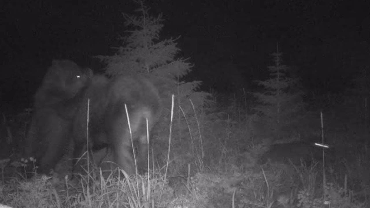
Alaska wildlife officials recently posted rare footage of a bear’s violent interaction with a moose and calf at Glacier Bay National Park earlier this summer.
The footage, which was released Aug. 28, was captured by the Alaska Department of Fish and Game on July 8. Officials set up the camera near the small city of Gustavus for a wolf predation study.
“Witness the intense moment when prey and predators come face-to-face in this clip!” the organization’s Southeast Alaska division wrote on Facebook.
“This camera was perfectly positioned along a popular animal travel corridor, giving us a front-row seat to Mother Nature’s drama,” the post added.
GRIZZLY BEAR MAULS MONTANA HUNTER IN CUSTER GALLATIN NATIONAL FOREST
Footage shows the two moose walking surreptitiously in the dark before a bear attacks. (Alaska Department of Fish and Game)
The footage shows the two moose walking surreptitiously at night when a bear suddenly pops up from the left.
In the video, the adult moose attempts to protect the calf and appears to smack the brown bear. The predator quickly lunges into the animal’s neck.
The Alaska Department of Fish and Game did not share video of the moose’s fate. A wolf was captured sneaking over to the calf off camera.
MONTANA MEN SURPRISE MOMMA BEAR WITH CUB, ENCOUNTER ENDS WITH ACCIDENTAL SHOOTING
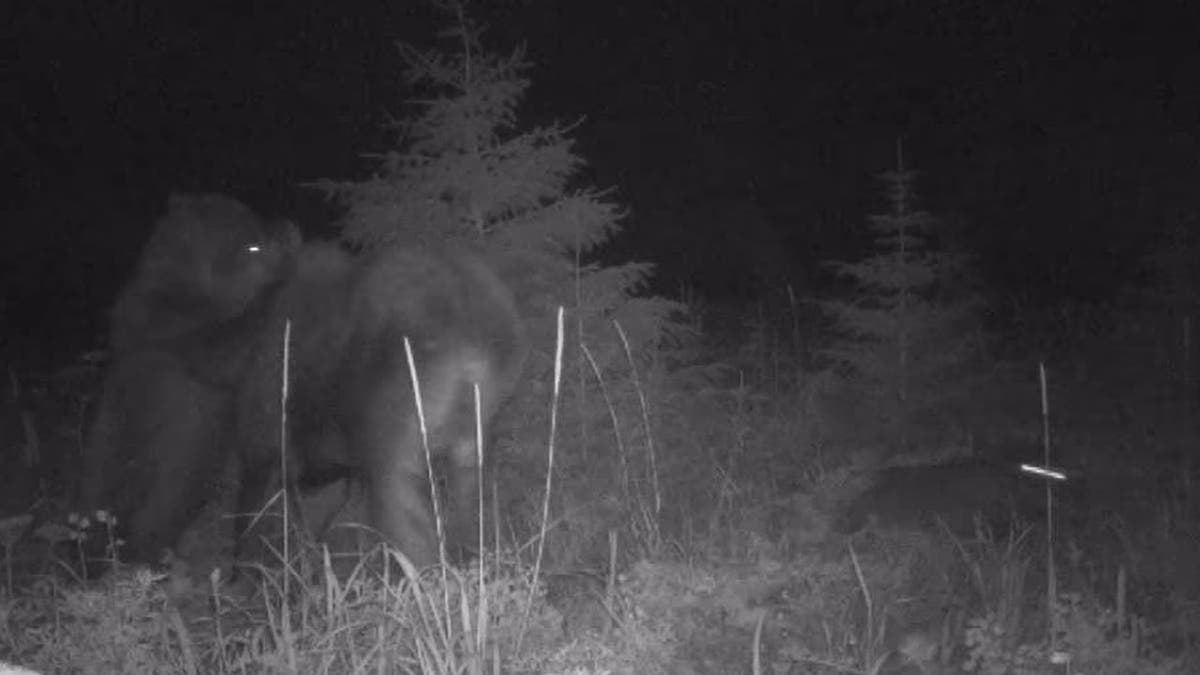
A wolf was captured sneaking over to the calf off camera. (Alaska Department of Fish and Game)
“Dang. Bears and wolves working together??” one stunned Facebook user wrote.
“It does look coordinated … but impossible to know for sure,” the Alaska Department of Fish and Game responded.
CLICK TO GET THE FOX NEWS APP
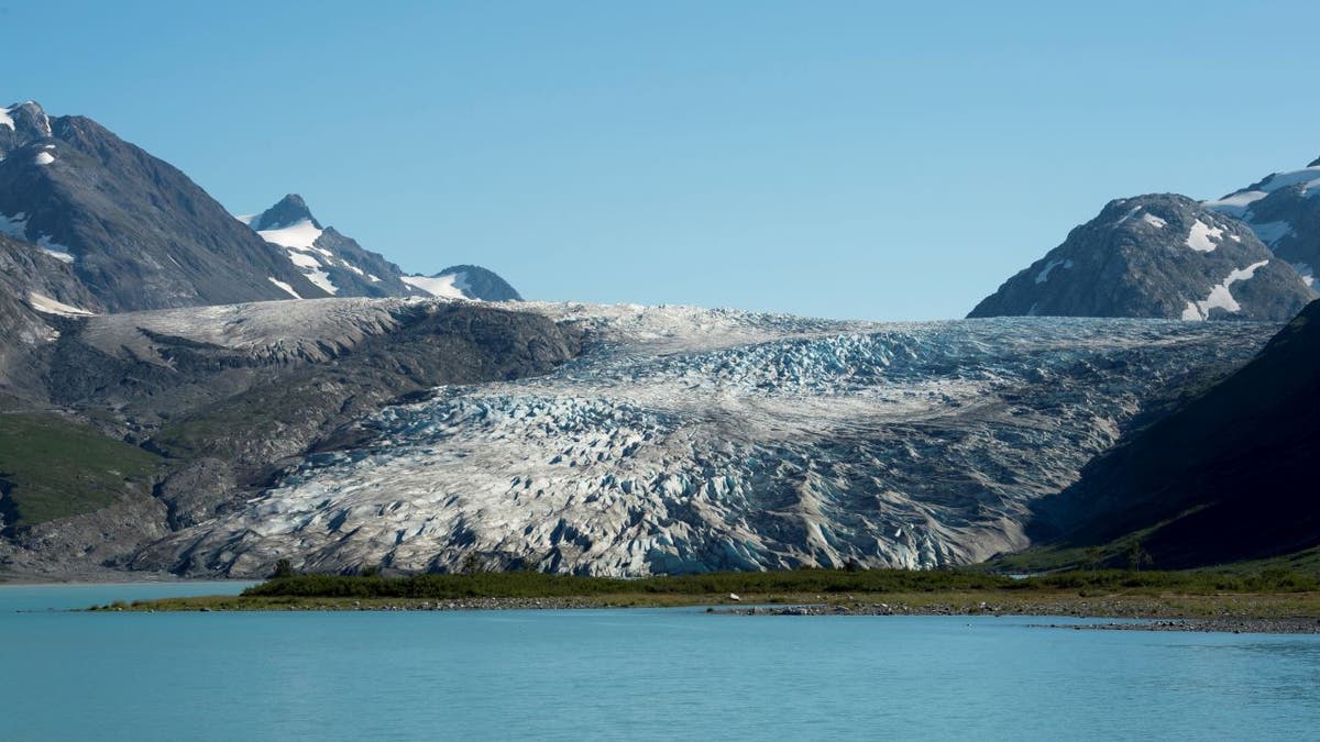
View of Reid Glacier in Glacier Bay National Park, Alaska. (Wolfgang Kaehler/LightRocket via Getty Images/File)
There are no additional details about the incident at this time.

Alaska
As Alaska sees a spike in Flu cases — another virus is on the rise in the U.S.

FAIRBANKS, Alaska (KTUU) – Alaska has recently seen a rise in both influenza and respiratory syncytial virus, better known as RSV. Amidst the spike in both illnesses, norovirus has also been on the rise in the United States. The Centers for Disease Control and Prevention (CDC) says it’s highly contagious and hand sanitizers don’t work well against it.
Current data for Alaska shows 449 influenza cases and 262 RSV cases for the week of Jan. 4. Influenza predominantly impacts the Kenai area, the Yukon-Kuskokwim Delta, and the Northwest regions of the state. RSV is also seeing significant activity in the Yukon-Kuskokwim Delta and Anchorage.
Both are respiratory viruses that are treatable, but norovirus — which behaves like the stomach flu according to the CDC — is seeing a surge at the national level. It “causes acute gastroenteritis, an inflammation of the stomach or intestines,” as stated on the CDC webpage.
This virus is spread through close contact with infected people and surfaces, particularly food.
“Basically any place that people aggregate in close quarters, they’re going to be especially at risk,” said Dr. Sanjay Gupta, CNN’s Chief Medical Correspondent.
Preventing infection is possible but does require diligence. Just using hand sanitizer “does not work well against norovirus,” according to the CDC. Instead, the CDC advises washing your hands with soap and hot water for at least 20 seconds. When preparing food or cleaning fabrics — the virus “can survive temperatures as high as 145°F,” as stated by the CDC.
According to Dr. Gupta, its proteins make it difficult to kill, leaving many cleaning methods ineffective. To ensure a given product can kill the virus, he advises checking the label to see if it claims it can kill norovirus. Gupta said you can also make your own “by mixing bleach with water, 3/4 of a cup of bleach per gallon of water.”
For fabrics, it’s best to clean with water temperatures set to hot or steam cleaning at 175°F for five minutes.
As for foods, it’s best to throw out any items that might have norovirus. As a protective measure, it’s best to cook oysters and shellfish to a temperature greater than 145°F.
Based on Alaska Department of Health data, reported COVID-19 cases are significantly lower than this time last year.
See a spelling or grammatical error? Report it to web@ktuu.com
Copyright 2025 KTVF. All rights reserved.
Alaska
Sky Watch Alaska: planets align plus the aurora forecast

ANCHORAGE, Alaska (KTUU) – This is a great time of year to do some star gazing. If you have clear skies in your part of Alaska, take the time to check out the night — and morning — sky.
After sunset, look toward the southwest. Saturn and Venus are snuggled up together (of course, they are more than 800 million miles apart) in the evening sky. They set at about 9:40 p.m. in Southcentral.
Before 9:40 p.m., you can see four planets with the naked eye — Saturn, Venus, Jupiter and Mars. Jupiter and Mars stick around through the morning. Mars is very close to the moon right now.
The Aurora forecast is fairly weak for the next few weeks. That’s not to say there won’t be the occasional burst but overall, solar activity is expected to be fairly low until the beginning of February.
If you get great pictures of the planets, the sky, or the aurora, don’t forget to send them to Alaska’s News Source.
See a spelling or grammar error? Report it to web@ktuu.com
Copyright 2025 KTUU. All rights reserved.
Alaska
Short-lived cold snap, with another warming trend this weekend
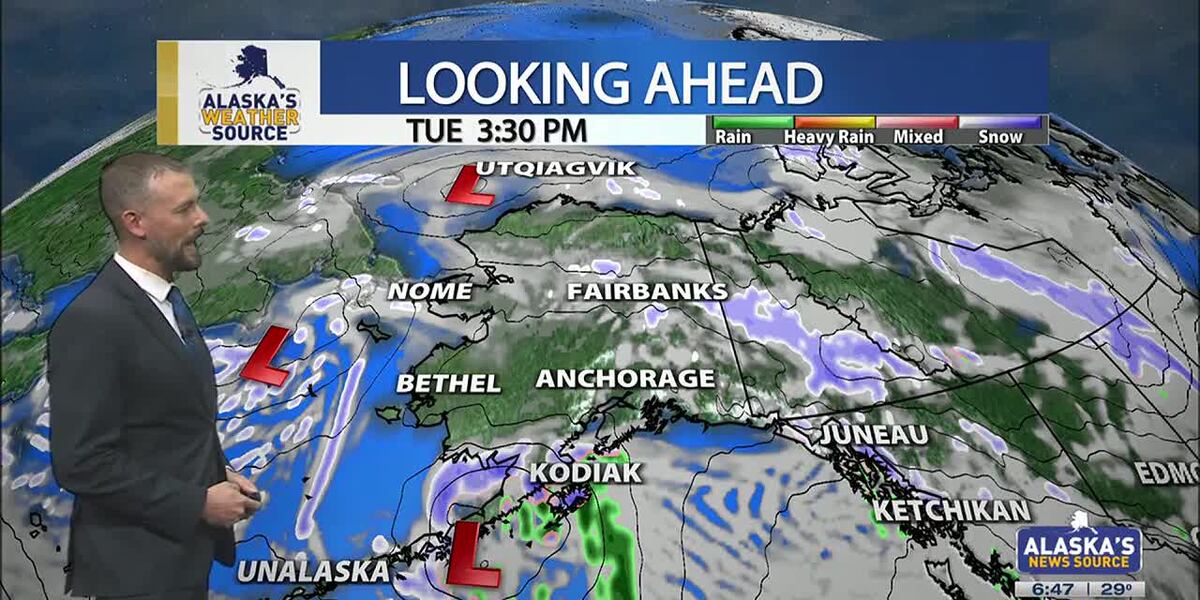
ANCHORAGE, Alaska (KTUU) – Temperatures across the state are cooling off, as our strong low from the weekend moves into the Chukchi Sea. This will set up for colder air to spread across the state this week, as another short-lived cold snap is expected. While some light snow is possible for the Interior, areas of the Slope and Western Alaska, Southcentral will stay on the drier side until the night. Meanwhile, Southeast will continue to hold onto moderate rain with gusty conditions.
SOUTHCENTRAL:
Temperatures this morning are 10 to 20 degrees colder than yesterday, as colder air has settled back into Southcentral. Clear skies and calm winds are evident this morning for parts of the region, with light snow falling through the Copper River Basin. We’ll see fairly quiet conditions today, outside of Kodiak which will see increasing snow and rain into the afternoon and evening hours. This comes as our next area of low pressure moves up the Alaska Peninsula.
We’ll see light snow spreading north across the Kenai overnight into Wednesday, with light snow expected through Prince William Sound. Several inches are likely through the Kenai and Chugach Mountains, with the pass expected to see a couple of inches of accumulation. Western parts of the Kenai will see the potential for a few inches, while inland areas of Southcentral largely stay dry. If Anchorage and surrounding locations see any accumulation, it’ll amount to less than half an inch.
As snow tapers off Wednesday, we’ll see the return to colder and drier conditions into Thursday. Thursday may be the coldest day this week across the region, before another warming trend carries us into next week. Right now holding with snow through early next week, but areas of wintry mix are possible as highs warm above freezing.
SOUTHEAST:
The winter storm warning for Skagway and higher elevations expired at 6am this morning. While some light snow showers are still possible, little accumulation will occur the rest of the day. Scattered to periodic showers are occurring elsewhere across Southeast today, with less than half an inch of rainfall through the day. Any moisture available into the evening will see a transition to some wintry mix or snow into Wednesday morning. However, the better chance will come from another low lifting north into the panhandle. Any snow and wintry mix we see for Wednesday will primarily stay confined to the central and southern panhandle. We’ll see much cooler weather taking hold this week for Southeast.
INTERIOR:
Some areas of light snow are possible this morning, with less than half an inch to be expected. While temperatures are still warm for much of the Interior, highs will steadily fall throughout the day. Many areas will see lows bottom out near or below zero by tomorrow morning. We’ll see high pressure keep things dry and sunny through the next couple of days, with the coldest stretch of weather from Wednesday morning into Thursday morning. Much like the rest of the state will experience, a warming trend arrives this weekend. We’ll see the return to highs in the 20s, with some snow in the forecast. Be prepared for some gusty conditions through the Alaska Range by the close of this week.
SLOPE/WESTERN ALASKA:
Areas of light snow and blowing winds will continue to impact the Slope, with a winter weather advisory remaining in place for the Central Brooks Range and the Beaufort Sea Coast. Both locations will see up to 1 inch of snow and gusty winds up to 35 mph. While the winter weather advisory will expire for the Central Brooks Range this afternoon, the Beaufort Sea Coast will see the alert continue into Tuesday evening. Snow and blowing snow will be the primary impact today, with a return to colder weather through the rest of this week, this comes as high pressure settles into the area.
The storm responsible for the damaging winds for Southcentral over the weekend, has pushed north into the Chukchi Sea. We’ll still see some light snow accumulations for Western Alaska, with 1 to 3 inches expected. Some fo the heaviest snow will fall across the Seward Peninsula and the Western Brooks Range.
An area of low pressure in the Bering Sea will keep gusty winds and snow in the forecast for Gambell/St. Lawrence. Be prepared for heavy snow at times and areas of reduced visibility. Overall, colder weather will settle into Western Alaska, with the possibility of morning fog in the valleys over the next few mornings.
ALEUTIANS:
Some light areas of snow will occur for the Pribilof Islands and into parts of the Alaska Peninsula today, as a weak low moves up the Peninsula. This will be the main focus for snow into Wednesday for Southcentral. This low will bring heavy precipitation and gusty winds for the Eastern Aleutians and the Alaska Peninsula. Looking ahead through the rest of the week, we can expect to see more a ridge beginning to build into the region. This ridge will slowly shift east, keeping several upper level disturbances traversing the Aleutians. Temperatures will remain fairly warm in the 30s and 40s.
OUTLOOK AHEAD:
Model consensus continues to agree on another warming trend heading our way into next week. This stretch of warmth will likely lead to many spots cementing themselves within the top warmest January’s on record. While we’ll spend the rest of this week on the colder side, highs steadily climb this weekend into next week. We’ll see highs in Southcentral climbing back above freezing, with areas of the Interior climbing back into the 20s.
Have a safe and wonderful Tuesday!
See a spelling or grammar error? Report it to web@ktuu.com
Copyright 2025 KTUU. All rights reserved.
-

 Health1 week ago
Ozempic ‘microdosing’ is the new weight-loss trend: Should you try it?
-
/cdn.vox-cdn.com/uploads/chorus_asset/file/25822586/STK169_ZUCKERBERG_MAGA_STKS491_CVIRGINIA_A.jpg)
 Technology6 days ago
Technology6 days agoMeta is highlighting a splintering global approach to online speech
-

 Science4 days ago
Metro will offer free rides in L.A. through Sunday due to fires
-
/cdn.vox-cdn.com/uploads/chorus_asset/file/25821992/videoframe_720397.png)
 Technology1 week ago
Technology1 week agoLas Vegas police release ChatGPT logs from the suspect in the Cybertruck explosion
-

 Movie Reviews1 week ago
‘How to Make Millions Before Grandma Dies’ Review: Thai Oscar Entry Is a Disarmingly Sentimental Tear-Jerker
-

 Health1 week ago
Michael J. Fox honored with Presidential Medal of Freedom for Parkinson’s research efforts
-

 Movie Reviews1 week ago
Movie Review: Millennials try to buy-in or opt-out of the “American Meltdown”
-

 News1 week ago
Photos: Pacific Palisades Wildfire Engulfs Homes in an L.A. Neighborhood


