Louisiana
Tropical rainstorm to bring deluge of rain to Texas, Louisiana
|
|
|
This AccuWeather Enhanced RealVue satellite image shows the strengthening tropical rainstorm over the Yucatan Peninsula late on Sunday, June 16. |
After a tropical rainstorm brought heavy rainfall to portions of Florida last week, AccuWeather hurricane experts warn that yet another tropical rainstorm is expected to impact the southern U.S. in the coming days.
In addition to the tropical rainstorm, two other areas in the Atlantic Basin are being monitored for tropical development later this week. It is possible that one of these areas could strengthen into Alberto, becoming the first named storm of the season.
AccuWeather began to highlight portions of the western Gulf of Mexico as a high risk on Thursday afternoon. A tropical rainstorm developed late on Sunday and is forecast to steer toward the border between Mexico and Texas early this week. The storm is expected to drift north-northwestward into Wednesday, bringing with it rounds of heavy rain.
|
|
“Very warm waters in this area of the Gulf, as well as low wind shear will make this a conducive environment the tropical rainstorm to strengthen,” said AccuWeather Senior Meteorologist Dan Pydynowski.
Given these factors, the rainstorm is forecast to strengthen into a tropical depression, then a tropical storm right before making landfall along the northern Gulf Coast of Mexico. Should the storm produce sustained winds of 39 mph or greater prior to any other development in the Atlantic Basin, it would be given the name Alberto.
A tropical storm is likely to bring widespread gusts to the Mexican states of Tamaulipas and Nuevo Leon, as well as portions of South Texas. Some storm surge can also be expected along the coast north of the storm’s landfall. For both Mexico and the United States, given the risk for damaging winds, storm surge and flooding rainfall, this storm is a 1 on the AccuWeather RealImpact™ Scale for Hurricanes.
|
|
Given the limited time over water and close proximity to land, the tropical system will need to intensify quickly in order to reach tropical storm strength before landfall late on Wednesday.
“Even if the tropical storm falls short of reaching tropical storm status, a plume of rich, deep tropical moisture is expected to surge into Mexico, Texas and Louisiana into the middle of the week,” Pydynowski explained.
Heavy rain is forecast to extend well north of the center of the storm, beginning as early as Monday.
|
|
A wet Monday morning commute is expected along the Interstate 10 corridor from New Orleans to Houston, as downpours threaten to slow travel, reduced visibility and cause flooding. Rain is forecast to continue into Wednesday before some of the heavier downpours shift north up the Mississippi River Valley and westward into more of Texas.
The ample supply of tropical moisture could allow rainfall totals to add up quickly, bringing the risk for over half a foot of rain across parts of the Texas and Louisiana Gulf Coasts. An AccuWeather Local StormMax™ of 30 inches is possible in the hardest-hit areas, resulting in road closures.
|
|
The Houston area has already received over 6 inches of rain through the first half of June, which is an amount more typical for the entire month. This new round of heavy rainfall to the already drenched area could bring renewed flooding woes for southeastern Texas.
Other zones along the Gulf Coast could use the rain. Brownsville, Texas, has only had 0.17 of an inch of rain so far in June, 14% of the historical average. In New Orleans, only 10% of the month’s typical rain fell in the first 15 days of June. In these areas, the soil may be so dry from the lack of recent rain that flash flooding could occur in the heavier downpours.
GET THE FREE ACCUWEATHER APP
Behind this wave of tropical rainfall, it’s not out of the question that another tropical system could form near the Yucatan Peninsula of Mexico late in the week.
“With warm waters and low shear still present in the southern Gulf of Mexico and northwestern Caribbean next weekend, yet another opportunity for tropical development may present itself,” warned Pydynowski.
|
|
Depending on the wind pattern in the atmosphere, any moisture from this area may again funnel into the Gulf Coast for the last week of June. Given the expected rain in the coming week, the risk for localized flooding may increase.
As the middle of the week approaches, yet another area could see a developing tropical system, according to AccuWeather meteorologists.
|
|
“This appears to be a quick-moving and compact low pressure area that will be moving westward into northeastern Florida or perhaps as far north as southeastern Georgia on Thursday,” said Pydynowski.
A stronger storm could bring gusty winds, especially to coastal locations. But even a less-organized storm would bring rough surf and downpours from the northern Bahamas to the Southeast Atlantic Coast.
|
|
Heavy tropical rainfall may hit some of the same areas that were drenched with last week’s tropical rainstorm. The highest rainfall totals are likely to miss to the north of Miami, which had over 11 inches of rain, and the town of Aventura, where 20 inches of rain fell. Instead, locations from Melbourne, Florida, to Charleston, South Carolina, may be more at risk for the heavy rain.
The zone currently primed for the heaviest rain has had very little rain so far this month, including Jacksonville, Florida, which only has reported 0.64 of an inch.
Forecasters will continue to monitor the development potential of all three areas throughout the week.
Want next-level safety, ad-free? Unlock advanced, hyperlocal severe weather alerts when you subscribe to Premium+ on the AccuWeather app. AccuWeather Alerts™ are prompted by our expert meteorologists who monitor and analyze dangerous weather risks 24/7 to keep you and your family safer.

Louisiana
People are changing how they mourn in a digital age. Here's why it works.

Louisiana
Stephanie Grace: What Louisiana’s Republicans could teach California’s Democrats

In 2024, California voters went for Kamala Harris over Donald Trump by 20 points. In 2025, they approved a ballot proposition designed to counter Texas Republicans’ audacious, Trump-backed redistricting plan by nearly 30 points.
In 2026, there’s a not-so-far-fetched possibility that the state, one of the nation’s bluest, will replace self-appointed Trump troll Gavin Newsom in the governor’s office with — get this — a Republican.
That the state’s Democrats are increasingly alarmed by this nightmare scenario has nothing to do with shifting political winds, and everything to do with California’s adoption in 2011 of the open primary, the same system long used in Louisiana.
So, as voters here are currently decoding new party primary rules to elect a U.S. senator and a few other top officials, Californians are grappling with one of the quirks of the system that Louisianans know and still love, according to polls: When Republicans, Democrats and everyone else run on one primary ballot, pretty much anything can happen.
In this case, a whole bunch of Democrats signed up, any of whom would be a heavy favorite against any Republican runoff opponent.
But because none of them has caught momentum or taken one for the team and dropped out, polls are showing that two Republicans could claim the top two primary slots, leaving Democratic voters with a deeply unpalatable choice come November.
If any of this sounds familiar to Louisianans, it should. Republicans in our state faced just such a scenario three decades ago.

Columnist Stephanie Grace
Louisiana’s Senate seat in 1996 was vacant, courtesy of J. Bennett Johnston’s retirement. At the time, the state was still regularly electing Democrats, but a shift was already underway, and Republicans thought they had a good shot at electing one of their own for the first time since Reconstruction.
But which one?
Four candidates who were considered mainstream conservative signed up: U.S. Rep. Jimmy Hayes, legislator Chuck McMains, New Orleans City Council member Peggy Wilson and businessman Bill Linder. So did former legislator Woody Jenkins, who had a firm base of Christian conservatives but was considered more right-wing than the others, and therefore less electable.
As they struggled to stand out, two Democrats, former state treasurer Mary Landrieu and attorney general Richard Ieyoub, stubbornly held the one-two spots in polls, potentially leaving Republicans shut out.
And there was another complication. Also in the race was Republican David Duke, the former Klansman and legislator who five years earlier made worldwide news by getting into a gubernatorial runoff. As folks in Louisiana politics knew, Duke was a wild card who often got more support on election day than he showed in public polls.
The prospect of an all-Democrat runoff or one pitting a Democrat against Duke was too much for Republican leaders, including the presidential campaign of Bob Dole, who understood that a Duke runoff candidacy would be an embarrassment for the party beyond Louisiana’s borders. And so a group led by then-U.S. Rep. Bob Livingston and his fellow GOP members of the state congressional delegation came up with a plan.
They would pick one of the Republicans, dominate the news cycle by staging a steady rollout of endorsements and signal to GOP voters to fall in line if they wanted a candidate in the runoff. While any one of the more mainstream candidates would have likely been a smarter and more personally appealing choice, Jenkins consistently polled just ahead of them, so he got the nod.
It came awfully close to working.
Jenkins finished first in the primary with 26% to Landrieu’s 22% and Ieyoub’s 20%, followed by Duke at 12%. Nobody else topped 6%. But then in the runoff, he fell 5,788 votes short, suggesting it’s highly likely that a different Republican could have won. Instead, Landrieu served three terms before the state’s gradual shift to the right finally came for her in 2014 — in the person, ironically, of the now-endangered Bill Cassidy.
I called Livingston recently to see if, given this experience, he might have some advice for California Democrats. He declined — “I think they’re crazy,” he said — but did have some thoughts about the Republicans.
“If polls show you’ve got a chance at two Republicans in the runoff, my advice is to stay firm,” he said.
He said he wasn’t happy to see Trump endorse one of them, Steve Hilton, because that might shift enough votes from fellow Republican Chad Bianco to allow a Democrat into the top tier.
“I think that was a mistake,” Livingston said.
Indeed, if the Democrats can’t find a way to choose among their own — and as of now they haven’t — it might well end up being a mistake that saves them come primary day on June 2.
It’s certainly a reminder that Louisiana’s traditional way of voting can be either charming or challenging, but is rarely boring.
Louisiana
Louisiana Republicans move to eliminate court office won by exonerated man

A man imprisoned for nearly 30 years before being exonerated won a landmark election in New Orleans promising to fix a judicial system that failed him. Now, Louisiana’s governor, Jeff Landry, and the Republican-controlled state legislature are racing to eliminate his job before he can be sworn in.
Calvin Duncan won 68% of the vote last November to become the Orleans parish clerk of criminal court after pledging to reform the justice system based on his own experience fighting to access court records while in maximum security prison.
Duncan rebuilt his life, in part by running for and winning the clerk’s office. But Louisiana state senate Republicans on Wednesday voted to scrap Duncan’s new job as part of a broader effort to streamline the judiciary in New Orleans, a Democratic hub with a predominantly Black electorate. The state legislature is largely Republican and white – and the deeply red state has been leading efforts to gut the Voting Rights Act.
Duncan’s swearing-in is scheduled for 4 May.
He told the Associated Press he believes he’s being retaliated against by Louisiana officials who have long denied his innocence, even though his name is listed on the National Registry of Exonerations.
Republicans say it isn’t personal and defend the effort as a step toward government efficiency.
“The citizens of New Orleans overwhelmingly said: ‘I want to give this person a chance, he can make a difference,’” Duncan, a Democrat, told lawmakers during a March committee hearing. “What this bill does, it says, ‘Thank you but you wasted your time.’ It disenfranchises everybody.”
The case started with the 1981 murder of 23-year-old David Yeager and landed Duncan in prison for more than 28 years. In 2011, on the eve of a hearing to consider new evidence, prosecutors offered to reduce Duncan’s sentence to time served if he pleaded guilty to manslaughter and armed robbery. Duncan was freed, but he didn’t give up trying to clear his name.
Finally, in 2021, a judge agreed that he had been unjustly convicted and vacated Duncan’s sentence altogether.
As state attorney general in 2023, Landry opposed Duncan’s petition to be compensated for his wrongful conviction. Duncan withdrew the petition after Landry’s successor, Liz Murrill, threatened to go after Duncan’s law license in the state. When Duncan ran for clerk, Murrill vowed to take “further action” against him if he did not stop calling himself “exonerated”.
Landry and Murrill have pointed to Duncan having accepted the 2011 plea deal for manslaughter and armed robbery.
“The attorney general made it clear during the election that if I continued to accurately speak about my innocence and exoneration that I would face consequences from her office,” Duncan told the Associated Press. “We are seeing those consequences today as she and the governor try to undo the will of 68% of voters in New Orleans.”
Murrill said she had “no involvement” in the move to eliminate the office.
Landry told the AP that eliminating Duncan’s elected office was about improving “government efficiency” and “cleaning up a system in [New Orleans] that has been plagued by dysfunction and corruption for years”.
Proponents of consolidating the criminal court clerk with the civil court clerk say the offices are combined in other parishes. Terminating the criminal court clerk position would save the state an estimated $27,300, according to the office of the legislative auditor, which added that the costs of combining clerks’ offices were “unknown”.
The bill’s Republican author, state senator Jay Morris, who represents a district in north Louisiana, acknowledged that once Duncan’s elected position is eliminated, the civil court clerk might struggle to handle the influx of cases. The solution, he says, is to “hire someone”.
Other New Orleans elected judicial officials whose jobs may be eliminated in the future would be allowed to serve out their terms – but not Duncan.
Morris told lawmakers that the goal is to pass the law in time to prevent Duncan from taking office before the start of his four-year term.
The bill, on track to be passed by the GOP-controlled house and approved by Landry, would immediately go into effect with the governor’s signature.
“I have never seen something so barbaric,” state senator Royce Duplessis, a Democrat representing New Orleans, said on the senate floor. “I understand politics and I know you all are going to vote how you are going to vote. But just know, when we are all done here, history has a record.”
Duncan, 62, was the driving force behind a 2020 US supreme court decision that ended non-unanimous jury convictions. He has also founded a non-profit dedicated to expanding incarcerated people’s access to the court system. He has said being elected to the clerk’s office was the culmination of his life’s work.
-

 Atlanta, GA1 week ago
1 teenage girl killed, another injured in shooting at Piedmont Park, police say
-

 Georgia5 days ago
Georgia House Special Runoff Election 2026 Live Results
-

 Pennsylvania6 days ago
Parents charged after toddler injured by wolf at Pennsylvania zoo
-

 Arkansas2 days ago
Arkansas TV meteorologist Melinda Mayo retires after nearly four decades on air
-

 Milwaukee, WI6 days ago
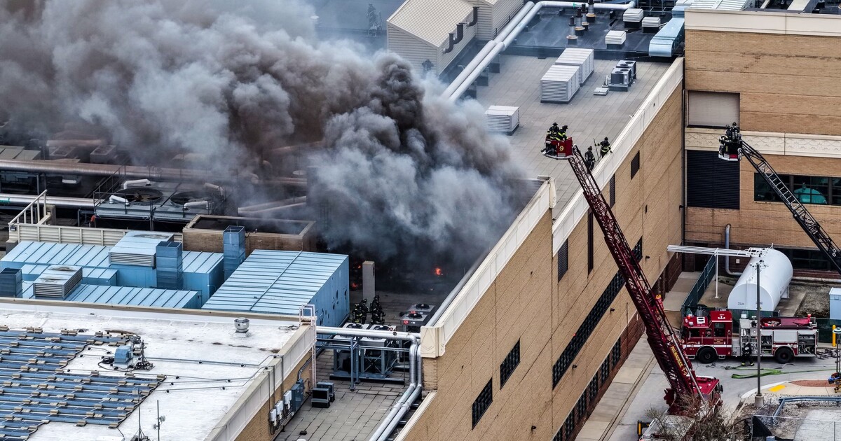
Potawatomi Casino Hotel evacuated after fire breaks out in rooftop HVAC system
-

 Indianapolis, IN1 week ago
Fighting Illini begin Final Four preparations in Indianapolis
-

 Technology1 week ago
Anthropic essentially bans OpenClaw from Claude by making subscribers pay extra
-

 Austin, TX4 days ago
ABC Kite Fest Returns to Austin for Annual Celebration – Austin Today


