Sign up for the Today newsletter
Get everything you need to know to start your day, delivered right to your inbox every morning.


Weather
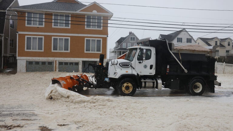
Most Massachusetts towns saw a few inches of snow Friday night into Saturday morning, with Franklin and Essex counties reporting the highest totals.
Another, likely snowier, storm was on the way for Sunday night into Monday. The National Weather Service in Boston called it a “high impact” storm with blizzard conditions and power outages possible.

Curious about how your town fared? Check out our table below.
| County | Location | Amount | Time | Date |
|---|---|---|---|---|
| Bristol County | NWS Boston/Norton | 0.5 in | 7 a.m. | 02/21 |
| Essex County | 2 NNW Haverhill | 5 in | 9:45 a.m. | 02/21 |
| Essex County | Haverhill 0.7 N | 4.7 in | 7 a.m. | 02/21 |
| Essex County | Methuen 1.4 NE | 4.6 in | 8 a.m. | 02/21 |
| Essex County | Newburyport 0.4 NNW | 4.5 in | 7 a.m. | 02/21 |
| Essex County | 1 SSE Haverhill | 4.5 in | 7:50 a.m. | 02/21 |
| Essex County | Andover 0.6 E | 4 in | 6:37 a.m. | 02/21 |
| Essex County | Hamilton 0.7 WSW | 4 in | 8 a.m. | 02/21 |
| Essex County | North Andover 0.3 NW | 4 in | 8 a.m. | 02/21 |
| Essex County | Middleton | 3.9 in | 7 a.m. | 02/21 |
| Essex County | 1 WNW Ipswich | 3.8 in | 8:25 a.m. | 02/21 |
| Essex County | Middleton 1.4 SSW | 3.5 in | 8 a.m. | 02/21 |
| Essex County | Beverly 0.5 SW | 2.4 in | 6:20 a.m. | 02/21 |
| Franklin County | 2 N Leyden | 6.5 in | 7 a.m. | 02/21 |
| Franklin County | Greenfield | 5 in | 9:44 a.m. | 02/21 |
| Franklin County | 1 WSW Ashfield | 4.3 in | 6:45 a.m. | 02/21 |
| Franklin County | Orange | 3.6 in | 7 a.m. | 02/21 |
| Franklin County | Sunderland 1.3 SE | 3.5 in | 7:30 a.m. | 02/21 |
| Franklin County | Shutesbury 2.9 SW | 3 in | 7 a.m. | 02/21 |
| Franklin County | New Salem 3.1 S | 3 in | 8:30 a.m. | 02/21 |
| Hampden County | Russell 0.9 W | 3.1 in | 7 a.m. | 02/21 |
| Hampden County | Westfield 2.2 N | 2.5 in | 7 a.m. | 02/21 |
| Hampden County | Westfield 2.8 SE | 2.3 in | 6 a.m. | 02/21 |
| Hampden County | Southwick 4.3 NW | 2.3 in | 7 a.m. | 02/21 |
| Hampden County | Holland 1.0 SSW | 2.2 in | 7 a.m. | 02/21 |
| Hampshire County | Williamsburg 1.2 WSW | 4.2 in | 6:30 a.m. | 02/21 |
| Hampshire County | Amherst | 3.7 in | 7:15 a.m. | 02/21 |
| Hampshire County | Northampton 0.6 ESE | 3.5 in | 7 a.m. | 02/21 |
| Hampshire County | Northampton 2.7 NE | 3.5 in | 8:08 a.m. | 02/21 |
| Hampshire County | 1 SW Southampton | 2.2 in | 7 a.m. | 02/21 |
| Middlesex County | Acton 1.3 SW | 3.5 in | 7 a.m. | 02/21 |
| Middlesex County | Maynard 0.7 ESE | 3.3 in | 7 a.m. | 02/21 |
| Middlesex County | Reading 1.2 N | 3.2 in | 6 a.m. | 02/21 |
| Middlesex County | Hudson 1.4 NW | 3.1 in | 7 a.m. | 02/21 |
| Middlesex County | Lexington 0.6 SW | 3 in | 7 a.m. | 02/21 |
| Middlesex County | Ayer 0.1 SW | 3 in | 7 a.m. | 02/21 |
| Middlesex County | Framingham 2.0 NNE | 3 in | 7 a.m. | 02/21 |
| Middlesex County | Chelmsford 1.8 NW | 3 in | 7 a.m. | 02/21 |
| Middlesex County | Littleton 2.8 NNW | 3 in | 8:30 a.m. | 02/21 |
| Middlesex County | Lexington | 2.9 in | 7 a.m. | 02/21 |
| Middlesex County | Melrose 1.0 WNW | 2.7 in | 7 a.m. | 02/21 |
| Middlesex County | Melrose 0.5 NE | 2.7 in | 7 a.m. | 02/21 |
| Middlesex County | Winchester 0.7 SE | 2.7 in | 7:15 a.m. | 02/21 |
| Middlesex County | Natick 1.9 NNE | 2.5 in | 8 a.m. | 02/21 |
| Middlesex County | Holliston 0.7 W | 2 in | 7:20 a.m. | 02/21 |
| Norfolk County | Norwood 1.3 NW | 2.6 in | 7 a.m. | 02/21 |
| Norfolk County | Blue Hill Coop | 2.6 in | 7 a.m. | 02/21 |
| Norfolk County | Braintree 1.5 SE | 2.5 in | 7 a.m. | 02/21 |
| Norfolk County | Walpole | 2.4 in | 7 a.m. | 02/21 |
| Norfolk County | Weymouth | 2.2 in | 8:45 a.m. | 02/21 |
| Norfolk County | 1 ESE Randolph | 2.1 in | 9:02 a.m. | 02/21 |
| Suffolk County | Logan AP | 1.8 in | 7 a.m. | 02/21 |
| Worcester County | 1 W Princeton | 4.8 in | 9:05 a.m. | 02/21 |
| Worcester County | 2 SSE Ashburnham | 4.5 in | 7:17 a.m. | 02/21 |
| Worcester County | 1 WNW Sterling | 4 in | 6 a.m. | 02/21 |
| Worcester County | Sterling 4.3 NW | 4 in | 7 a.m. | 02/21 |
| Worcester County | Lunenburg 0.6 NE | 4 in | 8 a.m. | 02/21 |
| Worcester County | 1 WSW Westminster | 3.8 in | 7:30 a.m. | 02/21 |
| Worcester County | Fitchburg 1.6 SSW | 3.6 in | 6 a.m. | 02/21 |
| Worcester County | Barre 1.4 NNE | 3.6 in | 7 a.m. | 02/21 |
| Worcester County | Westminster 0.6 WSW | 3.5 in | 6:39 a.m. | 02/21 |
| Worcester County | Rutland 3.8 N | 3.5 in | 7 a.m. | 02/21 |
| Worcester County | Fitchburg 1.5 NNE | 3.5 in | 8 a.m. | 02/21 |
| Worcester County | Holden 0.9 SSE | 3 in | 6 a.m. | 02/21 |
| Worcester County | Milford | 3 in | 7 a.m. | 02/21 |
| Worcester County | 2 SW Westborough | 2.9 in | 6:05 a.m. | 02/21 |
| Worcester County | West Brookfield 3.1 NNE | 2.9 in | 6:30 a.m. | 02/21 |
| Worcester County | Worcester AP | 2.9 in | 9 a.m. | 02/21 |
| Worcester County | Shrewsbury 0.4 S | 2.6 in | 8 a.m. | 02/21 |
| Worcester County | Spencer 1.7 W | 2.3 in | 7:07 a.m. | 02/21 |
| Worcester County | Worcester AP | 2.1 in | 11:51 p.m. | 02/20 |
| Worcester County | Upton 0.4 NE | 2.1 in | 7 a.m. | 02/21 |
| Worcester County | Warren 2.4 WSW | 2 in | 7 a.m. | 02/21 |
| Worcester County | Douglas 1.9 NNE | 2 in | 7 a.m. | 02/21 |
Get everything you need to know to start your day, delivered right to your inbox every morning.


Massachusetts’ recent smoky skies and hazy sunsets may look unusual, but experts say what we’re seeing is part of a growing pattern fueled by bigger and longer wildfire seasons.
The strange haze has lingered for two days — so far — thanks to a weather pattern bringing smoke straight from parts of Ontario, Canada, straight to New England.
NBC10 Boston NBC10 Boston
“A lot of the fires farther up north are burning longer and more intensely than they have previously, so that’s been a big change and may be why we’re seeing more of the smoke,” said James Urban, an associate professor in the Fire Protection Engineering Department at Massachusetts’ Worcester Polytechnic Institute.
It looks like Boston’s getting a break from the wildfire smoke that’s making the sky hazy enough that you can actually look at the sun, if briefly. But that break may not last. Plus, we’re looking at rain moving in this weekend.
He explained the nuances about how climate chance may play a role in what we’re seeing this summer.
“In general, drier conditions make things more flammable, but also, if you have a period before that of wet winter but not a lot of freezing, you may get a lot of plant growth, and then when it dries out in a drought, you get a lot of fuel that may ignite,” Urban said.
We went to a museum to find out more about what’s causing the unearthly images in the sky.
“With smoke, it’s driven into the air with the heat and then gets caught in the upper air current, so it travels over the mountains and comes straight across the country,” said Noreen Johnson Smith, president and CEO at Worcester’s EcoTarium.
The way the sun looks has to do with how smoke scatters light.
“We’re seeing these bright orange and red suns because the blues aren’t able to reach our eyes at the moment,” said Murphy Florman, an educator at the museum.
An air quality alert for Massachusetts has been extended through all day on Thursday, with the Department of Environmental Protection saying in a statement, “elevated levels of fine particles [mean that] air quality statewide is expected to be unhealthy for sensitive groups.”
Massachusetts is under an air quality alert due to the Canadian wildfire smoke that’s made the skies dark and hazy and turned the sun into an “orange orb.” Here are the factors making the air hard to breathe for some and what medial professionals say about it.
Tufts Medical Center pulmonologist Dr. Sucharita Kher said that it’s important to be aware of the air quality where you live, especially if you’re going to be spending time outside. The conditions Massachusetts has been experiencing are especially harmful to those with heart or lung disease.
“The symptoms of that can be tightness in the chest, they can experience more wheezing, they can have more swelling in their airways leading them to cough more, produce more phlegm,” she said. “All of that ultimately leading to worsening symptoms of that underlying disease.”
Needham pharmacist Kevin Ryan said certain medications can help with symptoms, such as histamines like Claritin or Zyrtec, as is wearing an N-95 mask.
“If you feel like you’re doing fine outside, that’s great. If you if you don’t feel like you can breathe effectively, then limit your exposure,” he said.

BOSTON (WWLP) – The Massachusetts Broadband Institute (MBI) announced Wednesday that it is distributing 5,063 internet-enabled devices to 45 organizations across the state.
The statewide effort, administered through the Connected and Online program, aims to expand economic opportunity by increasing digital access. This program is a $31.6 million initiative funded through the U.S. Treasury’s Capital Projects Fund that provides Massachusetts-based organizations with laptops, tablets, and desktop computers to help residents access the internet.
Equipment provided through the program also includes supportive items, such as braille keyboards, intended to assist vulnerable populations.
Both Gateway Cities and rural communities are supported by the Connected and Online program, as residents are provided with direct access to devices through lending programs or resources at publicly accessible locations.
“The Connected and Online program opens doors for communities to access critical services and build relationships with their neighbors,” said Governor Maura Healey. “By partnering with trusted local organizations, we’re helping more people get online, access essential services, and connect to new educational and economic opportunities.”
To date, the program has provided nearly 32,000 devices and more than 13,000 pieces of supportive equipment. These devices have been distributed to hospitals, municipalities, nonprofits, public libraries, elder and youth aid groups, and workforce training organizations across the Commonwealth.
This latest award announcement follows a prior distribution launched by MBI on April 2, which included nearly 27,000 devices to over 200 organizations across the state.
“MBI is leveraging strong relationships with local and regional organizations to deliver digital devices for Massachusetts residents,” said MBI Program Executive Jody Jones. “The Connected and Online program is a statewide effort to expand access, increase digital skills training, and, at its core, expand the ability to connect to the internet.”
For a full list of awardees, visit broadband.mass.tech.org.
WWLP-22News, an NBC affiliate, began broadcasting in March 1953 to provide local news, network, syndicated, and local programming to western Massachusetts. Download the 22News Plus app on your TV to watch live-streaming newscasts and video on demand.
All facts in this report were gathered by journalists employed by WWLP. Artificial intelligence tools were used to reformat information into a news article for our website. This report was edited and fact-checked by WWLP staff before being published.

If you want to help people in poverty, don’t drive the wealthy out of state.
That might be something the state senators in the Committee on Children, Families and Persons with Disabilities should keep in mind after they advanced a sweeping bill going full bore at reducing the state’s poverty rate.
Sen. Sal DiDomenico told the State House News his proposal (S 3095) “is a compilation of many bills that have already been filed.” According to his office, the bill, as originally filed, included provisions that would increase the Transitional Aid to Families with Dependent Children cash benefits for pregnant people, families and caregivers; increase Emergency Aid to the Elderly, Disabled and Children cash benefits; codify related benefits and allowances; and bar the government from taking any amount of child support payments from low-income parents.
His office also said the bill would direct the state to replace Supplemental Nutrition Assistance Program cash benefits “stolen by criminal rings through skimming or phishing”; ensure access to free menstrual products in public schools, homeless shelters, prisons and county jails; raise farmworker wages to at least the state’s minimum wage; establish a “baby bonds program”; and “enhance” the attorney general’s ability to “ensure companies pay their employees the wages they deserve and hold employers accountable when they steal workers’ wages.”
It’s a tall order, and an impressive one. But the hurdle isn’t just getting it on the Senate’s agenda before the July 31 deadline, it’s how to pay for it.
The idea of front-loading assistance appears sound: helping people escape poverty means they won’t need to rely on social services down the line. But it will still take a sustainable revenue source to keep it all going.
And Massachusetts has been shooting itself in the foot when it comes to keeping revenue inside state borders.
According to Moneywise, Massachusetts millionaires took $4.2 billion in income out of the state in 2023, new Internal Revenue Service data revealed.
As reported by Bloomberg, that’s an 8% increase from the year before, and it comes just as the state began enforcing a new 4% surtax on incomes above $1 million. Higher-income households are now accounting for a larger share of total departures from the state. In 2023, top earners accounted for roughly 70% of total income outflow. That doubles their share from just a few years earlier.
We need to keep them, and their tax payments, here.
But that won’t happen if efforts to lower taxes are met with derision, and the notion that tax breaks only benefit the very rich. The deep-pocketed set that’s heading to tax-friendlier states are gifting their new home turf with a cumulative windfall, even if the individual tax amount is lower than the Bay State.
The same goes for companies who see better opportunities elsewhere.
The senators working on anti-poverty measures have some great ideas, and they should have a budget to implement them. Lifting people up from poverty uplifts the state.
But we can’t pay the bill if we keep driving out high-earning taxpayers. To help the poor, we must keep the rich.


Game-changing cholesterol pill wins FDA approval after cutting LDL nearly 60%


2026 AL, NL MVP Odds: Ohtani Favored; Alvarez Holding Off Challengers


Tesla helped save a driver. Is your car ready?

SpaceX stock erases all its gains and slides below IPO price in intraday trading

Contributor: Hollywood will stop fueling racism when audiences demand better

Trump seeks prime-time spotlight for election claims, sparking concerns he’ll intervene

California employer health premiums will cost as much as a new car in 2027

How Spain ‘recaptured the spirit of 2010’ in its run to the World Cup final

