Maine
How many inches of snow did we get? NH and Maine totals listed here

Here are the New Hampshire and Maine snowfall reports in locations recorded in inches by the National Weather Service as of 10:30 p.m. Sunday (though some locations reported earlier).
New Hampshire
Rockingham County
1 E Salem 18.5
2 SSE Salem 17.0
Plaistow 16.5
Atkinson 16.0
Newton 14.0
Chester 13.8
2 NNE Newton 13.5
3 NE Derry 13.0
Seabrook 13.0
Londonderry 12.3
2 NNW Chester 11.4
Fremont 11.0
2 N Raymond 9.6
3 E Seabrook 9.5
2 NW Lee 9.0
Portsmouth Airport 8.0
4 E Epsom 7.2
Portsmouth in 2024: Development surge in North End, Route 1 corridor
Strafford County
1 N Milton 11.8
1 ENE Madbury 9.5
Durham 9.2
3 SE Dover 8.5
1 S Dover 7.6
3 NNE Northwood 7.0
Dover in 2024: Waterfront transformation to lead ambitious year of building
Belknap County
2 WSW Meredith 13.5
1 NNE Tilton-Northfield 11.0
Carroll County
1 SE Wolfeboro 14.8
1 NNW Brookfield 12.5
3 SE Albany 11.0
1 ESE Freedom 9.0
1 WNW Center Sandwich
Cheshire County
2 SSE Rindge 10.8
1 NE Jaffrey 8.0
1 ENE Spofford 5.0
Coos County
Berlin 5.0
Grafton County
5 S Piermont 14.5
5 WSW Littleton 10.8
2 ENE Plymouth 9.7
Waterville Valley 9.2
4 ENE Thornton 8.5
Hillsborough County
4 SSE Hudson 15.3
1 SW Brookline 15.1
2 SE Brookline 15.0
1 ESE Nashua 14.7
2 S Nashua 14.5
2 ESE Brookline 14.2
3 SSE Mason 14.0
2 SW Brookline 13.8
2 SSW Hollis 13.4
2 S New Ipswich 13.0
2 S New Ipswich 12.5
1 WSW Nashua 12.3
2 SSW Nashua 12.0
Milford 12.0
1 ENE Litchfield 11.5
3 N Hillsborough 10.1
1 SSE Manchester 10.0
1 ESE Milford 10.0
1 W Amherst 9.0
Amherst 9.0
Bedford 9.0
2 NNE Greenfield 8.8
Manchester Airport 8.5
2 SE Milford 8.2
1 W Bennington 7.3
2 NW Merrimack 7.3
Merrimack County
4 NNE Warner 11.5
2 NNE Bradford 11.0
Concord Municipal Airp 8.4
1 SSE Henniker 8.3
2 W Epsom 7.0
3 E Canterbury 7.0
Sullivan County
2 NE Newport 10.5
1 WNW Washington 8.4
4 SSW Lebanon 7.0
Maine
York County
5 NNW Acton 18.0
5 NW Hollis 17.2
4 NE Shapleigh 16.0
1 WSW Kittery 16.0
5 NNW Acton 15.0
5 NNW Acton 14.5
5 NNW Acton 14.2
2 SSW East Baldwin 13.2
3 NE Limington 13.0
2 WNW Kittery 11.2
6 W Lebanon 10.5
Ferry Beach State Park 10.5
1 SW Old Orchard Beach 10.4
1 SW Kennebunkport 9.0
1 N Kennebunk 9.0
2 S Sanford 8.0
1 SW Kennebunkport 8.0
2 NNE Saco 7.0
Development in 2024: York, Kennebunk, Wells projects coming this year, hotels, and more
Androscoggin County
S Turner 11.0
NW Auburn 8.2
2 W Lisbon Falls 7.8
1 W Mechanic Falls 7.7
2 N Lisbon 7.5
Mechanic Falls 7.5
E Lewiston 7.0
S Livermore Falls 5.3
Cumberland County
3 SSE Standish 18.0
1 N Gorham 17.0
2 WSW Falmouth 16.0
2 SSW Cumberland 15.5
1 N Cumberland 13.9
2 S Cumberland 13.8
4 SSE Gorham 13.5
Standish 13.2
3 SSE Gray 13.0
1 NW Freeport 13.0
Gorham 12.8
1 NE Portland Jetport 12.7
Portland Jetport 12.6
1 SSW Brunswick 12.5
Freeport 12.0
2 N Old Orchard Beach 11.6
3 E South Windham 10.5
2 SW Falmouth 10.3
5 S Bridgton 9.5
1 NNW Cape Elizabeth 9.5
South Portland 9.5 in
4 WSW New Gloucester 9.0
NWS Gray 8.8
1 S Portland Jetport 8.0
5 S Bridgton 7.0
Kennebec County
2 W Litchfield 10.3
1 SW Gardiner 7.5
Randolph 7.3
2 WNW Hallowell 7.0
2 WSW Gardiner 6.8
2 WNW Whitefield 6.5
1 ESE Augusta 6.3
1 NW Farmingdale 6.0
3 ENE Vassalboro 5.5
Knox County
1 WNW Tenants Harbor 10.8
2 SW Friendship 10.3
Thomaston 9.5
2 SSW Tenants Harbor 8.5
Hope 7.5
Camden 6.7
2 SE Washington 5.0
Lincoln County
1 SSW Nobleboro 9.8
2 SE Alna 9.0
1 W South Bristol 8.6
Oxford County
3 WNW Brownfield 9.5
Fryeburg 8.5
1 S Waterford 8.5
1 NNE Lovell 7.5
3 SW Peru 7.0
2 NE Oxford 7.0
Bryant Pond 6.8
4 W Stoneham 5.5
Sagadahoc County
2 ENE Topsham 10.3
Bath 10.0
1 NW Woolwich 10.0


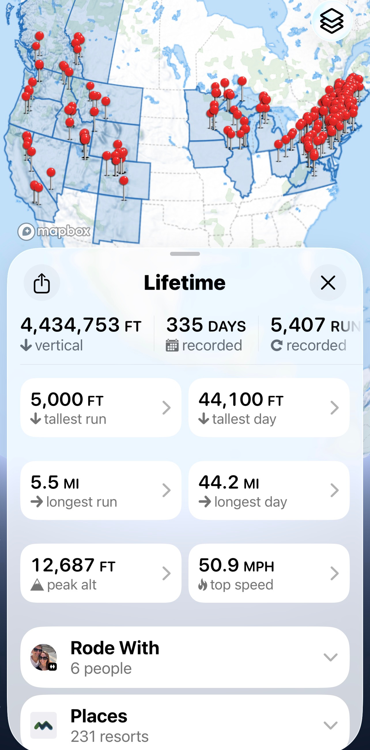
Almost the first thing Ryan asked when we met three years ago was if he could see my Slopes map. And it’s a pretty good map, stretching back to the 2018-19 ski season:
I didn’t suppose a Bozeman Bro would care about anything outside of the Bridger Bowl-Big Sky circuit, because the other first thing Ryan asked me was whether I had a transceiver, and I was like “No, I left it next to the scuba gear and car-waxing kit in my Box of Accessories I Don’t Own for Activities I Never Do on Purpose, like ski out of bounds or go underwater or pretend my minivan is anything other than a Chrysler Pacifica with a roofbox and a broken rear windshield wiper.” And he was like “Well that’s too bad you’d need one to ride Schlasman’s” and I was like “The chairlift at Bridger Bowl?” And he was like “Yeah” and I was like “Man that is so Bozeman.”
But Ryan did like the map because he’s the sort who keeps lists of, like, the names of everyone who’s ever given him a haircut and how many Oreos he ate each week in 1992 and how strange that our wives who were college roommates ended up marrying the same sort of List Bro. But I seized on his curiosity and love of novelty to insert a day of skiing into their annual family Christmas visit to New York, and after a 2024 day of blown-snowtrails over dirt at Windham and Hunter, I hoped to show him a better version of Northeast skiing.
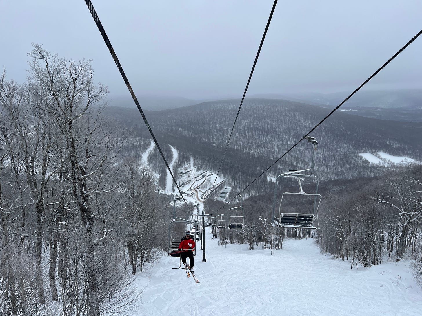
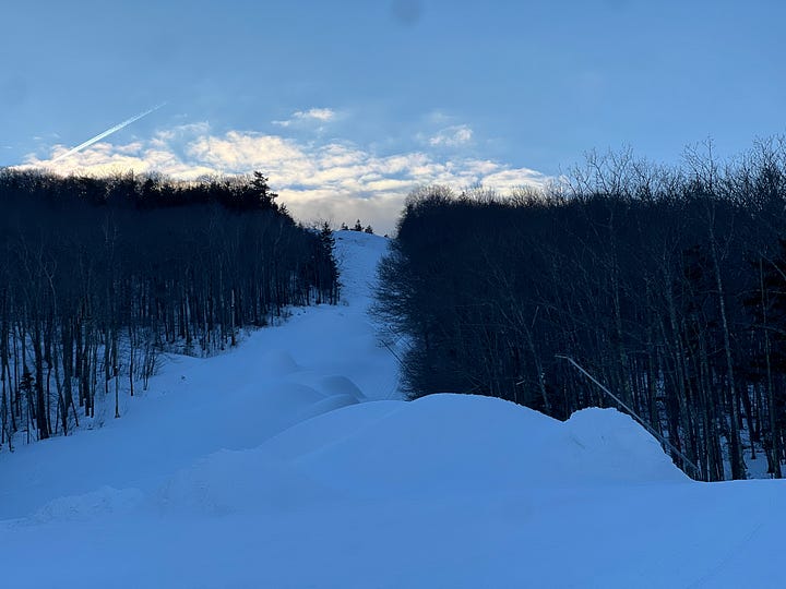
Fortunately December 2025 shaped up better than December 2024. Storms had pounded in one after the next and the obligatory rain-thaw cyclone that would typically have pulverized millions of gallons of accumulated snowmaking back to gutter water never materialized. A fortuitous eight inches fell overnight leading into our pre-planned ski day, and we aimed for Plattekill, an 1,100-vertical-foot elevator shaft disguised as a ski hill about three hours north of the city. And this time there was no dirt to be seen:
Plattekill is the Catskills’ hidey-hole, a family-owned bunker that’s dug an atmospheric moat sufficient to fend off Vail-owned Hunter and state-owned Belleayre and whatever-the-hell-Windham-is. The bump only spins two chairlifts but there are never liftlines, even on Christmas week. The triple gets a little backed up but the double never does. And what a spectacular chair that is, one of my favorites anywhere:
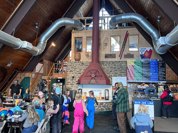
Platty is all vibes. That baselodge. Beers upstairs with the live band jamming. And yeah it was nice to have snow to share with Bozeman Bro in a year where he ended up with very little.
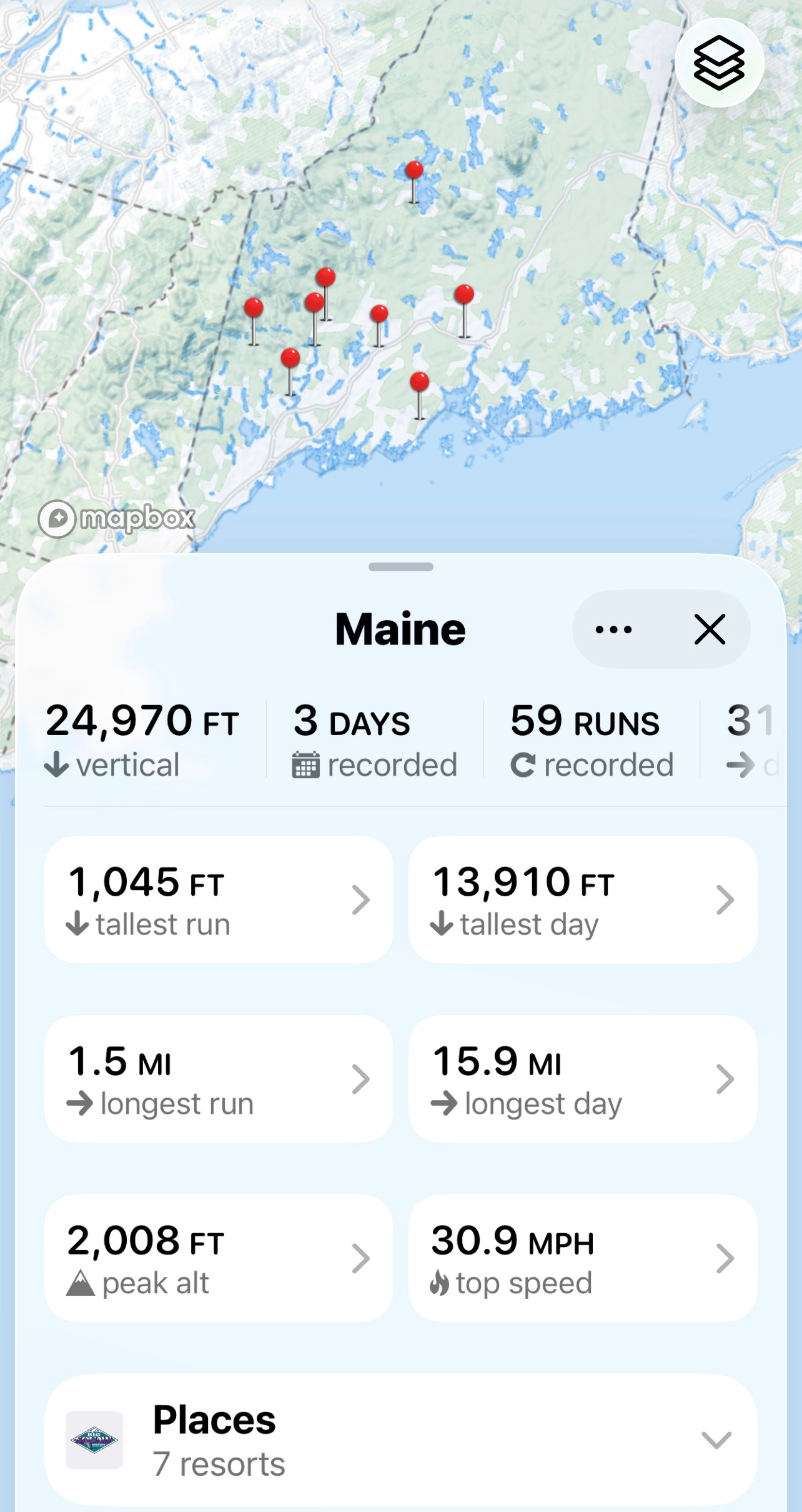
As we rolled into 2026, I’d skied nearly every ski area with a chairlift in New England, but Maine had proven elusive. Sort of because it tried to dismember me but mostly because it’s far and because most of those faraway ski areas are Wisconsin-sized coastal bumpies that don’t grab a ton of snow and because some of those ski areas (Baker, Jefferson) operate infrequently, have little or no snowmaking, and communicate their opening hours via websites that make the Pony Express look like Starlink. So my Maine ski history was limited to Boyne’s three mountains (Sunday River, Sugarloaf, Pleasant), Saddleback, and Black Mountain of Maine. But with the snowpack unseasonably deep, I prioritized three days in early January to survey the state’s smaller offerings.
And the first thing I thought when I arrived at Lost Valley was “Damn it I should have come here years ago.” Because my first impression of Lost Valley was that it is one of the best-run small ski areas in the country.
That meta-fact helps explain the existence, in 2026, of a 240-vertical-foot, 45-acre anthill within an hour of mega-bigster Sunday River. That, and the bump’s proximity to Lewiston, Maine’s second-largest city (population 37,121) and, so I hear, a hell of a fortunate place to land if your idea of a sickified ski trick is a tib-fib spiral fracture (I’m incapable of writing about skiing Maine without mentioning this incident a minimum of seven times).
About a decade ago, Lost Valley nearly joined the 79-plus ski areas that have dropped dead across Maine since the beginning of industrialized skiing. But then a fellow named Scott Shanaman showed up. With the help of crowd-sourced stopgap funding, he pulled Lost Valley out of debt. He cut new trails and glades and super-boosted snowmaking. In 2024, he relocated Mount Southington’s Northstar double chair to Lost Valley:
The chair is marvelously new looking for a machine that began life circa 1980 at the long-dead Craigmeur ski area in New Jersey and moved up to Connecticut in 2001 before migrating to Maine. Now called simply “Chair #3,” this is one of the few chairlifts to operate in three locations, and perhaps the only one to spin in three U.S. states.
The first sign of a well-run, skiers-first ski area: All three of Lost Valley’s chairlifts were spinning on a Wednesday night in January, even though they could have gotten away with running two. Everything about the place hummed. The grooming was outstanding, snowmaking had buried the trails. All that infrastructure helps, but what impressed me most about Lost Valley was the thing so often missing from night-skiing operations: order. Even in the froth and throng of teenage yee-haw flippy-screamy night. And everyone was nice. And yes that matters a lot, especially with the lift attendants.
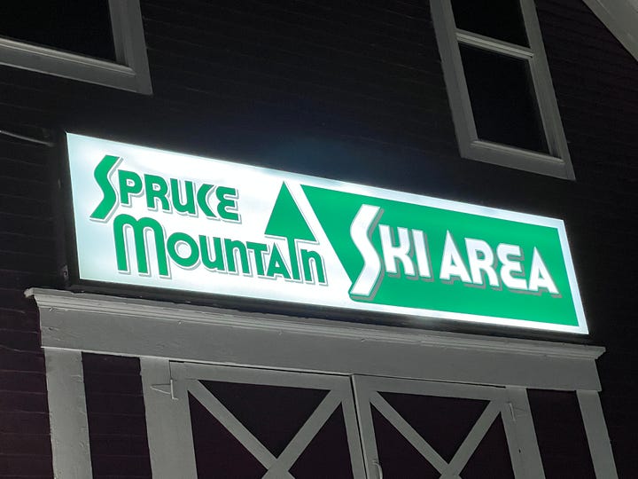
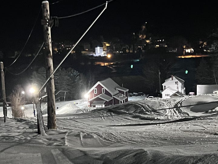
Forty minutes up the road from Lost Valley is Spruce Mountain, a three-ropetow bump so obscure that most ski area inventories miss it. It’s a down-a-dirt-road, up-a-hill, where’s-the-parking-lot-oh-this-is-the-parking-lot, still-has-wordpress.com-in-its-url, is-trying-to-raise-$20,000-to-buy-a-“new”-groomer sort of place.
Which means it was me skiing among a bunch of 12-year-olds who seemed confused as to why I would be here. But isn’t it astonishing and wonderful that places like this still exist?
Spruce maintains a surprisingly varied and dense trail network, a little of which I explored. But the upper-mountain tow isn’t night-lit (or wasn’t that night), and I’m fighting off some shoulder soreness that I later discovered is a torn rotator cuff (to be repaired next month; yes I am the king of stupid injuries and nearly dying on a more or less annual basis).
One thing I’ve learned when planning these ski-10-ski-areas-in-three-days hypertrips is that it helps a lot to not change hotels, even if that means more daily driving. So I set up in Waterville, home of Colby College and a pass-through zone for I-95. From there I drove two hours on Thursday morning to Big Moose, which, depending upon your point of view, is either the most dysfunctional or the most resilient ski area in America. In brief, Big Moose once looked like this, with an 1,700-foot lift-served vertical drop:
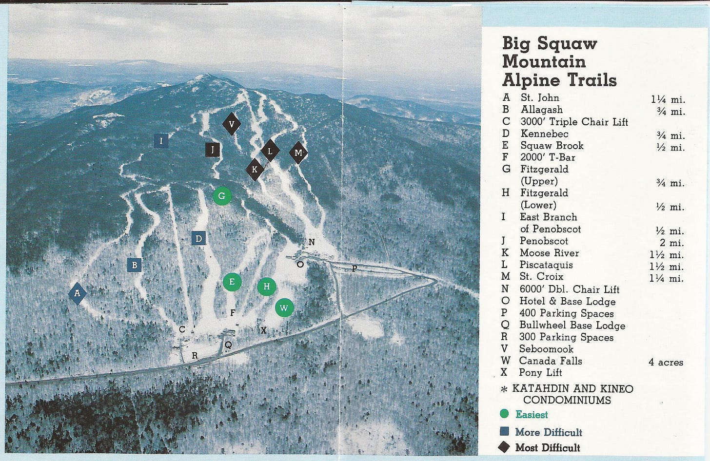
In 2004, the summit chairlift (“N” on the map above), broke, and the owner never fixed it, shrinking what had been a remote-but-large 1,700-vertical-foot ski area into a still-remote-but-teensy-tiny 583-vertical-foot ski area. Around 2010 the owner, a Mr. James Canfalone of Florida, stopped pretending to operate it, and was subsequently sued by the state, which had sold him the ski area on the condition that he not let it turn into a decrepit pile of crap. Which he did, while also allegedly running a bootleg timber operation, a crime that sounds so ridiculously antiquated that I’m tempted to ask him which pirate he owed money to.
That’s the dysfunction part. The resilience part is this: after the ski area sat idle for two years, a nonprofit group called Friends of the Mountain restored the triple chair and, over time, added snowmaking, a conveyor lift, and Cat rides to the summit. They also, against Canfalone’s indignant protests, renamed the ski area from “Big Squaw” to “Big Moose,” reflecting a change the state had made to the actual mountain that the ski area sits on 26 years ago. Friends of the Mountain’s goal is to raise nearly $6 million to purchase the ski area.
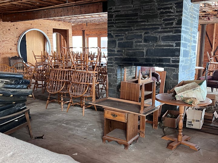
I hope they succeed. A previous plan to restore summit access with a six-pack chair as an anchor to a $113 million resort died. But this doesn’t feel like a dead or dying ski area. The place is pulsing, vibrant, filled, on the weekday I visited, with kids lapping the conveyor or riding up the old T-bar line on this thing:
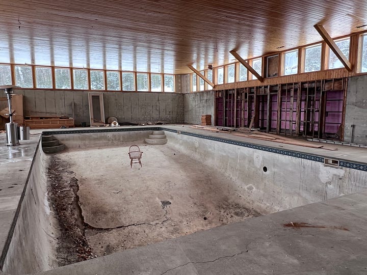
Oh and there’s this gigantic abandoned hotel/condo complex in the middle of the hill, which I totally did not explore to take these photos:
The skiing, as it stands, is fine, with a funky windy narrow trail network that delights and confuses in that New England, why-don’t-they-build-them-like-this-anymore kind of way. You can hike to the top but I did not hike to the top. Because that seemed like a lot of work for pretty mediocre snow, because I bought the kind of skis that only go down, and because I’d made the logical-sounding-at-the-time decision to chase my two-hour morning drive with a two-and-a-half-hour afternoon drive to the day’s second ski area.
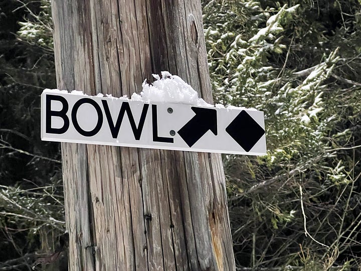
Let’s start by addressing what you’re all thinking right now: there are too many “snowbowls” in America and no one can agree on how to spell it, probably because it’s not a word:
Or perhaps Camden Snow Bowl is the rebel, facing off against Arizona Snowbowl, Montana Snowbowl, and Middlebury Snowbowl – a legendary ski area trifecta most skiers refer to simply as “The Strike Lane.”* (Fun fact: all three were founded by John Snowbowl IV, a fortuitous name for the ski-loving industrialist who built his fortune selling doorhinges.**) But that doesn’t explain the matter of the intransigent Elko “Snobowl,” a semi-functional outfit in the Nevada desert, and the utterly confusing Mount Hood “Skibowl,” which, when tasked with distinguishing itself as a ski area on a mountain with a half dozen other ski areas, chose the most confusing name possible.
*No one calls it this, mostly because there are probably a maximum of five people on Earth who have skied at all three of these places, and maybe 15 people who are aware that they all exist.
**Sorry I try to stop myself but it’s impossible.
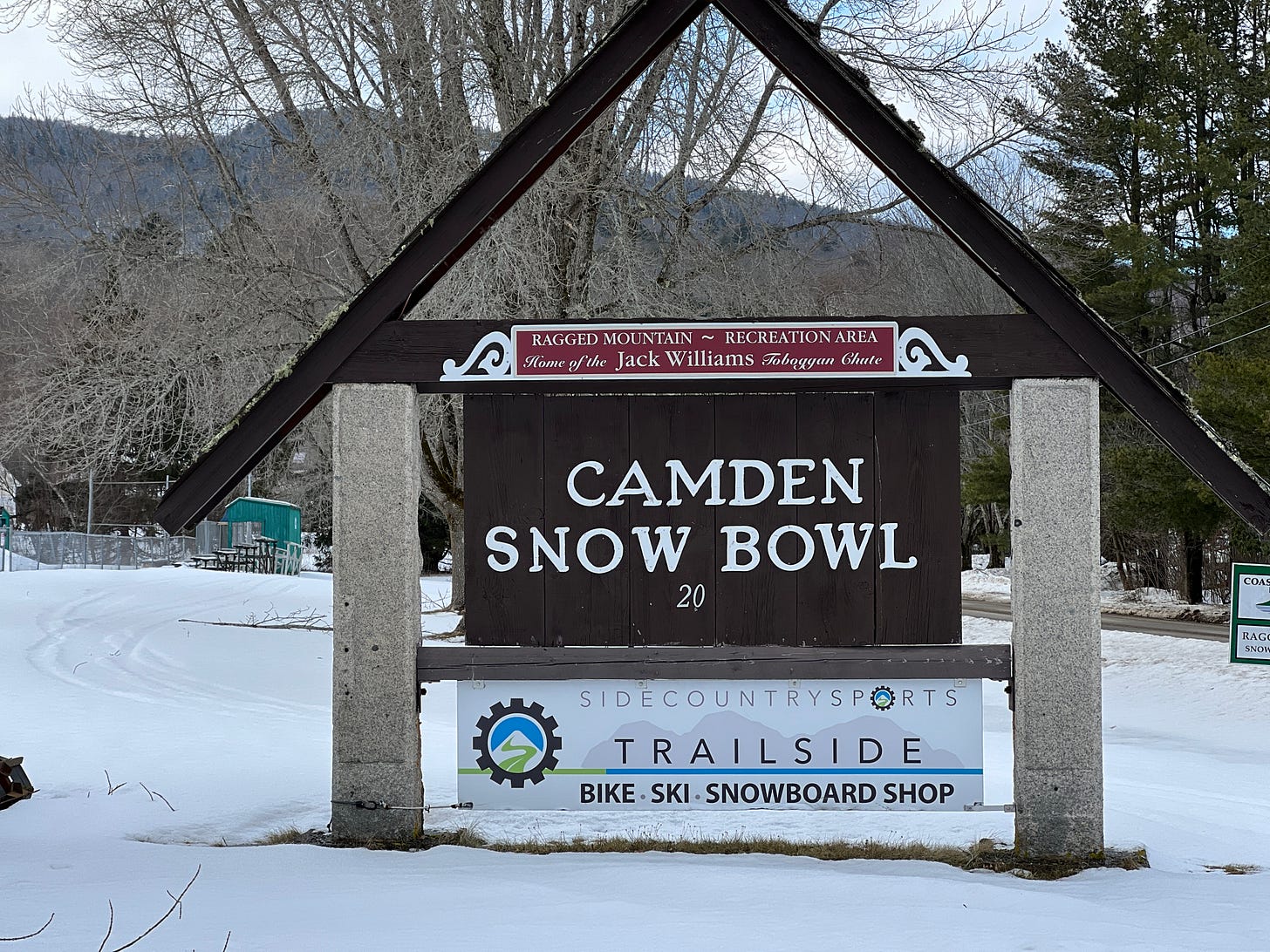
Anyway, even given all my righteous confusion, I found the Camden “Snow Bowl.” And the first thing anyone will tell you about Camden Snow Bowl when you mention Camden Snow Bowl is that from the summit of Camden Snow Bowl you can see the Atlantic Ocean.
I know that doesn’t actually sound that special. The Atlantic Ocean is not exactly hard to come by. Just go east from anywhere on the continent and eventually you’ll hit it. In fact, the Atlantic Ocean is a global brand, like McDonald’s or Wal-Mart. They have it in Europe and Africa and South America, too. It’s not like you ride the chairlift to the top of Camden Snow Bowl and they have, like, a triceratops up there. No, it’s an ocean that, incidentally, I live maybe 10 miles away from but almost never bother to visit. So why was it so goddamn cool to stand off Camden Snow Bowl’s summit unload and stare at an ocean that was difficult to even see, as water and sky had taken a similar hue on this midwinter Thursday?
I found a potential explanation in an unlikely place: Taylor Swift’s End of an Era documentary. “Taylor is my friend,” the also-very-famous Florence Welch says after a rehearsal scene of the clearly well-acquainted pair, “and I know her as this very cozy person, and I came out [on stage] and I was like, ‘Oh my God, it’s fucking Taylor Swift!”
And that’s what it’s like to get to the top of Camden Snow Bowl and see the Atlantic Ocean.
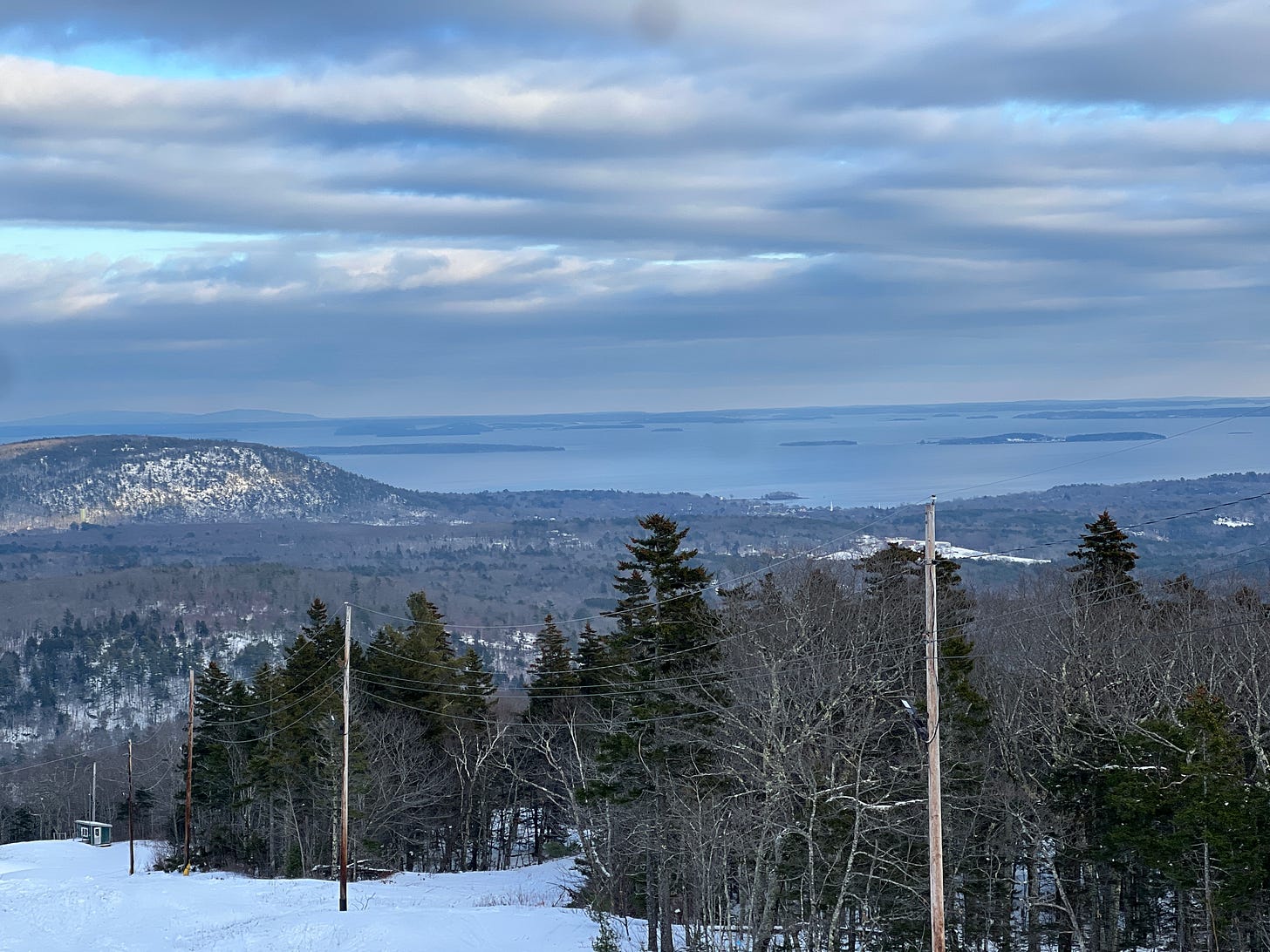
Now, there’s a reason why you can’t see the Atlantic Ocean from the top of very many ski areas. It’s because the Atlantic Coast is a lousy place to put a ski area. And Camden Snow Bowl does not get anywhere near the natural snow, at least on average, of Maine’s western monsters. Instead, Camden blows a lot of snow, and on my visit in January, mountain ops had blown a lot of snow. Unfortunately, that translated to just one top-to-bottom ski trail, which by the time I showed up at around 2 p.m. was pretty icy. So I took a few laps, snapped some photos, and bounced.
If you can help it, always try to arrive at a ski area during daylight hours, at least if it’s your first visit. And this is what I tried to do with Hermon Mountain – which joins “Snow Bowl” on the problematic-names list because it manages the trick of calling itself by two different names. Actually three:
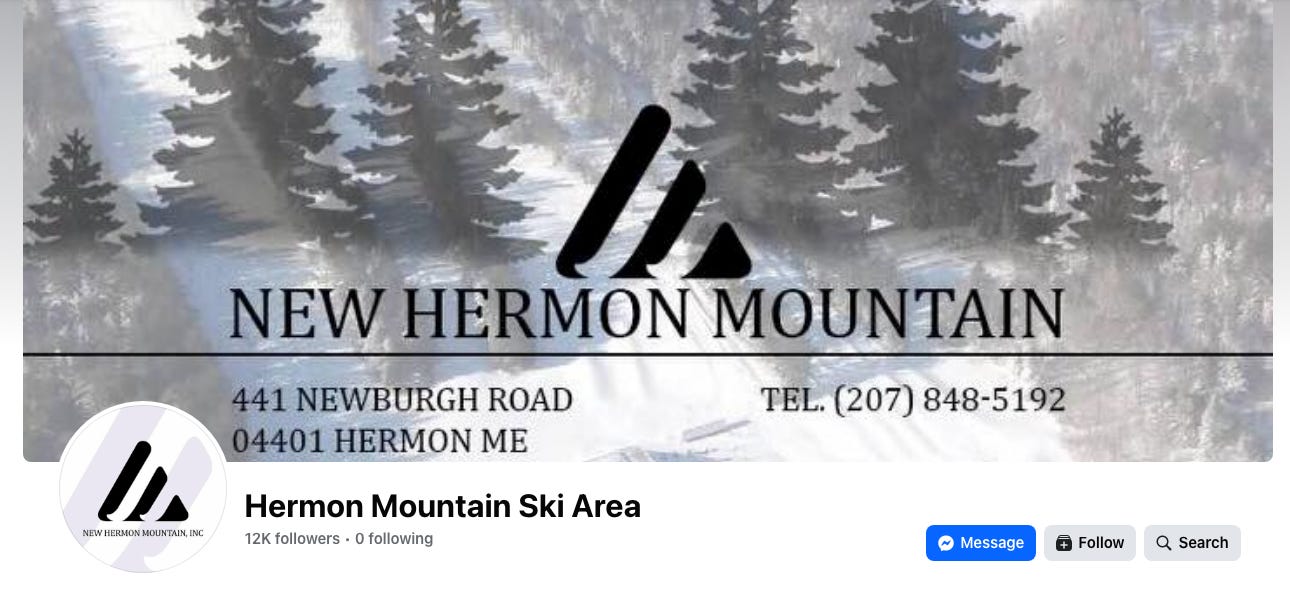
Trying to jam Hermon Mountain/New Hermon Mountain/New Hermon Mountain, Inc. into a day that had already included two ski areas in opposite directions from my hotel was ill-advised, and under different circumstances, I may have stowed this 276-footer for a better day. But the longtime owners had declared that they would shutter the place after this season if they couldn’t find a new buyer, and while the bump is under contract, I thought it best to take a few just-in-case laps.
Me and the rest of Bangor, Maine’s third-largest city (population 31,753). From the parking lot, I could see a line backed up dozens-deep across the snow beach at the base of the mountain. And I thought to myself, “Wow, I hope that’s not a line for lift tickets because I would sure hate to have to wait in that line.”
The good news is this wasn’t a line for lift tickets. The bad news is it was the line for Herman Mountain’s only chairlift, which sits exactly parallel to a T-bar that was for some reason idle. Which meant that I didn’t have to wait in that line once, but every single lift ride.
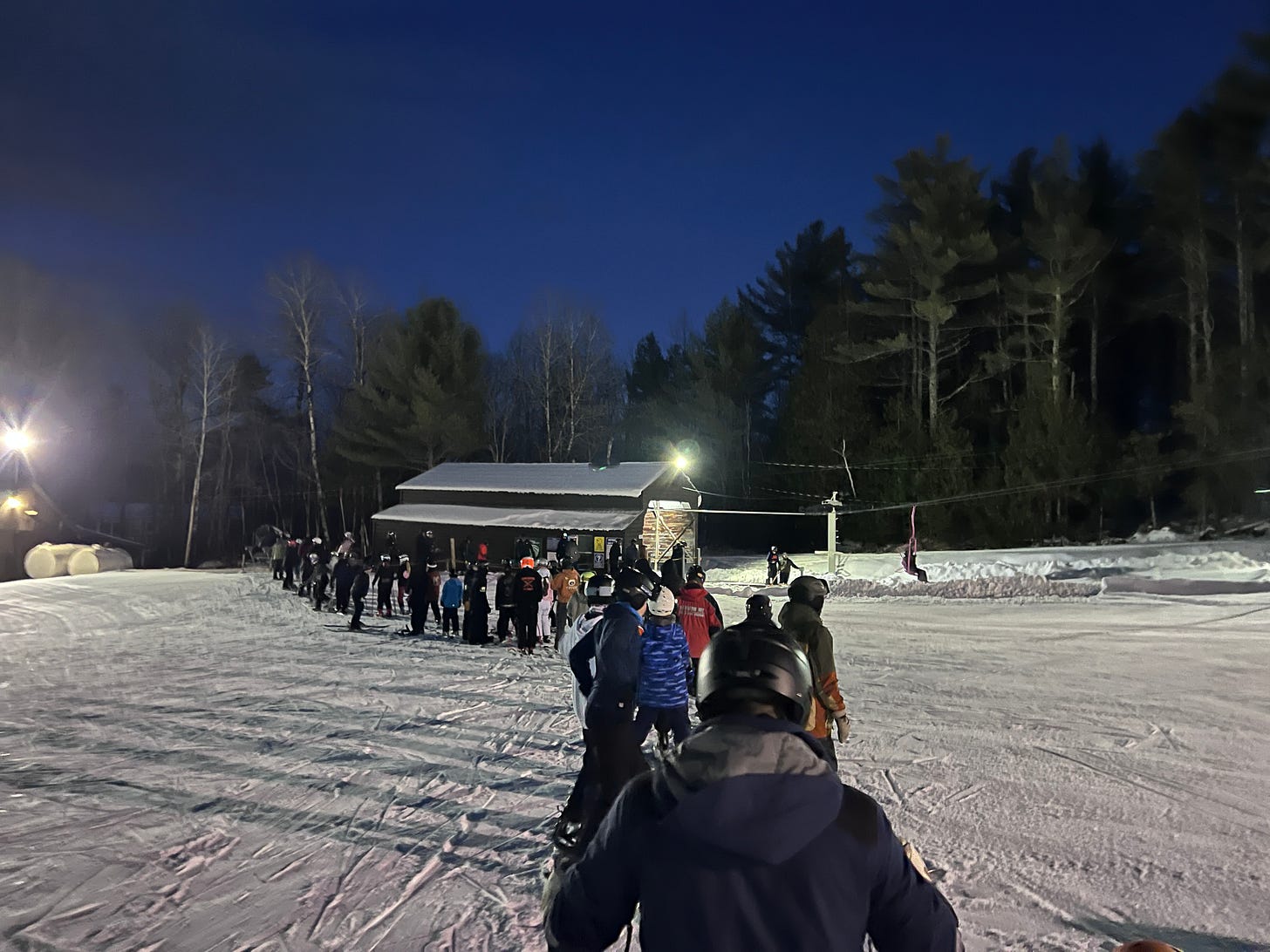
Which ended up being two lift rides. And the line actually moved pretty fast and, for a teenage scene, with great efficiency and order (Maine really is the best). But there was a lot of teenage energy pulsing through the bump. And after driving two hours up to Big Moose, two and a half hours back down to Camden Snow Bowl and an hour and change up to Herman Mountain, my Teen-O-Meter was out of gas. But, hey, I hope I can return next year.
Mt. Abram is the ski area you see as you drive out of Sunday River toward the interstate and say, “did that used to be a ski area?” Its close-cut trails don’t pop like Boyne’s megastar, and unlike Sunday River’s assortment of high-tech six- and eight-packs, which can be seen from space, it’s hard to make out Abram’s two antique double chairs from the road.
The ski area seems to be trying hard not to take itself too seriously, starting with its Rocky and Bullwinkle theme. Rocky and Bullwinkle, for those of you born after World War II, is a cartoon show that was popular in like the 1800s or something. Which was approximately 200 years after Mount Abram installed its base-to-summit Wayback Machine, a Hall chairlift which still runs, at least as an auxiliary component, on a straight-six Ford engine.* Here’s an Instagram reel where several hundred people probably tell me I’m an idiot for not giving a more complete engineering breakdown of how the various components of this chairlift work in tandem to transport skiers uphill.

*JK Bro-hombries, Abram installed Wayback in 1970.
But Abram, as it turns out, is an awesome little ski area. Fantastic grooming, with no icy patches, top to bottom, and liberal terrain management, with vast sections of off-piste available even on refrozen garbage snow.
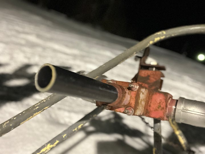
On my second off-piste run, I stumbled across this nifty multicolored, de-roped T-bar and skied down the line.
At the bottom, I ran into a patroller who told me that Abram had run that T-bar until around Covid, then abandoned it because the west side chair was working just fine as a beginner pod. I dug up some old trail maps and here’s the terrain he was talking about – the T-bar line I skied is the short red line labelled “Mini T-bar” on the far left:
That section marked “Hillside Condo” is actually an old trailpod that was served by yet another T-bar:
I’m not sure if Abram ever plans to bring back that beginner terrain. The mountain skis plenty big enough. This was, in fact, the only stop on the Storm Skiing Maine World Tour 2026 during which I recorded more than 10,000 vertical feet on Slopes.
There’s a feeling that I get at small ski areas that I’ve always failed to recreate at larger ski areas. Short shots down the narrow trails, skiing solo, fast, no fear of ice, weeds poking up, a down-bound time machine.
And T-bars. Two of them. Titcomb actually has one of the newest T-bars in America. Doppelmayr built it last offseason, a quick-turnaround replacement for a Constam T-bar that had arrived used in 1973, after a 20-year run as Cannon’s Lower T-bar.
If you want a contrast between what you think T-bars are and what modern T-bars actually are, find $30 and a day to visit Titcomb. The old T-bar, a Franken-lift that was maybe at one point a Poma and has been swinging up the hill since 1956, sounds like the inside of an atom bomb. The lift attendant wears earplugs and stands away from the lift when no one is actively loading.
The new T-bar? Its motor wouldn’t be audible over a running microwave. The Ts tug you uphill like a 3-year-old pulling you into ankle-deep lake water. It’s clean, smooth, and fast. The lift attendant can talk to you:
And of course the skiers were great. At the top of the old T, one kid asked me if I’d ever jumped off the cliffs over in the woods. I told him that, no, I’ve actually never skied here before, and besides, I think those trails are closed. “Closed is just another level of difficulty,” he said as he skied off into the forest.
Quarry Road is a ropetow bump that opened in 1937 as “Mountain Farm,” morphed into school-run “Colby College Ski Area” in 1964, went into mothballs around 1979, and sat dormant until the Waterville Parks and Recreation department purchased the bump and, with the help of an outfit called Friends of Quarry Road, re-opened the ski hill in 2021.
It’s a neat little outfit: one tow, a QR code to pay for your $15 resident lift ticket, a nice pitch, and a Slopes-measured vertical drop of 157 feet – about three times taller than most sources list the ski area’s vert. I took exactly one lap, which reminded me that ropetows and sore shoulders are a poor match. My next stop was scheduled to be Pinnacle Ski Club, a typical New England ski “club” where anyone appears to be able to ski if they show up with $20. The single-ropetow outfit was just half an hour straight up I-95. Which means I would have had to drive 30 minutes up 95. Reboot. Ski. Then drive half an hour back down 95, then six more hours home. Or I could just do the six hours right then. So I made a rare adult decision and turned the car back toward Brooklyn and was home by midnight.
So that was my Maine off Main Street Ski Safari. Not a lot of vert, but a lot of road, captured, as always, by Slopes, which buckets your stats together by trip:
I’m documenting my 2025-26 ski season with Slopes. Here’s a recap of days one through four:

BANGOR (BDN) — Maine’s Medicaid program lacks the proper controls to manage the billions of dollars going to health providers across the state, according to an audit released Thursday.
The findings from State Auditor Matt Dunlap’s office come amid a torrent of calls for increased scrutiny of how the state spends its MaineCare dollars and allegations of fraud, which has prompted another battle between President Donald Trump’s administration and Gov. Janet Mills.
Front and center in the growing debate is the embattled Portland health care provider Gateway Community Services, which is currently under investigation for potentially defrauding MaineCare largely through overinflated and underdocumented claims for interpreter services.
Dunlap’s report doesn’t mention either Gateway or interpreter services, but it does warn the state that inadequate monitoring of MaineCare could lead to federal regulators finding Maine out of compliance with its regulations. The state disputed that, but the watchdog’s words could add heat to a tense dispute between the Mills and Trump administrations.
Republicans stretching from top Medicaid regulator and former TV personality Dr. Mehmet Oz to the Maine Legislature are pressuring Mills on the issue during her heated U.S. Senate primary. Dunlap himself is running in a Democratic primary for Maine’s open 2nd Congressional District.
The Maine Department of Health and Human Services paused MaineCare payments to Gateway in December while it investigated “credible allegations of fraud.” The pause came as a result of an audit by DHHS that included a review of 15,000 claims made by Gateway between March 2021 and December 2022.
Dunlap’s report said the Program Integrity Unit, MaineCare’s internal auditing arm, “may not provide adequate monitoring of all Medicaid services. Medicaid programs are jointly funded by states and the federal government, but administration of the programs are mostly left to states.
In recent months, Oz has taken an increasing interest in how Maine is overseeing its program. He sent a letter demanding detailed information regarding the state’s oversight of Medicaid spending, outlining concerns and mentioning a federal criminal case against two interpreters who are charged with defrauding the federal government by filing false tax returns.
The case alleges that two interpreters filed false tax documents with the federal government showing their companies were paid for interpreter services that didn’t happen. The third defendant in the case was an employee of the Lewiston-based Bright Future Healthier You, who died after she was charged.
Bright Future Healthier You was the largest biller of MaineCare for interpreting services in the last 10 years. The company itself has not been accused of any wrongdoing.
The case is the first case the federal government has brought in Maine since a 2021 report by a federal investigator that outlined a suspicious billing pattern for interpreter services. The report highlighted that the billing patterns seemed especially prominent among providers working with Maine’s Somali community and indicated widespread fraud within the MaineCare system.
Gateway was the second-highest biller of interpreter services in the last 10 years and has been the subject of numerous fraud allegations dating back to May 2025, when The Maine Wire, the media arm of the conservative Maine Policy Institute, first reported on claims from a former employee that Gateway falsified records.
Oz’s letter followed an audit performed by the U.S Department of Health and Human Services that found that Maine had made at least $45.6 million in improper Medicaid payments for support services for children with autism in 2023.
In November, widespread federal fraud prosecutions began in Minnesota, and with them, the employee, Chris Bernardini’s claims resurfaced in national conservative news outlets. Then, in December, U.S. Rep. James Comer of Kentucky, the top Republican on the House oversight committee, sent a letter to the U.S. Treasury that identified Gateway, along with its founder Abdullahi Ali, as targets in a broader welfare fraud investigation.
The Maine Department of Health and Human Services disagreed with Dunlap’s finding, saying it resulted from a “misunderstanding” of the federal regulations and how the department is structured. The department also said Dunlap’s findings discounted the regular ongoing checks the Program Integrity Unit undertakes on a more regular basis.
Dunlap said his office wasn’t persuaded by the department’s criticism and that the department “did not provide evidence of utilization control review procedures.”

WARREN, Maine (WWTW) – Dog owners are being urged to take steps to protect their pets from a potentially deadly virus.
The Midcoast Animal Emergency Clinic in Warren said on Tuesday that it is seeing a significant increase in canine parvovirus cases throughout the Midcoast and Augusta areas. Clinic staff also said they have been told about possible contamination at Quarry Hill Dog Park in Portland. Our media partner WMTW has reached out to city officials to learn more about the reported contamination there and mitigation efforts.
A spokesperson for the City of Augusta said there had been no formal notification from the state indicating a confirmed outbreak in the area, but that they had heard, anecdotally, of local cases.
The Kennebec Valley Humane Society did temporarily close in November due to an outbreak of parvo.
As of Wednesday, the city was not implementing any closures or restrictions at local dog parks, but officials were developing educational materials to help inform residents about canine parvovirus, including prevention and symptoms to watch for. These resources will be shared on the city’s website, social media channels, and posted at local dog parks.
What is canine parvovirus?
Animal experts say canine parvovirus (CPV, or parvo) is one of the most serious viruses that dogs and puppies can get. It typically causes severe illness in young and unvaccinated dogs. Parvo is spread by contact with contaminated feces. The virus can also live on surfaces that have been contaminated.
Parvo primarily affects the body’s rapidly dividing cells, meaning the intestinal tract and bone marrow are the most affected.
There is no specific cure for parvovirus in dogs and puppies, but there are treatments and vaccination is highly effective at preventing the virus when administered as directed by veterinarians.
In September of 2025, several animals in Houlton tested positive for the virus.
At the time, WMTW reported there had been an increase in cases in Maine since late 2024.
In the fall of 2025, the Eastern Maine Emergency Veterinary Clinic said dogs were being brought into their facility with the disease almost every week.
Puppies are most vulnerable to the virus, but older dogs that are unvaccinated and/or have compromised immune systems are also at risk.
If your dog is experiencing symptoms such as vomiting, diarrhea, and extreme lethargy, you are asked to quarantine them from other dogs immediately and seek veterinary attention.
Copyright 2026 WABI. All rights reserved.

Iran-linked hackers have breached FBI Director Kash Patel’s personal emails | CNN Politics

Retired Detroit sergeant faces new sexual assault charge involving 14-year-old victim from 2002

Trump floats sending federal agents to San Francisco to tackle crime

Dallas ISD will offer free pre-K starting next school year

Norwegian Cruise Line offers a first look at Luna, new cruise ship setting sail from PortMiami – WSVN 7News | Miami News, Weather, Sports | Fort Lauderdale

Florida High School Football Rankings: Top 25 teams – Oct. 21

How old is Bo Nix? What to know about Oregon quarterback ahead of 2024 NFL Draft

Cleary's 21 help Le Moyne down Central Connecticut State 69-64 in OT

99th annual Pony Swim held in Virginia

Indiana Members Credit Union announced as new anchor tenant at Bottleworks District
Iran-linked hackers have breached FBI Director Kash Patel’s personal emails | CNN Politics

Live: CPAC 2026 Day 2

Video: Will ICE Change Under Its New Leader?

DHS shutdown breakthrough comes at cost for Republicans as funding fights nears end

Rubio joins crucial G7 talks as Iran war set to dominate second day
-

 Detroit, MI1 week ago
Drummer Brian Pastoria, longtime Detroit music advocate, dies at 68
-

 Science1 week ago
How a Melting Glacier in Antarctica Could Affect Tens of Millions Around the Globe
-

 Movie Reviews1 week ago
‘Youth’ Twitter review: Ken Karunaas impresses audiences; Suraj Venjaramoodu adds charm; music wins praise | – The Times of India
-

 Sports6 days ago
IOC addresses execution of 19-year-old Iranian wrestler Saleh Mohammadi
-

 New Mexico5 days ago
Clovis shooting leaves one dead, four injured
-
 Business1 week ago
Disney’s new CEO says his focus is on storytelling and creativity
-

 Technology5 days ago
YouTube job scam text: How to spot it fast
-

 Tennessee4 days ago
Tennessee Police Investigating Alleged Assault Involving ‘Reacher’ Star Alan Ritchson