Boston, MA
With snow still piled up, Boston says it’s time to remove your space saver


Mounds of snow continue to make getting around Boston difficult, and a new hurdle for drivers came Wednesday.
The city allows drivers to use space savers — objects placed in a street space that’s already been dug out — for 48 hours after the end of a snow emergency. That deadline came at 8 p.m. Wednesday.
“You have 48 hours to use a space saver after the end of a declared snow emergency,” the city wrote. “By 8 p.m. Wednesday, January 28, you need to remove it from the street.”
Boston added that space savers can never be used in Bay Village or the South End.
The Boston area experienced significant snowfall Sunday into Monday. While road crews have kept busy since then, huge piles of snow still sit along the sides of the city’s streets — which have become more narrow, along with sidewalks, as drivers and pedestrians are forced to navigate blocked paths.
“City gets rid of snow, I’ll get rid of my space saver,” the top comment under Boston’s Facebook post read.
A shortage of rock salt after one major storm is impacting preparation for more possible snow this weekend.
Residents living on Whiting Street in Roxbury told NBC10 Boston Wednesday that they weren’t surprised it took two days for a plow to come through. They said it’s frustrating, but they kept calling 311 until the snow was cleared.
“We’ve lived here since 1988,” said Bolade Owolewa. “It’s been a problem on and on.”
Boston requires property owners to remove snow from sidewalks within three hours of snow ending. Some remained unshoveled days later, including along Washington Street.
The city issues citations to property owners, but that doesn’t make it easier for people living in the area to get around.
“It’s very dangerous and it’s very slippery,” said Roxbury resident Sigal Pudasaini.
Getting around Boston requires some patience after this weekend’s snowfall, whether you’re walking or driving.



ATTLEBORO, Mass. (WJAR) — U.S. Immigration and Customs Enforcement Boston said Friday that it arrested a Barbados national during targeted operations in Attleboro.
ICE Boston said Irijah Jabarri Stowe Marshall is “a criminal illegal alien.”
According to officials, his criminal history includes a pending charge for failing to register as a sex offender in Massachusetts.
He was also previously convicted of attempted rape and aggravated sexual contact, ICE Boston said.

A 20-year-old Boston man is facing a series of charges after prosecutors say he shot at Boston Police officers during an attempted stop in Dorchester before leading them on a foot chase through neighborhood backyards.
Rasiel Carbuccia was arraigned in Dorchester District Court Thursday on a list of charges, including assault with a dangerous weapon, carrying without a license and possession of a large capacity firearm, stemming from the Wednesday night incident near Devon and Laredo streets.
Opened fire with ghost gun, prosecutors say
According to prosecutors, Boston Police officers attempted to stop Carbuccia when he pulled out a gun and began shooting, striking a Boston police cruiser before fleeing the scene.
Investigators said Carbuccia ran through backyards and hopped fences before he was taken into custody. Officers did not fire their weapons during the encounter.
Prosecutors said investigators later recovered the firearm along the path where Carbuccia had been running.
“It was determined that the firearm was a ghost gun, and it did not possess a serial number,” Suffolk County prosecutor Jacqueline Martinelli said in court.
Union says “everyone should be outraged”
Larry Calderone, president of the Boston Police Patrolmen’s Association, said the shooting is part of what he believes is a troubling trend of violence this summer and renewed his call for more officers on Boston streets.
“Everybody should be outraged. Bullets flying in the city’s streets at uniformed police officers. How can we possibly convince the general public that they’re safe to walk around their own neighborhoods?” Calderone said.
“We have teenagers pulling firearms and stealing mopeds from others in broad daylight. We have shots being fired at police officers in uniform, officers being attacked, people being shot daily that we can’t solve the crimes,” he added.
No one was injured in the shooting, but Calderone said the outcome could have been much worse.
“Thank goodness, neither officer or a pedestrian, an innocent child or somebody in the middle of the evening did not get killed last night. Just as thankful, at least they caught him. They recovered the weapon,” he said.
After the arraignment, Carbuccia’s attorney declined to discuss the case in detail but indicated mental health issues could become part of the proceedings.
“Ultimately as you guys know this is a process that has to play out and he’s presumed innocent and there’s going to be a number of things that are going to come out in respect to mental health and potentially the investigation, I don’t really have much more to say beyond that,” attorney Bob White told reporters.
According to prosecutors, Carbuccia had two open assault cases and an active warrant at the time of his arrest.
He’s being held in jail without bail and is scheduled to return to court later this month for a dangerousness hearing.

The Boston Red Sox will return to action on Friday to kick off the second half of the 2026 Major League Baseball season with a doubleheader against the Tampa Bay Rays.
The last few weeks have been incredible for Boston and have really gotten the organization right back into the thick of the playoff race. Beforehand, the Red Sox looked like one of the worst teams in baseball. Now, Boston is 46-48 and has won 14 of its last 16 games. It’s why you play the games. The MLB season is long and full of ups and downs. Sure, the first few months of the season were full of many down moments for the Red Sox, but they flipped a switch, got hot, and now are right back in the mix.
Now, there are just over two weeks to go until the 2026 trade deadline and Boston should be looking to add. But who should the Red Sox be targeting? Here are four intriguing options for Craig Breslow and the Red Sox’s front office to target.
Gleyber Torres — Detroit Tigers
The former longtime New York Yankee is a member of the Detroit Tigers and was slashing .280/.395/.395 with a .790 OPS, four homers and 18 RBIs before the All-Star break. Torres is on the Injured List, but has already begun a rehab assignment. Torres has the type of right-handed pop Boston’s lineup needs. Plus, he’s just 29 years old.
Luis Arráez — San Francisco Giants
Luis Arráez isn’t a right-handed bat and doesn’t have much power, but this is a guy with three batting titles under his belt and has a shot at another one. He’s batting .330 right now and would go a long way for Boston by getting on base towards the top of the lineup.
James Wood — Washington Nationals
This would be a pipe dream type of move. Wood is under team control for four more seasons and is just 23 years old, and yet he’s already a two-time All-Star. He blasted 31 homers last year and already has 28 this season in 97 games played. If the Red Sox could get a bat like his, they’d be all set. But it would cost quite a bit to pry him from Washington.
Isaac Paredes — Houston Astros
There are few players who were connected to Boston more this past offseason than Isaac Paredes. The Astros don’t look like a team that is going to sell, but Paredes is still worth a call. Houston traded Lance McCullers Jr. to the Milwaukee Brewers on Wednesday in a salary dump.
 Add us as a preferred source on Google
Follow
-

 Los Angeles, Ca1 hour ago
LADWP begins long-term repairs after West Hollywood water main rupture
-

 Detroit, MI2 hours ago
Livestream: Mayor Sheffield, Detroit health chief to address wildfire smoke threat
-
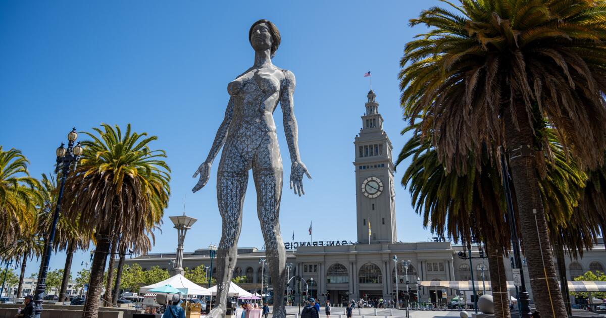 San Francisco, CA2 hours ago
A sculpture of a giant naked woman goes on sale in San Francisco. Bring a crane
-

 Dallas, TX2 hours ago
No ‘straight answer’: Why Pioneer Cemetery is the latest battleground at City Hall
-

 Miami, FL2 hours ago
TSA hosts news conference ahead of World Cup third place match at Miami Stadium
-

 Boston, MA2 hours ago
ICE Boston arrests Barbados national during targeted operations in Attleboro
-

 Denver, CO2 hours ago
Denver Broncos training camp is 2 weeks away
-

 San Diego, CA3 hours ago
Daily Business Report: July 17, 2026, San Diego Metro Magazine

