Colorado
Colorado GOP chair doesn’t think Rep. Lauren Boebert’s 2024 district switch ‘was the best move’

The head of the Colorado Republican Party on Thursday questioned Rep. Lauren Boebert’s (R-Colo.) surprising decision to quit her re-election race in the Centennial State’s 3rd Congressional District to instead run in the more GOP-friendly 4th District.
By making the switch, Boebert will avoid facing Democrat Adam Frisch in a rematch of the 2022 midterms, whom she beat by a razor-thin 546-vote margin, and instead vie for the seat being vacated by retiring Rep. Ken Buck (R-Colo.).
“From a party perspective, we certainly don’t think it was the best move,” Colorado GOP Chairman Dave Williamson said of Boebert’s 2024 gambit during an interview with CNN.
“We felt that she was best suited for Congressional District 3 and that she was in the best position to win re-election and retain that for Republicans,” he added.
The 3rd District leans 9 percentage points in favor of Republicans compared to the 27 percentage-point advantage the GOP has in the 4th District, according to the Colorado Sun, which cited an analysis of election results from 2016 to 2020 conducted by Colorado legislative staffers.
In a Facebook post Wednesday announcing her decision, Boebert argued that “dark money” from “Hollywood elites and progressive money groups” is being deployed to personally target her in the 3rd District – where Frisch has raised more than four times as much funds as Boebert in the most recent quarter.
She contends that by switching districts, Republicans stand a better chance of keeping both seats in Congress.
“We cannot lose the third and Colorado’s Fourth District is hungry for an unapologetic defender of freedom with a proven track record of standing strong for conservative principles,” she said in the post. “We have to protect our majority in the House, win the Senate and win the presidency.”
Boebert is not required to reside in the 4th District to represent it, but Williamson suggested that the 37-year-old lawmaker might have trouble defending the switch to voters.
“Time will tell whether or not we’re right, but I think she’s got a serious challenge on her hands trying to explain to the voters of [the 4th District] why she thought it was necessary to leave [the 3rd District] and have a better chance at keeping her seat in Congress,” Williamson said. “It’s kind of a problematic proposition. But it’s again, it’s something for the voters to decide.”
Frisch, a former Aspen City Council member, slammed Boebert over the move in an X post on Thursday,
“This just proves Lauren Boebert was never committed to the communities of CO03,” he said. “She is only in politics for herself.”
“Boebert is running scared from CD-3 because she knows she can’t match our campaign’s ability to connect with voters and the hard work we have put in to provide them with a common sense voice in Congress,” Frisch said in a separate statement.

Colorado
Denver bracing for at least 96+ hours of dangerously cold air, several inches of new Colorado snow on the way

An arctic front will sweep through Colorado Friday afternoon with dangerously cold air and accumulating snow lagging behind it for the holiday weekend.
This is a long duration event in the Denver metro area and across that state. At least 96+ hours will be spent below freezing and two waves of snow are likely.
Confidence is increasing in detail for the first wave of snow and cold but decreases as we begin to focus on the reinforcing shot of cold air and additional snow chances on Sunday.
Here is everything we know to a high degree of confidence:
- An arctic front will sweep through the state from the northwest to the southeast on Friday evening. Snow will lag an hour or two behind the front. Exact timing will be key for potential impacts to the evening commute.
- Another reinforcement of cold air on Sunday, Monday will likely be the coldest day of the blast.
- Odds for another round of snow Sunday night into Monday are increasing.
Now for the nitty gritty…
Arctic front arrives Friday afternoon, snow arrives by evening
There will be a nice start to the day Friday with highs reaching the 40s by the noon. An arctic front approaches in the afternoon and sweeps through the state from northwest to southeast. You’ll feel it as the front passes as temperatures will plummet int he matter of an hour.
Exact timing of the front is uncertain, if it comes a bit ahead of schedule travel impacts are expected for the Friday evening commute. This is an aspect of the storm we will continue to fine-tune. Flash freeze potential will be high at the onset of snow across both I-25 and the mountains. With near-record heat out ahead of the arctic front, it will take roads an hour or two to drop in temperature. This means melted snow will freeze up.
Snow lingers on-and-off on Saturday, things start getting cold
On-and-off snow will linger through Saturday evening. I’m still favoring a general 2-5″ across the Front Range with 5-9″ for the foothills and portions of I-70. he snow will be dry and fluffy, this means it can accumulate quicker, and these types of systems tend to have a better chance of overperforming. Additionally, banding will be involved. This means a few bands of heavier snow only a few miles wide develop. Those under the heavier bands will pick up a lot of snow, while those outside the band get robbed of moisture and typically end up on the lower end.
At one point Saturday was the day to watch for extremely cold windchills. The timeline of the extreme cold will be delayed until Sunday. For now windchills will bottom out in the single digits.
Reinforcing shot of cold air arrives Sunday, more snow
Another arctic front will surge across Colorado on Sunday bringing downright bone chilling air. This is where things get interesting temperature-wise. As of now we are forecasting 10 degrees as the high in Denver, but this may need to come down a degree or two. By evening, temperatures plummet below 0 and light snow will spread across much of the state.
Frigid Monday and Tuesday morning
Monday is the day of cold… snow will come to an end and life-threatening wind chills will swoop in. As of now, 6 degrees is the forecast high, but this too may need to be lowered to near 0 degrees. Wind chills will be below 0 degrees all day, reaching a peak Monday night into Tuesday. Wind chills will plummet to -35 degrees with actual temperatures well below 0.
Stay tuned to CBS Colorado newscasts for updates on the severity of cold and snow headed our way.
Colorado
Colorado weather: How cold will it get when arctic blast hits this weekend?

Colorado is set to see a freezing weekend as snow and a bitterly cold arctic blast of air moves into the state on Friday, according to the National Weather Service.
Wednesday and Thursday will be the last semi-warm days before temperatures begin to drop, NWS forecasters said.
Snow arrives Friday
Light snowfall will begin in Colorado’s mountains at about 11 a.m. Friday, move into the Front Range and Denver area in the afternoon and reach the Eastern Plains in the evening, according to NWS forecasters.
How much will stick is still up in the air, but several inches of dry, fluffy snow is expected, especially near the foothills, NWS forecasters said in a Hazardous Weather Outlook.
Other weather services, like AccuWeather, are calling for 4 to 8 inches of snow in Denver and its surrounding suburbs from Friday into Saturday.
Colorado’s mountains, including peaks as high as Mount Elbert and mountain towns like Estes Park, are expected to get 3 to 6 inches of snow this weekend, according to AccuWeather. The Eastern Plains are forecast to get 2 to 4 inches.
Overnight Friday, temperatures across the state will dip into single digits, NWS forecasters said.
Chilling Saturday temps signal first subzero weather in Denver for the season
Once temperatures start to drop Friday, they won’t come back up until Tuesday.
Saturday will mark Denver’s first chance for subzero temperatures of the season, according to NWS forecasters. Though the snow will wrap up at about 11 a.m., temperature highs won’t rise above the teens in the metro area and could fall to around minus 2 degrees overnight.
The Eastern Plains will see similar overnight temperature lows of minus 2, but “blustery” wind conditions could make it feel even colder, NWS forecasters said.
In the mountains, snow will continue to fall throughout the day and overnight Saturday, forecasters said. Temperatures will drop to minus 6 overnight before any windchill.
Northern Colorado, including Walden and Kremmling, will see temperatures as low as 13 degrees below zero overnight Saturday, according to NWS forecasters.
Snow, negative temps return Sunday
Snow will return to the Front Range and Eastern Plains on Sunday, but little to no new accumulation is expected, NWS forecasters said.
Most of the state will see temperature highs between 10 and 12 degrees on Sunday before dropping back into or near the negatives, forecasters said.
Denver will see a high of 11 degrees and overnight temperatures as low as minus 5 degrees, according to NWS forecasters. The Eastern Plains could be as cold as minus 10 degrees Sunday night and the mountains will see low temperatures between minus 1 and minus 8.
The cold could feel even worse with wind chill, forecasters said.
The western slope, including Delta and Cedaredge, will barely escape the weekend without temperatures going below zero. The area is forecast to scrape by with overnight lows near 1 degree.
Monday to be the coldest day of the weekend’s winter weather
The coldest day of the arctic blast will be Monday, where “highs may struggle to get much above zero,” NWS forecasters said.
“Low temperatures could reach minus 10 to minus 20 across the I-25 corridor and Eastern Plains with the lowest temperatures occurring Monday night,” forecasters said in a Hazardous Weather Outlook. “With breezy conditions, wind chill values may reach minus 30.”
Northern Colorado will be the coldest part of the state Monday. In Walden, temperatures will hover around 3 degrees during the day and drop to 25 degrees below zero overnight, forecasters said.
It won’t be quite as cold in the Denver area, but forecasters said the city will see temperature highs near 7 degrees and overnight lows of minus 12. Temperatures in the Eastern Plains and mountains could drop even lower, with overnight temperatures of 15 to 20 degrees below zero.
Temps begin to warm up Tuesday
Temperature highs will escape the teen and single-digit cage on Tuesday, warming up to 33 degrees in Denver and the mid-20s across the mountains and Eastern Plains.
Get more Colorado news by signing up for our daily Your Morning Dozen email newsletter.
Originally Published:
Colorado
Toyota Game Recap: 1/14/2025 | Colorado Avalanche

ColoradoAvalanche.com is the official Web site of the Colorado Avalanche. Colorado Avalanche and ColoradoAvalanche.com are trademarks of Colorado Avalanche, LLC. NHL, the NHL Shield, the word mark and image of the Stanley Cup and NHL Conference logos are registered trademarks of the National Hockey League. All NHL logos and marks and NHL team logos and marks as well as all other proprietary materials depicted herein are the property of the NHL and the respective NHL teams and may not be reproduced without the prior written consent of NHL Enterprises, L.P. Copyright © 1999-2024 Colorado Avalanche Hockey Team, Inc. and the National Hockey League. All Rights Reserved. NHL Stadium Series name and logo are trademarks of the National Hockey League.
-
/cdn.vox-cdn.com/uploads/chorus_asset/file/25822586/STK169_ZUCKERBERG_MAGA_STKS491_CVIRGINIA_A.jpg)
 Technology7 days ago
Technology7 days agoMeta is highlighting a splintering global approach to online speech
-

 Science4 days ago
Metro will offer free rides in L.A. through Sunday due to fires
-
/cdn.vox-cdn.com/uploads/chorus_asset/file/25821992/videoframe_720397.png)
 Technology1 week ago
Technology1 week agoLas Vegas police release ChatGPT logs from the suspect in the Cybertruck explosion
-

 Movie Reviews1 week ago
‘How to Make Millions Before Grandma Dies’ Review: Thai Oscar Entry Is a Disarmingly Sentimental Tear-Jerker
-
 Health1 week ago
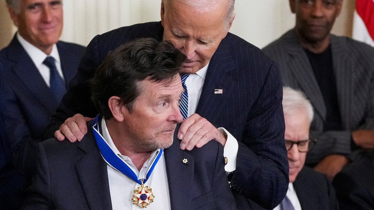
Michael J. Fox honored with Presidential Medal of Freedom for Parkinson’s research efforts
-

 Movie Reviews1 week ago
Movie Review: Millennials try to buy-in or opt-out of the “American Meltdown”
-

 News1 week ago
Photos: Pacific Palisades Wildfire Engulfs Homes in an L.A. Neighborhood
-

 World1 week ago
Trial Starts for Nicolas Sarkozy in Libya Election Case


