Alaska
Valdez, Alaska, Report: 9-Runs in Explosive Powder on Phenomenal Terrain on Day #1 – SnowBrains

Report from April 7, 2024
(if you would like to heli-ski with Miles this April please email us: contact@snowbrains.com)
Sunday was the first day of my 2024 Alaska ski season.
This is my 3rd season heli-ski guiding for Pulseline Adventure and my 16th spring in Alaska.
I consider skiing up here a completely different season because there’s nothing else like it.
There’s not even a great way to prepare for skiing here – except maybe to ski your ass off before you get here.
I arrived in Valdez, AK, on Thursday night and spent Friday and Saturday grinding through guide training.
- Medical component
- Helicopter safety component
- Crevasse rescue component
- Dispatch component
- Fueling component
- Avalanche rescue component
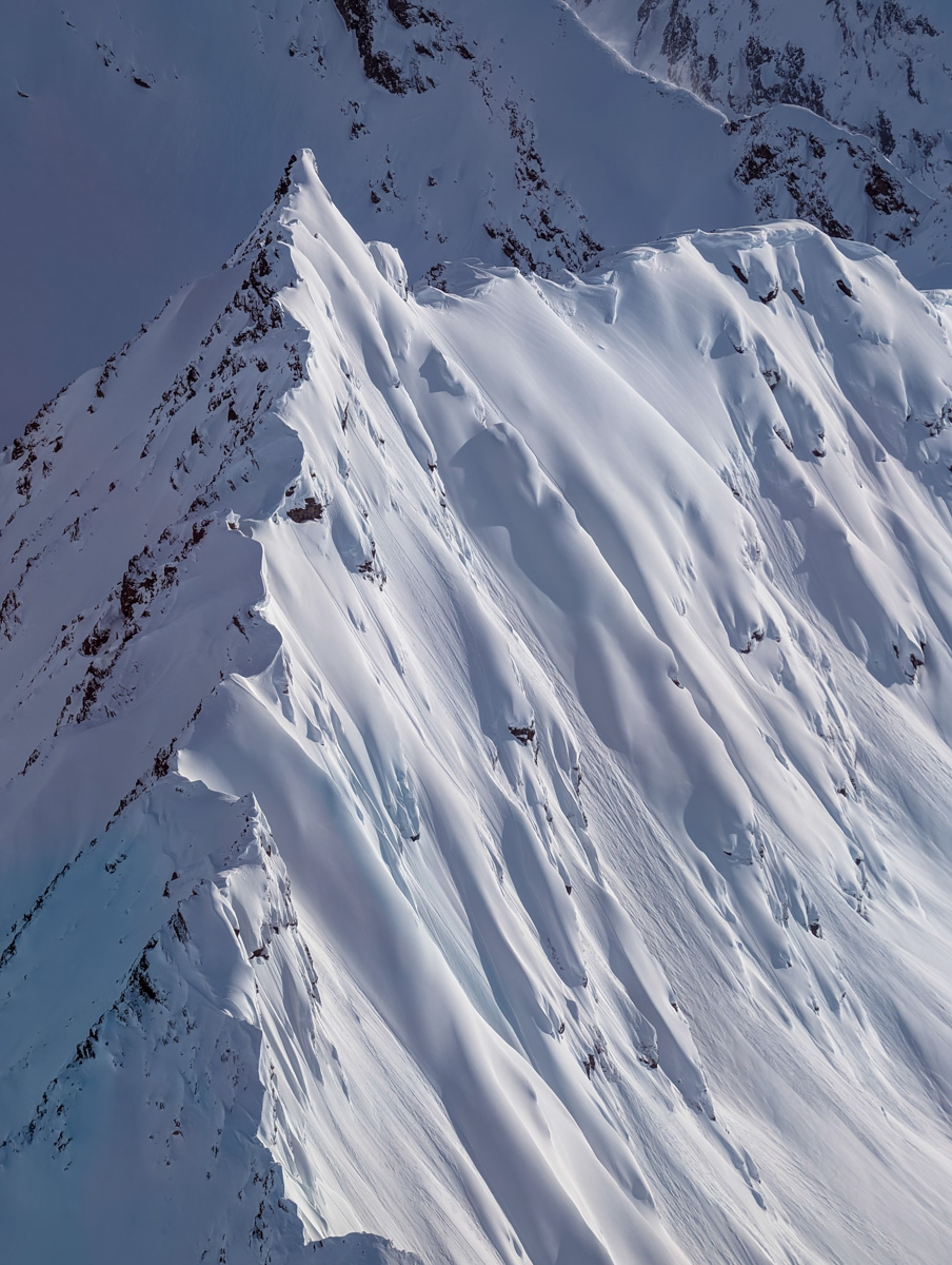
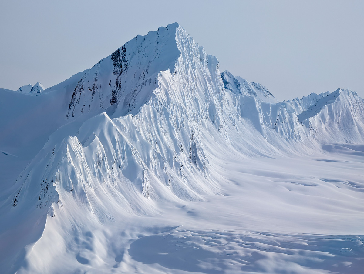
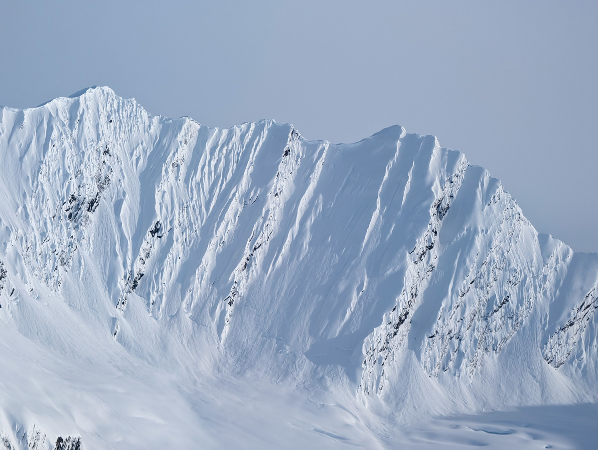
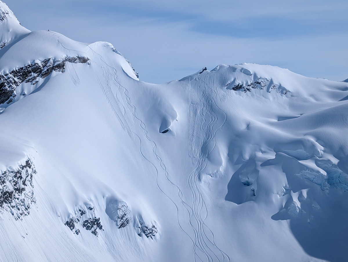
On Sunday it was truly a sun day and game on.
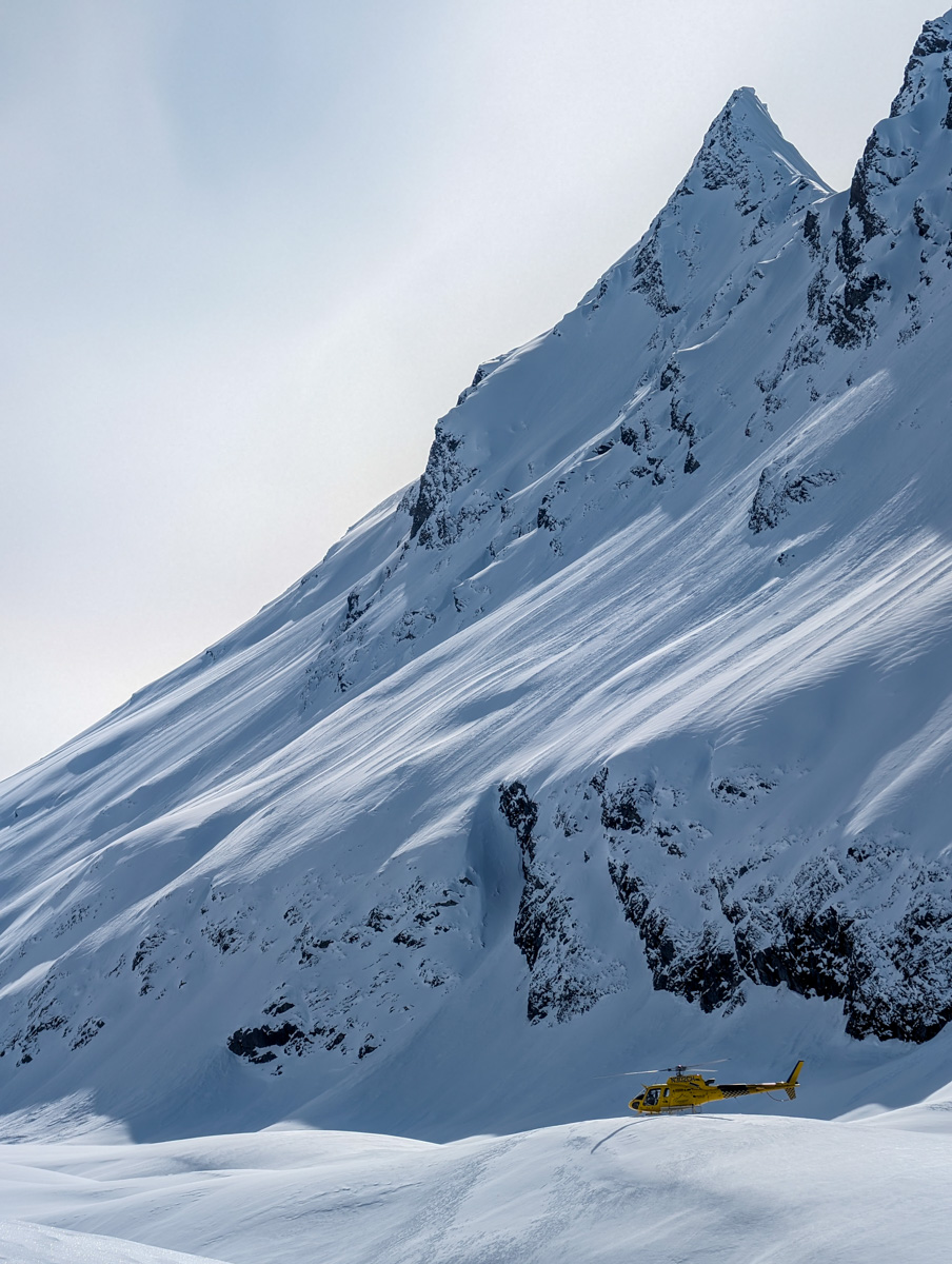
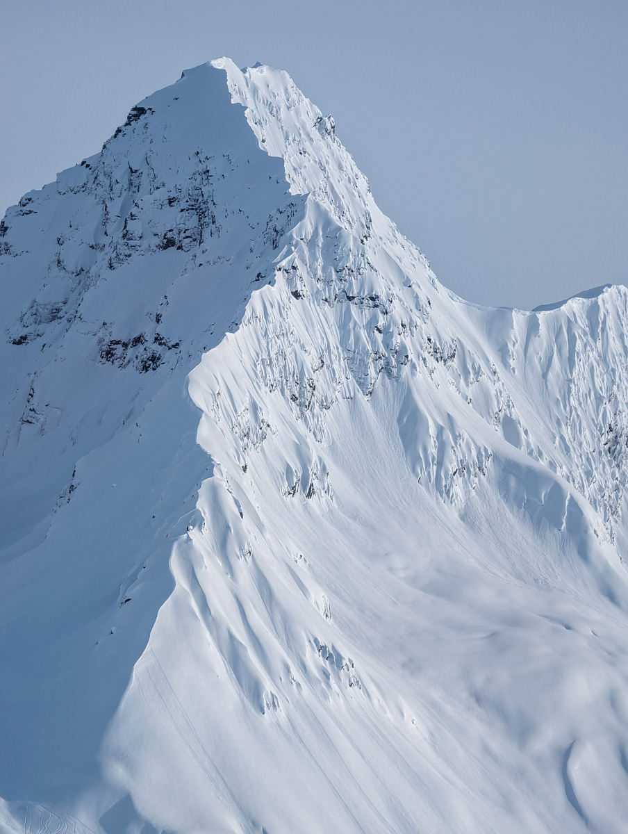
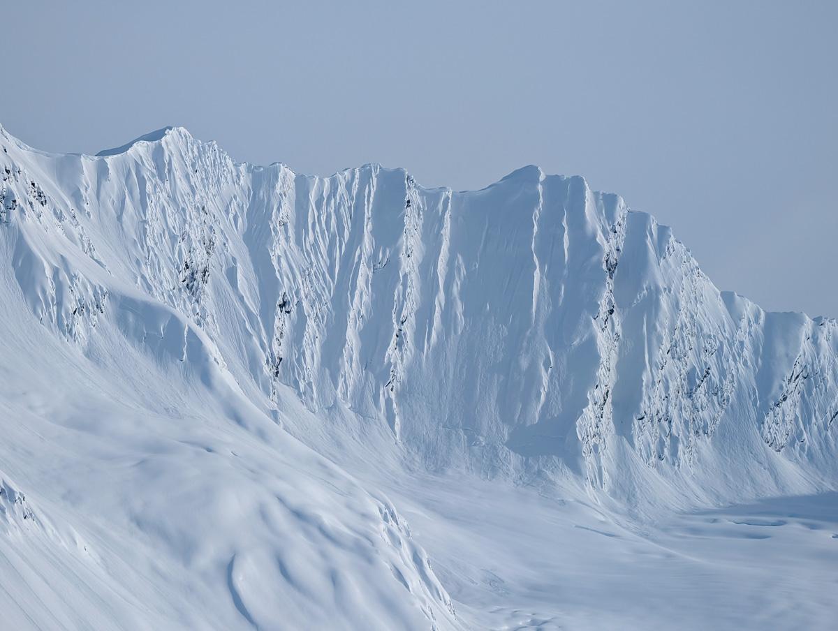
We skied 9 runs in the most explosive snow I’ve skied all season.
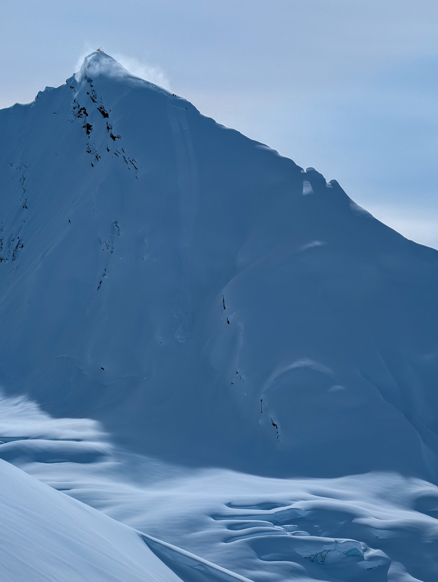
We rolled straight out to the Wortmanns Glacier area and skied a fun warm-up run in blower powder and dramatic light.
Then we hit “Vito’s” off The Deserted Glacier and took it 2,800-vertical-feet down to the glacier below.
From there we bounced over to the Tasnuna Glacier – a zone I’ve never skied in.
The Tasnuna is full of ramps, terrific terrain, and on this day, unmatched crystaline powder.
We got right into and skied 7 splendid runs in a very tight zone being very efficient.
One ramp we liked so much that we skied it twice.
We also hit “The Hammer” twice as it was splendiferous on our first run, then surreal on our last run of the day as the evening light began to grace it.
My clients Toby, Steven, and Gary were beyond stoked.
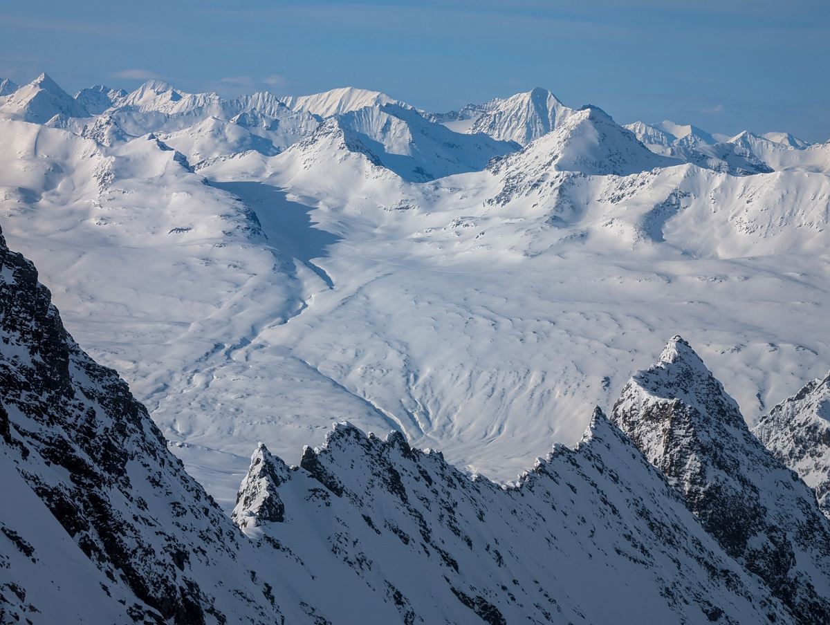
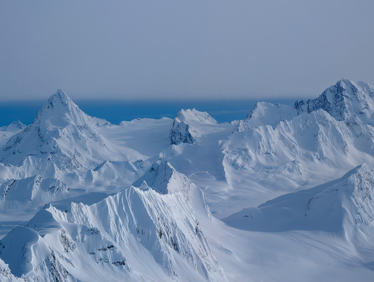
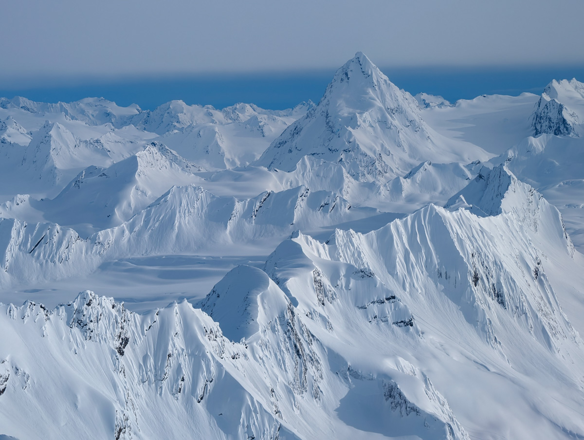
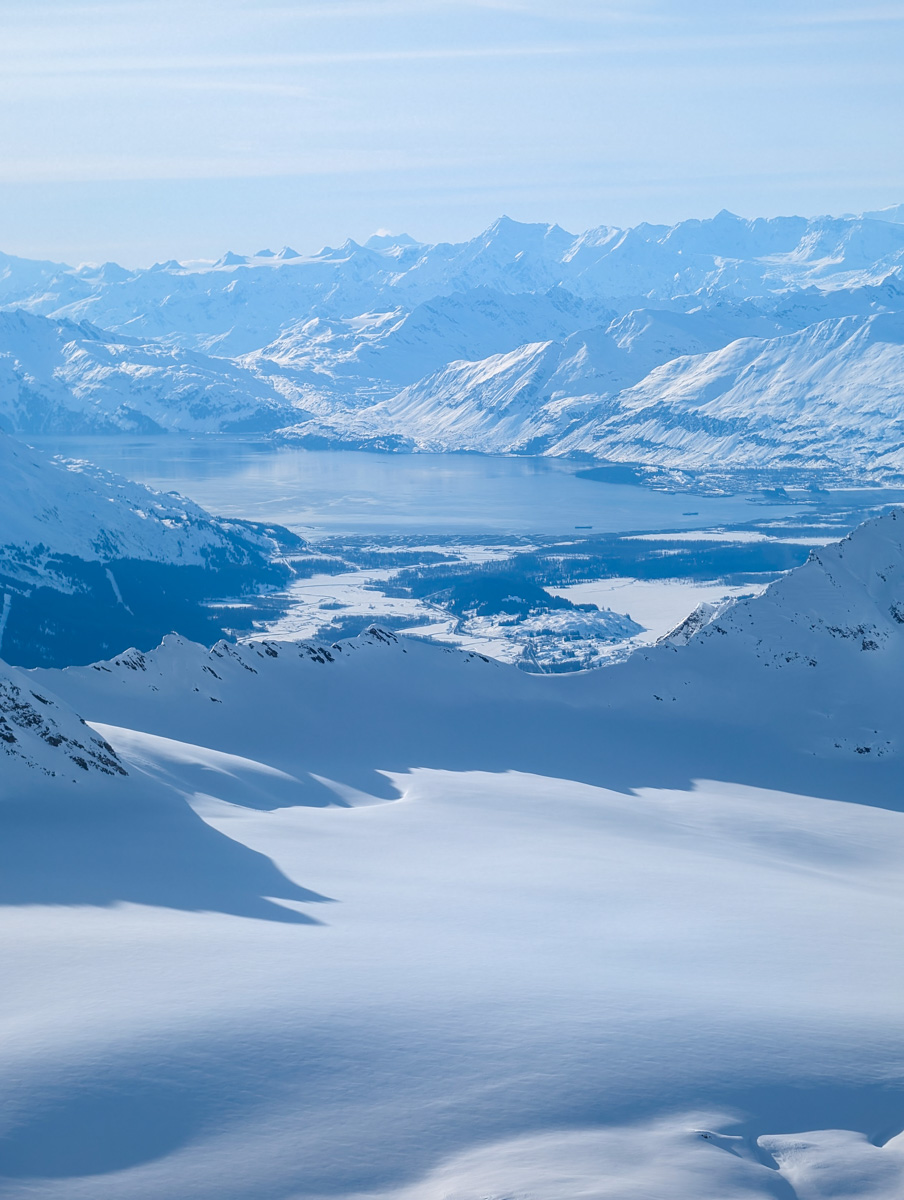
We flew back to the airport suffering from severe glee.
The views of Pontoon and friends on the trip home bent our minds.
Dinner at Growler Bay with the clients was a stoke-fest full of smiles, cheers, and speeches.
And a plethora of “…the best day of my life” proclamations.
I collapsed into bed at 11pm simply buzzing…
I’m feeling extremely grateful.
What a world we live in…
Thanks, Alaska!


You might also like:


I grew up greeting friends and neighbors on my walk to my neighborhood Anchorage public school, just as my kids do now. It’s an essential, and value-added, part of living in our community.
In the late 1990s, when I attended Service High School, I had amazing teachers. My AP chemistry teacher left the oil and gas industry to teach. He could have earned significantly more money in another field, but teaching was competitive enough, given pensions and compensation, that he stayed in the job he loved and gave a generation of students a solid foundation in chemistry.
Now, my kids, who are in first, third and fifth grade, face a different reality. Teachers across our state are leaving in droves. Neighborhood schools across Alaska are closing. Art and music are being combined, which is nonsensical — they are not the same and they are both valuable independently. When he was in second grade, my oldest had a cohort of more than 60 students in his grade — split between two teachers. When he enters sixth grade next year, there will be no middle school sports and he will lose out on electives. Support systems and specialists to help when kids are falling behind have been cut. I’m lucky that my children have had amazing teachers, but many excellent teachers are nearing retirement age or don’t have a pension and are pursuing other careers. What happens then?
Despite skyrocketing inflation, last year was the first time in years that our schools received a significant increase in the Base Student Allocation — and that money doesn’t begin to make up for what they have lost over the years. Even that increase had to overcome two vetoes from what a recent teacher of the year calls “possibly the most anti-public education governor in the history of Alaska.” Shockingly, my own representative, Mia Costello, despite voting for the increase, failed to join the override to support education. She has failed to explain that decision when asked.
State spending on corrections is up 54% since 2019; meanwhile, spending on education is up only 12% in the same timeframe. Schools are now working with 77% of the funding they had 15 years ago when accounting for inflation.
When we starve our public schools of funding, Alaska families leave. No one wants their child to suffer from a subpar education and the lower test scores and opportunities that come with it. A significant number of people are working in Alaska but choosing not to raise their families here.
To the elected officials who preach school “choice” but starve public schools: our family’s choice is our neighborhood school. It’s our community. It’s where our friends are. Neighborhood public schools, which are required to accept all children, should be the best option out there. Public schools should be a good, strong, viable option for communities and neighborhoods across our great state. Once, they were.
I am thankful for those in the Legislature working to solve these problems. This includes HB 374, which raises the BSA by $630, and HB 261, which would make education funding less volatile.
It breaks my heart that across the state, dedicated teachers keep showing up for our kids while being underpaid and undervalued. Underfunding our schools is also a violation of Alaska’s constitution, which requires “adequate funding so as to accord to schools the ability to provide instruction in the standards.”
Not so long ago, Alaska’s public schools were adequately funded, and they produced well-educated students and retained excellent teachers. It’s up to all of us to reach out to our elected officials and urge them to make that the case once again.
Colleen Bolling is a lifelong Alaskan and mother of three who cares deeply about Alaska’s schools.
• • •
The Anchorage Daily News welcomes a broad range of viewpoints. To submit a piece for consideration, email commentary(at)adn.com. Send submissions shorter than 200 words to letters@adn.com or click here to submit via any web browser. Read our full guidelines for letters and commentaries here.

ANCHORAGE, Alaska — Karen Burnett spends most days in the sorting room at the Food Bank of Alaska, ensuring every donated item finds its place.
The Anchorage woman dedicates her time to sorting, packing and organizing food donations.
Finding purpose after loss
Burnett’s journey at the Food Bank of Alaska began after a personal loss. Following the death of her husband, Burnett said she found herself with time on her hands and a desire to help.
“I had a friend who had talked to me about it, and it just sounded like a good thing to be out doing,” she said.
Burnett now volunteers between 500 and 600 hours each year.
“I started, but it got to be so fun. I spent more and more time here,” Burnett added.
Understanding community need
Burnett has witnessed the growing need in the community, particularly as more families struggle to make ends meet.
“If you took a look at the pantry and saw those empty shelves, it’s hard sometimes when you know people are coming in and looking for something, for their clients, and there’s absolutely nothing in there,” Burnett said.
Her dedication has made a lasting impact on countless families.
“I just feel real involvement in a way that is appreciated,” Burnett said. “You know, people need this food. They need people to put it out for them.”
See the full story by Ariane Aramburo and John Perry.
Copyright 2025 Gray Media Group, Inc. All rights reserved.

Alaska is home to some of the most remote and quietest communities in the US, where year-round populations are often well under 3,000. Their isolation has shaped communities along fjords and glaciers, with hundreds of Alaskan communities accessible only by air or water, including Tenakee Springs on Chichagof Island and Sitka on Baranof Island. Girdwood is another tranquil spot right in the heart of the wilderness, but it is home to Alyeska Resort, for those travelers who want comfort during their trip. Tour historic fishing villages on the Kenai Peninsula and ferry-linked communities in the Inside Passage, in these quietest Alaska towns.
Girdwood
Girdwood is a mountain valley community in the Chugach Mountains and a haven for nature lovers seeking a quieter environment. Despite its size, Girdwood supports a concentrated outdoor recreation sector, including guided hikes, kayaking, flightseeing, ATV rides, and seasonal dog-sledding adventures. Only a one-hour drive from Anchorage, this small town is defined by its mountain setting and glacier-fed rivers.
One of the biggest drivers of traffic to Girdwood is Alyeska Resort, a luxury resort at the base of Mount Alyeska. The resort features alpine ski slopes in winter and meadows of wildflowers in summer. For visitors wanting to explore beyond the resort itself, Alyeska also coordinates guided excursions into nearby wilderness areas.
Girdwood also sits near the Chugach National Forest trail system, where forest hikes and wildlife viewing opportunities are widely available. Chugach is the second-largest national forest in the United States, covering 5.4 million acres and offering more than 60 trails through temperate rainforest, alpine terrain, and glacial valleys. Another scenic way to experience the area is aboard the Alaska Railroad. The railway runs through coastal and alpine landscapes and connects travelers to excursions such as Kenai Fjords cruises, Resurrection Bay wildlife tours, and other regional sightseeing trips.
Haines

Haines sits between fjords and snow-covered peaks. Its mountain-enclosed coastal setting, laid-back pace, and frequent wildlife sightings make it a notable destination for outdoor recreation. Glacier-fed waters support activities such as fishing and kayaking, while nearby trails allow hikers to explore the surrounding landscape.
Haines is home to the Chilkat Bald Eagle Preserve, which protects roughly 48,000 acres of habitat supporting the world’s largest recorded population of bald eagles. The preserve also safeguards the salmon run and supports other wildlife, including mountain goats, moose, swans, and bears. Visitors are asked to remain in designated viewing areas to minimize disruption to wildlife.
The town also preserves a historic military site. Fort William H. Seward, built in 1902 during a border dispute period between the United States and Canada, is the last remaining Gold Rush-era military post in Alaska. Located only a ten-minute walk from downtown along the waterfront, the site includes preserved barracks, officers’ homes, and parade grounds that can typically be explored in one to two hours.
The surrounding waterways further define Haines’ landscape. Lutak Inlet and Chilkoot Lake sit at the foot of the Takshanuk Mountains and provide opportunities for boating, canoeing, kayaking, and fishing. The ten-mile drive to Chilkoot Lake features several scenic pull-offs overlooking the inlet where birds and marine life are often visible.
Ninilchik
This fishing village on the Kenai Peninsula is known for its coastal sunsets and quiet beaches. Located 180 miles south of Anchorage and 35 miles north of Homer, Ninilchik is a historic settlement and an active fishing village. A prominent local landmark is the Holy Transfiguration of Our Lord Chapel, an iconic Russian Orthodox church often photographed by visitors. Built in 1901, the bluff-top structure features five golden onion domes and stands beside a historic Russian Orthodox cemetery. From the site, there are sweeping views across the Cook Inlet toward volcanoes on the western horizon.
For outdoor recreation, the Ninilchik River and Cook Inlet provide fishing areas and beach access. Tide-walking and coastal fishing are common activities, and the beaches offer clear views of the volcanoes across the water.
Ninilchik also hosts Salmonfest each summer. The three-day event features more than 60 bands across four stages along with camping, food vendors, local brews, and salmon-themed artwork, while also supporting educational programming and conservation initiatives focused on Alaska’s salmon fisheries.
Sitka
The seaside community of Sitka on Baranof Island, known for its Indigenous heritage with visible Russian historical influence, is only accessible by air and sea. The town is surrounded by fjords, boreal forest, and glacial landscapes along Alaska’s Inside Passage. Marine wildlife viewing is a common activity in Sitka’s coastal waters. Whale-watching tours, sea kayaking excursions, and guided boat trips provide opportunities to see humpback whales, sea otters, and other marine species. Visitors who prefer to stay on land can visit Whale Park, where shoreline viewpoints sometimes offer glimpses of whales offshore.
One of Sitka’s most recognizable landmarks is St. Michael’s Cathedral. Constructed between 1844 and 1848, the Russian Orthodox cathedral features traditional onion domes and gold-colored crosses, reflecting Russia’s cultural presence in Alaska during the 19th century.
Another well-known site is the Alaska Raptor Center, which rehabilitates injured birds of prey before releasing them back into the wild. Located on a 17-acre campus bordering Tongass National Forest, the facility includes a large flight-training aviary where visitors can watch eagles, hawks, and owls during rehabilitation.
Petersburg
Often called “Little Norway,” Petersburg maintains strong Scandinavian cultural traditions alongside its active fishing industry. Each year, the community hosts the Little Norway Festival, celebrating Norwegian Independence Day with parades, folk dancing, traditional costumes, and food booths featuring local seafood and Norwegian dishes. Local history is also preserved at the Clausen Memorial Museum, where exhibits highlight the town’s fishing heritage through historic gear and artifacts such as a traditional Tlingit dugout canoe and the largest king salmon caught in the region.
This is another town this is only accessible by air or water. Just outside town lies LeConte Glacier, the southernmost tidewater glacier in Alaska. Located at the end of a 12-mile fjord roughly 20 miles by boat from Petersburg, the glacier can be viewed through flightseeing trips, kayaking excursions, or charter boat tours that travel through the fjord.
Tenakee Springs
Located on Chichagof Island, Tenakee Springs is accessible primarily by water or small aircraft. Its remote setting and small population contribute to a slower pace of life along the waterfront community. Despite its size, Tenakee Springs maintains two long-standing institutions that draw seasonal visitors. The first is the Hot Springs Bath House. Construction began in 1900 around the natural hot spring that originally attracted settlers, and residents and visiting boaters still gather here for communal soaking.
Tenakee Springs is also home to the Tenakee Springs Market, founded in 1899. The store serves as the town’s main supply hub and carries groceries, household items, and locally made goods. Across the street, the Tenakee Museum displays photographs and household artifacts that document daily life in the community’s early years.
The town is surrounded by Tongass National Forest, which spans roughly 17 million acres and is recognized as the largest intact temperate rainforest in the United States. The forest supports abundant wildlife, including eagles, bears, and spawning salmon.
Skagway
Skagway developed during the Klondike Gold Rush and remains closely tied to that period of frontier history. The town sits between steep mountains and coastal waterways at the northern end of the Inside Passage, where transportation routes first built for stampeders still shape the landscape.
The White Pass and Yukon Route Railway is one of Skagway’s defining attractions. Built in 1898 during the Gold Rush, the railroad climbs steep mountain passes above town. The popular White Pass Summit excursion passes landmarks such as Bridal Veil Falls, Inspiration Point, and Dead Horse Gulch while traveling through alpine scenery.
Six blocks of downtown Skagway form a designated Historic District. Private, city, state, and federal organizations have worked together to preserve many late-1890s buildings, including former saloons, hotels, and storefronts now interpreted by Klondike Gold Rush National Historical Park.
Visitors can learn more about this history at the Skagway Museum, located in the historic McCabe Building, constructed in 1899. Exhibits include historic photographs of early Skagway streets and personal belongings from stampeders who traveled the Chilkoot and White Pass trails. Documents and photographs of early life in Skagway provide visitors with a look into the town’s rich history.
Whittier
At the head of Prince William Sound, steep mountains and tidewater glaciers surround the small community of Whittier. About 90 minutes from Anchorage by car, the town serves as a gateway to the surrounding marine environment. Day cruises departing from Whittier travel through Prince William Sound and often pass tidewater glaciers such as Blackstone Glacier and Beloit Glacier. These trips frequently provide sightings of marine wildlife, including humpback whales, sea otters, and harbor seals.
Although small, Whittier has a history tied to World War II and the Cold War. A self-guided walking route highlights preserved military buildings and explains the town’s role as an ice-free port and logistics hub during those periods.
Access to Whittier is controlled by the Anton Anderson Memorial Tunnel, the longest highway tunnel in North America at roughly two and a half miles. Built in the mid-20th century, the tunnel alternates traffic direction on a timed entry schedule and was engineered to withstand the region’s extreme weather conditions.
Alaska’s scale often draws attention, but in these smaller communities, the landscape becomes part of everyday life. Fjords, forests, and rivers shape how people travel, work, and spend their time. With small populations and limited development, these towns maintain a slower pace that stands apart from busier destinations.
For travelers hoping to experience a quieter side of Alaska, these communities offer something increasingly rare: space, quiet, and a close connection to the surrounding environment. Many also preserve historic districts, cultural traditions, and working waterfronts that continue to define local life.

Merkley Announces Additional Oregon Town Halls April 2-4

Pennsylvania-born indie rockers Tigers Jaw return with new album release

A new safety role at Rhode Island College comes into sharper focus after Brown shooting – The Boston Globe

NFL Draft Injury Analysis: Jalon Kilgore, S – South Carolina

Retired Air Force four-star general Maryanne Miller speaks at South Dakota Mines

Florida High School Football Rankings: Top 25 teams – Oct. 21

How old is Bo Nix? What to know about Oregon quarterback ahead of 2024 NFL Draft

Cleary's 21 help Le Moyne down Central Connecticut State 69-64 in OT

99th annual Pony Swim held in Virginia

Indiana Members Credit Union announced as new anchor tenant at Bottleworks District

Video: Will ICE Change Under Its New Leader?

DHS shutdown breakthrough comes at cost for Republicans as funding fights nears end

Rubio joins crucial G7 talks as Iran war set to dominate second day

A surprise resignation could open the door for an independent to win a Montana Senate seat

Video: Savannah Guthrie Says She Believes Her Mother Was Taken for Ransom
-

 Detroit, MI1 week ago
Drummer Brian Pastoria, longtime Detroit music advocate, dies at 68
-

 Science1 week ago
How a Melting Glacier in Antarctica Could Affect Tens of Millions Around the Globe
-

 Movie Reviews1 week ago
‘Youth’ Twitter review: Ken Karunaas impresses audiences; Suraj Venjaramoodu adds charm; music wins praise | – The Times of India
-
 Science1 week ago
I had to man up and get a mammogram
-

 Sports6 days ago
IOC addresses execution of 19-year-old Iranian wrestler Saleh Mohammadi
-

 New Mexico5 days ago
Clovis shooting leaves one dead, four injured
-
 Business1 week ago
Disney’s new CEO says his focus is on storytelling and creativity
-

 Texas1 week ago
How to buy Houston vs. Texas A&M 2026 March Madness tickets