Texas
South Texas Storm Chances continue the evening
This is a weather radar image of south Texas taken at 3:11 PM. Scattered storms continue moving east/southeast across South-Central Texas, the Coastal Bend, and Southeast Texas.
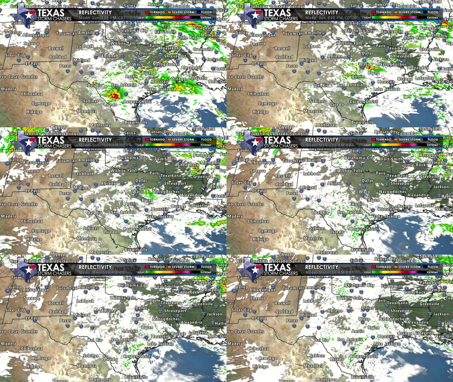
Scattered thunderstorms are possible this afternoon across the southern Edwards Plateau, South-Central Texas, east into the Coastal Plains, and Southeast Texas. Most individual storms will move east/southeast through the evening hours. Some storms may be strong to severe with large hail, localized damaging winds, and a non-zero risk of a spinup tornado. Nearly constant cloud-to-ground lightning, along with heavy rainfall, is a guarantee for any thunderstorm.

Click the ? or static image for a full animated version. Simulated weather model radar this afternoon through Monday morning from the High-Resolution Rapid Refresh (HRRR).
As we continue into tonight, thunderstorms will weaken and start to die down across the southern portions of the state. Into Monday morning, we will feature southerly winds, bringing a tropical-like environment north across the eastern seventy-five percent of Texas. That environment will continue advancing north into Oklahoma and Kansas. Spotty showers, drizzle, and low clouds will be widespread tonight.
Monday afternoon through Monday night will bring a severe weather outbreak to Oklahoma and Kansas. Northern portions of Texas are on the southern edge of the risk, where we may see one or two storms fire up during Monday’s evening hours. If any storms do manage to develop, they would likely become severe with a threat of destructive hail and localized damaging winds. The most likely outcome is that storms remain north of the Red River. Most of Texas should remain thunderstorm-free on Monday.