Cleveland, OH
Now’s your chance! Apply to be an extra in James Gunn’s new ‘Superman’ movie filming in Cleveland

CLEVELAND, Ohio (WOIO) – Warner Bros’ new Superman movie will be filming in Cleveland and Cincinnati in the coming months, and a Northeast Ohio casting agency released details this week about how you can be cast an extra.
Angela Boehm Casting posted details on their social media Tuesday about the project’s shoot dates, hourly rates and much more.
The project, listed under the code name “Genesis,” will shoot in Cleveland from June 17 to July 16. They will also shoot in Cincinnati on July 17 and 18.
Background rate for the film starts at $12/hour, with a guarantee of eight hours.
The post also outlined other rates and needs, such as stand-ins and children.
The general interest form for those looking to apply also asks about schedule conflicts, sizes and other optional roles.
According to the film’s Ohio tax application, “Superman,” or “Genesis” which was the early title of the film, was allowed to start pre-production earlier this year on February 5.
The application lists the production-related budget as $363,845,386. The film will be awarded $11,091,686.70 in tax credit from the Ohio Motion Picture Tax Credit.
Though the film is listed under a code name, “Superman” is the true project based on the director listed, James Gunn, the cast list, including David Corenswet, Rachel Brosnahan, and Nathan Fillian, and the production company S&K Pictures, Inc, which is a subsidiary of Warner Bros.
The application reveals 25% of the total production will be filmed in Ohio. Though the application does not yet list specific addresses, the two Ohio filming locations are listed as Cleveland and Cincinnati.
Production is expected to take place between April 1 and August 23.
19 News has reached out to the Cleveland Film Commission for details on filming locations, job and acting opportunities and they released the following statement:
Back in 1938, the very first Superman comic book was created by Jerry Siegel and Joe Shuster, two Clevelanders, to help people get through the Great Depression.
James Gunn announced last November “Superman” will hit theaters on July 11, 2025.
Copyright 2024 WOIO. All rights reserved.


LAKEWOOD, Ohio — It was Sunday morning when Lakewood police discovered a man and woman shot dead inside a home. The shooter then turned the gun on himself.
On Monday, we learned the victims were 33-year-old Amanda Wakut and 35-year-old Richard “Ricky” Eastin. Police say the shooter was 45-year-old Stephen Davis. On Wednesday, friends and family spoke with us about the life Eastin lived.
We interviewed Ricky Eastin’s younger brother, Ian Eastin, over Zoom because he’s currently on his honeymoon in Thailand. You could easily see the resemblance between him and his big brother.
“He was one of the kindest people I know. He would be willing to give his own shirt right off his back,” Eastin continued. “We just got married last week, so I just saw him.”
Eastin said he last talked to his brother on Saturday.
“He was sending us some pictures of- that he took at our wedding, and just asking how our honeymoon was going,” said Eastin.
Then, at 2 a.m., Eastin learned he would never hear from his brother again.
“I just didn’t believe it. I still feel like how is this even possible,” said Eastin.
Police say Ricky Eastin and Amanda Wakut were found shot and killed inside a home on Chesterland Avenue around 4:30 a.m. Sunday.
3 dead in Lakewood double murder-suicide
3 dead in Lakewood double murder-suicide
“You’d see stuff on the news, people get shot or people get killed, you don’t believe it, like it just is unreal,” said Ian Eastin.
When officers arrived at the scene, police said the shooter, Davis, believed to be Wakut’s boyfriend, drove off in a truck. He was later stopped on Warren Road, where he took his own life.
“Ricky was there supporting her because I guess Amanda was going to break up or end stuff with that guy, and I guess he didn’t take the news well, and just started shooting,” said Eastin.
Ricky Eastin’s boyfriend shared photos with us, including one Eastin sent earlier that Saturday. We also spoke to Eastin’s friend Gwendolyn McCrary Williams.
“That really hurt and I’m angry, he didn’t deserve it, they didn’t deserve that,” said Williams.
The two worked on home improvement projects together and had been making plans just last week.
“Everybody just loved Ricky, soon as you cross his path, it was just something about him that just made you want to just always be connected,” said Williams.
That love has shown in a GoFundMe, which has already raised more than $15,000 to cover funeral expenses and support his mother, whom Eastin was caring for.
“It’s crazy how many people, how many lives he’s touched in that just short period of time that he’s lived,” said Ian Eastin.
While Ricky Eastin may be gone, his friends and family say the love and impact he left behind will never fade.
“This wonderful vibrant full of life young guy, loves everybody, he’s gone and I’m going to miss Ricky,” said Williams.
For more information on the GoFundMe for Ricky, click here.
Earlier
On Monday we spoke to Wakut’s friend and business partner, Megann Galehouse, about her. She described Wakut as a mother, athlete and someone filled with joy and laughter.
Galehouse told News 5 she had just talked to her in the days before she was killed, saying what happened seemed surreal.
“She said, ‘Happy Birthday, I love you so much,’ and I said, Thank you, I love you too,’” Galehouse said.
As police search for answers to what happened, Galehouse mourns Wakut and Eastin and is raising money for funeral costs. She’s also raising money to support Wakut’s 7-year-old son, who was with his grandmother when the shooting happened. While it still doesn’t feel real, she hopes people remember Amanda for her light and her spirit.
“She was always joking. I don’t think I will ever forget her laugh. Her laugh was really, really good,” Galehouse said.
For more information on the GoFundMe for Wakut, click here.
Nadeen Abusada is a Cuyahoga County and immigration reporter at News 5 Cleveland. Follow her on Instagram NadeenAbusada or email her at Nadeen.Abusada@wews.com.

CLEVELAND, Ohio (WOIO) – Cleveland Police gave a tragic update to the SR-176 crash that happened in the southbound lanes near Spring Road on Tuesday afternoon.
Police said two people died in the multiple-vehicle crash that closed the highway for several hours starting around 4:20 P.M.
When officers arrived, they found three vehicles were involved in the crash.
The investigation concluded that a dump truck traveling southbound on SR-176 struck a Jeep Patriot that had slowed. The crash caused the Jeep to continue forward and collide with a Ford E-350 van.
Following the collision, the Jeep rolled over and burst into flames.
The van hit the median and overturned.
The dump truck driven by a 35-year-old male man was not hurt, according to police.
The Jeep was occupied by two people whose ages are unknown were pronounced dead at the scene.
A 71-year-old man and a 70-year-old woman, who were driving the van, were taken by Cleveland EMS to a local hospital for treatment.
The Cleveland Division of Police Accident Investigation Unit is investigating the incident. No additional information is available at this time.
Copyright 2026 WOIO. All rights reserved.

Getty
CLEVELAND, OH – JUNE 08: LeBron James #23 of the Cleveland Cavaliers throws a pass against the Golden State Warriors in the first half during Game Four of the 2018 NBA Finals at Quicken Loans Arena on June 8, 2018 in Cleveland, Ohio. NOTE TO USER: User expressly acknowledges and agrees that, by downloading and or using this photograph, User is consenting to the terms and conditions of the Getty Images License Agreement. (Photo by Jason Miller/Getty Images)
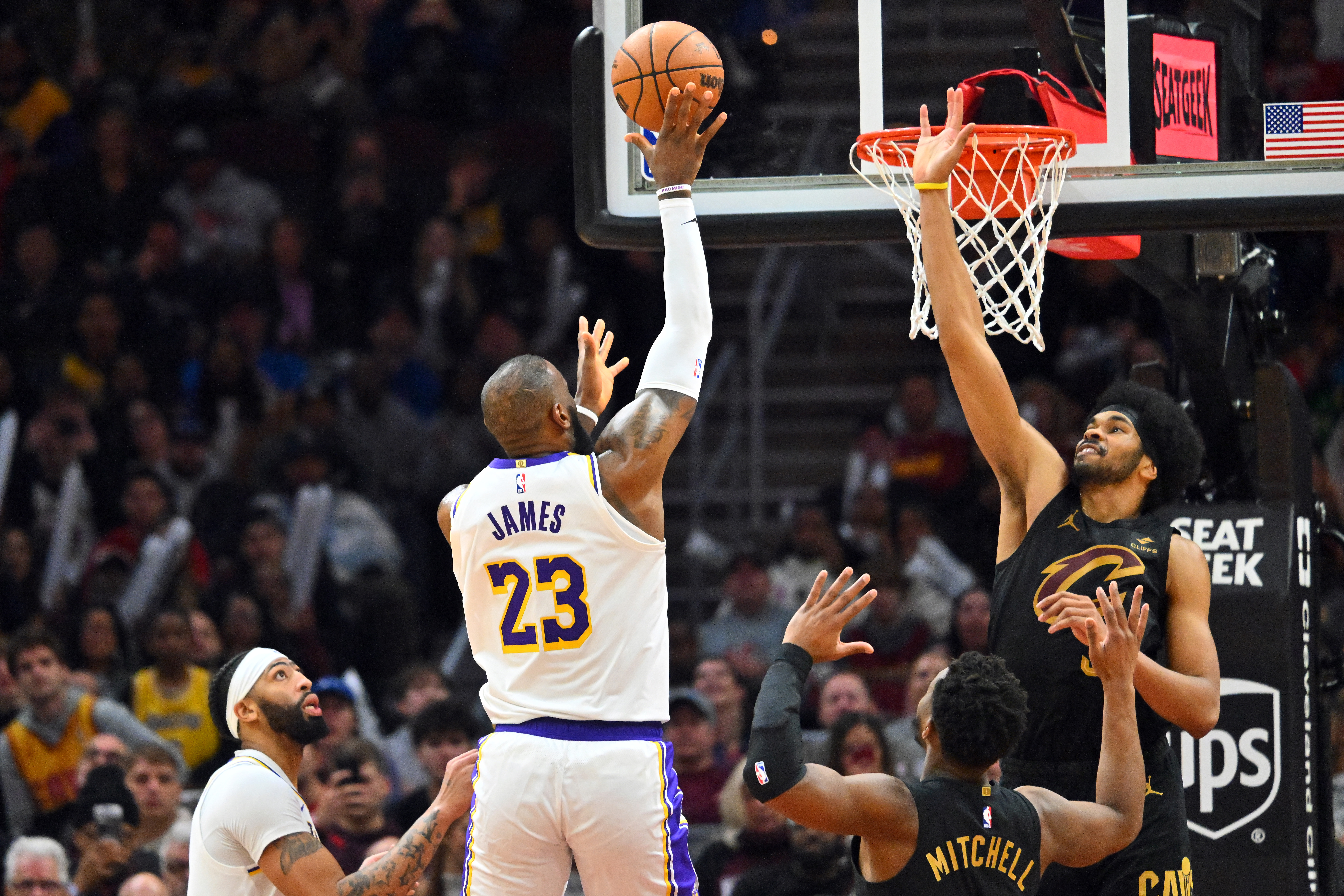
LeBron James could return for a final run with the Cleveland Cavaliers with a massive caveat, and it involves center Jarrett Allen, who has been one of the team’s defensive anchors.
According to ESPN insider Brian Windhorst, the Cavaliers could get LeBron from the LA Lakers in exchange for Allen, a center the Lakers would want to pair with their franchise superstar, Luka Doncic.
However, Windhorst said James would first want to go to Cleveland to make the deal happen. On the other hand, such a trade is a no-brainer for the Lakers.
“There is a thought process in Los Angeles where they have to sign-and-trade LeBron James for Jarrett Allen. And I think if the Cavs are willing to do that, they can have LeBron,” Windorst said via ESPN Cleveland radio.
“Obviously, LeBron would have to want to sign with the Cavs, but if your pathway to paying LeBron the money is to trade Jarrett Allen for him, the Lakers would kill for Jarrett Allen. Kill for him. All right? They would do that deal in 17-tenths of a second.”
How A LeBron James-Jarrett Allen Deal Would Work
GettyCLEVELAND, OHIO – NOVEMBER 25: LeBron James #23 of the Los Angeles Lakers shoots over Jarrett Allen #31 of the Cleveland Cavaliers during the fourth quarter at Rocket Mortgage Fieldhouse on November 25, 2023 in Cleveland, Ohio. The Lakers defeated the Cavaliers 121-115. (Photo by Jason Miller/Getty Images)
LeBron James is an unrestricted free agent after his contract with the Lakers ended in the past season.
If they were to trade Allen, the Cavaliers could accommodate James’ expected hefty salary, as reports indicated that he is not willing to take a pay cut on his next contract.
There have been rumors about retirement for James and a possible homecoming once more to Cleveland over the past few months, but there are no decisions yet on his future.
There is no word yet about James’ contract value or how long a contract he would sign for, if he is to remain an active NBA player beyond 41 years old.
On the other hand, Allen is locked into a highly secure financial situation after signing a three-year, $91 million contract extension with the Cavaliers.
James last played with the Cavaliers in 2018, leading them to the NBA Finals, but they got swept by the Golden State Warriors. After that NBA Finals stint, he signed with the Lakers and has stayed in Los Angeles since then.
Such a deal suits the Lakers’ biggest offseason objective of getting an A-list center, as reportedly requested by Luka Doncic.
LeBron James’ Future Remains Up In The Air
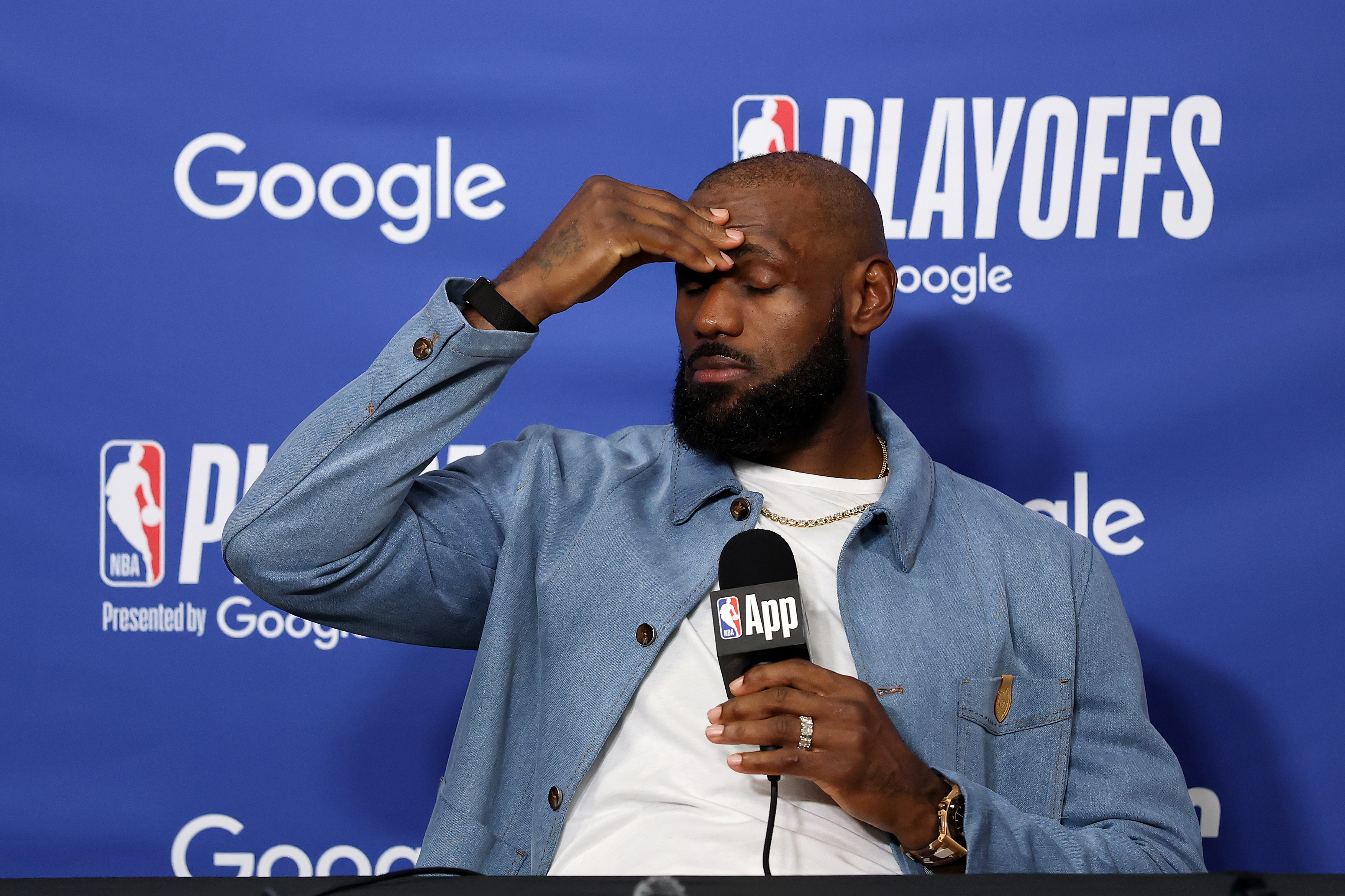
GettyLOS ANGELES, CALIFORNIA – MAY 11: LeBron James #23 of the Los Angeles Lakers speaks to the media during a press conference after the game against the Oklahoma City Thunder in Game Four of the Second Round of the NBA Western Conference Playoffs at Crypto.com Arena on May 11, 2026 in Los Angeles, California. (Photo by Luke Hales/Getty Images)
LeBron James, who had won an NBA championship with Cleveland in 2016, has been contemplating many things at this juncture of his life.
As retirement looms and Father Time starts to creep in, James is expected to decide on his career in the coming weeks.
Right now, according to ESPN’s Ramona Shelbourne, James’ future remains up in the air.
“LA is the first team he can talk to because they’re their own free agent,” Shelburne said during her interview on SportsCenter. “My understanding is they had initial conversations with LeBron James’ representative, but he has not even fully committed to returning next year in these conversations.”
James’ decision is one of the most awaited ones in free agency as teams could still be interested in getting one of the greatest players of all time for a final hoorah in the league.
Rob Andrew Lo Rob Andrew Lo is a writer at Heavy Sports and is covering the NBA. He has covered local, collegiate, professional and international sports in various sites. He was the sports editor of The Varsitarian, the official student publication of University of Santo Tomas, and a sports, entertainment, and lifestyle writer for Rappler.
A Journalism graduate from the University of Santo Tomas, he has built his voice across both collegiate and international platforms, previously contributing NBA coverage to Fansided and Sportskeeda.
More about Rob Andrew Lo
-

 Health3 minutes ago
Latest COVID vaccine may have unexpected health benefit, study suggests
-

 Sports6 minutes ago
How to watch USA vs Turkey: Live stream the 2026 FIFA World Cup
-

 Technology11 minutes ago
Bionic hands are now teaching robots to feel
-
 Business18 minutes ago
Snap CEO Evan Spiegel and Miranda Kerr help erase $550 million in medical debt for Californians
-
 Entertainment21 minutes ago
How Culver City-based Scopely built ‘Monopoly Go!’ into a mobile games juggernaut
-
 Politics33 minutes ago
Supreme Court rules Trump may end legal protection for Haitians and Syrians
-
 Science36 minutes ago
Drug overdoses in L.A County drop for third straight year. Here’s why
-
 Sports41 minutes ago
Drug charges against U.S. skiing great Bode Miller to be dropped, his attorney says

