Austin, TX
Beryl is expected to hit the Texas coast early Monday as a Category 1 hurricane

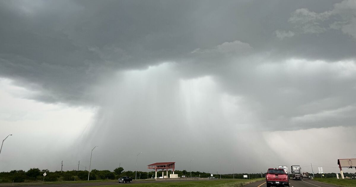
This post was last updated at 10 a.m. Sunday. Scroll to the bottom for the latest updates from the National Weather Service.
Tropical Storm Beryl is expected to make landfall in the area of Matagorda Bay early Monday morning, as the storm track shifts east closer to Houston and away from Austin and San Antonio.
Austin is no longer in the storm’s cone — the path that weather forecasters believe Beryl will probably take — and rainfall chances along the Interstate 35 corridor have lowered to 0.5-1 inch of rain, the National Weather Service said Sunday morning. Counties to the east of Austin are expected to get higher rainfall totals of 2-4 inches.
The NWS believes Beryl will make landfall as a Category 1 hurricane, which means the storm has sustained wind speeds of 74-95 mph. Tropical storm-level winds could arrive to coastal areas as early as Sunday afternoon, the Weather Service said, with hurricane-force winds arriving Sunday night.
Even though a Category 1 hurricane is expected, the NWS says people in the path should prepare as if a Category 2 hurricane will hit, due to levels of uncertainty in the forecast.
“Based on the current forecast, heavy rain and some localized flooding could occur all the way from the coast through areas near College Station, Tyler, and Texarkana as the storm moves through Texas on its current track,” Lt. Gov. Dan Patrick said in a statement early Sunday. Patrick is serving as acting governor while Gov. Greg Abbott is in East Asia on an economic development trip.
Patrick added 81 counties to the state’s disaster declaration in preparation for the storm, including Travis, Williamson, Bastrop and Hays counties.
Follow the latest updates from the National Weather Service below. Refresh your screen if the updates do not appear.


KERRVILLE, Texas (KXAN) — The City of Kerrville issued a shelter-in-place Thursday morning, with heavy rain causing reported evacuations early Thursday morning. A Flash Flood Warning is currently in place for Kerr County as the Guadalupe River continues to rise.
Around 5:30 a.m., the National Weather Service said a “large and deadly flood wave is moving down” the Guadalupe River.
KXAN First Warning Weather Meteorologist Kristen Currie said approximately 11 inches of rain have fallen northwest of Kerr County since 10 p.m. on Wednesday. The Guadalupe River is expected to reach major flood stage in multiple areas.
Kerr County PIO Lisa Walter said “there have been multiple swift water rescues and evacuations.” Officials emphasized not to drive through flooded streets and to turn around if water covers the roadway.
Evacuations were underway in multiple areas, according to the county, including:
- Goat Creek
- Arcadia Loop
- Lowery/Guadalupe area
- Junction Highway low-water crossings
- Other low-lying neighborhoods
Emergency shelters are open at Impact Church (Goat Creek evacuation point), Calvary Temple Church and City West Church for people in West Kerr County, the county said.
Here are the latest headlines:
Live updates
7:03 a.m.: KXAN’s Kevin Baskar is in Gillespie County providing updates on the latest flood conditions in the area. Watch his update below.
6:37 a.m.: Kerr County officials emphasized not to drive through flooded streets and to turn around if water covers the roadway.
Evacuations were underway in multiple areas, according to the county, including:
- Goat Creek
- Arcadia Loop
- Lowery/Guadalupe area
- Junction Highway low-water crossings
- Other low-lying neighborhoods
Emergency shelters are open at Impact Church (Goat Creek evacuation point), Calvary Temple Church and City West Church for people in West Kerr County, the county said.
6:27 a.m.: Video shows emergency crews hauling boats and rescue equipment through Kerrville.
6:15 a.m. NewsNation correspondent Xavier Walton and his photographer captured a structure being swept up in river water and crashing into a Kerrville bridge. The structure appears to be some sort of shipping container, pushing against the bridge.
Watch the video below:
6:08 a.m.: Kerr County PIO Lisa Walter confirms “there have been multiple swift water rescues and evacuations.”
6:02 a.m.: The Guadalupe River at Center Point is expected to crest at 35 feet, which is the same crest as July 4, 2025.
5:57 a.m.: The National Weather Service said “a large deadly flood wave” is moving down the Guadalupe River.
5:49 a.m.: The Comfort Volunteer Fire Department said it has units in Kerrville and Centerpoint alerting people along the Guadalupe River. They’re helping Kerr County with evacuations along Highway 27 between Comfort and Centerpoint. They said all VFD personnel are OK.
5:30 a.m.: The Kerr County Sheriff’s Office said in a Facebook post that it’s received reports of “street flooding in Ingram, and it’s likely many roads and city streets are flooded as well.”

AUSTIN (KXAN) — As flood threats continue across parts of South Central Texas, Austin Pets Alive! has activated emergency response efforts to support animal shelters affected by the inclement weather.
In a social media post, APA! wrote, “We began offering aid last night, working to secure fosters for 10 dogs in the Castroville shelter, an open-air shelter that sits at the bottom of a valley.”
APA! said the situation escalated overnight with additional shelters reporting flooding. One shelter confirmed that floodwaters reached its facility, APA! added.
Communities overwhelmed due to weather include Uvalde, Castroville and Sabinal.
The nonprofit is asking the Austin community to foster, adopt or donate to free up capacity for animals displaced by the disaster. APA! needs to clear out its facilities to assist the animals in need of shelter.
Here are ways you can help:
- Adopt: APA! is offering a “Name Your Own Adoption Fee” on all animals.
- Foster: The shelter is seeking foster homes for a minimum of three weeks.
- Donate: Proceeds will fund vans and response teams setting up a staging and triage center at the heart of the disaster zone, along with an expanded stockpile of preventatives, PPE and additional supplies.
If you would like to donate, click here.

AUSTIN, Texas — With heavy rain expected across parts of Central Texas this week and flooding top of mind, the city of Austin is proposing to put more money toward flood mitigation improvements in next year’s budget.
The proposal would invest in new flood infrastructure, add staff, and help move flood mitigation projects forward, according to city leaders. Austin City Councilmember Ryan Alter said the investments are aimed at keeping the city prepared for future flooding.
Residents who live near waterways say they have seen how quickly conditions can change. David Haderspeck, who lives near Shoal Creek, said the creek “fills up pretty fast” and “gets a lot higher than you’d expect.” He said he has watched the water rise dramatically after rain.
“I’ve seen it come up probably 10 to 15 feet to the ordinary high-water mark,” he said.
This week, parts of Central Texas, including the Hill Country, are expected to get heavy downpours. While Austin is not expecting the same impacts as parts of the Hill Country, leaders said the city is using this year’s budget planning to continue investing in flood safety.
Alter said the city has the expertise to address flooding risks but needs to follow through on projects.
ALSO| Central Texas urged to prepare as heavy rainfall sits in forecast over next two days
“We have the experts. We just have to put the plans into practice, and that’s what we’re doing in this budget,” he said.
Under the budget proposal, the city would provide about $134.5 million for the Drainage Utility Fund, which helps pay for flood mitigation, drainage infrastructure and watershed protection efforts.
Alter said the proposal would shift more of the funding balance toward building new infrastructure.
“What we’re going to do is shift that balance a little bit more to building new infrastructure so that when we do have large flooding events, we’ve got that infrastructure in place to keep people safe,” he said.
The proposal also adds staff and invests in both new and existing flood mitigation projects across the city.
Asked whether the proposed investments would be enough moving forward, Alter said, “I do…I think we’re doing the right thing and just making sure that our residents have the infrastructure to stay safe.”
Alter said heavy rain cannot be prevented, but the city’s goal is to have infrastructure in place to help keep people safe when it happens.
-

 North Dakota1 minute ago
Vernon Krause
-

 Ohio7 minutes ago
Man pleads guilty to inappropriate conduct with minor in Howland
-

 Oklahoma13 minutes ago
Local Star Goose Hutchens Reclassifies, Will Join Oklahoma for 2027 Season
-

 Oregon19 minutes ago
Meet Miss Oregon at the Ross Ragland Theater Next Month – KOBI-TV NBC5 / KOTI-TV NBC2
-

 Pennsylvania25 minutes ago
Wildfire smoke puts Pittsburgh under Code Red air quality alert
-

 Rhode Island31 minutes ago
These 8 Towns In Rhode Island Were Ranked Among US Favorites In 2026
-

 South Dakota43 minutes ago
South Dakota confirms three cyclosporiasis cases as CDC investigates growing outbreak
-

 Tennessee49 minutes ago
How did your school district do? New TCAP scores released across Southeast Tennessee

