Montana
Quick-moving system brings rain/snow to NW Montana
A plume of moisture is pushing into NW Montana early this morning and is set to expand southeast later this evening thanks to a cold front.
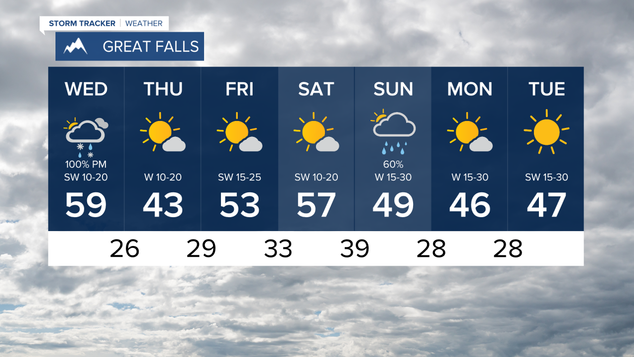
Light to moderate rain/snow is dropping in the Missoula and Kalispell areas initially this Wednesday. This fast moving system will expand eastward towards Great Falls, Helena, Havre and even out towards Glasgow around 6/7PM. Then the system drops south thanks to the incoming low pressure. Overnight we’ll continue to see an impact of this system.
A Winter Weather Advisory has been issued for the East/West Glacier regions as higher terrain west of the Continental Divide. Some areas of east of Helena are also seeing this warning. Accumulations between 2-5 inches in the lower valleys and up to 10 inches in the highest mountain elevations. Travel may be difficult in some areas, so use caution today. This advisory expires Thursday morning.
MTN MTN


Thursday will be much colder and drier throughout Montana with highs in the upper 30s to mid 40s. We will have cool and mostly sunny conditions through Saturday ahead of another weathermaker Sunday.
KTVH
KTVH