Colorado
Wild weather will include fire danger and winter blast Friday into the weekend for Colorado

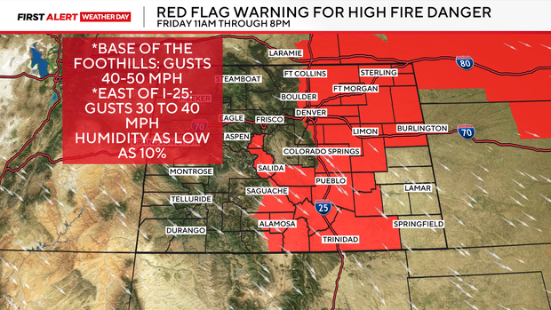
Our prolonged period of strong winds and critical fire danger rolls on for Friday for day number two of a three day threat. Warm temperatures, dry air and super, gusty winds will team up again for a First Alert Weather Day that creates ideal conditions for rapid wildfire spread.
Winds on Thursday were as strong as a category 2 hurricane in parts of northern Colorado! The Wellington area north of Fort Collins clocked wind gusts of 90 to 100 mph. Category 2 hurricane force is 96 to 110 mph and category 1 is 74 to 95 mph.
Friday has another Red Flag Warning in place from 11am to 8pm for the entire Denver area, base of the Front Range and most of the eastern plains once again. Winds wont be as strong as Thursday but should gust 40 to 50 mph in the mountains and foothills with 30 to 40 mph gusts east of I-25 and for most of the Denver area.

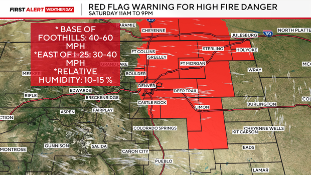
Day three of our wind event will surge on Saturday as a cold front approaches from the Pacific Northwest. Temperatures will be warm again with strong west-northwest winds. Winds will be a bit stronger gusting up to 60 at the base of the foothills and 30 to 40 over the plains.
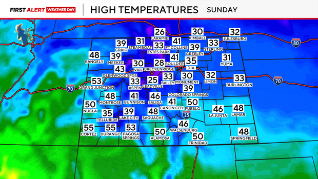
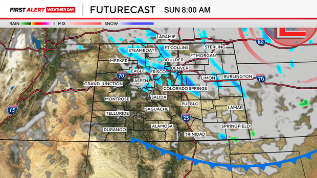
A strong cold front pushes through the region on Saturday night into Sunday. This will bring the Front Range a chance for snow and much colder temperatures to finish the weekend.
High temperatures on Sunday will plummet as much as 40 degrees cooler from Saturday to Sunday!