Colorado
High pressure brings warmer days, cleaner skies to Colorado before late-week cooldown


High pressure will dominate much of the week ahead, leading to two key changes across Colorado.
First, temperatures will climb into the mid to upper 80s through at least Thursday.
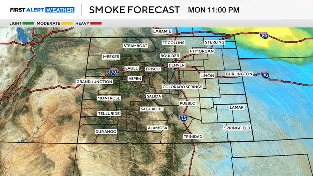
Second, air quality will see major improvements. Much of the wildfire smoke that had been drifting into the state will be pushed east into the Midwest, leaving little to no concern for the Front Range, high country, and Western Slope.

Each day will bring about a 10 to 20 percent chance for an isolated shower or thunderstorm, like what we saw Sunday. Most areas will stay dry, but a quick hit-or-miss storm is possible.
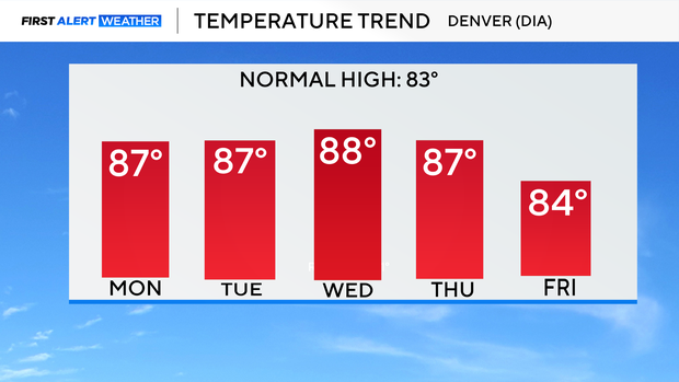
By Friday, a trough of low pressure moves in. This will cool temperatures back into the upper 70s and low 80s while also bringing a chance for light, fresh snow on the tallest peaks of Colorado’s high country. More widespread afternoon and evening showers are possible by Friday.