North Carolina
Strong storms are possible in North Carolina again on Thursday

North Carolina had a stormy start to the week with powerful storms from the mountains to the coast Monday.
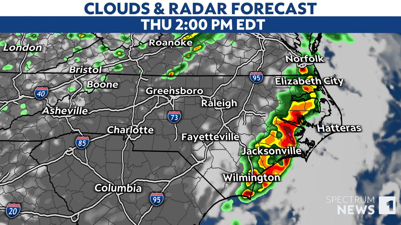
Storms are now back in the forecast for Thursday, but it won’t be exactly like Monday.
For now, we’re watching an area from Missouri and Arkansas to Tennessee where severe storms are expected on Wednesday.
Some of those storms are expected to track to the south toward South Carolina late Wednesday night.
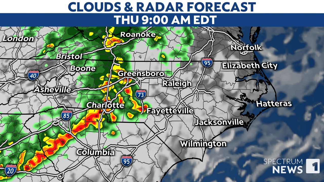
Another round of storms could also make it into the mountains of western North Carolina during the early morning hours of Thursday.

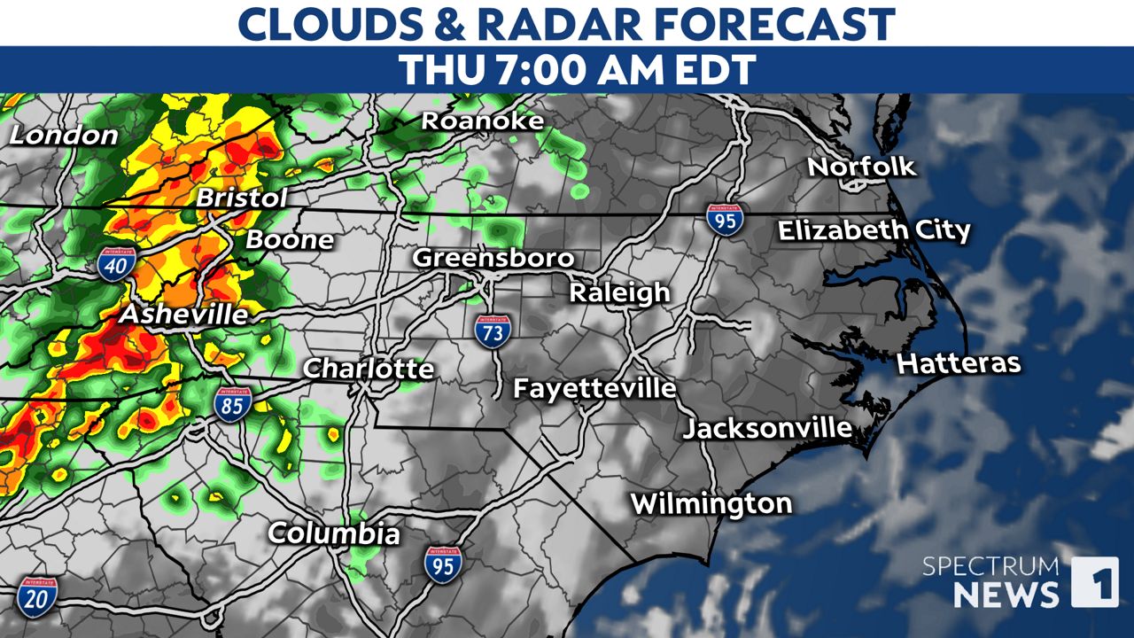
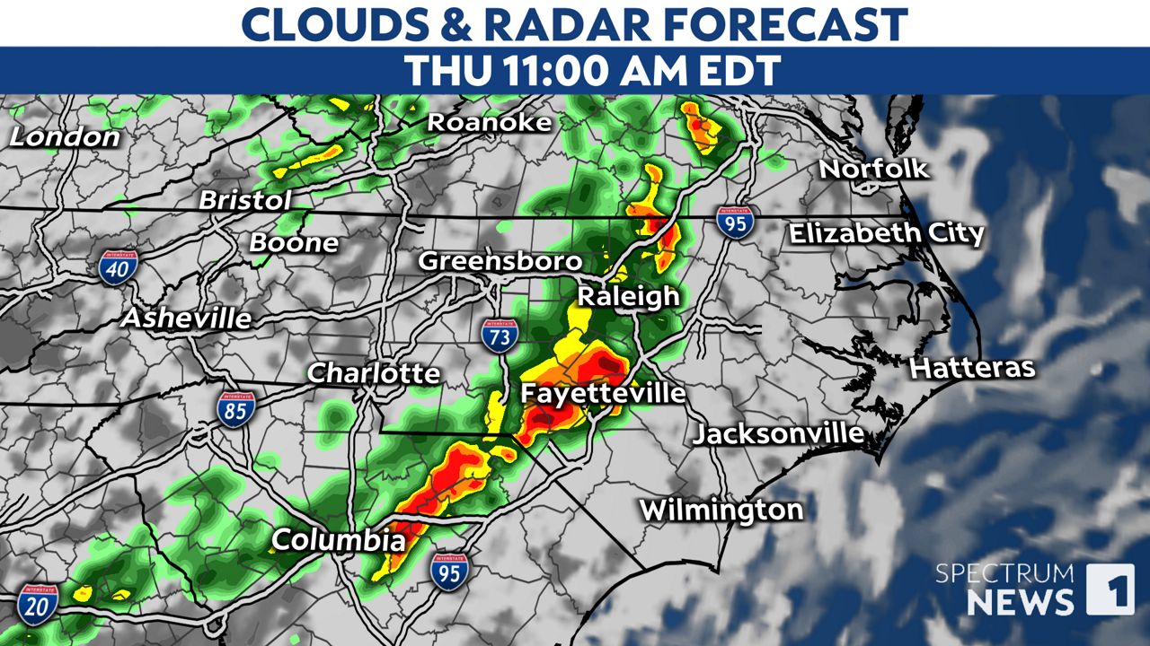
Those storms could then track across the Piedmont through the morning and into the Coastal Plain around midday or afternoon.
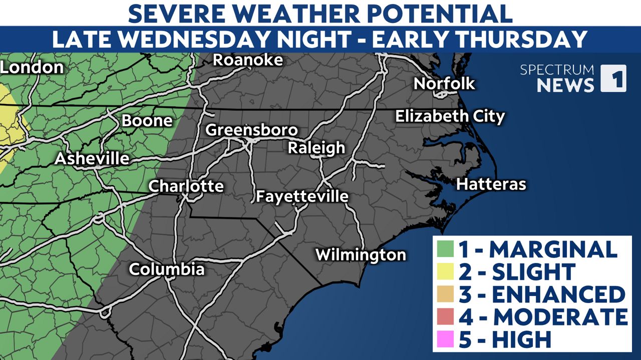
As it stands now, Thursday’s severe threat is not as high as it was on Monday.
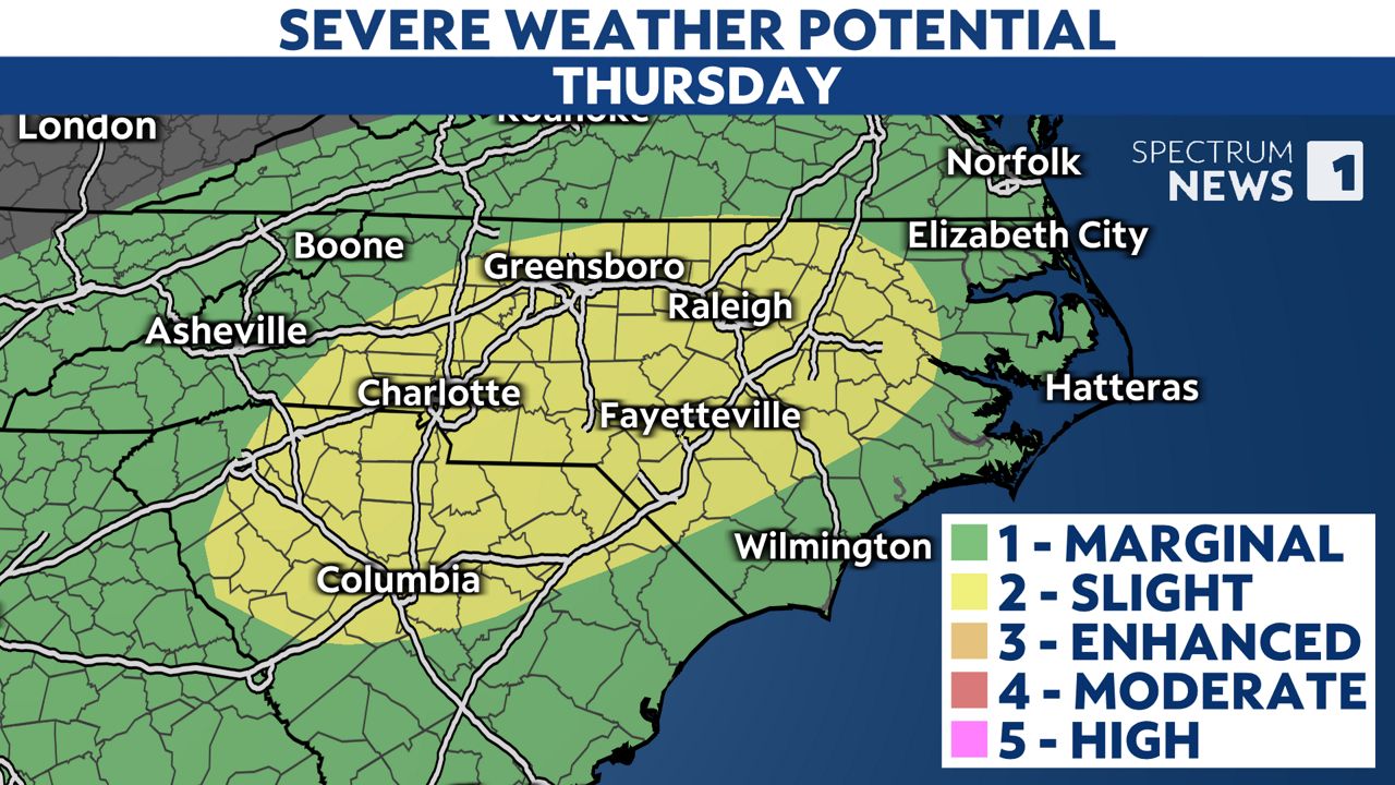
Much of the state was under a level 3 risk on Monday, and parts of the mountains were even under a level 4 risk.
While Thursday will not be exactly like Monday, the main threat from the storms will still be damaging straight-line winds in excess of 60 mph. That could lead to downed trees and power outages in some areas. There’s also a low risk for a brief tornado.
Any of the storms could also produce downpours and frequent lightning.
For now, make sure you have a way to receive weather alerts on Thursday. Stay tuned to Weather on the 1s on Spectrum News 1 and the Spectrum News app for updates.