North Carolina
Strong and severe storms are possible through tonight

A low pressure system will bring warmer air along with the chance of strong storms.
Temperatures continue to warm up thanks to a warm front moving to the north. However, the approaching cold front moving through tonight could trigger strong and even severe storms.
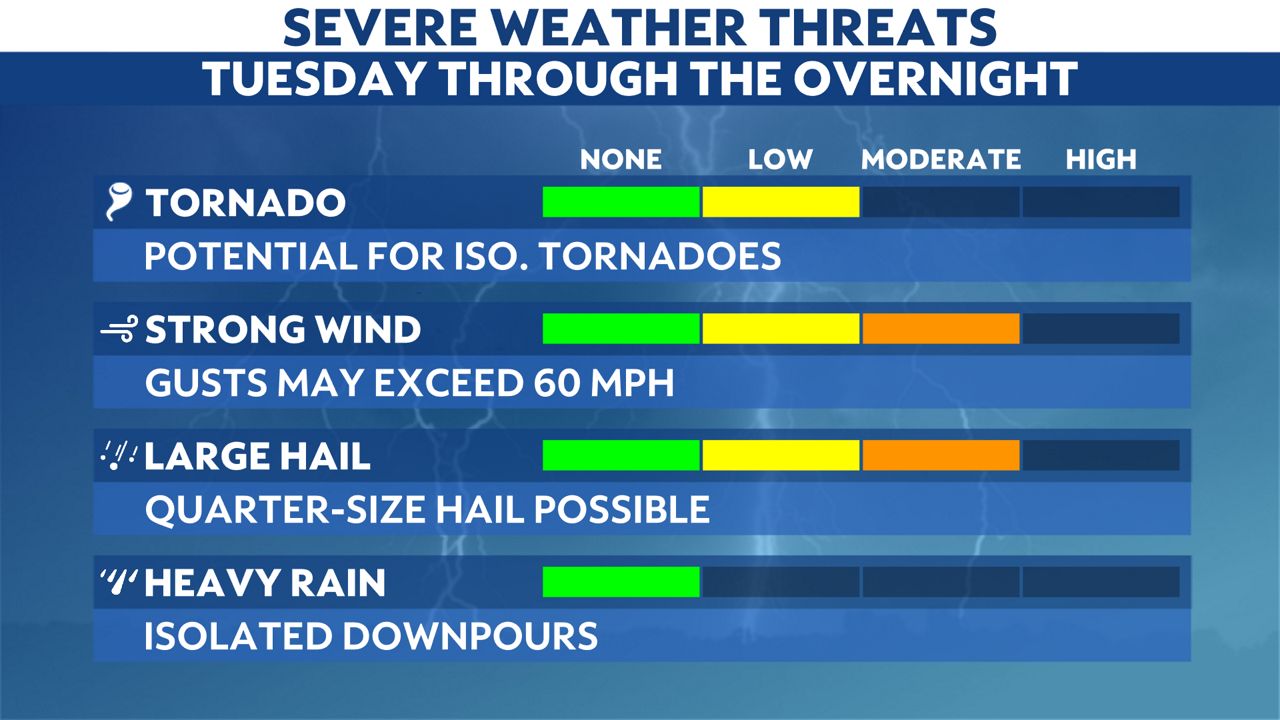
The enhanced risk (3/5) includes part of the mountains. Much of the state is under a slight risk (2/5). The primary threats with these storms include damaging winds, hail and a few tornadoes.
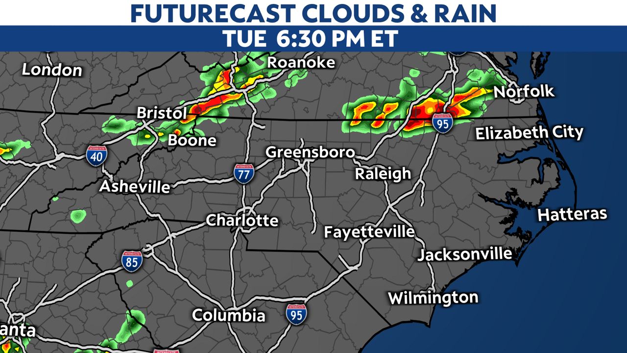
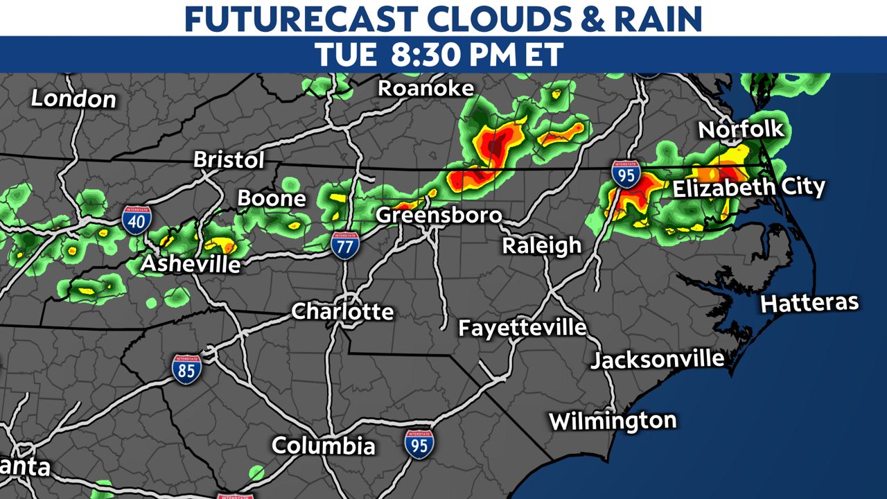
The storms will move in ahead of the cold front, from west to east. The mountains and foothills could see storms from the late afternoon and into the early evening.
As storms move east, Charlotte, the Triad and the Triangle may deal with strong to severe storms and gusty winds this evening through tonight.

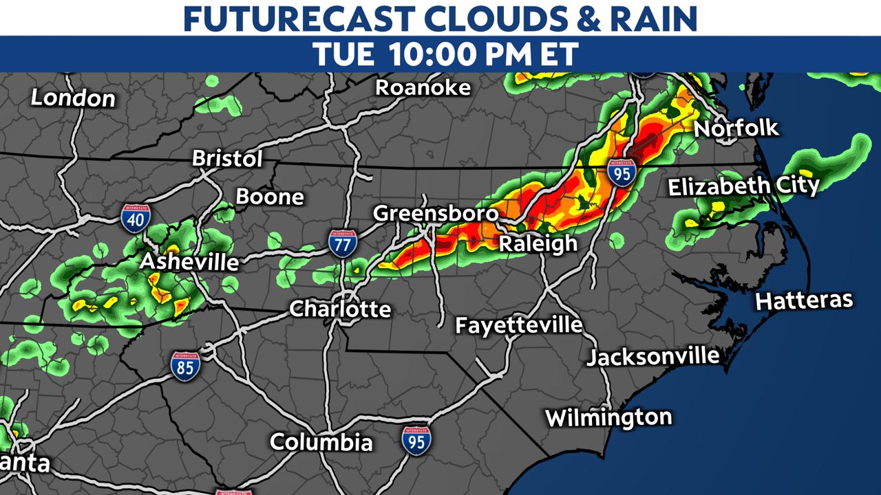
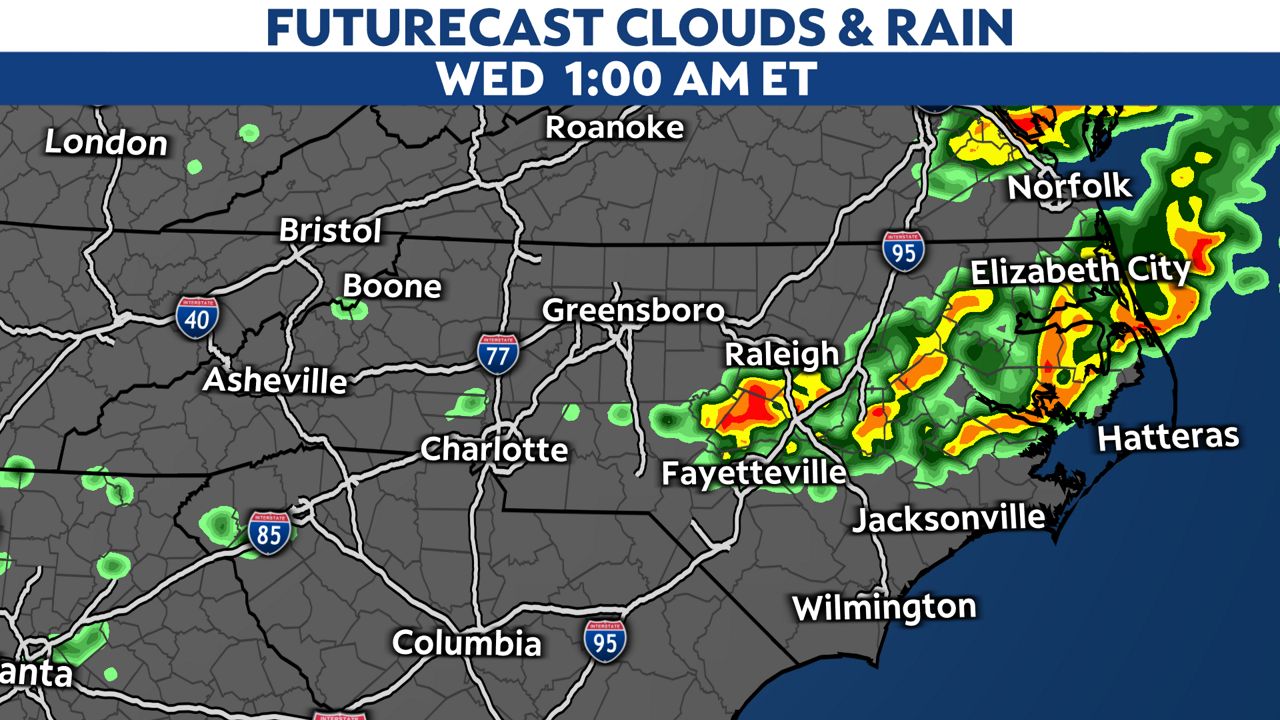
The risk for severe storms is lower toward the coastal plain, but a few strong thunderstorms are still possible through Wednesday morning.
Everyone in and near the severe weather risk area should have a way to receive weather alerts today and tonight in case they are issued.
If a Tornado Warning is issued, seek shelter in an interior room on the lowest floor of a sturdy building.
Basements, hallways, closets and windowless bathrooms often provide the best protection during a tornadic storm.