It’s called a blue card survey. But some residents in the Preston Hollow neighborhood of Dallas believe it could be their ace in the hole and their fight against the proposed development.
The 2019 tornado left a trail of destruction in North Dallas, including Victor Toledo’s home. He said been able to rebuild along with others in his neighborhood.
But he says one area is still an eyesore.
“It’s become a very desirable neighborhood, other than that one corner, that one corner is still stuck six years ago with the old office buildings,” said Toledo.
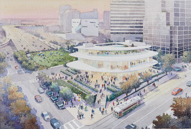
That “one corner” he’s referring to is the southwest side of Preston Road in Royal Lane.
It’s where developers want to build an $800 million 19-story resort hotel, apartment building, and mixed-use development.
There are signs all around Preston Hollow opposing the project.
A recently completed survey of residences within 500 yards of it reveals just how strong the opposition is.
City of Dallas survey:
- 258 opposed
- 7 in favor
- 18 no response
Margaret Chabris hopes the city’s planning and zoning commission, which meets again on Aug. 6, will take the results of the survey seriously.
“It does have an impact because this is what the city wanted to know, and this is the chance that residents and property owners right here can voice their opinion; it should have a considerable impact.”
But some residents, like Toledo, believe the benefits of the development outweigh concerns about traffic and construction.
“It’ll be great for the neighborhood to have that kind of amenity,” Toledo said. “To have hotel options, new restaurants. Now it’s a vacant old building that wasn’t being used much.”