West
Oregon hotel featured in Jack Nicholson's 'The Shining' catches fire

Firefighters responded to a call at the famous hotel that was featured in director Stanley Kubrick’s 1980 horror film, “The Shining.”
According to The Oregonian, a portion of the Timberline Lodge on Mount Hood in Oregon caught on fire at around 9:30 p.m. on Thursday. The official X account for the Clackamas Fire Department shared that at 11:12 p.m on Thursday, the fire was declared under control.
“The fire was kept to the roof & part of the attic, & didn’t spread any further. Crews are clearing the scene. The U.S. Forest Service will be conducting the investigation with the help of federal resources,” the account wrote, adding several photos of the scene.
The Clackamas Fire Department first shared the news on X on Thursday night, with an image of their firefighters hard at work trying to put the flames out.
‘THE SHINING’S’ CREEPY ‘JULY 4TH BALL 1921’ PHOTO TURNS 100 — AND TWITTER NOTICED
“Firefighters are on-scene of a 3-alarm commercial fire at the historic Timberline Lodge. Crews are working to extinguish the fire. No injuries reported,” the post read.
A fire broke out Thursday at The Timberline Lodge in Oregon, which was featured in “The Shining,” starring Jack Nicholson, inset. (Getty Images/AP Images)
Mount Hood, Oregon’s Timberline Lodge, which was used in “The Shining,” was built in 1937 and became a National Historic Landmark in 1977. (George Rose/Getty Images)
The fire at Timberline Lodge was declared under control late Thursday night. (AP Images)
Timberline Lodge was built in 1937. It continues to operate as a hotel even after becoming a National Historic Landmark in 1977. It was used three years later in Kubrick’s “The Shining,” which starred Jack Nicholson, Shelley Duvall and Danny Lloyd.
LIKE WHAT YOU’RE READING? CLICK HERE FOR MORE ENTERTAINMENT NEWS
According to the hotel’s website, it continues to be one of Oregon’s most popular tourist attractions and brings in “nearly two million visitors every year.”
“The 1980 cult-classic film ‘The Shining,’ based on the Stephen King novel of the same name, used aerial shots of Timberline as part of its opening scene,” the website shared. “Film of the exterior of Timberline Lodge was used for some establishing shots of the fictional Overlook Hotel throughout the movie.”
Timberline Lodge noted that “Kubrick was asked not to depict Room 217 (featured in the book) in ‘The Shining,’ because future guests at the lodge might be afraid to stay there. So a nonexistent room, Room 237, was substituted in the film.”
Jack Nicholson walks through a snowy maze in the film “The Shining” (1980). (Warner Bros./Getty Images)
Shelley Duvall, Danny Lloyd and Jack Nicholson drive on their way to the Timberline Lodge in 1980’s “The Shining.” (Warner Bros./Getty Images)
The hotel shared that even though its Room 217 was not featured in the cult classic film, it “is requested more often than any other room at Timberline.”
“Rest assured, Timberline is not haunted!” Timberline Lodge shared with its customers.
Read the full article from Here

June 27, 1776, was a momentous day for the Bay Area, California, and the world as 240 men, women, and children arrived mostly by foot from Mexico to what is now called San Francisco to set up camp and lay the groundwork for the future.
The “traveling village” is known as the Anza Expedition.
On Saturday, the 250th anniversary of the event was commemorated on Pershing Square at the Presidio of San Francisco in a two-hour ceremony.
The celebration opened with piercing fifes and thundering drums from the Young Patriots Fife & Drum Corps from Pleasanton, as a nod to America’s quincentennial.
But it was then followed up by a Spanish hymn, sung by musicians, dressed in 18th-century Spanish Colonial attire, including the garb of soldado, vaquero, pioneers, military, and indigenous peoples. The song is known as “Alabado” and it was sung by the ancestors as they made their long journey to the Bay.
A proclamation on a scroll was then read with gusto by local actor Dane Andrew, who was portraying the Spanish trailblazer Lt. Colonel Juan Bautista de Anza.
The message was loud and clear: When it comes to history in the Bay Area, Spain swings a big sword.
“People don’t realize in California our early Spanish history. While on the East Coast was becoming a brand-new U.S.A. was a small part. Actually, Spain owned a large part of the West Coast,” remarked Andrew.
The Anza Expedition established the first reliable overland route from Mexico to what was then known as Alta California, claiming San Francisco Bay for the Spanish Crown.
In 1776, the expedition’s leaders established both the Presidio as well as Mission San Francisco de Asis, which is known today as Mission Dolores.
In the crowd, the direct descendants of those who traveled the long, arduous route, including 98-year-old Eddie Grijalva of Vallejo. He was accompanied by his wife Lydia and her son Jeff.
“What an honor to be here and to remember my ancestor,” exclaimed Grijalva.
The event was coordinated by the nonprofit Los Californianos. The nonprofit represents the direct descendants of those who were part of the Anza Expedition. Its documented purpose includes efforts “to preserve the heritage of early Hispanic Californians in Alta California, to conduct research on genealogy, and to provide an accurate and authentic interpretation of Alta California’s history”
Carol Eber represents the group and is the co-chair of the event. She told us the group is thrilled to celebrate its heritage along with the quincentennial of the United States.
“We have a celebration on the East Coast. We wanted to have the 250th celebration on the West Coast as well as recognizing history was made on both coasts,” noted Eber.
During the ceremony, the crowd recited the Pledge of Allegiance and heard from Superintendent David A. Smith, who is with the Golden Gate National Recreation Area.
There were also presentations from the Daughters of the American Revolution and a group called “Our American Patriots”. The keynote speech was delivered by Professor Damian Bacich. He focused on San Francisco’s Spanish-American Legacy.
Also on hand for the festivities, the Consul General of Mexico Marco Mena. Mena told CBS News Bay Area that this was his first visit to Presidio and found it beautiful. He was pleased to be invited.
“The Anza expedition is very related to Mexico, especially to the states of Sonora and Sinaloa,” Mena explained.
As the Presidio ceremony was underway, a mass was said at Mission Dolores. The event concluded with a Roll Call, which was the reading of the names who those who walked on the route in 1776.
Descendants, including Grijalva, placed a flower in a memorial wreath as children were asked to blow bubbles for expedition members named without descendants.
Afterwards, participants went on docent-led tours of the Presidio’s Heritage Gallery and also were invited to tour the site of the Spanish Presidio Chapel.

The Denver Broncos have undergone a uniform overhaul, beginning in 2024. The Broncos rolled out the Mile High Collection ahead of the 2024 season, which included three different uniform combinations, plus the ’77 Throwbacks.
In 2024, Broncos fans were also treated to a Midnight Navy jersey/pants combination with the white ‘D’ helmet on Monday Night Football against the Cleveland Browns. On top of that, the Broncos rocked their White Out look, which included the Summit White jersey/pants combination and their standard Bronco logo on a white helmet, against the Kansas City Chiefs on Christmas Day last season.
The Broncos are keeping things fresh, and it’s going to be fun to see the different jersey combinations the team rolls out each week this coming season. Fans are obviously partial to the designs, but where do the Broncos’ uniform combinations rank among their NFL peers?
Sports Illustrated‘s Mike Kadlick ranked all 32 NFL teams’ uniform combinations, with the Broncos checking in at No. 10.
“Known as the ‘Mile High’ collection, the Broncos’ new uniforms debuted ahead of the 2024 season, and they remain awesome. Jam-packed with nods to Denver and the surrounding area, their jerseys feature a sleeve cap with a mountain peak and subtle triangles along the sides to represent Colorado’s summit markers. Their helmets, meanwhile, don a bumper that reads “5280”—a reference to Denver’s elevation above sea level. Rounded out with an all-blue alternate kit and a classic throwback look that incorporates the team’s D helmet logo, the Broncos nailed their recent redesign,” Kadlick wrote.
Attention to Detail
It’s not No. 1, but at least the Broncos are in the top 10. As Kadlick noted, Denver’s attention to detail in the new uniform designs is second to none.
Kadlick had the Los Angeles Chargers ranked No. 1, which, I’ve got to admit, kind of surprised me. I’ve never been that impressed by the Chargers’ designs, but to each their own, I suppose.
The Chiefs ranked No. 11, with the Las Vegas Raiders at No. 14, for whatever it’s worth. Beauty is always in the eye of the beholder, but Kadlick had a few questionable uniform designs ranked ahead of the Broncos, I must say.
Besides the Chargers at the top, Kadlick had the Cincinnati Bengals (No. 5), Tampa Bay Buccaneers (No. 6), Washington Commanders (No. 8), and Miami Dolphins (No. 9) ranked above the Broncos. I’ll hear you out on the classic look of the Dallas Cowboys and San Francisco 49ers (with slight modern twists), as well as the cool options the Baltimore Ravens and Houston Texans are rolling out nowadays, but the Chargers are meh, the Bengals and Bucs are downright ugly, and the Commanders are just plain.
No big deal, though. Posts like this make for timely offseason fodder as we await the return of football. The Broncos just finished up their offseason training program, and we’re now firmly in the NFL summer.
The cleats will hit the grass again at Broncos Park Powered by CommonSpirit on July 28, when the veterans report for training camp. From there, the whirlwind of the 2026 season will begin in earnest.
Let’s hope the product on the field looks as good as the Broncos’ Mile High Collection uniforms. The Broncos have produced two double-digit-win seasons since the Walton-Penner ownership group rolled out the new uniform designs, so there is a precedent in place.
Sign up for our free Denver Broncos On SI newsletter, and get breaking Broncos news delivered to your inbox daily!
Follow

PHOTOS BY OLIVER HAMLIN FOR WEST SEATTLE BLOG
Hundreds of people spent Sunday admiring and photographing the 12 gardens spotlighted on this year’s West Seattle Garden Tour. Among them was WSB contributing photojournalist Oliver Hamlin, who presents a scene from each garden (including some of the gardeners. First, at Garden A, “A Show of Northwest Natives“:
Charles Anthony, who created Garden B, “Salish Sea Sanctuary,” posed with his Japanese Maple:

Garden C, “Heron Cove,” has its namesake standing sentinel:
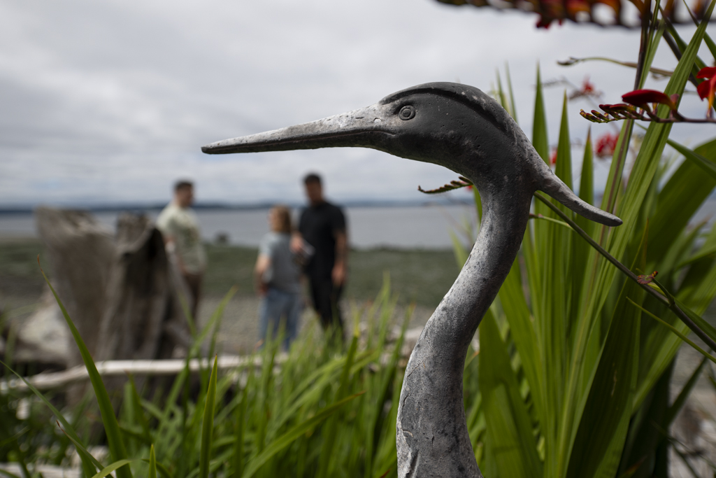
Below are Debra Montgomery and Lee Kelly; she bought the “Heron Cove” house 7 years ago and inherited Lee, who has been the gardener for 40 years. She said the previous homeowners sought out a buyer who wouldn’t tear down the house and would keep caring for the garden, which she and Lee both now do.

Garden D was described as “Small Spaces, Big Moments”:

Below (L-R) are the gardeners behind Garden D, Laird Applegate and Brian Pelzel:

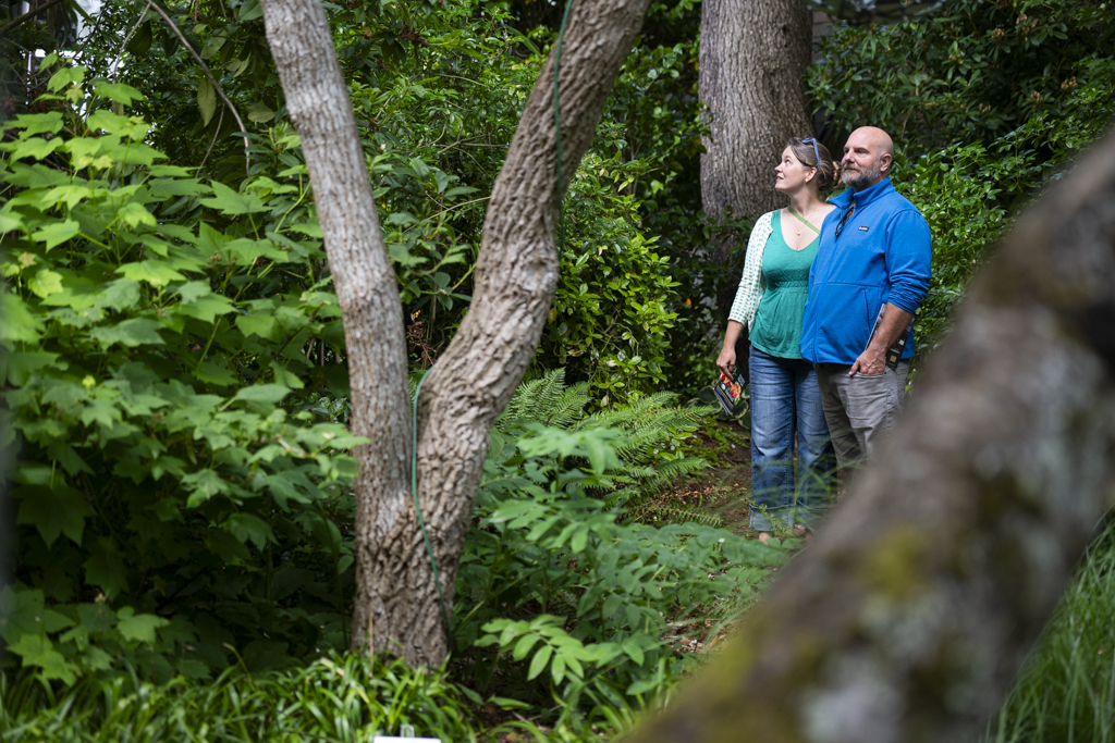
Garden E was “From a Sprawling Lawn and One Tree to …”

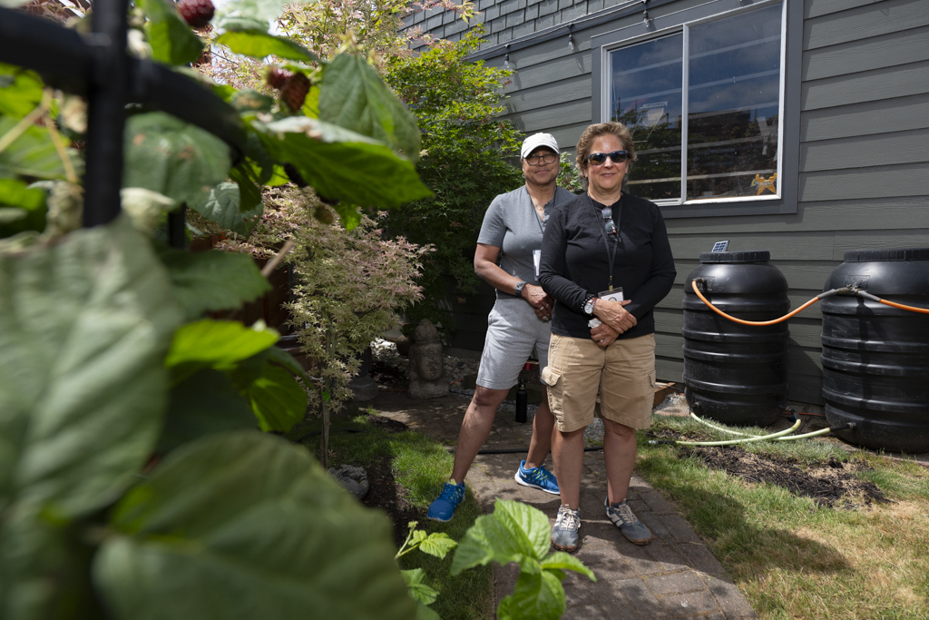
Blackberries are often the bane of a gardener’s existence, but in Garden F, “Transformation,” they were beautiful:

Garden F’s (L-R) Diane Elie and Raquel Gonzalez store water in 60-gallon rainbarrels and told Oliver that it fills most of their irrigation needs:
At Garden G, “Hidden Gem,” Julie Robinson-Jasper and Maple the dog are seen through a mirror surrounded by star jasmine at Garden G, “Hidden Gem”:

Another scene from Garden G:

Garden H, “Behind the Fences,” sported an arch of bittersweet nightshade:

A clawfoot bathtub graced Garden I, “A Fresh Look for A Once-Beloved Garden“:

Garden J, “Garden of Many Rooms,” was conducive to wandering:

Garden K offered onlookers “Plants from Around the World“:
And Garden L, “Conifer Corner,” featured a 75-year-old wisteria:

(Read details of each garden here.) The West Seattle Garden Tour is organized by a nonprofit that uses the proceeds to support other nonprofits – here are this year’s grant recipients; see how to apply for one of next year’s grants by going here (July 15 is the deadline).
-

 New York24 minutes ago
Metropolitan Diary Challenge Day 2: How to Write Your N.Y. Story
-

 Los Angeles, Ca29 minutes ago
Company has weeks to complete cleanup of Boyle Heights warehouse fire, officials announce
-
")
") Detroit, MI51 minutes ago
Detroit, MI51 minutes ago18 New Kid-Friendly Places That Opened in Metro Detroit in 2026 (So Far!)
-

 San Francisco, CA1 hour ago
Anza expedition celebrates 250th anniversary in San Francisco
-

 Dallas, TX1 hour ago
Preston Hollow residents oppose proposed $800 million mixed-use development in Dallas, survey reveals
-

 Miami, FL1 hour ago
Bradley Beal to Miami Heat rumors draw skepticism
-

 Boston, MA1 hour ago
Boston Pops surprise travelers at Logan Airport with July 4th preview performance
-

 Denver, CO1 hour ago
Denver Broncos Crack Top 10 in NFL Uniform Rankings

