A 20-year-old man died in a hospital after being shot early Friday in the Love Field neighborhood, Dallas police said.
Officers responded to a 911 call about gunfire in the 3300 block of Hudnall Street, near Lemmon Avenue, police officials wrote in a news release. When officers arrived, they found Isaiah Blasig-Prickett shot on the ground at an apartment complex.
Man called 911 then left Dallas hotel after pushing WV jeweler who later died, records say
He was taken to a hospital, where he died from his injuries, officials said. A police investigation identified a suspect in the fatal shooting as 29-year-old Shevaun Ffrench.
Crime in The News
Advertisement
Read the crime and public safety news your neighbors are talking about.
Ffrench was arrested on a murder charge and taken to the Dallas County Jail, officials said. Jail records show he was booked about 7 p.m. Friday, and his bail was not yet set.
Ffrench and Blasig-Pickett are “known to each other,” according to police.
No additional information was immediately available.
The Stewpot, a Dallas-based homeless services organization, is helping people who have experienced homelessness be seen in a new light.
During a special art exhibit Thursday night, paintings filled the walls, but it was artists like Darrell Plunkett who were the real focus.
When Plunkett first discovered The Stewpot’s art program more than a decade ago, he was at one of the lowest points in his life. He was struggling with alcoholism.
“I was staying in a shelter and I was waiting for them to take us back downtown, and I saw a gentleman with sketches and a bag full of art supplies,” he said.
Advertisement
Immediately, he wanted to learn more.
“He told me about the program, and back then, there was an interview process to get in, and so I went through that,” he said.
Plunkett was accepted and quickly discovered a love for painting, especially sunflowers and roosters. More importantly, he found an escape from the struggles he was facing.
“It kept me out of trouble and give me a safe place to come and create instead of running the streets,” he said.
He said many artists in the program have found that same sense of purpose.
Advertisement
“It gives me peace and quiet and comfort,” Luis Arispe said. “People who buy my work love the way I talk to them and speak to them.”
Every painting sold directly benefits the artists. They receive 90% of each sale, while the remaining 10% goes back into the program to help pay for art supplies.”
“It’s a nice little boost if you get a little more pocket change.. to get paid for your work and to be acknowledged as an artist,” The Stewpot Director of Enrichment Programs, Betty Heckman, said.
“The recognition that someone actually likes what I created it just gives me joy,” Plunkett said.
Since joining the program, Plunkett has remained sober. He now has his own apartment and works at the Dallas Arboretum, where he finds constant inspiration.
Advertisement
“I’ll just stop and take a quick snapshot and go home and create,” he said.
He estimates he’s created hundreds of paintings over the years, and some of his work has even been featured in murals across Dallas.
Looking back, he says he’s forever grateful for this program that changed the course of his life.
“I don’t know what I would do without it,” he said. “It’s been a blessing.”
Editor’s note:Follow LIVE World Cup quarterfinal coverage today
France and its dynamic duo of Kylian Mbappé and Ousmane Dembélé appear practically unstoppable.
France is advancing to the World Cup semifinals after a 2-0 victory over Morocco on Thursday afternoon thanks to goals from both players in the second half as Mbappé has tied Lionel Messi for the Golden Boot lead with hist eighth goals of the tournament.
Advertisement
SHOP: France semifinal World Cup tickets
Now, France will await the winner of Friday’s Spain vs. Belgium match. The semifinal will be held on Tuesday, July 14 in Dallas, when the team will look to secure its third-consecutive World Cup Final.
With the electrifying play of Mbappé and Dembélé, it’s hard to pass up the opportunity to buy tickets to the team’s next match at AT&T Stadium.
Here’s everything you need to know to buy France semifinal World Cup tickets:
Shop France semifinal tickets
Advertisement
France semifinal World Cup tickets
As of publication, get-in ticket prices for France’s semifinals match in Dallas start at $2,066.
If you’re looking to see Mbappé and the entire France team up close, the cheapest lower level Hall of Fame ticket starts at $3,571 in Section 121.
France quarterfinals game information
When: Tuesday, July 14
Where: AT&T Stadium in Arlington, Texas
What time: 3 p.m. ET
TV – English : FOX – Fubo
TV – Spanish: Telemundo – Fubo
Tickets: Starting at $2,066
France 2026 FIFA World Cup schedule, results
IMAGE
France vs. Senegal – WIN 3-1
France vs. Iraq – WIN 3-0
France vs. Norway – WIN 4-1
France vs. Sweden – WIN 3-0
France vs. Paraguay – WIN1-0
France vs. Morocco (quarterfinals) – WIN 2-0
July 14 (semifinals) – France vs. Belgium/Spain at AT&T Stadium in Arlington, Texas – Shop tickets
When are the semifinals for the FIFA World Cup?
The semifinals will take place on Tuesday, July 14 and Wednesday, July 15. The two games will take place at AT&T Stadium in Arlington, Texas and Mercedes-Benz Stadium in Atlanta.
We don’t know which teams will face off in the semifinals just yet, but the bracket is set so once the quarterfinal matchups are set, we will have a clearer picture. Until then, you can shop the semifinal game tickets below:
Tuesday, July 14 – Winner of France/Morocco vs. Spain/Belgium/at 3 p.m. ET in Arlington, Texas – Get tickets
Wednesday, July 15 – Winner of Norway/England vs. Argentina/Switzerland at 3 p.m. ET in Atlanta – Get tickets
When is the 2026 FIFA World Cup Final?
The final match of the 2026 FIFA World Cup will take place on Sunday, July 19 at MetLife Stadium just outside of New York City.
As of publication, the cheapest available tickets for the 2026 FIFA World Cup Final start at $8,404. If you want to get closer to the action, lower-level (category 1) tickets are starting at $21,783.
The glitz. The glam. The parties. The trips. The allure of high fashion bedazzled with a life of luxury. As with much of the filter-polished nature of social media, all is not as it appears.
For Shaun Balkum, he was living a dream as a high-fashion model with ties to New York and as one of Dallas’ most recognizable faces. The statuesque king of pose was living the high life — or so it seemed. Gracing the runways and booked for Dallas’ marquee fashion shows like DIFFA, Balkum appeared to have it all. Behind closed doors, though, was a past riddled with pain, trauma, suicide ideation and repeated bouts with homelessness. With nowhere to turn and little help, he internalized in the dark, not knowing that many of his peers were also struggling in the same deafening silence.
“Being in the industry for about 15 years now, I’ve been through a lot,” the 34-year-old father of two tells the Observer. “Working in New York at a young age and seeing so many people going down different, dark paths, and the industry just eating them up, was eye-opening for me. A lot of people on the outside will wonder ‘why is this actor on drugs’ or ‘why is there so much suicide within these careers?’ What they don’t realize are the things that these individuals put themselves through. They don’t express or talk about it because they feel like they’re going to be judged at the end of the day by their peers and family.”
Shuan Balkum is a model and influencer who wants to provide more mental health resources to Dallas’ creative community.
Advertisement
Sign up for the Arts & Culture newsletter to get the latest stories delivered to your inbox
THANK YOU!
You’re all set.
Going digital-second
With the dominance of a digital-first culture, creatives today face unprecedented pressure, from constant content demands, online comparison, scrutiny, burnout and isolation. According to a recent study conducted by Creators for Mental Health, an organization that aims to provide resources to digital creators, approximately 1 out of 10 creators say that they’ve experienced suicidal thoughts, with nearly 2 out of 3 creators admitting to mental health challenges such as anxiety and depression. Higher incidence rates rank even more among tenured creators.
According to the National Institute of Health (NIH), suicide continues to be one of the leading causes of death in the U.S. The rate observed among influencers is nearly double the NIH’s reported national average.
Advertisement
And, as online content creation has become an increasingly lucrative path, market oversaturation has fueled added stressors of competition and gig instability.
“There’s an influx of constant competition,” says Jessica Serna, a veteran influencer behind My Curly Adventures. “People don’t realize that it’s not enough just to take good pictures and videos. A lot of times there’s way more going on [behind the scenes] so that you can stand out amongst 100,000 other influencers and creators. I think that’s where the burnout comes – it’s the pressure to stay above in such a competitive field.”
In videos captured across the country, the Dallas-based Serna is all smiles and full of vibrancy as she and her husband traverse turquoise Caribbean waters and dive deep into the ocean blue. Posting daily, she has amassed an audience of over 300,000 Instagram followers sourcing tips on travel, lifestyle and food. Over on TikTok, her reach extends even further with 571,000 followers.
While Serna admits that all that glitters can be gold in the influencer lifestyle, there can also be a dullness when creators face the not-so-glamorous business side of being a creative in order to stand out among a sea of others.
“This has been the most stressful job I’ve ever [had],” Serna says. “I go to sleep thinking about things. I wake up and there’s the pressure of… so many businesses that don’t value your time, or wait two weeks to issue you a paycheck, and then want something the next day, only to ghost you again for another three weeks. Or, a paycheck that you were supposed to get three months ago is now taking its time because it got caught up in something corporate.”
Advertisement
Late paychecks and the pressure to be perfect are only the tip of the iceberg of what creatives experience.
In a recent Youtube confessional titled “being a full time influencer ruined my life,” Dallas creator Ashley Devonna candidly detailed what life was really like for her behind the filters, hashtags and sponsorships. After a 4-year hiatus to recover, the Texas Woman’s University graduate is back, but now on her own terms. Many others are still stuck in the cycle.
Finding community on and offline
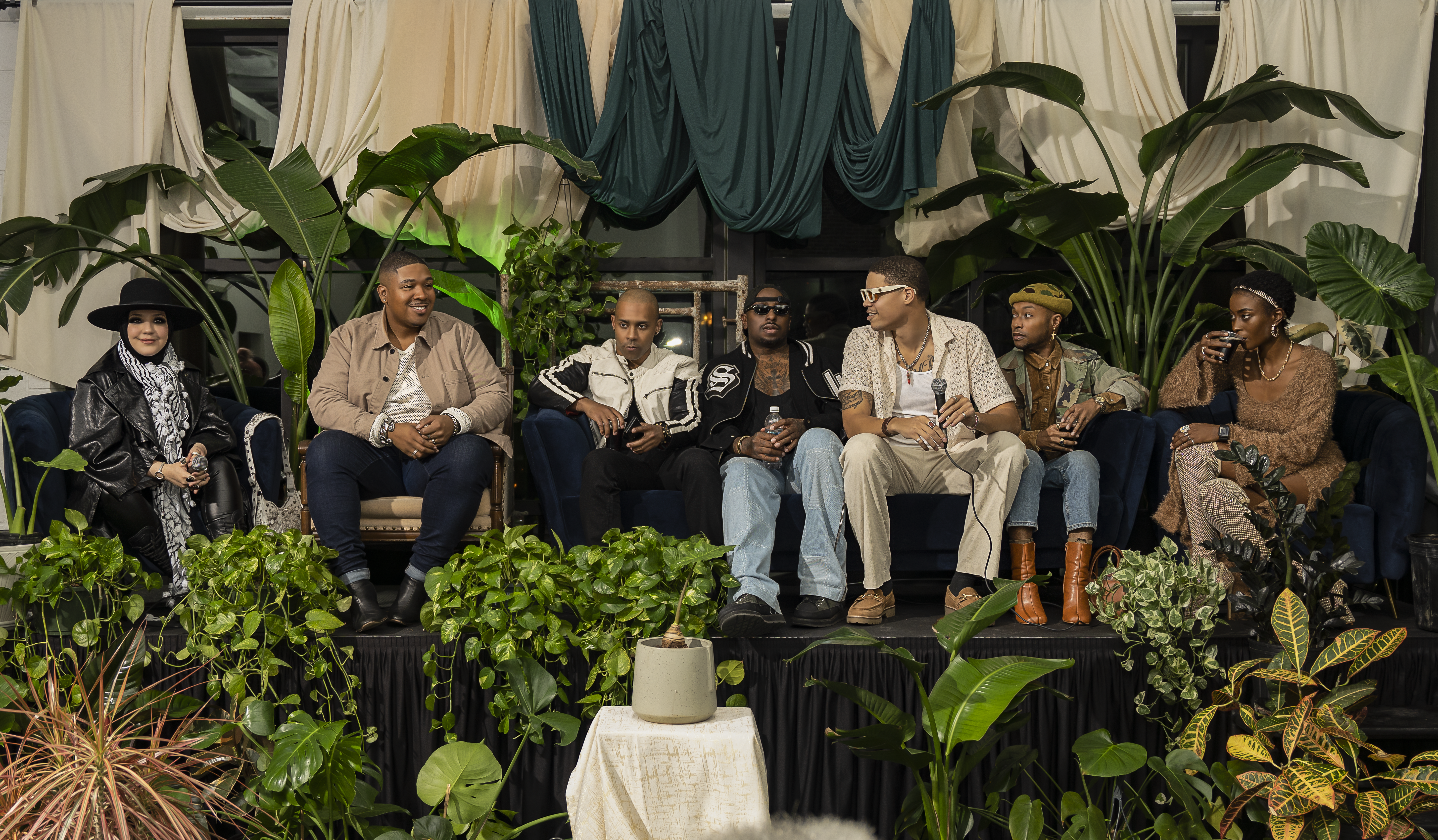
Balkum cites a lack of community and safe spaces for honest reflection, as well as a shortage of affordable mental health resources, as inspiring him to launch his House of Balkum Foundation, a 501(c)(3) initiative stemming from the inadequacies of the fashion industry, and now offering emergency relief assistance, emotional support, community gatherings and mental health and wellness resources. His upcoming event, Saving the Creatives —dubbed the “church for creatives” — will feature an all-star panel of Dallas’ top talent including Celebrity Stylist KJ Moody, Actor and Model Kamen Casey, Photographer Jamie House and others, to discuss the challenges suffocating the industry, but also to provide solutions and support.
“We’re all intertwined in a way, and we all need each other,” Balkum says. “You know, the models need the photographers, and the photographers need the makeup artists, and the makeup artists need the models. At the end of the day, I want creatives to understand that they finally have somebody here for them, and that’s looking after them. For all of the creatives that have felt alone, that have struggled in silence – we hear you. You can talk to us and we’ll provide whatever help that we can for you.”
RM11 is an organization that aims to support creators in entrepreneurship while offering expanded access to mental health programs.
Dallas startup RM11 is on a similar mission. The creator-first platform was founded by Natasha August and boasts numerous perks that allow creators to own their relationships with their followers, receive fair monetization and build a sustainable business – and, hopefully, a less stressful one.
Advertisement
“Creators are entrepreneurs in every sense of the word,” August says. “They’re building brands, communities, revenue streams and entire businesses around their voice and audience. The more I learned about the creator economy, the more I realized how underserved creators really are. They’re expected to be talent, a marketer, customer support, content strategist, community manager and business owner all at once. I saw an opportunity to build something that gave creators more control, better tools and a more supportive way to monetize directly from their audience.”
Recently, RM11 strategically partnered with both Revive Health Therapy and Creators 4 Mental Health – a major step in its mission to support creator well-being, reduce burnout and build a healthier creator ecosystem through its CreatorCare approach. RM11 creators have access to licensed mental health professionals who specialize in creator-specific stressors, as well as affordable, flexible therapy options, community support and wellness tools to help manage burnout and emotional fatigue.
“One of the biggest misconceptions that the general public has is that creating content is easy or not a ‘real job.’ In reality, creators are running small businesses, often by themselves, while also putting their personality, image and personal life in front of the public,” August says. “There’s also a misconception that if someone has followers or makes money online, they must be confident, happy or unaffected by negative comments and pressure. But creators can experience burnout, isolation, anxiety and emotional exhaustion just like anyone else, sometimes even more intensely because their work is so personal and public.”
According to a 2026 study with data from Social Blade, Texas ranks fourth among the nation’s largest hubs for online influencers, accounting for roughly 8% of the most-followed creators. The state is also home to 1 out of 10 creators ranked in the top 500 of the creator ecosystem. If you want to make it to the top of the creator economy, Dallas is where you come. Therefore, Dallas-based businesses like House of Balkum and RM11 are not only essential but necessary with growing demand.
“Being an influencer is easy, but when something’s easy, and you actually want to be successful in it, that’s when it gets harder than people even realize. I’m extremely grateful for it though,” Serna says. “It’s so funny how something can be so simultaneously amazing and so draining at the same time.”
Advertisement
Saving the Creatives will be hosted by The House of Balkum on Sunday, July 12, at 6:00 p.m. at Four Day Weekend, 5601 Sears Street. Tickets are available for $35.
If you or someone you know is struggling with suicidal thoughts, help is available. You can call or text 988 to reach the Suicide & Crisis Lifeline, or chat via 988lifeline.org for free, confidential support 24/7.